“Dunstable Town…”
The song now moves to Dunstable Town (1860-1965) in Bedfordshire which is also the closest station to London to be mentioned in the lyrics.
The little station here was built by the Great Northern Railway on a branch that left the Kings Cross-Hitchin (East Coast Main Line) line near Welwyn. It provided Luton with its first station before the Midland Railway opened its own more direct line (Midland Main Line) through Bedford to St Pancras.
The branch extended from Dunstable Town towards another station: Dunstable North where it connected with a branch that the London North Western Railway had built from Leighton Buzzard on their Birmingham-Euston line (West Coast Main Line).
It is a shame the line closed because it could have provided a useful link between Luton Airport and both the West Coast and East Coast Main lines.
All is not quite lost though because the entire track bed between Luton and Dunstable has been converted to a guided busway that opened in 2013.
Location
The X on the map shows the approximate location of the station in relation to the current British railway network.
The rough position of the line between Welwyn and Leighton Buzzard (added) has been shown in red.

The X on the map below shows the approximate location of the station in relation to the busway. The guided section of the busway, shown in brown, follows the old railway all the way from Luton and terminates just short of the site of Dunstable North.
As the crow flies: the nearest open station is Leagrave at 3.3 miles. Although Luton, 4.7 miles along the busway, is probably more useful.

Services: Past, Present & Future?
In 1962 Luton could be reached in 10 minutes and the full journey to Hatfield took about an hour. The service was poor though with just 8 trains each weekday: basically, every two hours but also with longer gaps.
Today, buses run every 10 minutes and take around 30 minutes to get to the centre of Luton.
Station Site
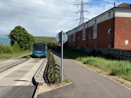
The station site was easy enough to locate on the busway just before it crossed Church Street (A505) heading into Dunstable. Although the current bridge was modern and dated from when the busway was constructed, it replaced one that used to stand in the same position carrying the old single-track line into the town and around towards Dunstable North station.
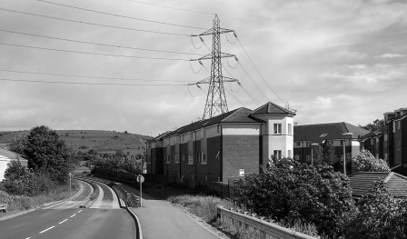
The old station building and platform which used to stand on the right (looking south) had been demolished and there was absolutely no trace remaining. The former railway land had been used to build modern flats.
Surrounding Area
The guided busway claims to be the second longest in the UK. By coincidence, the one we had seen at Longstanton is said to be the longest. The one here was opened two years later than the Cambridgeshire version but it looked the same to me. It had a “car trap” near the entrance: a wider gap in the concrete that any trespassing vehicle with a small wheelbase would fall in to.
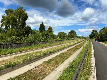
There was a cycle path that ran next to the busway and we followed it out of the town. The busway uses the old railway track bed for the whole distance to Luton nearly five miles away. It curves away from the old station heading southeast and forms the boundary between the built- up area of Dunstable and the green countryside beyond.
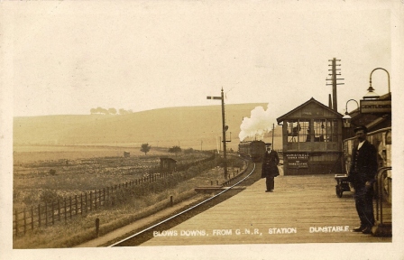
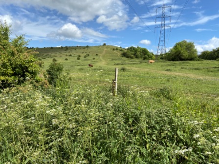
Looking at an old postcard of the station taken in the early 20th century with Blows Downs in the background and the view from the same position now, it was startling to see how little had changed. The old picture suggests Dunstable Town has a surprisingly rural setting; you could still get that impression today.
Eventually we headed off the old track bed onto a footpath that led towards Blows Downs nature reserve itself. There were plenty of people out walking dogs and many were heading up to the top of the Downs. We chatted with a few. Bedfordshire does not have a great reputation for scenic walking, but I must admit the area here and the countryside around about Dunstable did not look bad all.
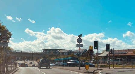
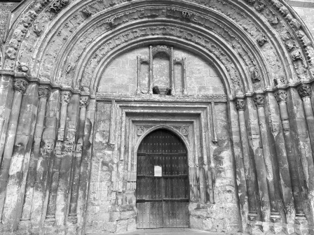
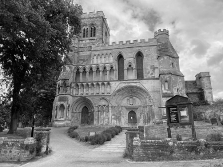
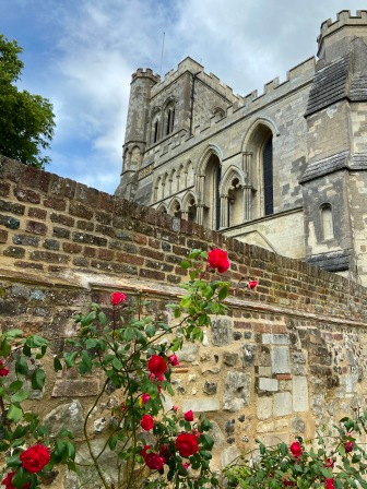
Back at Church Street it certainly was not picturesque though; there was a McDonalds, just reopened after the COVID scare and doing great business; a branch of Sainsbury’s and a branch of Wickes, the building materials store. We headed west and after a short while came to the ancient Priory Church of St Peter on the left.
The church used to be part of a larger priory which existed on the site between 1131 and 1540. The old priory gatehouse remained and walking through it we came to the well- kept Priory Gardens which now occupy the land of the former building.

We stayed for a while reading the various sign boards dotted around which told some of the history of the church and the priory. On one of them we read that Henry VIII and his wife Catherine of Aragon had their divorce confirmed here.
We walked further east and eventually turned north onto the high street. This was actually part of “Watling Street; the Saxon-era track that was paved by the Romans and used to connect Dover and Canterbury with London and then led north towards Hadrian’s Wall. The Romans named the settlement close by “Durocobrivae”, although walking along today past a normal selection of modern shops and takeaways there was nothing to suggest the road’s ancient origin.
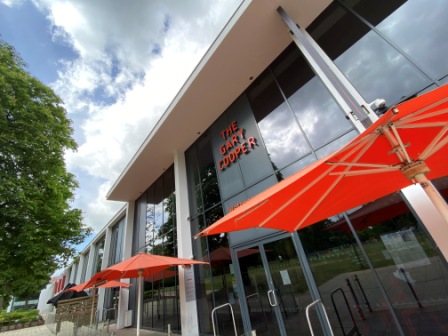
We walked past the impressive town hall and then made a loop back through attractive Grove Park Gardens. There was a lot of modern development around and opposite the Asda Supermarket was an ultra-modern Wetherspoon’s pub named for Gary Cooper; the Hollywood star who spent some time in the town.
Although often claimed as the largest town in the south east without a railway station, Dunstable did not seem too bad a place to be. As we headed back towards the busway through the Quadrant Shopping Centre, I wondered if Gary Cooper himself had ever caught the train from Dunstable Town.