FRIDAY
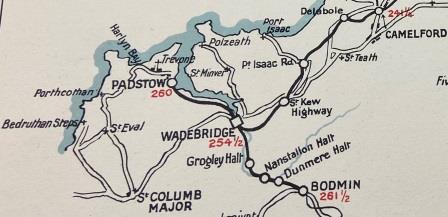
Delabole to Padstow (Walk: 20 miles)
A quick start
I have finished my breakfast by 8:20am and ten minutes later I am on the path heading out of Delabole already enjoying glorious views to the south. At first, I follow the old track bed but eventually leave it to cut across fields to bypass the village of St Treath. The curse of the Cornish footpath returns once more; the paths have obstacles and diversions that are not clearly waymarked and soon I am wandering from field to field wondering if I am going the right way.

Eventually I spot the old line on a long embankment that is, surprisingly, still intact and clear of foliage. It helps me confirm where I am, and I adjust my route. I cross the old line and then leave it alone again for the next mile or so.

I pass a camping site full of native American style tents with large signs telling me that I am passing the home of the Cornish Tipi located in the former Tregildrans Quarry. Eventually I come to a turning signposted for Port Isaac and a short way down I pass under the railway bridge. I am now 4 miles from Delabole and have reached my first station of the day.

Port Isaac Road (247 miles from Waterloo)
In July 1962 the A.C.E. would have stopped here at 4:38pm. Presumably most of the passengers disembarking would have been heading for the coastal village of Port Isaac a few miles to the north. The village has recently been made more famous by the TV series Doc Martin, but it first became a tourist spot after the decline of pilchard fishing in the 1920s. The station here is still intact and being used as a dwelling.
I retrace my steps a bit and then head south towards Trelill, the old line crosses my path once more and is close by on my left, then as I climb towards the village it disappears. Trelill looks to be a perfect little place to live, although I am a little surprised by the name on one of the houses I pass: “up yours”.

I don’t take it personally, but I don’t linger either and soon I am past Trelill on a path heading down through fields filled with sheep. As I walk, the line, in a mass of dense trees and foliage here, is back on my left. It has just passed through a tunnel under Trelill. The tunnel is the only one on the lines I have been following since Meldon Junction and it seems that it is pretty inaccessible. I don’t have time to investigate, but some people have made more of an effort to explore and the interesting results can be seen here – Trelill Tunnel.
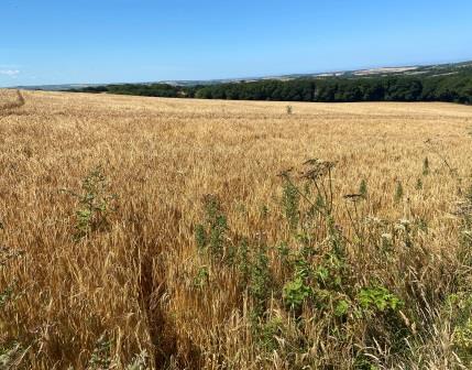
I make good progress criss-crossing fields until suddenly my path is blocked by wheat. The sign on the stile agrees with the map; the path is straight across. Instead, I go around the edge and then struggle to find a way out of the field on the other side. Eventually, having lost the path, I find a farm track and follow it to the hamlet of Trequite. After a short rest, another 20-minute walk gets me to my next station, 8 miles from Delabole.

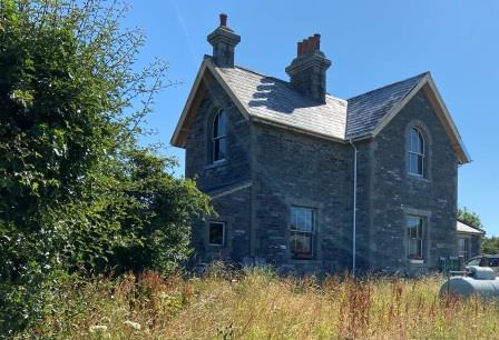
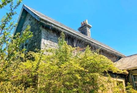
St Kew Highway (250 miles)
The area around St Kew Highway has changed a lot since the railway closed. The A39 (the highway that the name refers to) has been widened and diverted and it now severs the track bed. The old road with its over bridge has been retained as a slip road. The station building itself, on the south side of the main road, is part hidden in trees and in use as a residence.
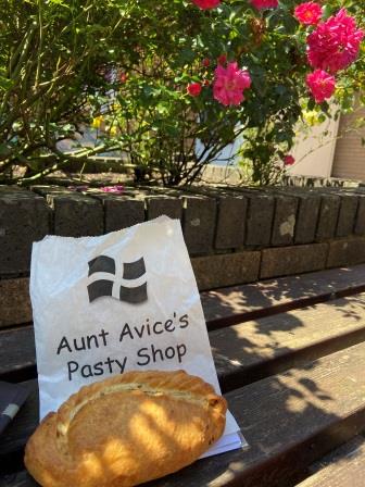
In July 1962 St Kew Highway would have been the last station the A.C.E. passed without stopping, but the train would have paused here in Winter at 5pm exactly. There is a little service area just off the main road and, as it is approaching 1pm, I decide to pause myself. I spot Aunt Avice’s behind the petrol station and get a large steak pasty and sit down to eat it in the shade.
For the next part of the walk, I descend to Dinham’s Bridge and then follow delightful little wooded footpaths alongside the River Allen for a few miles. The railway follows high up to my right on an embankment. Eventually the path and track bed emerge at Sladebridge with the old line crossing the Allen and the River Camel on two successive bridges. I try to keep in close pursuit, but then yet another blocked footpath means I need to make a longish detour to Polbrock to pick up the Camel Trail (built on the track bed of the old Bodmin to Wadebridge line) further south.

I walk north on the Camel Trail, crossing the River Camel before eventually coming back to the place where the line I had been following, having just crossed the river itself, joins. This was the point where the lines from Halwill and Bodmin met and then side by side proceeded north to Wadebridge. I continue along the trail until it ends on the edge of the town, then a short while later, 15 miles from Delabole, and located on the aptly named “Southern Way”, I reach Wadebridge Station.

Wadebridge (254 miles)
Link to Wadebridge entry on “Disused Stations” website

Wadebridge was originally opened in 1834 for the line from Bodmin and rebuilt in 1888. The NCR line from Halwill that I have been following reached here in 1895 and was extended alongside the Camel estuary to Padstow 4 years later. The passenger building along with the adjacent goods shed have both been retained and converted into public-use buildings. 60 years ago, the A.C.E. would have pulled up here at 4:49pm for a couple of minutes before setting off on the last leg to Padstow.
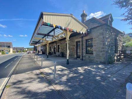
I take a break too, resting my legs whilst enjoying a coffee in the little courtyard outside the passenger station. As well as the cafe, the old station has been turned into a little museum filled with memorabilia and photographs of Poet laureate Sir John Betjeman (1906-1984), famous for helping to save London’s St Pancras station from demolition in the 1960s.

His deep connection with this area started with his childhood holidays; the family often travelling down from Waterloo on the A.C.E. and its predecessors. He is buried at Trebetherick 10 miles from here on the other side of the Camel Estuary.
Betjeman first mentioned the line to Wadebridge in “First and Last Loves” (1952)
“Green Southern Railway engines came right into the brown and cream Great Western district of Cornwall, to reach Padstow, Launceston, Egloskerry, Otterham, Tresmeer, Camelford – and so on, down that windy single line. I know the stations by heart, the slate and granite-built waiting rooms, the oil lamps and veronica bushes.”

After quite a longish break, I set off on the very last part of the walk. To leave Wadebridge I head up Eddystone Street. The trains came this way too, squeezing through at the side of the road. Soon, I am clear of the town and back on the Camel Trail as it heads under the impressive new A39 bridge that forms part of the Wadebridge bypass.


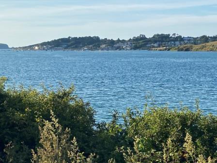
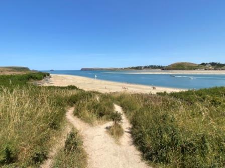
The Camel Trail, and particularly this stretch between Wadebridge and Padstow, has become quite famous now. The views of the estuary are dramatic and change as the river widens. Even though it is now early evening, the trail is still quite busy with cyclists and walkers.

This would have been a lovely railway journey too, but it is difficult to see how any restoration of the line could easily coexist with the path. The Camel Trail is said to attract over 400,000 people every year and brings in £3m in tourist revenue for the local economy. That is quite hard to argue against.

Whilst most of the way the path clings to the shoreline, there are a few places where cuttings have been blasted through the rock; evidence that although this section is perfectly flat, constructing it can’t have been so easy.

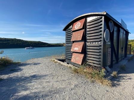
About half way along my journey from Wadebridge I meet the “Atlantic Coast Express” at the side of the track. This converted freight wagon, named in honour of the train, is a thriving little cafe for the cyclists and walkers on the Camel Trail. It has excellent reviews online and its own website. It operates 6 days a week, but it is always closed on, you guessed it, Friday.
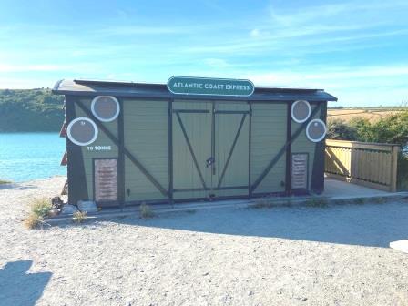
This is a shame, although as it is already past its normal 5pm closing time now, I guess I would have missed it anyway. I promise myself that I will return when I am next in the area and have a bit more time, and I press on.
I am getting tired, but I keep walking; the estuary continues to widen and the village of Rock on the other side of the Camel comes into view, and then suddenly on my own side of the river I can see Padstow in the distance.
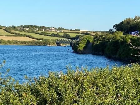
Then I recognise the bridge in front of me as the one featured in the old railway poster that I saw back at Okehampton on Monday. Just ahead of Little Petherick Creek Bridge there is a weight limit sign restricting access to vehicles less than 3 tons, with, curiously, an exception being made for fire engines.

There are signs against climbing on the structure, but perhaps inevitably there are kids lining up to jump off the bridge into the creek, egged on by their comrades in boats below. I do my best to ignore them and cross quickly to enter the final cutting just after the bridge. Now I have a spring in my step as I know that there is very little of the walk left.

Sure enough, in less than 10 minutes I am already looking back at the bridge in the distance, there are now houses on my left side and straight ahead is Padstow Station. The total distance of my walk from Delabole is just over 20 miles. I calculate I have walked almost 95 miles since leaving Okehampton.
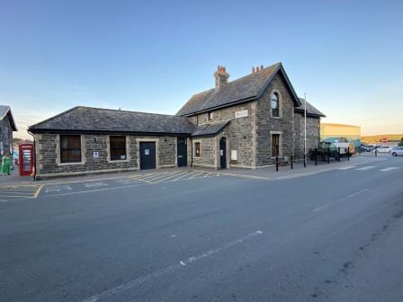
Padstow (260 miles)
Link to Padstow entry on “Disused Stations” website
The attractive preserved station building is a great place to end the walk. Although I am a little disappointed to see that, unlike Okehampton and Halwill, there are no signs commemorating its original purpose or the role it played in the town’s history. It is home to the town’s museum, but as of July 2022, the opening hours are quite limited. It would be nice to at least have a sign.
Meanwhile, sixty years ago, after a journey from Waterloo of exactly 6 hours the Padstow portion of the Atlantic Coast Express would have finally terminated here at 5pm. The winter train, slowed by the extra stops, would have arrived at 5:21pm.
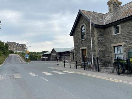
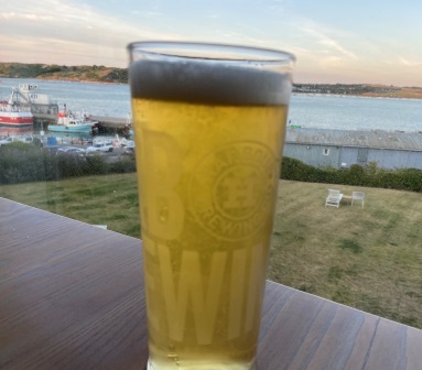
Quite a few of the passengers from the A.C.E. would have been heading the short distance up Station Road to the Metropole Hotel. It overlooks the station and was opened at around the same time as the railway itself. It is still operating today although it is now known as the Harbour Hotel. After enjoying takeaway fish and chips sitting next to the habour, I recover enough strength to head up to the hotel myself. I get a pint and go to sit by the window in the main bar. Then, looking back towards the station, I raise a toast to my walk, to the old railway and to the memory of the Atlantic Coast Express.
Silence after Steam
I spend Saturday in Padstow. I have been here twice before and, to be honest, I have mixed feelings about it. The flourishing foodie tourism originally created by Rick Stein and now sustained by others, obviously has its benefits, but it has driven up prices too. Certainly, the locals I talk to seem to have their own diverse views on the subject; their town is now on the map, but property values have rocketed too and prevented young people getting on the housing ladder.

Walking around today though, I am generally more appreciative of the place. Maybe it is the idyllic sunny weather or maybe it is the fact that I have worked reasonably hard to get here and I am just glad I am not walking anymore. Even though the school summer holidays haven’t started yet, the town is quite packed, and it seems to be attracting a variety of different types of holiday makers.

I wander around the town’s old streets trying to count the number of businesses that could be said to be appealing to the “foodie” market but give up. I sit at a pub overlooking the harbour with a pint of cider and a crab sandwich for lunch. The sandwich costs £9 but is, I must admit, excellent.
I wander up to the war memorial and down to St George’s Cove for a lie on the beach. I fall asleep in the shade for a few hours. I am eventually woken by a man who is now sitting close by and explaining all the problems of the pension industry to the woman sat next to him, his wife perhaps, who doesn’t seem to be listening at all.

I move to the lower beach and then catch the little ferry, operating from here because it is low tide, across the estuary to Rock. It costs £3 but lasts less than 3 minutes. I am deposited on the beach on the other side and walk up towards the centre of Rock. Rock has a reputation for being a kind of “Chelsea-on-Sea” and certainly it doesn’t seem to have any local atmosphere. I call in at the trendy Mariners Pub, run by celebrity chef Paul Ainsworth, and have a pint of ice-cold Doom Bar, brewed by local Rock brewery Sharps.

I cross back to Padstow on the ferry. It is high tide again, so now it is operating directly between the two harbours. I enjoy a longer ride for my £3 and get time to survey all the different kinds of pleasure boats on the Camel. For dinner I buy a pasty from the excellent Chough Bakery just before they close; I sit eating it back overlooking the harbour.

And now it is finally time to go. As I wait for a bus opposite the old station I wonder if Padstow has really lost anything by not being connected to the rail network for more than 50 years. It certainly seems very prosperous without its trains. And yet, it is still difficult not to imagine just how wonderful it would have been to have boarded a shiny green carriage at Waterloo and alighted from it here just six hours later.
Nobody could have described that journey better than Sir John Betjeman himself in “Summoned by Bell” his blank verse autobiography first published in 1960.
And those young twins, Free Thought and clean Fresh Air:
Attend the long express from Waterloo
That takes us down to Cornwall. Tea-time shows
The small fields waiting, every blackthorn hedge
Straining inland before the south-west gale.
The emptying train, wind in the ventilators,
Puffs out of Egloskerry to Tresmeer
Through minty meadows, under bearded trees
And hills upon whose sides the clinging farms
Hold Bible Christians. Can it really be
That this same carriage came from Waterloo?
On Wadebridge station what a breath of sea
Scented the Camel valley! Cornish air,
Soft Cornish rains, and silence after steam……

RETURN TO – “In the footsteps of the Atlantic Coast Express”
Read more about the ex-LSWR lines in Devon & Cornwall and the A.C.E.
