Part Four
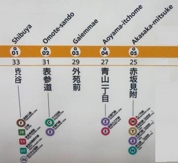
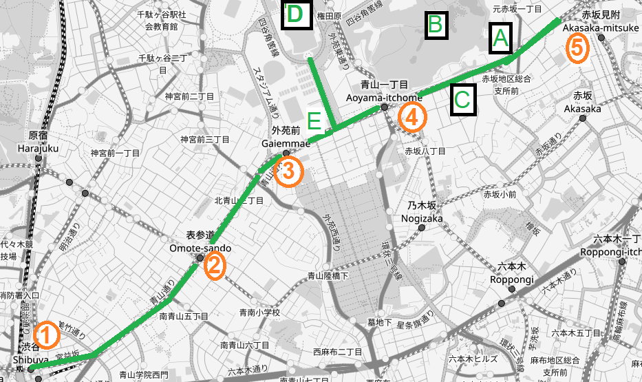
Walk to Aoyama-itchome, G-04 (1.3 km / 11.6 km)
The main entrance to the subway station at Akasaka-mitsuke is inside the Belle Vie Shopping Centre. I walk through the centre and emerge on the little street on the other side. This area is packed with restaurants, bars and entertainment venues. In the late 1980s I used to work close to here and seeing the street again gives me a sense of nostalgia. It doesn’t seem to have changed much either.
The name “Mitsuke” means “look-out,” and refers to the role this area used to have in guarding the Edo Castle. Remnants of moats and walls are still visible around here.
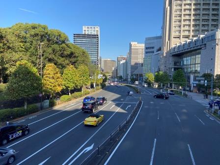
Now the Ginza Line takes a sharp left turn and heads under Aoyama-dori, the wide road that it will follow almost all the way to the Shibuya terminus. I turn too.
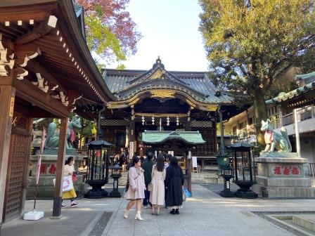
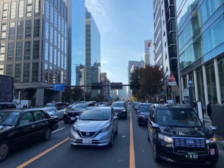
Aoyama-dori is wide here, there are 4 lanes in each direction; the only realistic way of getting across the road is by using one of the numerous footbridges. I go across and after a short walk arrive at the entrance to a lantern-filled temple complex on the right.

Having just visited Hie Shinto Shrine, now I have a quick look at Toyokawa Inari Buddhist Temple. It is known for its countless fox statues, vibrant red banners, and an association with the entertainment world. Luckily it has a toilet too.
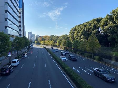
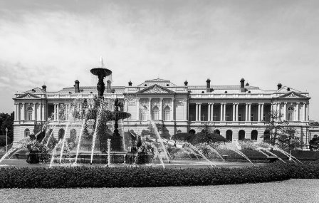
As I continue to walk away from Akasaka the right hand side of the road is lined with trees. This is the boundary of the Akasaka Palace. It was originally built as the Imperial Palace for the Crown Prince in 1909 but is now the designated accommodation for foreign state dignitaries. One of its most recent visitors was President Trump.
One of the largest buildings constructed during the Meiji period (1868-1912), it is said to be modelled on Buckingham Palace. Its reception and dining rooms are elaborately decorated. Since 2008, it has been open for pre-booked tours by the public.
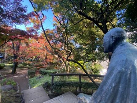
A little further along I come to a small park on the left side. It commemorates Takahashi Korekiyo, (1854-1936) who was Prime Minister of Japan from 1921 to 1922. Also credited with helping pull Japan out of the Great Depression, his decision to cut military spending helped make him the victim of an assassination and he died during a failed coup d’etat (The Ni Ni-Roku Jiken) in 1936.
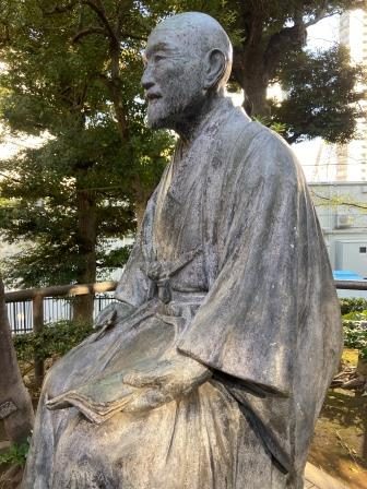
The garden was created here in 1938, around the time the chikatetsu was also being constructed, and it is known for its traditionally styled Japanese landscaping. The statue of Takahashi sits in the centre. I spend a few pleasant minutes wandering around the place. Takahashi has a contented look on his face; I think he would have liked it here.
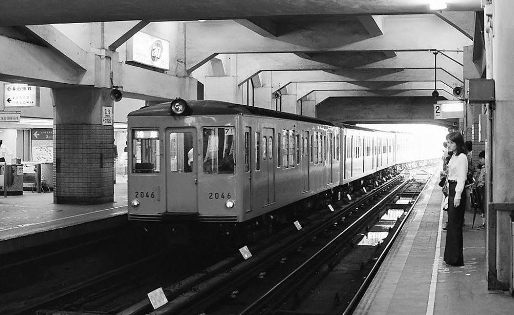
A few minutes later I come to the next Ginza Line station, G04, Aoyama-itchome. It opened as part of the initial Omotesando (current name) to Toranomon stretch on November 18, 1938. A separate set of platforms for the Hanzomon Line was added in 1978 and another set for the Toei Oedo Line in 2000.

Walk to Gaiemmae, G-03 (0.7 km / 12.3 km)
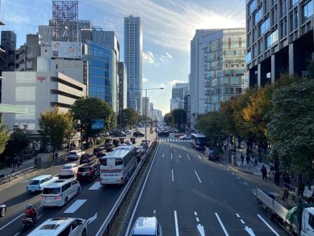
I continue walking along Aoyama-dori. Now with the Akasaka Palace behind me, tall buildings appear on both sides of the wide road creating an ‘urban canyon’ type effect stretching off into the distance.
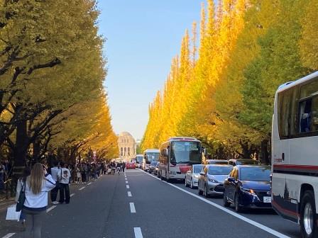
A little way along on the right is a wide opening leading off to a tree-lined avenue. There are crowds of people here and I join them strolling away from Aoyama-dori for a few minutes. It is so densely planted with ginkgo trees that the leaves create a beautiful “golden tunnel” effect.

The avenue eventually leads to another classic 1920s Tokyo building. The Meiji Memorial Picture Gallery commemorates Japan’s Meiji Emperor. It is installed on his funeral site in the Gaien (outer precinct) of the Meiji Shrine. The gallery is actually one of the earliest museum buildings in Japan.
On display in the gallery are eighty large paintings, forty in “Japanese style” (Nihonga) and forty in “Western style” (Yoga), that depict, in chronological order, scenes from the Emperor’s life and times. The gallery opened to the public in 1926.
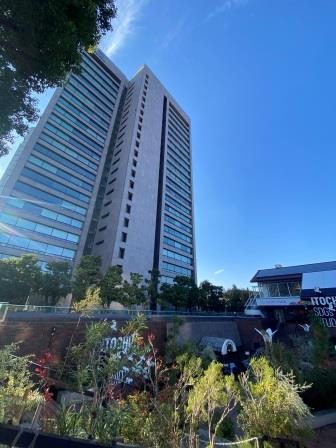
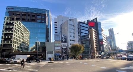
Back on Aoyama-dori, I come to the Tokyo headquarters of Ito Chu, a Japanese general trading company with a history stretching back to 1858. The company began in textiles but now extends as a global business, import/export, trading, and investment. There is a neat little garden at the foot of the building.
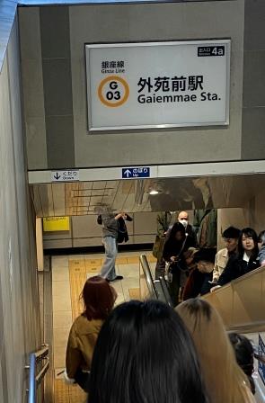
A few minutes later, I come to my next station, Gaiemmae, G-03. The station opened as Aoyama-yonchome on November 18, 1938, and was renamed Gaiemmae in 1939. It is only served by the Ginza Line and with the exception of an extra entrance built more recently, it retains its original layout.
Walk to Omotesando, G-02 (0.7 km / 13 km)
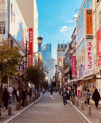
The area around Gaiemmae is bustling with shops and restaurants. Around here are chic fashion boutiques and sophisticated dining establishments. But this district has a big connection with the world of sport as well. From its junction with Aoyama-dori, the aptly named “Stadium Road” leads to no less than three sports venues. Their associated crowds often put pressure on the little subway station.
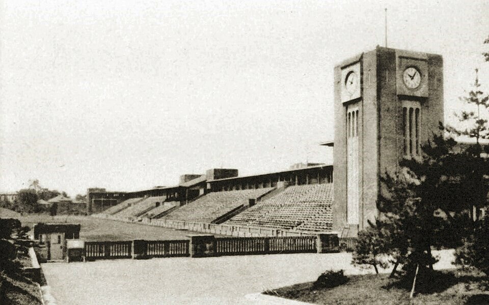
The nearest venue to the station is the Chichibunomiya Rugby Stadium. At the time of the opening of the chikatetsu in 1938, the site was still part of the grounds of Keio University but it was actually on this spot that Rugby was introduced to Japan in 1899. The stadium was completed in 1947 and named in honour of Prince Chichibu who loved the game.
Nearby, the Meiji Jingu baseball stadium was opened back in 1926 and is still going strong. It appears on an early map of the chikatetsu. It is currently the home of the Tokyo Yakult Swallows but is used for other tournaments as well.
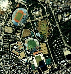
The last of the three venues is the prestigious National Stadium, the main venue for the 2020 (held in 2021) Tokyo Olympics. It stands on the site of the 1964 Olympic Stadium which was demolished back in 2015. That stadium itself was built on the site of an even earlier one demolished in 1956.

Passengers getting off the chikatetsu back in 1939 would have been able to walk to the original Meiji Jingu Gaien Stadium. The multi-purpose venue was opened in 1924 and was to have been the centrepiece of the cancelled 1940 Tokyo Olympics.
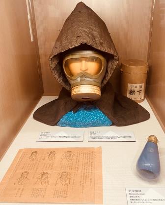
The old arena has a tragic association with the Second World War as the location for a 1943 send-off for 25,000 student conscripts to the front, many of whom never returned. At the end of the short walk to my next station, there is another poignant reminder of the tragedy of the war.
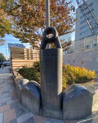
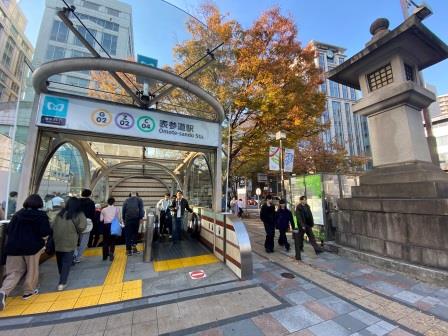
On the night of May 25 1945, American B-29s dropped incendiary bombs over the whole area here and created a firestorm along Omotesando Avenue. Of the 201 trees lining the avenue, only ten survived the inferno. The death toll of 3,242 is commemorated by a memorial in the shape of a lantern, only erected in 2008.
They replanted the trees in 1948 and today they stetch from Aoyama-dori all the way to the entrance to the Meiji Shrine. This avenue is often referred to as the “Champs-Élysées of Tokyo,” and today’s Omotesando is famous for its fashionable boutiques and popular restaurants. 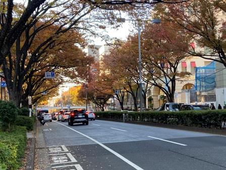
The station here was opened on November 18, 1938 as the temporary terminus of the Tokyo Rapid Railway from Toranomon. Originally known as Aoyama-rokuchome it became Jingumae on September 16, 1939. The Chiyoda Line opened at Omotesando Station in 1972. Then platforms for the new Hanzomon Line and Ginza Line, offering cross platform interchange between the two, opened on August 1, 1978 and the whole complex was renamed Omotesando on the same day.
Walk to Shibuya, G-01 (1.3 km / 14.3 km)
I walk away from Omotesando in the direction of Shibuya. On my right is the University of the United Nations Tokyo. Described as a global think tank and postgraduate teaching organisation, the iconic Kenzo Tange-designed headquarters here was completed in 1992.
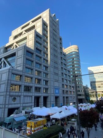
There is a farmers market held here each weekend and it boasts over forty stall holders selling anything from fruits and vegetables to homemade cakes. I wander around enjoying the relaxed atmosphere.
A little further along I come to a fork in the road. This is the point where Aoyama-dori, the street that I have been following since Akasaka, diverts off to the left. The road I will now follow, Miyamasuzaka (Miyamasu Slope), is to the right. The Ginza Line, below the surface, takes a central route going directly under the building in front of me.
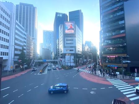
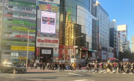
As I begin to walk down Miyamasuzaka, I notice the queue of young people outside the “I’m Donut” shop on my right. Shibuya is one of the centres of Japanese youth culture, and this is obviously the latest trend.

As I go down the hill I am descending into the little valley where Shibuya Station is located. The Ginza Line is on my left. It is underground at first but, staying level, it emerges from its tunnel onto a viaduct to cross the valley in a roughly east to west orientation. It then intersects with the Yamanote line, which is running roughly north to south here.
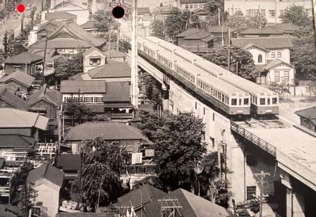
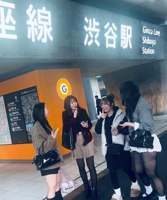
The original Ginza Line station was above the Yamanote Line platforms on the third floor of Shibuya Station. It opened on December 20 1938, a month after services had begun running from Omotesando (current name) to Toranomon. It was integrated into a Tokyu Department Store, which made sense because the original operating company of the Shibuya to Shimbashi section was part of the Tokyu group.
Although it was a terminus, Shibuya was operated almost like a through station. Trains arrived at Platform 1 and deposited their passengers before heading off across a continuation of the viaduct to the small depot on the other side of the valley. After reversing, trains heading back to Asakusa would pick up passengers on Platform 2. In later years, the small depot complex beyond the station was enclosed inside the Mark City shopping centre.
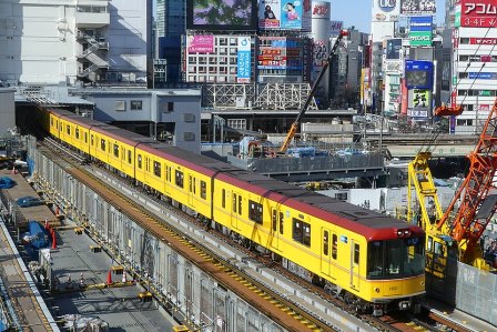
Things changed dramatically at Shibuya in 2020 when the 1938 station closed and a new one slightly to the east was opened. It occupies the former open air section of viaduct between the old station and the tunnel mouth. As I near the bottom of Miyamasuzaka there is a side entrance to the new station off to my left.
I reach the crossroads at the bottom of Miyamasuzaka with the Yamanote Line tracks in front of me. Off to the left, looking south, is the main entrance to the new Ginza Line station. The scene here has been transformed from just a few years ago, when it would have been possible to stand here and watch the subway trains trundling out of the old station and into the tunnel.
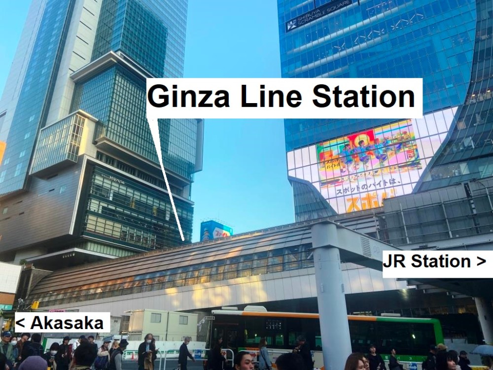
I walk up to the Ginza Line station. With large, illuminated letters across the main entrance it is hard to miss it. I decide that my walk will end here, but before I jump on the train back to Asakusa I resolve to make a quick circuit of the area to see if I can find anything from when the subway first arrived here.
Route Map
Return to Asakusa by Train (G1 to G19)
