FOUR
Wath to Penistone (15 Miles)
Bolton upon Dearne
I get up early and make my way to Sheffield station in time for the 7:15am train to Bolton upon Dearne. There seems to be a bit of disruption this morning and the departure board shows a few delays.
Happily, my train, one of Northern’s brightly refurbished Class 156s heading to Leeds, is on time. The journey of little more than half an hour takes me past the Meadowhall shopping centre and through the centre of Rotherham.
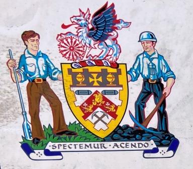
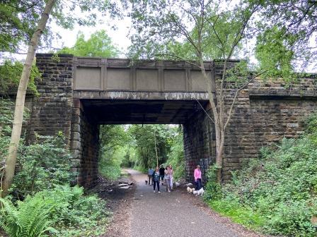
From Bolton upon Dearne station I walk the short distance to the Trans Pennine Trail. I am in the suburbs of Barnsley here and the town’s crest of arms is on all the street signs. It features a glass blower and a miner, the latter giving a big clue to the industry that once dominated the area I am walking through.
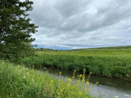
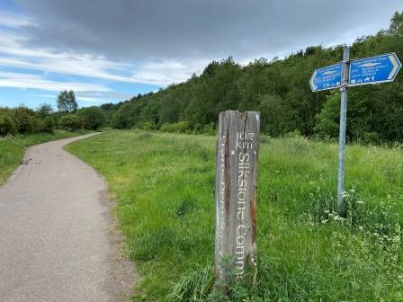
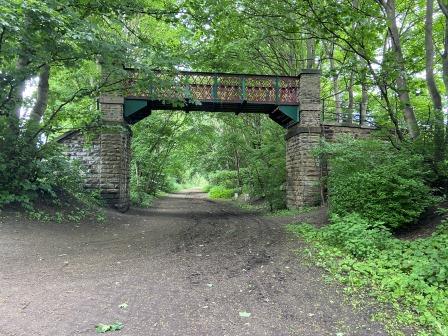
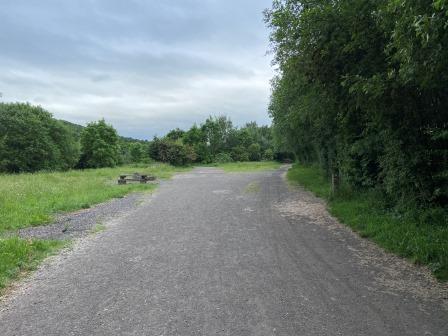
I reach the trail and head off west. The walk takes me along the banks of the River Dearne at first and is very green and pleasant. This whole area has been transformed over the past few years; there is absolutely no clue to the fact that I am surrounded here by old collieries and that just to the south of me was once Wath marshalling yard.
Wath
Wath marshalling yard was located on the GCR’s Doncaster to Barnsley line and lay at the centre of South Yorkshire’s coal field. When it opened in 1907 it was linked to up to 40 collieries in the area. Here wagons loaded with coal were assembled into trains and despatched to the west. Today the site is covered by a golf course, a lake, and a housing estate.

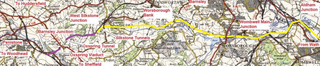
The yard was the eastern extent of the 1950s electrification scheme. The wires led west from here on a route that bypassed Barnsley back to Penistone.
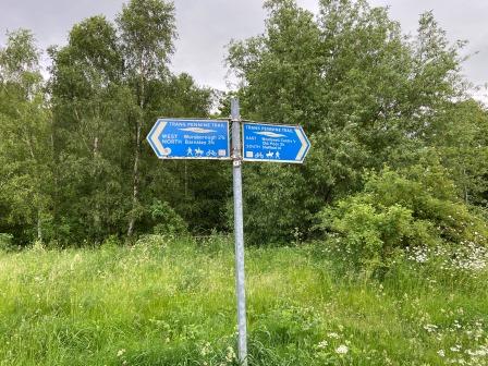
Today most of that old railway has been converted into the Trans Pennine Trail (shown in yellow below) and I will spend the next few hours following it. The last few miles from West Silkstone Junction into Penistone (shown in purple below) are still a functioning railway, so I will need to use footpaths to complete my walk.
Most of this route was only ever for freight and very few rail tours were ever allowed to traverse it. However, a video film from the cab (available in 2021 on YouTube) was created just before closure and it gives a fascinating insight to how the line looked in the early 1980s.
Wombwell Central
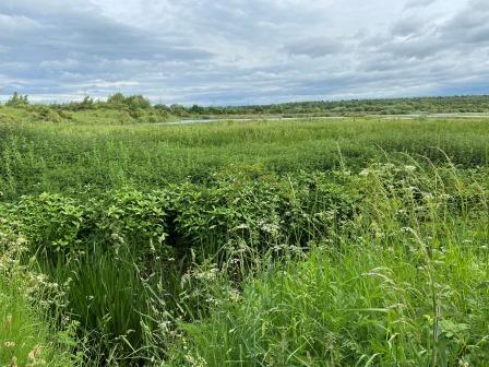
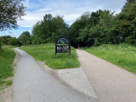
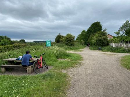
I reach the Old Moor RSPB bird sanctuary and I am now roughly at where the west exit of Wath Yard was. The sanctuary occupies 250 acres of land, much of which used to be a tipping ground for coal waste.
From here the Trans Pennine Trail follows the old formation of the GCR Doncaster to Barnsley line. Until 1981 the electrification masts would have spanned several tracks here as they led out of the yard and onto a straight section of track heading through Wombwell.
Wombwell Central station was located along this section of line. It was never served by electric passenger trains though and it closed in 1959.
Aldham Junction
Eventually I reach the site of Aldham Junction (A on the map below), the point where the electrified line to Penistone turned off the line to Barnsley. There used to be a substation here but there seems to be nothing left of the railway today.
There is a junction of footpaths though: one branch of the Trans Pennine Trail heads along the old line to Barnsley whilst the main one that I am following goes off to the left.
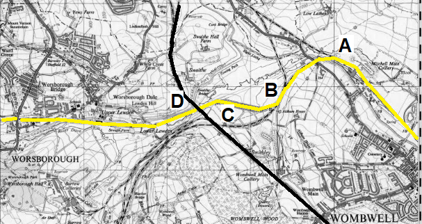
The track bed path now curves sharply. I am walking on what was the Blackburn Valley line. Another chord from Barnsley used to join the line here (B above) and then soon after the lines split again. This was Wombwell Main Junction.
The Blackburn Valley line went left towards Dovecliffe (It stayed open until the 1980s to serve a colliery) and ultimately back to Sheffield. Meanwhile, the electric route and the trail I am now following went off to the right.
Wombwell Main Junction
This was the start of the strictly-freight-only Worsborough branch. The line was opened as a bypass route for Barnsley in 1880 and cut across the southern outskirts of the town to link up with the Barnsley to Penistone line at West Silkstone Junction just outside Penistone.
Whilst the line avoided congested Barnsley, it included the notorious Worsborough Bank, a gruelling 1 in 40 incline that heavy westbound steam-hauled coal trains struggled up at walking pace. Even after electrification trains needed assistance.
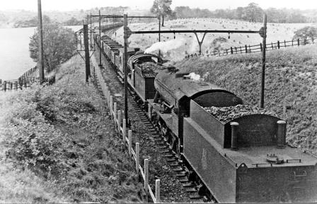
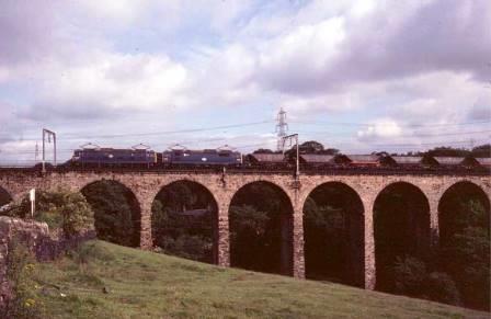
Mining subsidence made the gradients worse and even the cross beams of the electrification gantries (as shown above before completion of the wiring project) had to be made adjustable to cater for movements in the ground.
The spot I am passing now is where the sidings (C on the map above) used to attach the electric banking locomotives once were. From here the heavier coal trains would proceed with two Class 76 locomotives on the front and two more banking at the rear. This was the only place in the UK where four locomotives were regularly used on one train.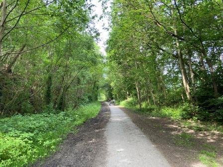
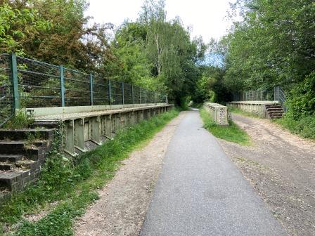
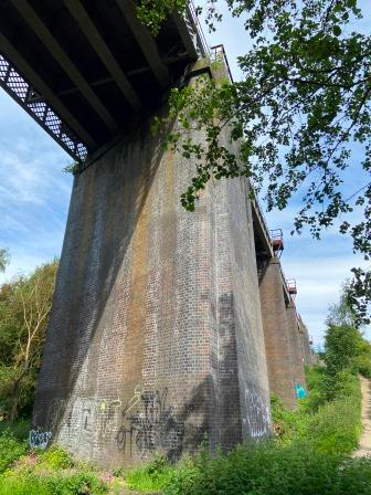
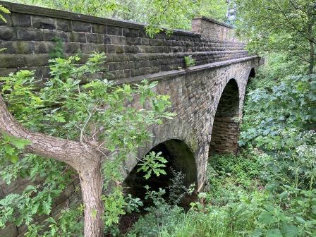
Soon I reach the viaduct (D on the map above) that carries the former Midland railway line high over the Worsborough branch. This line, linking Barnsley and Sheffield, is still in use today and will later form part of my route home.
Worsborough Bank
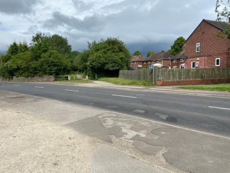
As the trail begins to skirt the southern outskirts of Worsborough it is crossed by several roads. These were level crossings and when the line was open each one of them was guarded by a little signal box.
There is a footbridge too. Anyone standing on it in the 1970s would have been greeted by the sight of the slow westbound trains laden with coal travelling around 20mph up the bank, or pairs of 76s returning east after completing their banking duties.
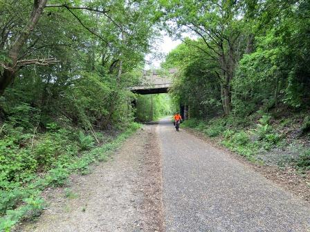
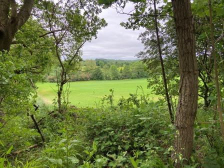
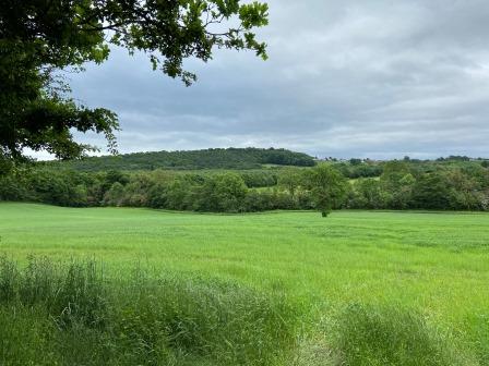
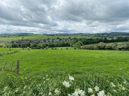
The path eventually curves to cross the M1 motorway and soon afterwards the steepest two miles of the Worsborough incline begins. Even walking, the gradient is palpable, and I meet cyclists coming in the opposite direction who are freewheeling down the gradient.
Whilst the views off to the sides are pleasant, it is certain that the steam locomotive crews would never have appreciated them. With up to 5 locomotives being used on one train, the crews would have been battling just to keep moving. The poor operating conditions here formed a powerful argument back in the 1930s for the line’s electrification.
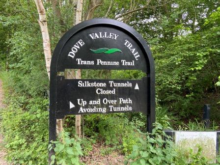
Silkstone Tunnels
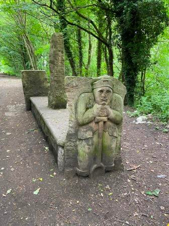
I reach Silkstone Common. There is a little bench with some very interesting wooden scultures of miners here. There is also a little memorial to the 26 children who died in the Huskar mining disaster in 1838 nearby.
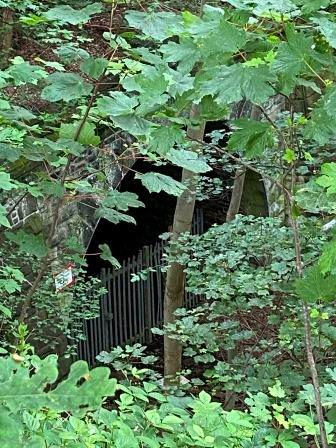
Shortly after there is a sign that indicates that the Trans Pennine Trail will leave the track bed and climb off to the left. Straight ahead through the thick bushes is the short Silkstone No. 1 tunnel soon followed by the longer Silkstone No 2 tunnel. Subsidence and underground combustion of old coal workings caused damage to No. 2 tunnel several years ago and one end has collapsed. Both the tunnels are closed.
These two bores sat almost at the top of the Worsborough incline. They were notorious with steam crews who often struggled to breathe in them. The longest and most powerful steam locomotive ever used in Britain once worked this bank and its footplatemen were given special respirator equipment to assist their breathing.
From the path I can see down into the cutting, but although the eastern portal of the first tunnel is visible, it is difficult to make out much more. The second tunnel seems difficult to locate.
West Silkstone Junction
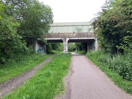
Eventually I come to a bridge that takes a lane across the old cutting to my right. Looking down all I can make out is a dense mass of bushes and trees that have reclaimed the old track bed.
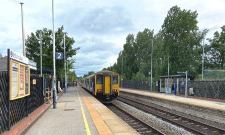
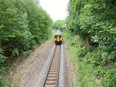
The bridge also crosses the present-day Barnsley to Penistone line which is now running almost parallel. I make a little detour to cross it. As I look down, I can now see a fully intact railway. The contrast could not be clearer.
Looking west from this bridge, I watch as a train heads underneath travelling in the direction of Penistone. The track in the distance here is slewed a little. This was West Silkstone junction where the electrified route, now hidden in the bushes to the left, joined the Barnsley line for the last part of its journey into Penistone.
Oxspring Tunnel
My own journey into Penistone starts by taking a slightly different route. I head across open farmland past the hamlet of Four Lane End and down towards Oxspring. I make a slight detour off the main trail and walk on a footpath back alongside the Barnsley line.
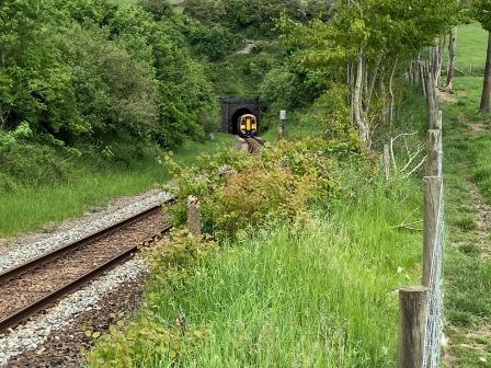
This is the section between West Silkstone Junction and Penistone. It used to be double track and electrified but it has now been singled. I watch as a train emerges from Oxspring Tunnel. This tunnel used to have two single track bores but now only the southern one is in use. In the photograph below the disused one is hidden behind the bushes on the left.
Barnsley Junction
I continue my walk with a pleasant stroll down to the River Don. I cross the river on a beautiful old narrow stone bridge which used to convey a packhorse trail from Leeds to Cheshire. A little further on I meet up with the Penistone to Sheffield section of track bed that I walked on yesterday. Although now, of course, I am heading in the opposite direction towards Penistone.
I soon arrive back at Barnsley junction. Meanwhile, the line that I saw at Oxspring Tunnel has crossed the Don itself on the impressive Oxspring Viaduct and is now curving around to meet the path I am walking on.
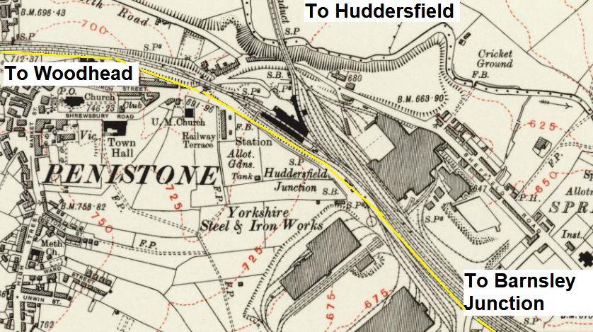
Today the railway between Barnsley Junction and Penistone is just a single track with the trail next to it, but once there was a whole network of lines and sidings here connecting to the Penistone steel works. The map below from 1929 (with today’s Trans Pennine Trail in yellow) gives some idea of what was here before.
Penistone
Penistone’s steel works opened in 1864 and was active until 1930. It was founded by Charles Cammell and later run by the Cammell Laird company. Plates for ships used in the American Civil War were made here, but its main products were railway lines and steel tyres for railway wheels.
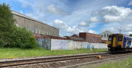
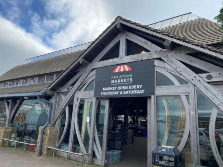
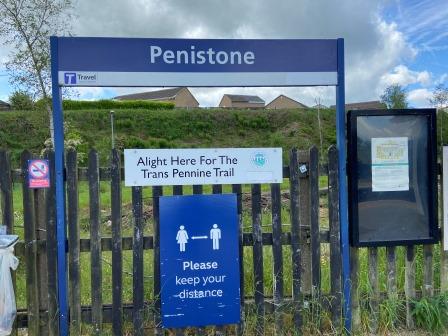
I arrive back at Penistone station and as I have a little bit of time before my train, I pop into the town. It is an interesting place with a vibrant little high street and a market.
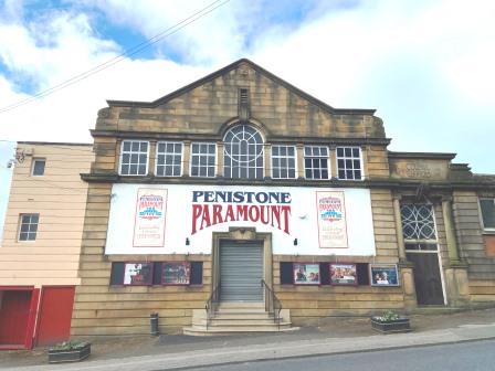
It is also home to the Penistone Paramount Cinema which dates from 1915 and is one of the oldest in Britain.
Home
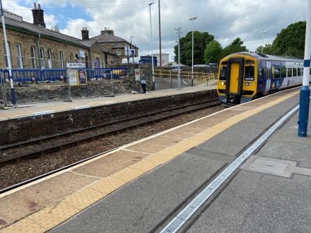
I return to the station for my train back to Sheffield.
As the train heads south from Penistone, I am retracing some of the ground I have just covered. The train curves past Barnsley junction, goes through Oxspring tunnel, and heads towards West Silkstone junction.
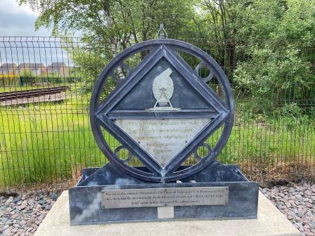
As we pass the old junction, I look through the window and I catch one last glimpse of the railway that was once there: Britain’s first electric main line.
More about the Woodhead electrification
Also
Part 1 – Manchester to Hadfield
Part 2 – Hadfield to Penistone
Part 3 – Penistone to Sheffield
