PW Day 16 (Trip 6 – Day 1)
Friday 27th July 2018 – Once Brewed to Bellingham – 16 Miles
The very hot weather that we had encountered on the last two days of our previous walk in June had continued, almost unceasingly, until we were due to set off for our next trip in July. In fact, the heat wave was only finally forecast to break on the first day of our walk. The outlook for Friday was a little worrying; violent thunderstorms that would start in the north and then move south. Cooler weather and more rain were then expected over the rest of the weekend.
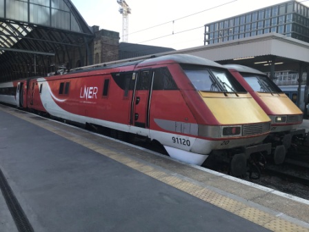
We caught the 7:00pm train from Kings Cross to Newcastle on Thursday night. Now operated by the “nationalised” LNER, the railway was clearly having big problems with the hot weather. There were multiple disruptions and delays. All the reservations on our own train were cancelled and we ended up having to stand until York. The air conditioning failed and the catering crew refused to work in the hot conditions. We reached Newcastle after 10:30pm, 40 minutes late. It was the journey from hell and not a good start to the trip. We got yet another full refund though.
After a pleasant enough night at Newcastle Central Station Hotel, we breakfasted on bacon rolls on the station concourse and then caught the first little diesel train of the morning out to Hexham. At Hexham we were reunited with the AD122 bus for the trip back to Sill Centre via Haltwhistle. The only other passenger for the whole 40 minute trip was a young lass called Helen.
Helen was working at one of the Roman Museums on the wall and spent the whole journey telling us all about it. She was tremendously knowledgeable and very enthusiastic about everything connected with the Romans. Her passion for the subject was infectious and we found the things she told us about the wall and the time when it was built absolutely fascinating.
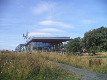
By 9:20am we were back at the Sill Centre. We nipped into the plush new Youth Hostel to use the toilet and then headed back the half mile or so to Steel Rigg Car Park and the Pennine Way. When we reached the trail we set off walking again immediately. We knew only had another couple of miles to go along Hadrian’s Wall but were still not looking forward to them.

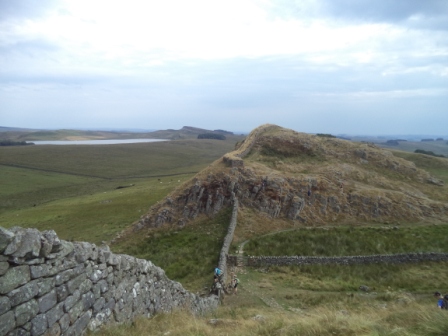
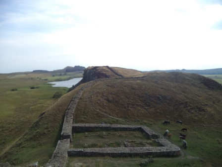
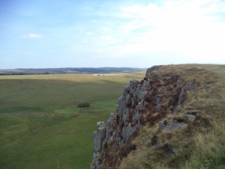
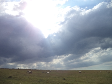
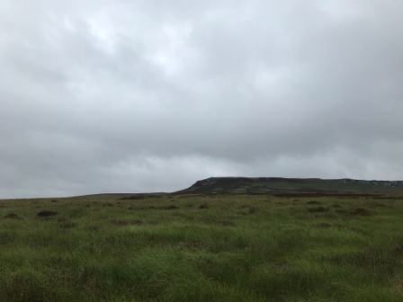
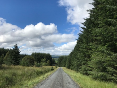
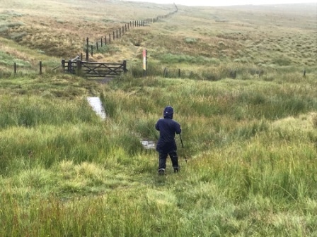
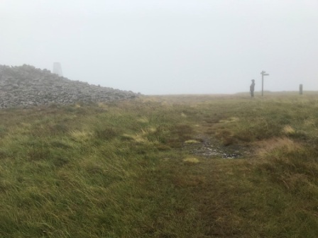
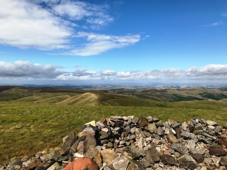
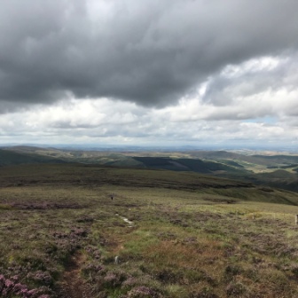
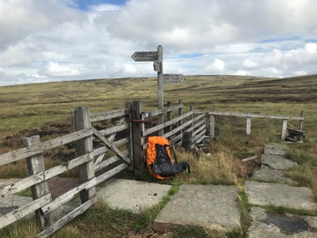
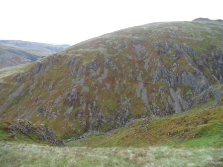
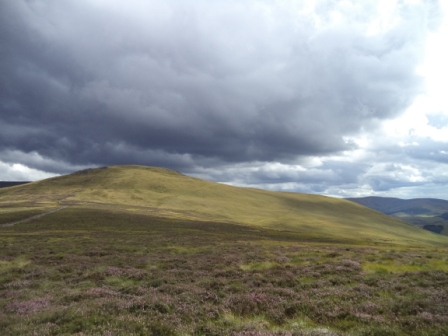
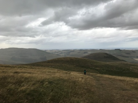
It might not have been quite as hot as the previous month but the constant climbs and descents on the wall were still pretty uncomfortable. After an hour or so of turrets and mile castles we dipped down one last time and found ourselves at Rapishaw Gap. There was a ladder stile and we climbed it to take us finally over the wall, away from all the day trippers and tourists and onto the flat moors that would lead us north.
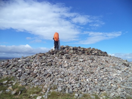
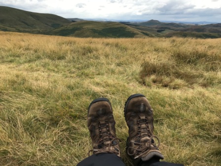
Leaving the wall at last !


From the news on the iPhone I knew that thunderstorms were causing havoc further south, but we seemed to be luckier with our own weather. It was certainly changing and the sky seemed to indicate that heavy rain was a distinct possibility, but it was holding off for now.

We crossed a couple of fields and at the stile at the end of the second one we caught up with a mother and daughter. They were doing the Pennine Way in sections too. Just like us they had started in Once Brewed that morning and were covering exactly the same sections as ourselves over the next 4 days. We chatted for a while and found that we would all be staying in the same accommodation in Bryness and Kirk Yetholm. We wished them well as we left them behind.

We never met anyone else the whole day. Inevitably, given the remoteness, we met very few people walking on these last four days. We also found that each time we did meet someone we stopped longer for a chat.
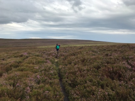
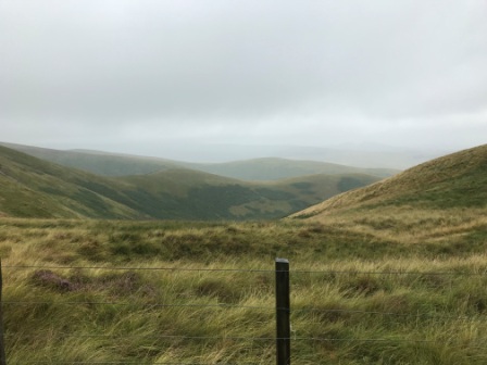
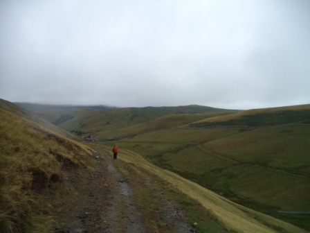
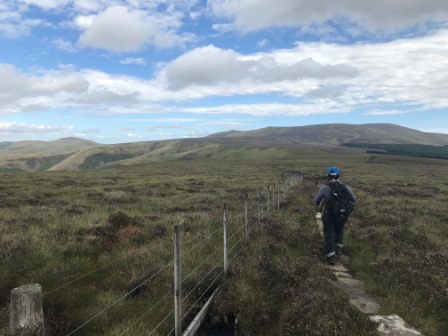
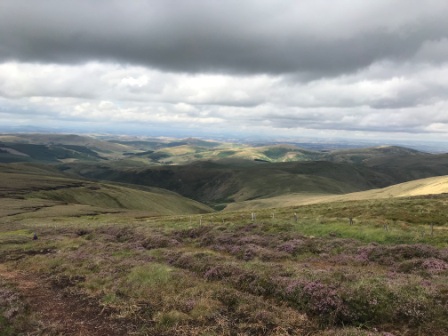
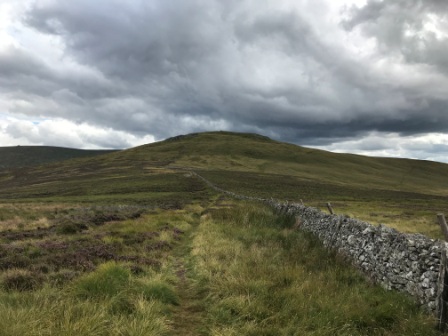
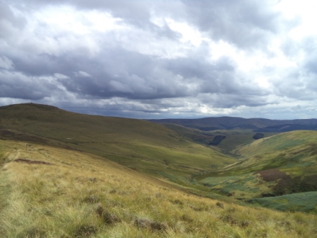
We continued over the moor for a bit more and then passed through Wark Forest. Wark is a subsection of the much larger Kielder Forest that lies to the north and which we were due to traverse the next day.
It was quite a change to be walking through the woods but it didn’t last too long and we were soon back on the moorland at Haughton Common. We paused for lunch but as the weather seemed to be changing and the threatened thunderstorms seemed to be approaching, we decided to press on without lingering too long.

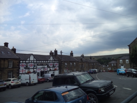
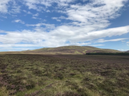
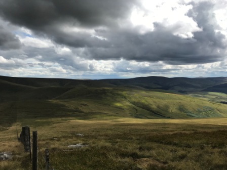
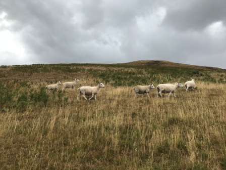
We carried on past Lowstead Farm, through fields full of lambs and out onto a tarmac road for a while. We passed Shitlington Hall and then made the only significant climb of the afternoon onto a series of sandstone boulders known as Shitlington Crag. The thunderstorms still seemed to be holding off as we trudged downhill and at last the village of Bellingham came into view. The guide book warned us that the correct pronunciation was “Belling Jam”.
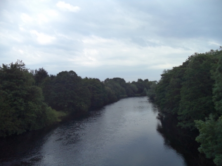
We joined the main road for the last mile or so into the village, first crossing the River North Tyne and then joining a picturesque little footpath along its banks before finally arriving in the centre of Bellingham.

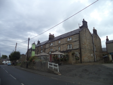
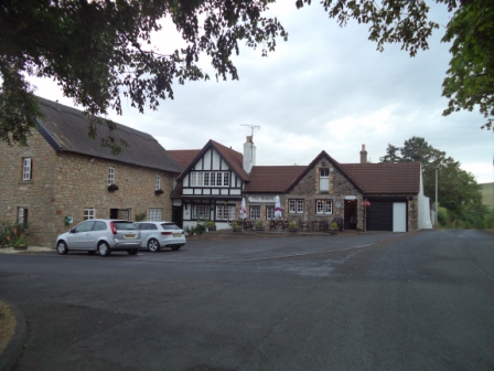
We found our accommodation, the Cheviot Hotel, on the main street and sat recovering in the main bar for a while enjoying a pint. We were very impressed with the Cheviot. The room was nicely furnished and comfortable, the bar downstairs was friendly and the food they served was delicious.
That evening we met up with another Pennine Way walker, Malcolm from Scunthorpe. He was walking, by himself, from North to South. Malcolm was a geography teacher, the same age as us and, like me, he enjoyed running too. He explained that he was walking the opposite direction to most people partly because he wanted to meet different people every night. That sounded reasonable enough to us.
We enjoyed several pints of the local ale and an excellent chicken and bacon pie whilst chatting with him about marathons, half marathons and our experiences on the Pennine Way. It was certainly one of the most pleasant evenings we had on the whole trip.
PW Day 18 (Trip 6 – Day 2)
Saturday 28th July – Bellingham to Bryness – 16 Miles
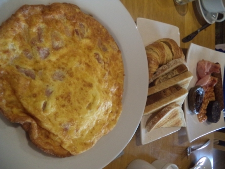
The breakfast at the Cheviot was excellent. The portions were very generous too and we struggled to finish a really delicious but huge omelette. We chatted with the owner over breakfast and we learned, to our surprise, that there had been quite a bit of a thunderstorm overnight. The forecast was for more precipitation during the day.
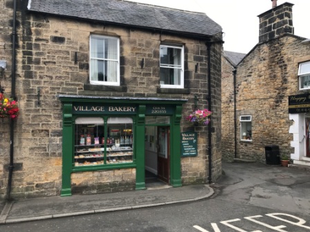
We checked out and wandered across the road to the village bakery. It was a lovely old shop stuffed full of homemade bread, cakes and jars of old style sweets. As we didn’t anticipate needing a substantial lunch, we limited our purchases to a meat & potato pie, a vegetable pasty and some griddle cakes.
As we were leaving the bakery it started to rain. It didn’t seem like it would be heavy, but, for the first time in 2018, we donned our waterproofs anyway. It would later prove to be a wise decision. Suitably weather-proofed, we set off.
Like most mornings on the Pennine Way, the walk began with a steep climb. These climbs always came straight after breakfast and were thus always a bit more uncomfortable. Ironically, our walk to Bryness wouldn’t involve a lot of climbing at all, so it was just unfortunate that most of it was right at the start.
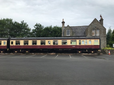
On the way out of Bellingham we went past the old station. It had been turned into a little café and they had brought in some old railway carriages to make it look a bit more authentic.


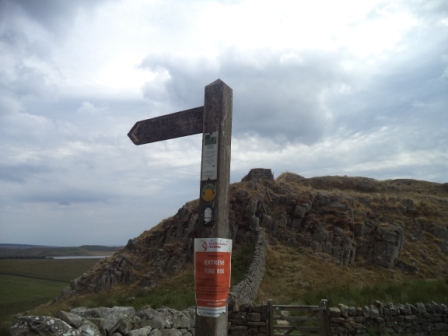
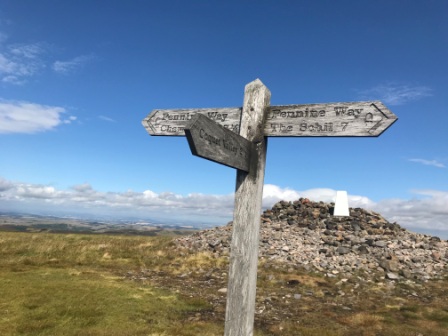
We gained altitude quickly on the main road as it snaked up out of the village. Eventually we came to a gate with a Pennine Way signpost. The sign said “Bryness 14 miles”. This was clear evidence that there was going to be no substantial settlement between us and our destination for the day.

We climbed out onto the moor and almost immediately the heavens opened. The light drizzle turned to rain and then to hail.

It was so heavy that at one point we were forced to try to take shelter behind a wall. Eventually we were able to continue walking, but the rain was still coming down as we crossed the B6320, squelched across the heather and started a gentle ascent towards Whitley Pike.
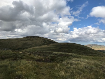
Whitley Pike was marked by a cairn, but that didn’t stop us going wrong briefly on the way down. We had about a half mile detour as we retraced our steps. By the time we had reached the correct path again the rain had stopped and the weather brightened up a bit. It stayed dry for the rest of the walk.

We carried on past Padon Hill and soon after we met a father and daughter going in the opposite direction. They were the only walkers we met the whole day and we stopped and chatted for a while. They were section walking the PW North to South and were heading for Dufton. They had started that morning from Bryness, having completed the most northern section a year earlier. We exchanged stories about the terrain we had each just faced and were each about to face before setting off in opposite directions again.

We climbed a steep muddy incline to Brownrigg Head and then we perched on a dry section of wall whilst we ate our pies. They were delicious. It was also a good time to stop for lunch. We knew that the day’s walk consisted of two distinct halves: the walk across the moor from Bellingham that was now behind us, and the walk through the forest to Bryness that now lay ahead.
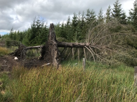
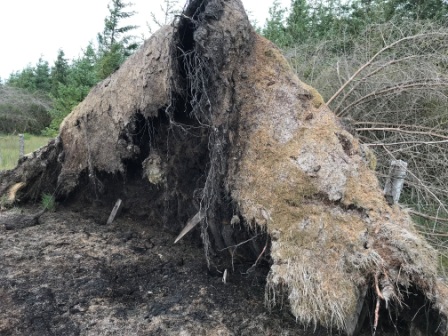
From the top of Brownrigg Head the path first took a route along the edge of the forest. We knew we would end up in the forest eventually, but for the moment we just kept walking alongside it. As we got closer we passed rows of upturned trees that had been dragged (we didn’t quite know how) out of the ground. Their exposed roots formed shapes almost like little shelters. There were more than ten of them and I found them strangely beautiful.
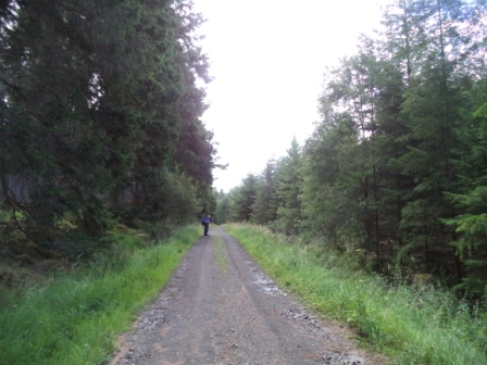
Eventually we came to a gate marked with lots of signs. There were several warning signs about forestry commission operations, a notice to say the road was closed to regular traffic and a little welcome sign for Pennine Way walkers. We turned on to the forestry track that we knew the PW would follow for the next few miles.
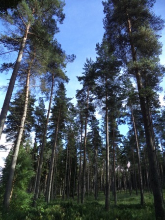
The next part of the walk was a little boring. We had envisaged walking in a dark forest and certainly that is what you conclude from looking at the map. In actual fact, the forest was cut back well away from the road and there was no experience of walking through it at all. It was a bit disappointing, but we were quite glad to be on firmer dry ground.
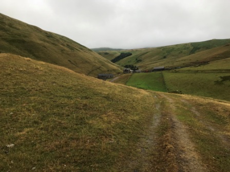
Eventually we came to the end of the forest track close to Blakehopeburnhaugh. We then navigated along a narrow path along the River Rede, went past a camp site and over a small ford to a church on the main A68 road. We had arrived at Bryness. We left the Pennine Way as it headed up to Bryness Hill, and walked the short distance to our lodgings for the night: Forest View Guest House. It was just before 5:30pm. As we reached the front door it began to pour down.

The Forest View Guest House is something of a Pennine Way legend. It was originally the Bryness YHA youth hostel, but in 2006 (when it was faced with closure) a local couple, Colin and Joyce, bought it, renovated it and took it a little upmarket. They also introduced a transport service that many people use to make the last part of the journey to Kirk Yetholm much easier.

One of the problems of the Pennine Way is the total lack of accommodation on the last 27 or so miles from Bryness to Kirk Yetholm. If you don’t fancy walking in one go and if you can’t face wild camping, there is no real option. Colin and Joyce provide a great solution by offering two nights in Bryness with a free transfer to and from the half way point 15 miles away. Like many before us, we had booked this option.

Forest View is located in 3 terraced cottages located in a little cul-de-sac off the main road. The cottages have been knocked through to form one semi-continuous building with a common conservatory stretching along the back. The living room of one cottage has been converted into a real ale bar and another into a little restaurant. The whole place has a lovely “at home” feeling to it.

Joyce opened the door to us and introduced herself as she led us into the conservatory. Colin was waiting there for us to offer hot drinks, and then after we had removed our boots he took them off to the drying room. I guessed that Colin and Joyce must be in their mid to late sixties.
There were 6 other people already in the conservatory and we all introduced ourselves. There were two middle-aged couples from Settle in Yorkshire who were walking the Pennine Way in sections together and there was another younger couple from Bavaria who were living in Preston and doing the walk all in one go.
After relaxing a bit upstairs, we went down to the bar and chatted to the other three couples. They were all a day ahead of us and were now on their second night at Forest View. They had walked to Windy Gyle (about 13 miles) during the day and then descended 2 miles to a meeting point where Joyce had picked them up in her van at 4:30pm. She would take them back to the same place in the morning. We would follow in their footsteps the next morning.
As we moved from the bar room to the dining room at 7pm, Colin announced that he was a little worried. We were missing two guests due from Bellingham. It was getting late and he started to think about calling the mountain rescue. This was something, he explained, he was obliged to do if guests didn’t turn up.
It didn’t take us long to work out that the missing guests were the mother and daughter we had last seen at Hadrian’s Wall. We suggested that they might be slow walkers as they hadn’t caught us up at all on the first day. Colin wasn’t convinced, but as we were just finishing some of Joyce’s delicious Cottage Pie, they finally appeared outside.
They hardly had time to get their coats off before they were shown to our table for dinner. Now we formally introduced ourselves; the mother was Angela and the daughter was Sarah. Angela was retired and living in South London, Sarah was working for a museum in Yorkshire.
They explained, reasonably enough, that they just liked to walk slow and stop often. Colin was still worried and wondered whether they would make it to the halfway point in time for the 5pm pick up the next day. He explained that they would need to be on time as Joyce had to be back by 6pm to make dinner.
After dinner we all retired back to the bar room and spent an enjoyable couple of hours discussing a range of subjects including Japan, politics and the Pennine Way itself. Colin claimed he met 95% of the walkers who passed through Bryness and explained how all the different hotel owners along the trail communicated with each other and exchanged tales about their guests and sent warnings to each other about problem customers. It was another great evening and it was getting close to eleven by the time we finally made it to bed.
PW Day 18 (Trip 6 – Day 3)
Sunday 29th July 2018 – Bryness to Windy Gyle & Trow’s Farm – 16 Miles
The weather forecast had predicted a full day of very heavy rain. We had hoped it would be wrong, but as we woke we saw dark clouds through the window. Looking out we could see that it was already raining quite hard. We didn’t know it then but we were about to be treated to the worst single day’s weather of the whole 19-day trip: A day of almost non-stop rain, most of it heavy rain.
On the way through to breakfast we were greeted by a magnificent sight: everyone’s boots were lined up in the conservatory, the insoles had been removed, they had been dried, cleaned, and they had all been numbered.
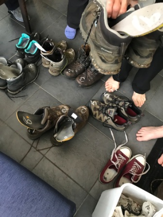
It was typical of the thoughtful service that Colin and Joyce provided. They really were great hosts. Colin played the role of convivial Geordie pub landlord and made everyone laugh. Joyce had quite a hard exterior and it was obvious she didn’t suffer fools gladly, but it was also pretty clear she had a heart of gold and would do anything to please.
As we enjoyed baked beans on toast for breakfast, the day’s plan was explained to us. Angela and Sarah would not be picked up with us that evening. Instead they would be taken after breakfast with the other six to the halfway point and then they would walk back to Bryness in the opposite direction to us. This meant they could take their time and arrive back in Brynees whatever time they liked.
Meanwhile, we were given very clear instructions about the pick up. We were to walk as far as Windy Gyle, intersect with a signpost at Russell’s Cairn and then follow a footpath down for about 2 miles to Trow’s Farm. Joyce would be waiting there. We were to be there by 5pm, no later.
We gathered a few things together for the walk and placed them in one pack. It was a luxury to be able to leave most of our stuff in the room rather than carrying it. At 9am we set out into the heavy rain. As we were leaving we saw the others getting into the car.
We said good bye to the three couples who were heading for Kirk Yetholm and told Angela and Sarah we would look out for them coming in the opposite direction on the trail. Then we headed out of the cul-de-sac, crossed the A68 and soon arrived back on the Pennine Way.
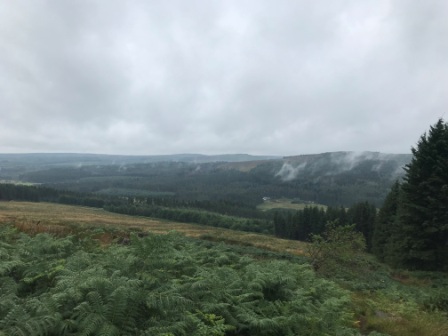
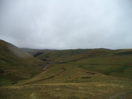
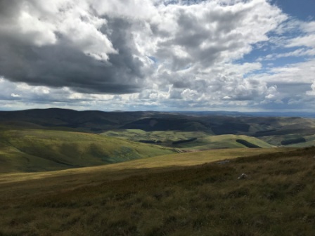
I was grateful for the fact the pack was much lighter than usual as we headed up the steep and steady climb out of the forest. We picked our way through thick ferns and then had a bit of a scramble to the top of Bryness Hill. It was pouring down with rain but we were still rewarded with the fantastic sight of the valley below from the top of the hill.

As we reached the top of the hill we saw a large sign that told us the land surrounding us was under military control and was used for exercises. Although there was a reassuring note about no live firing on the Pennine Way, another sign pointed out that we mustn’t pick anything up as it could explode and kill us. We set off again with our eyes peeled for spent munitions.

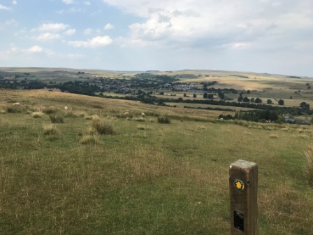
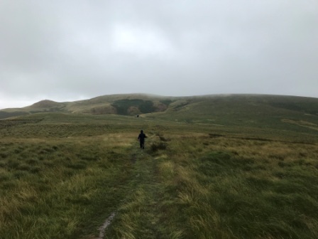
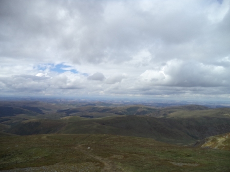
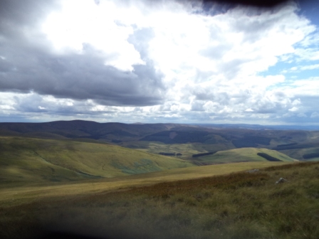
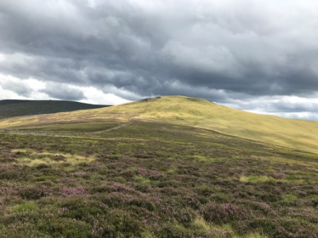
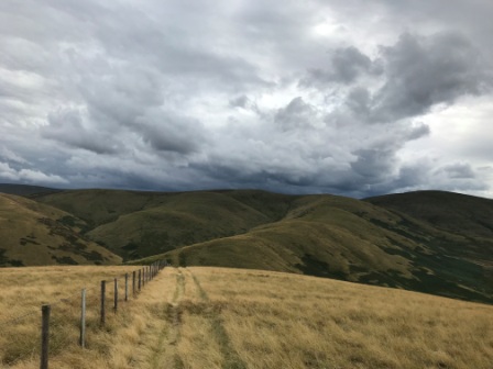
From the top it was clear to see, through the mist, the shapes of the Cheviot Hills. A lot of people describe them as “cartoon” hills as they look a lot like something out of an animated film. Think about multiple layers of letter m’s stretching into the distance. Our final two days would mostly be spent walking along a ridge that would take us through the Cheviot range.


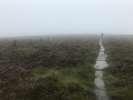
It was easy to see that some of the path could normally be quite boggy, but thankfully the recent dry weather meant that we wouldn’t be troubled too much by the squelchy stuff on the ground. In any case, it was clear that a lot of the worst parts of bog had been treated with duck boards and flag stones.

After an hour or so of walking we came to the England-Scotland border fence and immediately crossed into Scotland. Then, after a couple of miles walking “north of the border” we looped round and passed back again into England. With just one brief foray into Scotland again at the summit of Windy Gyle, the Pennine Way would keep close to the border fence on the English side until we were just 4 miles from Kirk Yetholm.
We passed the site of the Roman Camp at Chew Green without stopping and carried on in the relentless heavy rain. The slabs made it relatively easy going and the border fence took most of our navigation worries away.
We had a brief break near a footbridge and then carried on towards Lamb Hill. As we turned a corner we saw two figures coming in the opposite direction. At first we thought it was Angela and Sarah but as they came closer we realised it wasn’t. It was another father / daughter combination who were heading south on the Pennine Way all the way down to Edale. We didn’t stop long in the rain to chat but we wished each other well and carried on.

Half an hour later we saw the mountain shelter at the foot of Lamb Hill. It was a great feeling finally to have somewhere to get inside from the rain. We were not too surprised to find Angela and Sarah already inside drying out and eating their lunch. It was about 1pm by then and we had covered about 2/3rds of the route in 4 hours. They had managed a 1/3rd but they had had the lift in the car and the climb up to Windy Gyle to contend with as well.
We sat in the hut together. Sarah had managed to find some candles and had lit them to try and get a bit of warmth. We tried to dry out as best we could and we actually had quite an enjoyable lunch together. The wind was picking up and the hut seemed to amplify the noise. We looked through some of the “horror “ stories that were written in the log book and then we left our own comments. We mostly wrote about rain.

Eventually, and quite reluctantly, we decided to make a move. It was close to 2pm and although we had 3 hours to cover the 6 or so miles left, we decided not to take any chances. We knew that Joyce wouldn’t want to be kept waiting.

We went out into the rain and wind and walked in a straight line on the path that led out from the hut. We had been walking for 10 minutes when I realised we were on completely the wrong path. We doubled back and returned to the hut hoping that Angela and Sarah, now climbing away in the distance, would not recognise what we had done. We finally regained the Pennine way near the hut (the border fence should have been the clue) and set off again.
We climbed Lamb Hill, Beefstand Hill and finally after an hour or so we started the slow ascent along the ridge towards the summit at Windy Gyle. Windy is a very apt name. At this point it was blowing an absolute gale and although the ridge was wide on the top, it still felt quite disconcerting to be traversing it. We were high, we knew, but the visibility was so poor that we didn’t really know how high we were.

Finally, and with some relief, we got to the top. After crossing the border fence we made it to Russell’s Cairn; a pile of rocks on top of which was positioned the trig point. We did not hang around up there. We quickly located the signpost that Joyce had mentioned and then darted off the Pennine Way to begin the slow descent off the ridge and down into the valley.
The journey down was misty at first but as we got lower the weather began to clear and the scenery became more and more beautiful. We finally saw some of what we had been missing. It took about 40 minutes to get down to Trow’s Farm. It was exactly 5:00pm when we arrived.

The Trow farm buildings were completely abandoned, but Joyce was sitting in the car in the farm car park. She explained that we were also waiting for some “North-Southers” (in other words, people who had set off from Kirk Yetholm that morning and were now cutting their journey in half in the same way as we were).
She told us that we were waiting for a couple to turn up. She had checked on them by phone several times during the day and she seemed convinced they would be turning up on time.
While we waited, I asked Joyce about the farm and she explained that it was an old army property. Originally it had been officers’ quarters but now it was not used for anything. We were, she reminded us, on Ministry of Defence Land here. The MOD owned the roads too but Joyce had special dispensation to drive on them.
The couple didn’t turn up and Joyce began to get more and more worried. We carried on waiting and we chatted to her about the difficult logistics of running the guest house and her plans to retire. By 6:00pm we were all worried. Dinner would be late for sure, but more worryingly Joyce wondered about calling the Mountain Rescue. She told us that they called the team out at least once a year every year but that so far 2018 had been quiet.
There was no mobile phone coverage where we were, but we knew that the latecomers should be able to get coverage up on the ridge. We drove off in search of a better signal. We drove about 15 minutes but couldn’t get one, so we returned once again to the farm. Finally Joyce spotted the two walkers coming down off the ridge and we all breathed a sigh of relief. By 6:40pm they were in the car and we were all finally heading back to Bryness.

Our two new passengers were a couple from London who were section-walking the PW. They had previously walked North from Edale to Malham and were now going South to Middleton. They explained they had missed Russell’s Cairn and overshot. It had taken them a while to realise where they were before they finally turned back. It didn’t matter, at least they were safe. The drive back, along the MOD roads, was incredibly scenic. Dinner would certainly be late though.
Back at Forest View we met some more walkers who had come up from Bellingham and were a day behind us. There was a lad from Manchester walking the whole thing on his own, a Belgium couple from Ghent and a couple of ladies from Lancashire. We had only been back for a few minutes when Angela and Sarah walked in.
We had another lovely meal but decided to forego any more drinking and headed off for an early night. The weather forecast didn’t look too promising for the next day. More rain was definitely in prospect, although it wasn’t forecast to be heavy until later. We hoped it would stay dry long enough for us to enjoy just a little of the Cheviots.
PW Day 19 (Trip 6 – Day 4)
Monday 30th July 2018 – Trow’s Farm & Windy Gyle to Kirk Yetholm – 15.5 Miles
Joyce was in a good mood as she served breakfast. She explained that as she only had a small vehicle for the morning, the latecomers from the previous day would wait whilst she took Angela, Sarah and ourselves out to the halfway point.

By 9am we were saying our goodbyes to everyone once again. We drove out back along the MOD roads towards Trow’s Farm. It took just over 35 minutes to reach the point we had been picked up the day before.


During the journey Joyce explained that the red flags we were seeing meant that the military were having one of their “wars”. She told us that soldiers from all over the world sometimes gathered in the area to war game. They also stopped her vehicle occasionally to do mock inspections. She was in on the joke but told us that it often surprised the passengers.
We set off from the farm slowly leaving the ladies behind as we made slightly faster progress back up towards Windy Gyle. The weather was certainly much better than the day before and as we climbed we could still see clearly in all directions. The views were actually fabulous.

We crossed back into Scotland just before the summit and we reached the trig point in exactly the 50 minutes Joyce had promised we would. After a brief climb up onto the cairn to touch the trig point we set off following what we thought was the Pennine Way north again. The map certainly suggested we would stay in Scotland for a short while before crossing through the fence once again.

After about ten minutes we met a girl walking towards us on the English side of the fence. She pointed her walking pole at the summit behind us and her opening words were “That is the most misleading sign on the whole Pennine Way”. I soon realised that this was a nice way of saying “You are on the wrong path”. We scrambled across the heather and climbed over the fence to join her. I saw that she was walking on flagstones and soon realised that we had gone wrong somewhere.
She didn’t dwell on our mistake. Instead she told us that she had walked the Way a few times and had just left her daughter in Kirk Yetholm after bringing her all the way from Edale. Now she was heading back alone to Edale in just 10 days. (More running that walking I figured) She already knew Joyce quite well and was heading to Bryness to stay with her that night. She had met the Germans and the Settle people the day before too. We chatted for about 10 minutes and then we were off again on our separate ways.
The next section was almost all on flagstones. We walked through the heather and alongside the fence for another hour or so. We went down, then back up, down again and then finally we started the longish ascent to the point where the path diverges to the Cheviot summit.
The Cheviot Summit is not officially on the Pennine Way, although the signposts (which point in all 3 directions) suggest that it is. It is a 1 hour round trip from signpost to summit and many people leave their rucksacks at the signpost to make it a bit easier.
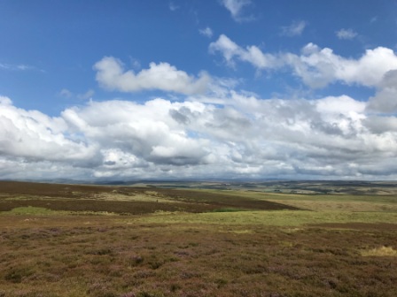
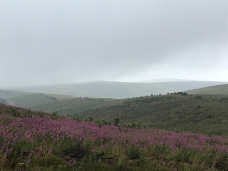
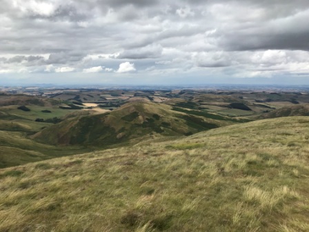
We had already decided not to bother with the Cheviot. We paused at the junction for a while though. It was the highest point we would reach that day. The weather was still behaving itself and we had gorgeous views of the countryside for miles around.
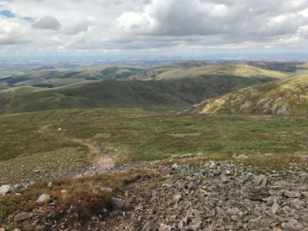
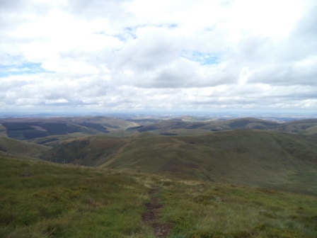
The Cheviots were definitely in the running for the best scenery of the whole Pennine Way trip. As the day went on the views were getting better and better too.


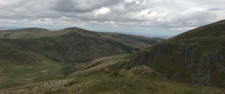
We continued on towards Auchope Cairn and encountered more fabulous scenery as the valley opened up as we skirted the side of Hen Hole and walked down towards the Auchope mountain hut.


As we descended we heard the sound followed by the sight of an RAF Tornado jet as it darted across the valley. It must be taking part in Joyce’s war we thought.


We had lunch at Auchope Hut, although, in contrast to the previous day, we didn’t really need it to shelter in as the weather was holding up quite nicely.

We saw a couple coming in the opposite direction and we greeted them as they walked past without stopping. They were day walkers with a dog. They were to be the last people we ever bumped into on the Pennine Way.

We left the hut behind and started to climb the shoulder of the next hill: the Schil. Looking back we could get a clear view of the Cheviot and we managed to see Angela and Sarah descending towards us in the distance. They were doing well and we calculated that they couldn’t be more than an hour behind.

Although it wasn’t to be the last ascent, the Schil was the last official summit on the Pennine Way. We thought back to some of its predecessors; Kinder Scout, Black Hill, Shunner Fell and Cross Fell as we climbed. It wasn’t a particularly difficult climb and within no time we were over the rocky escarpment at the top and on the way down again. We were still hugging the border fence on the English side, admiring yet another stunning Cheviot view.

Finally, at the bottom of the Schil we crossed over the fence into Scotland. We were leaving England behind for the last time. A sign indicated that we had 4.5 miles to go until Kirk Yetholm.

The path darted off at an angle from the border fence and we followed it as it began to descend a little. A little further on the path divided into two. We now had two Pennine Way options.

There was the original shorter route that led directly down to Kirk Yetholm and there was the new “main” route that added a bit more height and an extra half a mile in exchange for better views. We chose the latter.
Soon we found ourselves back along the border fence, this time on the Scottish side, as we climbed two small hills one after each other. The exertions were worth it though, the scenery was yet again stunning.
There was a new dimension too; straight ahead we could see how the Cheviots suddenly stopped and the lowlands of Scotland opened up before us. I realised now why the Pennine Way stopped at Kirk Yetholm – it simply ran out of hills.
At the last hill we paused for a while. We sat there just taking in the view. We rested a little longer than normal too. We knew it would all soon be over.
Then we began a gentle descent. The hills fell away and we saw trees and fields with sheep again. About half way down we met up with another long distance trail: St Cuthbert’s Way.
Then, right on cue, it began to rain. The Pennine Way wasn’t going to let us go without one last downpour.
About a mile out of Kirk Yetholm the path joined a country lane and we realised our walk was just about done. I will admit we got quite emotional at this point. 19 days of walking it had made us grow quite attached to the Pennine Way and we didn’t really want it to end.

We were briefly interrupted as a shepherd on a quad bike, aided by his three dogs, herded his sheep across the road. Then we continued down the lane for the last half a mile until the houses of Kirk came into view.

The Pennine Way stopped suddenly at a signpost in the middle of the village green opposite the famous Border Hotel. We took our time. We read all the signs describing the Way and took the obligatory “We are at the end of a long walk” photographs in front of the Border Hotel sign.
Then we popped into the Border Hotel itself and ordered a pint. It was strange to suddenly hear all the Scottish accents surrounding us. We certainly felt a long way from Edale. We sat there for a good half an hour before asking for the signing book they keep behind the bar.

Despite the fact we were clad in walking gear and carrying rucksacks, the bar maid acted as if she was astonished when we said we had just completed the Pennine Way. “Congratulations!, and you will be needing your certificates and your free half pints of beer then?”, she said. We agreed that we would.

We supped our half pints and admired our certificates and then suddenly we saw Angela and Sarah at the sign post outside. We greeted them and then we all walked down to our B&B together.
After checking in to the B&B we all returned to the Border Hotel later in the evening for a celebratory meal of Lamb Pie and Scampi as we recounted each other’s adventures of the walk.
Tuesday 31st July 2018
The next morning we had our last ever Pennine Way breakfast. We were again in the company of Angela and Sarah but we also met yet another father/daughter combination who were doing the St Cuthbert’s Way. As we ate, they explained something about the history of that path and its route from Melrose to the west all the way across to Lindisfarne on the east coast back in England.
After breakfast we said our goodbyes and walked back to the bus stop. We took one last look at the Pennine Way and the Cheviots in the distance as we waited for the bus to Kelso to come.
It was almost time for the bus to arrive when an elderly couple in a small car pulled up and asked us if we wanted a lift to Kelso. We jumped in, a little surprised to find such friendly locals. It turned out they were from Kent and had just retired to Scotland a few years back. They were off to the posh new Sainsburys that had just opened in Kelso (about 20 minutes drive) and they dropped us in the centre of the town.
The lift gave us a bit of extra time to explore the centre of Kelso and get a freshly baked Scotch Pie from a local shop. We then jumped on a bus for the 40 minute trip to Tweedbank. 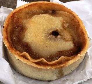
Tweedbank is the southern terminus of the recently re-opened “Borders Railway” to Edinburgh (about 40 miles to the north). Once part of the Edinburgh-to-Carlisle “Waverley” line (closed in 1969), the “new” railway is doing really well and now features a half hourly service to the Scottish Capital.
We jumped on the 11:59 train and enjoyed a very smooth ride on the brand new track for the hour or so journey into Edinburgh. Hopefully the rails can be extended back to Carlisle at some time in the future too.

We had about an hour to wait in Edinburgh and then we boarded the 1:30pm LNER express to Kings Cross. The journey, in First Class, was in sharp contrast to the one we had endured on Thursday night. We ate, drank and arrived back in London, bang on time, just before 5:50pm.
Two years and two days after we had first left St Pancras for Edale, we had completed our final expedition.
We had walked the Pennine Way !
It really had been quite something !!

