DAY ONE – Carlisle to Longtown (12.5 mile walk)
A Long Delay
My trip didn’t start out quite as I had planned. On Monday morning I boarded the 08:30 Avanti West Coast service to Glasgow at Euston. It was due into Carlisle just before noon, so I had envisaged having a light lunch before a leisurely afternoon stroll out to Longtown.
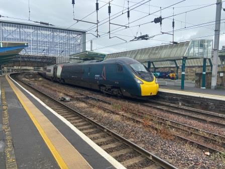
In the event, a serious incident at Oxenholme shut the railway line for more than four hours and stranded me, with hundreds of others, at Preston. I finally made it to Carlisle at 4:30pm. I grabbed a sandwich at the station and began eating it as I started out walking along English Street, conscious that if it I didn’t get a move on it would be after 9pm by the time I reached Longtown.

I turned left on to Castle Way, crossed the West Coast Main Line (WCML) and then looked north (A). In the far distance (above) would once have been Port Carlisle Branch Junction (B) where the Waverley Line headed off to the left.

The poor relationship between the North British Railway (NBR) and its rival the Caledonian Railway, who owned the WCML north of Carlisle, forced the NBR to access the city via a pre-existing railway. The only candidate was the Port Carlisle Railway which actually headed west towards Silloth; the wrong direction for the NBR. After Port Carlisle Branch Junction, the Waverley Line peeled off from the Silloth line at Port Carlisle Junction and headed towards a crossing of the WCML further north.
To get a closer look, I took the next left into Willow Holme Road, and at the end, facing the sewage works, I peered into a car repair company on the right. At the back of the yard a line of trees marked out the WCML; a row of cars parked in an arch shape marked out the Waverley Line curving from it towards me (above). I turned right and walked with the old formation now recognisable on an embankment to my right.

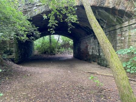
Where the road turned right, I descended some steps to a path alongside a stream, walked beside it for a bit before eventually crossing it on stepping stones. I was now in Engine Lonning Nature Reserve. I had to scramble around a bit to find a way through but eventually I was walking on the Waverley Line formation itself, a wide muddy path (above) at this point.

A short distance further along was the site of the first station, Port Carlisle Junction (1), the platform of which was still just about visible (above). I continued following the path through the nature reserve until my route was blocked by two large boards covered in graffiti (below).

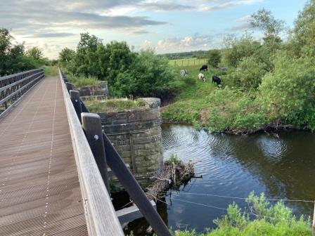
Behind them was the viaduct that took the old line over the River Eden; It is still extant but closed for the moment. A group of volunteers known as the Carlisle Waverley Viaduct Trust are aiming to restore it. Their website has the whole fascinating story and excellent photographs.

A Long way around
With a view of the viaduct just visible (below) through the trees, I now began my trek west to find an alternative river crossing, following the course of the river and the Hadrian’s Wall National Trail. The area I was now walking through was where Carlisle Canal, the main locomotive shed at the southern end of the Waverley Line, stood from 1861 until its closure in 1963.

Eventually I reached the bridge carrying the A689 Carlisle bypass over the Eden (D) and crossed it (below). Once over, I turned right on to a footpath leading along Holme Lane heading towards Stainton and back to the Waverley Line .

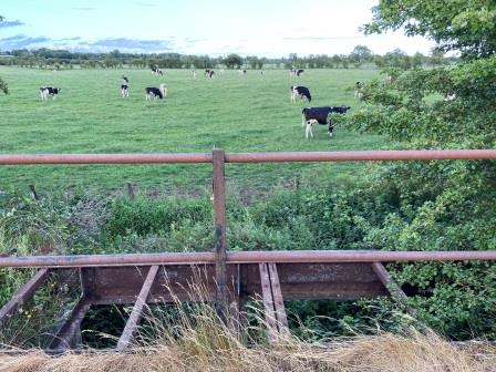
The formation of the old line disappears for a bit on the north side of the viaduct but just north of Stainton it reappears rather dramatically. As I walked north along Stainton lane, I could see a buffer stop (E) and rail track off to my right. Here a section of the old line is still being used as a siding (below).

At Kingmoor Road, I crossed the WCML once more (F), and looked south (below). On the right was a chord that linked around to the west (right) into the siding. In the distance I could see the bridge where the Waverley Line, still with operational track today, crosses over the WCML to the eastern (left) side.

This bridge was the place where the rival railways once crossed each other’s paths. At grouping in 1923 the NBR’s Waverley Line to Edinburgh (via Hawick) passed to the ownership of the LNER, whilst the Caledonian’s WCML to Glasgow and Edinburgh (via Carstairs) passed to the LMS.

I headed south along Kingmoor Road, eventually passing under the Waverley Line before turning sharp left into Kingmoor South Nature Reserve. I walked parallel with it for a while until the track terminated at a buffer stop (below) in the middle of a road/rail distribution centre(G). I then continued to head along the course of the old railway which now turned into a narrow paved path.
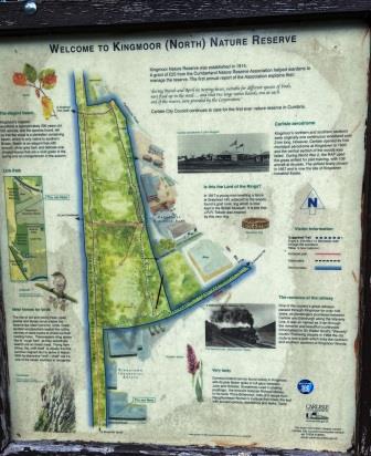
Eventually, the path linked into Kingmoor North Nature Reserve. A sign at the entrance explained a bit about the park and, illustrated by a photograph of a steam train, had a little bit about the Waverley Line too.
I continued walking along the course of the old line at the extreme west side of the reserve. It was already well past 6pm, I had walked more than 5 miles and I still hadn’t quite managed to leave Carlisle behind.
Eventually, I came to the bridge (above) which used to take Parkhouse Road, the old A74, across the railway. Just before the bridge, exactly where I was standing, was the site of Parkhouse Halt (2).

Out into the Countryside
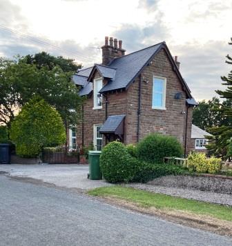
The M6, built since the line closed in 1969, severed the route just beyond the bridge, so I could make no more progress northwards. I walked west to cross the busy motorway and then back towards the line. Here two stations, built at different times, used to serve the village of Harker. Peering over the bridge down onto the line and looking south, I could see no trace of Harker 2nd Station (3) but looking north, Harker -1st Station (4), now a private house (below) was clearly visible.

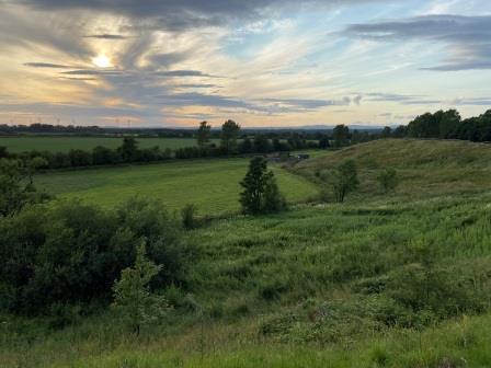
For the next few miles the track bed, although used by private farm tracks in places, was inaccessible. I set off on a zig-zag course along a lane to the left of it. I was now in the open countryside finally beyond Carlisle. It was now approaching 7pm and the sun was casting beautiful shadows.
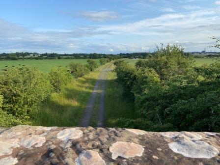
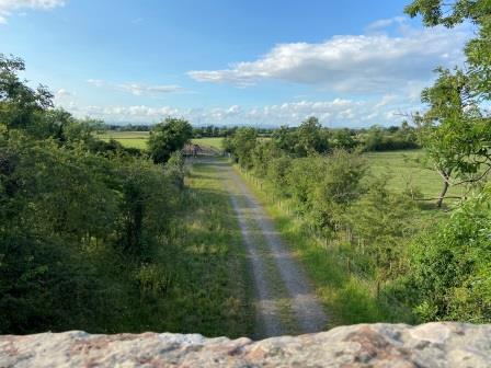
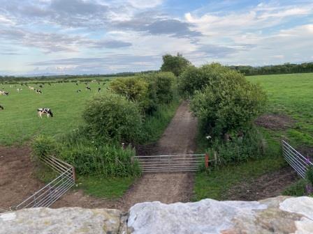
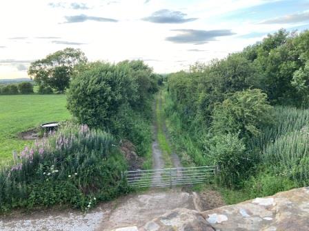
At Newtown of Rockcliffe I took a little detour through the hamlet to check out the railway(I), peering over the bridge back towards Harker (above) and then north towards Longtown (below). I had to admit that, in both directions, the formation here looked temptingly “walkable,” but I was determined not to trespass or to end up on the wrong side of some unforeseen obstacle.
I backtracked through Newtown and then headed north along another lane, following an old sign that encouragingly pointed in the direction of “Lyneside Station”, the fifth on my route.

Tractor Terror
Lyneside station (5) has also been preserved as a private dwelling. The old track bed is now part of the lawn, but just to the side of the property was the start of a cycle path which occupies the formation for the next mile north.
The path was in excellent condition and included a new bridge across the River Lyne (below). It seemed the path was popular for a Monday evening stroll too; I met the first pedestrians I had seen since central Carlisle.
The path ended at Woodside, where on the other side of the road, the old line continued behind a locked gate as a farm track towards Longtown.
As I was looking towards the gate (J), a guy in a Land Rover pulled up and beckoned me over; “a lot of people think that is a path, but it is not”. I told him that I certainly didn’t think it was a path and to reassure him, whoever he was, I showed him my intended route along the adjacent lane on my map. “Right, be careful of the tractors then,” he shouted as he drove off.
It was “tractor rush hour” along the little lane: I counted four in the space of ten minutes. They were extra large ones too; I was forced to huddle into the hedge at the side of the narrow lane to let them pass. At the next bridge I looked over the track bed back towards Lyneside (above) and wondered if it would have been so awful to have extended the cycle path just a bit further.
Looking north (above), I again dismissed the idea of just creeping down and following the old railway. I elected instead to continue alongside it on the lane.

Into Longtown
Around the next corner I came to the pretty church of St Michael and all Angels (K) and diverted off into the churchyard (below) and out into the field beyond.

With the sun setting ahead of me, I descended along a footpath (below) to walk parallel with the track bed the short distance into Longtown, eventually walking back on the formation itself. I turned right off the track bed just before the missing bridge over the River Esk. By the time I had walked up Esk Street into the centre of the little town it was 8:45pm. It had taken me just over 4 hours to walk from Carlisle. In 1968 the train took 20 minutes.
My landlord at the Sycamore Tree Bed & Breakfast couldn’t have been nicer. He sympathised with my delay, apologised that there was no takeaway food available in the town after 8pm on Mondays but assured me that the SPAR across the road was open until 10pm.

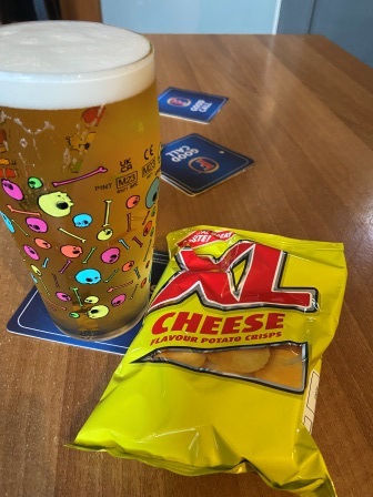
I put off the SPAR and headed straight out to the Graham Arm’s hotel for a pint. I was the only customer and I had a chat with the barmaid about my eventful day, and what life was like in Longtown.
It was approaching 10pm, although still quite light, when I finally arrived back in my room with some basic provisions from the SPAR. I had a little light supper, got into bed and quickly fell asleep.

Continue – #2 – Longtown to Newcastleton
