Day Three – Newcastleton to Hawick (22 mile walk)
Water Worries
I was awake by 6:30am the next morning. I had had another excellent night’s sleep thankfully not experiencing any nightmares about cows. After coffee and donuts, I was back on the road again by 7:45am. In contrast to yesterday’s constant drizzle, the forecast was bright spells at first and then much heavier rain later. With my longest day’s walk ahead, I was keen to get a move on.
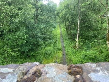
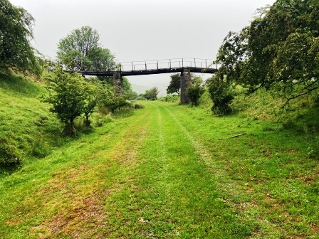
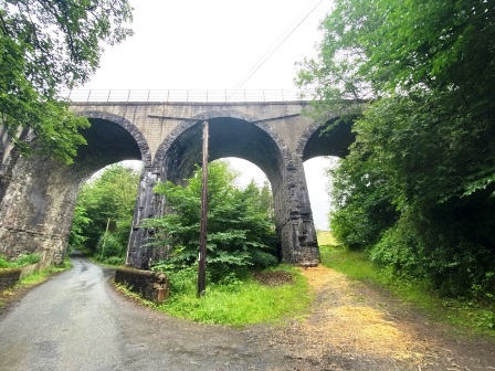
There was a bridge over the Waverley Line just opposite the B&B, but it had no access down to the cutting (above). A few minutes later after walking down the B6357 I found a better entry on to the track bed and began to follow it north again.
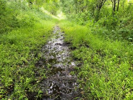
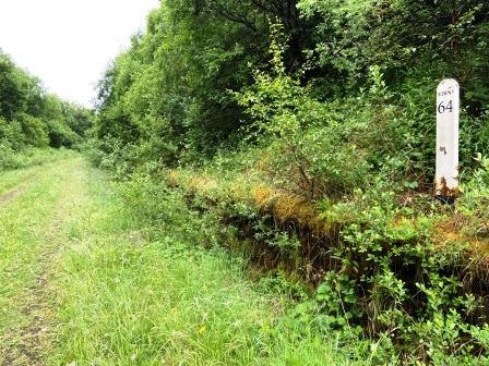
Here was yet another hazard that the “right to roam” couldn’t hope to compensate for: the ground was totally waterlogged (above). I was immediately up to my ankles in muddy water. Just 10 minutes after leaving my lodging, I already had wet feet. I persevered and made it to where the track bed was interrupted a short while later at Ralton Bridge.
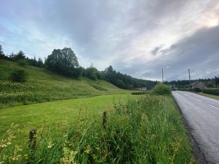
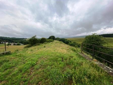
Back on the road, I did my best to keep out of the way of the logging trucks that were already thundering up and down the B6357. I could clearly see the formation on the left hand side rising up on an embankment (above). This section, I believed, was actually walkable, but I knew there was a dead end where it encountered the gap caused by the loss of the viaduct over the River Hermitage.
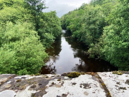
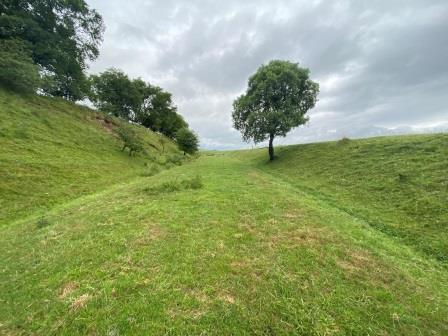
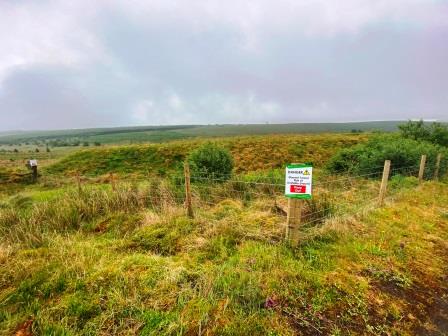
I reached the road bridge over the Hermitage and looked over towards where the railway viaduct (A) must have been (above). There was nothing to suggest anything had ever bridged the river here. I had read in a survey that 96% of the track bed between Longtown and Tweedbank was intact awaiting restoration, yet looking at a gap like this it was obvious that rebuilding that remaining 4% would not be cheap.
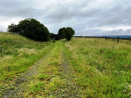
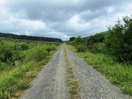
A short distance on from the River Hermitage, I branched off the road at Powisholm, passed a cluster of buildings and climbed the short distance back to the Waverley Line on a little farm track. From here the route ahead seemed very walkable and totally inviting (above).

Yet, just a few yards around the next corner, I encountered my next obstacle just beyond a bridge. Not shown on my OS map, somebody had built a sheep shearing shed across the full width of the line. Not finding an obvious way around it, and finding nobody about and no warning signs, I eventually decided to just walk right through the thing. I later discovered that farm yards are not included in the right to roam but reasonable access through farms to paths should be granted. That might have covered it, I thought.
Now, I was in open country with wonderful views on both sides, gently climbing as I walked along the embankment. Suddenly it was just me and the Waverley line, it seemed as if there was not another soul around for miles.

Climbing up to Steele Road
Now the walking was becoming very pleasant, and better still my feet had already begun to dry. In the distance the clouds were threatening, but for now it was staying fine. I continued to follow the railway as it wound its way gently through the landscape, off to the right were some pretty glorious views of Liddel Water and the hills beyond.
What a wonderous train ride this must have been, although given the remoteness you might be forgiven for questioning how many people actually used the line back in the 1960s. By 1968 there were four local passenger trains a day on this section, three of them covered the whole line but one only went as far as Hawick. Two or three extra trains also ran daily between Hawick and Edinburgh, but there was no Sunday service between Carlisle and Hawick.

In addition, there was also a day time express, in summer conveying a restaurant car and known as “The Waverley”, and a sleeper train. Both of these were direct services to/from London St Pancras and stopped only at 3 or 4 of the major Waverley Line stations.

In 1968 the Carlisle to Edinburgh journey time varied between two and a half and three hours depending on the stops made. This compared with the then fastest times of two hours via Carstairs and the WCML; a journey that today can take less than 1 hour and 20 minutes.

During my planning I had worried about whether I would be able to walk through Bridgehouse Forest Plantation just ahead of Steele Road and had organised a little route back down to the road just in case. In the event there were tall gates blocking the track bed at the entrance (below), but I was pleasantly surprised to find they were not locked, nor were there any warning signs telling me to keep out. I pressed on.

The route was very clear to follow through the plantation but as I reached the other side the track bed was finally blocked, and I was forced to turn and walk the short distance down to the road.
A few yards further on was the entrance to Steele Road (12), yet another old station that is now a residence. By rail I was now 28.75 miles out of Carlisle, although I calculated that I had already walked about 37 miles.

“Waverley No Way”
The people at South of Scotland Countryside Trails have created a page on the Waverley Way on their website. They claim it is a trail that starts at Steele Road and heads to Flex just south of Hawick. For several months leading up to my visit the website had reported problems with downloading maps of the trail. Parts of the route were still being “resolved”, it had suggested.

As I walked on from Steele Road, I found no evidence of the “Waverley Way”. In fact on my whole journey to Flex I never encountered any signage indicating its existence. Nevertheless, the track and the scenery remained just as it had been earlier; all very pleasant and very walkable.

I walked past an old plate layers hut (above), the first one I had seen completely intact, and then passed through another plantation (below). Many of the trees in the vicinity have been planted since the railway closed and part of the area is now being deforested.
The grassy path I had been following now turned into a more substantial track, and it was clear that this was being used for the logging trucks. It was also very obvious as the old track bed winded on that we were climbing.

The Waverley Line had some fearsome gradients and this section, 1 in 75 up from Steele Road, was one of the worst. The sharp curvature also made things worse for locomotives climbing it.

There is an excellent recording of a “V2” locomotive climbing up this section of track at night in the early 1960s. It is available on the Trains in the Night album and is definitely worth a listen. It is also a reminder that this railway was once operated 24 hours a day.
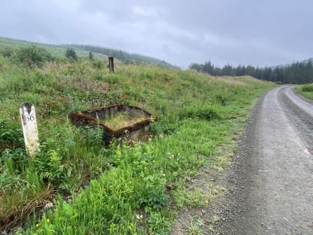
After a bit more climbing, I reached the first of several replica mile posts that have been placed alongside the line (above). Positioned next to an old ballast bin, this one showed that I was now 66 miles from Edinburgh, which meant 32 miles from Carlisle.

A Lonely Junction
Just a few paces further on, the path I was walking on was joined by another coming in from the right. There was a signpost here with an image of a steam locomotive on the top (below). The arm pointing in the direction I had come was broken, but the other arm pointed to Kielder Water, and happily the third arm pointed, in the direction I was walking, to Hawick.

This was Riccarton Junction. Looking back (below) I could now see the two routes clearly, on the right was the Waverley Line from Newcastleton, on the left was the old branch line that once led to Reedsmouth and Hexham. Today, part of it lies under the Kielder Water reservoir.
A few yards further on was the station itself. Riccarton Junction (13) was not built to serve any local settlement, although some of the dwellings that were added by the railway are still in use. Linked to outside world only by a track, the station had a reputation for being one of the most remote in Britain.
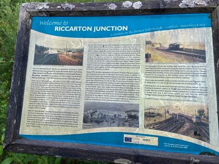
Several years ago, attempts were made by a local group to restore the station, and excellent progress was made preserving the only remaining building, a hut that housed the generator which (in lieu of any link to the national grid) used to provide the station with its electricity. Sadly, the group have not been active recently and the condition of the station has now lapsed.

I had a little wander around, finding the replica station sign (above) part hidden in foliage on the abandoned platform. As I was exploring, the forecast rain finally arrived. There were dark clouds ahead, so I quickly donned my waterproofs. It was to rain quite hard for much of the rest of the day.

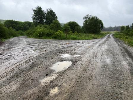
I set off walking again. After Riccarton Junction there was even more evidence of deforestation activity. Large warning signs were on display and there were piles of freshly cut logs being stored at each side of the track. I half expected a logging truck to come speeding around the bend, but in the end met no one.

Heritage Halt
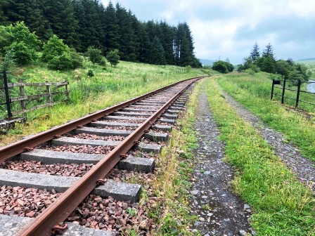
A little further on there was another replica milage sign (below) indicating just 64 miles to Edinburgh. These signs have been placed here by the Waverley Route Heritage Association, a group dedicated to preserving part of the line.
Around the next corner I came to much more substantial evidence of the group’s efforts: track. A collection of traffic cones made for a buffer stop and from there the line continued into the distance.

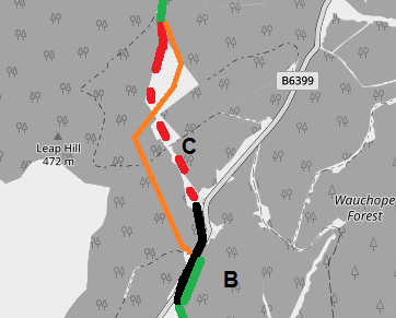
I followed the track around the corner, keeping to the path next to it as several signs sensibly suggested. A few minutes later I arrived at the platform the group have created at Whitrope Siding (B).
There was never a station here originally, but there was a siding for use of the banker locomotives which pushed heavier trains up the gradients from either direction. I had reached the (1006 feet above sea level) summit of the line.
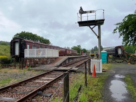
I walked along the platform and peered through the windows of the two coaches stabled there. I had been hoping to find someone to talk to, but the place was deserted.

It seems the group only open things up about one day a month. It must be quite a challenge to keep something like this going in such a remote location.
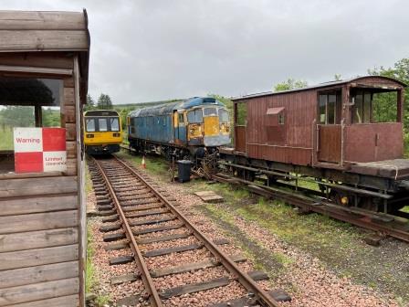
As well as the two coaches at the platform there was also a collection of Pacer DMUs, a Class 26 diesel locomotive (above) and a Mark 3 sleeping car. It must also have been a bit of a challenge to get things here by road too.

The track that the group has restored leads a short distance from the platform right up to the South portal of the 1208 yard Whitrope Tunnel (C). The tunnel has suffered a couple of collapses and is now securely fenced off. Happily, an alternative route over the summit, known as Sandy Edge, has been created.

It starts off from the Heritage Centre car park, but the entrance was a bit difficult to find. I avoided the obvious mistake of following a wider track which went off in the opposite direction, but still went wrong following a “no cars beyond this point” sign. Having finally located the track, I began to climb and as I looked back towards the station it looked almost as if the little Pacer had just paused after a tough climb from Newcastleton, ready for the downhill section to Hawick.
As I continued to climb up the little path, I passed a fenced off section of land. Several signs warned of the dangers of unstable ground over the roof of the tunnel. If the line ever does reopen, it would seem there is a lot of work to be done here too.

The path was pretty clear and easy to follow. It seemed to be reasonably well used, certainly there were cycle tyre tracks visible. There was also a little bench provided just after the summit (above) and I sat there for a few minutes enjoying the glorious views looking north.
Eventually the path led back to the old line a little further up from the Northern portal of the tunnel, the approach cutting of which was just about visible in the distance. From here, the track bed continued on towards Hawick.
Shankend
The railway was obviously descending here, but it didn’t really feel like it. For the next five miles or so I was walking on high embankments. The amount of time and effort all these earthworks took to build in the early 1860s must have been phenomenal.
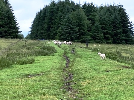
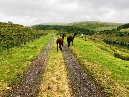
As I descended, I came across more and more wildlife. At one point there were three or four Alpacas sharing the track bed with me.
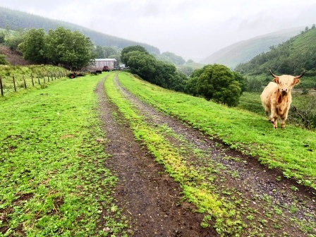
A little further on there was one lone long haired cow standing off to the right. This concerned me a little more, especially given the size of the horns. To my relief, as I got a bit nearer it turned around and fled.
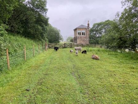
There were also plenty of sheep around, particularly in the vicinity of Shankend Signal box (below). The box has been tastefully restored as a holiday home, but seemed deserted as I walked past.
A few minutes later I was passing Shankend (14) 38.25 miles along the line from Carlisle. The old station here had been turned into a residence once again. Having passed the main building, the path led me off the formation to the right descending to a little lane. To have continued along the track bed would have meant crossing the lawn of the residence, but moreover would have landed me at the blocked entrance to the magnificent Shankend Viaduct (D).
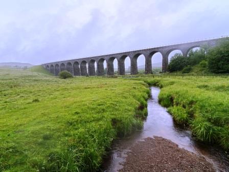
It had started to rain quite heavily now, so I sheltered underneath an arch of the viaduct and ate my lunch. I then took the first right on to a track that led over the main stream and afforded beautiful views of the structure, and then I made another right turn to head back to the track bed on the other side of the viaduct.

As I rejoined the track bed (above), I was tempted to wander back to the fence that stopped people from crossing the viaduct, but then I noticed a cow blocking the way. There were five others close by; I decided it wasn’t such a good idea and pressed on.
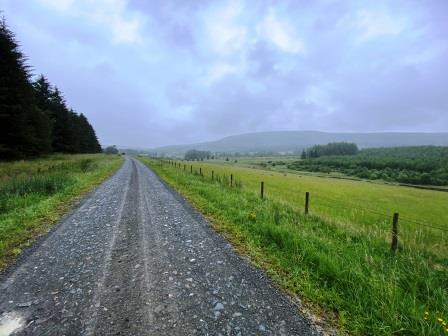
For much of the rest of the way, the line was following a ledge, again with substantial earthworks, high above Slitrig Water as it wound its way towards the Teviot at Hawick.

Obstacles at Stobs
The views down towards Slitrig Water were quite fantastic, but as I made progress north, the track bed path entered Stobs Woods and became narrower. The walking here was much less rewarding.
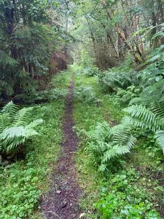
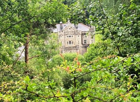
One small respite was the view, caught through an opening in the trees, of the impressive Stobs Castle (below) on the other side of the river. Nevertheless, as I pushed on the path was getting thinner and wetter.
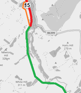
It was actually a relief when I found the way ahead was blocked and I was forced to divert off to the left along a footpath that took me through open fields. The path emerged onto a little lane that took me past the entrance to the station at Stobs (15), 41.5 miles from Carlisle.
Pig Peril and Straw Stress
I walked under Barns (or Stobs) Viaduct (E) but there didn’t seem to be any obvious way of rejoining the track bed from here. My maps also suggested that part of the formation was missing a little further north of the viaduct. I resolved to follow the lane to its junction with the B6399 and then walk to New Mill.
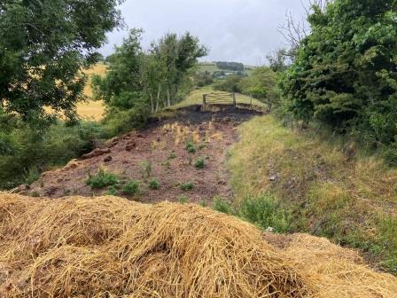
I turned back towards the track bed at New Mill and followed a lane down to some old railway cottages. The formation heading from Shankend had definetely been severed here, but worse still, heading north there was a pig farm (below) across the whole width of the track bed.

I retraced my steps slightly and found another path leading onto the old railway a little further north. Now back on the track bed once again (below), I continued north, soon passing the site of the old Stobs Army camp on the left hand side.

The camp had its own station, Stobs Camp (16) located in a siding facing Hawick off the main line to the left. Looking back in the direction I had come (below), the location of the old camp was just about visible on the right.

Now with just about a mile to go until the end of the “Waverley Way” trail at Flex, I encountered a significant obstacle. Someone had deposited a large pile of straw and horse manure across the whole track bed. At first, it seemed I wouldn’t be able to make any progress, but I finally spied a way to squeeze through on the right.

Then I saw that the next part of track bed had been excavated and the fence gate at the other side was almost inaccessible. Carefully I made my way along a narrow ledge on the right, holding the fence as I went.
When I reached the fence gate, I found it covered in barbed wire. Someone didn’t want me on this part of the “Waverley Way” that’s for sure. Somehow, I made it over and then looked back at the way I had come (below). If you had started your cycle ride from Flex and were coming south, you would be in for one hell of a shock!

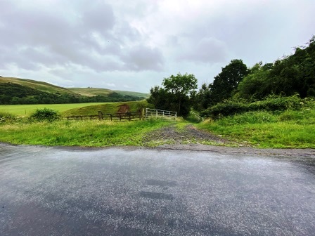
After an uneventful walk of about 10 minutes, I made it to Flex (F). There was no way north from here, and as I exited onto the lane and turned towards the B6399, I looked back at the entrance. No signage here, nothing at all to tell you that the “Waverley Way” Trail to Steele Road is supposed to start here, or that it is effectively blocked a little further on.
Back on the B6399, I walked alongside the track, high up and in forest at this point, until I made it around to the bridge where the road crossed Slitrig Water.
Into Hawick
It was approaching 5pm as I walked along the B6399 on the north bank of Slitrig Water. There were a few houses here on the outskirts of Hawick and I met the first pedestrian I had seen since leaving Newcastleton over 9 hours ago.
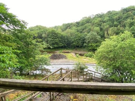
A few minutes later I came to a wooden staircase leading up the side of the valley. Half way up was a little bench. I sat down and looked back over the river (above). You wouldn’t know it now, but this was where the railway crossed Slitrig Water on the six-arch Lynwood Viaduct (G). Somwhere high up on the other side, hidden in the trees, was the track bed back towards Flex.
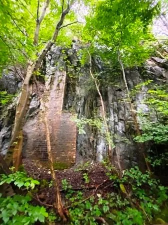
The steps led to the track bed on the Hawick side and once at the top, I began to follow it again. A few minutes later I passed through a very impressive rock cutting (above).

This was obviously a popular walking track for locals and as I continued, I met quite a few people. The old track was still quite high up and afforded me with pretty good views of the town as I approached the centre.

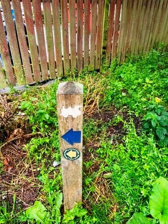
Now there were more signposts too, with the little steam locomotive logo on the top. Following them I negotiated a few streets until I arrived at the end of the embankment overlooking a large roundabout (H). It was almost 5:30pm, my walk from Newcastleton had taken me just under 10 hours. The fastest train did the journey in 35 minutes back in 1968.
From here the railway would have continued, still on its embankment, passing through the area ahead of me where a large Morrisons supermarket now stood (below). Just beyond that was the bridge across the River Teviot.

As I descended from the embankment I looked back (below). I got the impression that if they really want to bring the railway back through here, they are going to create quite a lot of disturbance. Hawick famously suffered after it lost its rail link, but you would have to think there might now be a bit of opposition to bringing it back.

For some reason, booking.com had cancelled the hotel I had booked with them in Hawick. Worse still, I had only been informed when I reached Longtown two days earlier. Luckily the more expensive Mansfield House still had a couple of rooms left and I had managed to get one at a substantial discount. It was another mile east but having completed 21 already I didn’t really care.

Continue – #4 Hawick to Newtown St Boswells
