DAY TWO – Longtown to Newcastleton (20.5 mile walk)
Cow Concerns
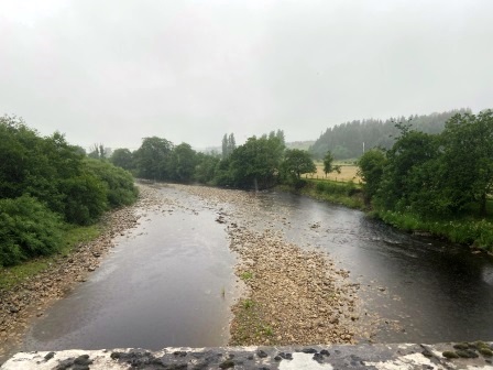
I slept incredibly well, but not realising I had left a small window open, was woken up to the sound of trucks thundering down the A7 at 6am. Nevertheless, I felt good; I was back on schedule. The breakfast at the Sycamore Tree was excellent and by 8:15, having returned to the SPAR to buy my picnic lunch, I was crossing the River Esk on the A7 bridge. The only problem was that it had started to rain gently; it wouldn’t stop all day.
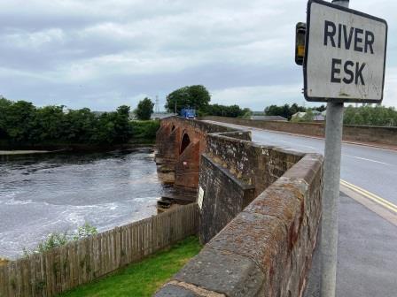
I stopped in the middle of the bridge (below) and looked south to the place where the railway had once been (A). The Waverley Line crossed the Esk here at an angle. Just before it went across the A7 at a level crossing there was a junction with a branch that ran from the WCML.
There is still a rail connection to the vast munition works (B) less than a mile from where I was standing. If the Waverley Line is ever restored, the new link from Edinburgh will use this line to reach Carlisle, leaving the route via Harker dormant.
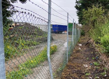
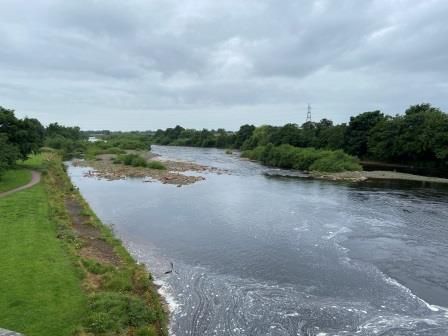
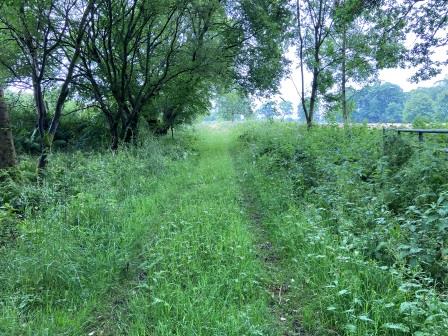
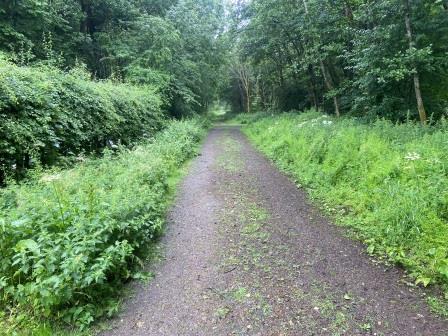
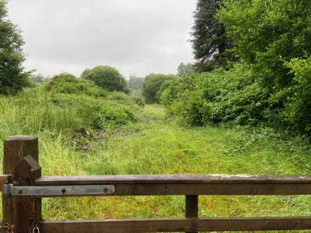
After crossing the bridge, I turned right into the yard of an Isuzu truck dealership. This was the site of Longtown Station (6), 9.75 miles from Carlisle, positioned just to the north of the level crossing. There was nothing left of the old station, and I struggled a bit before I found the narrow footpath that follows the track bed north at the back of the yard (above).
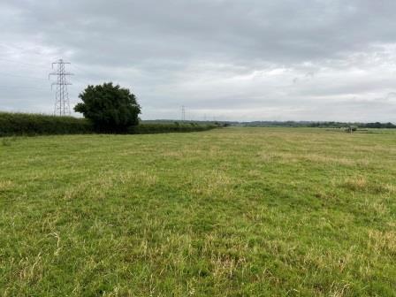
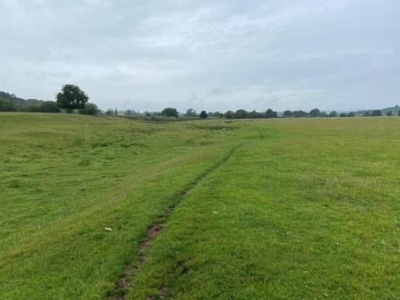
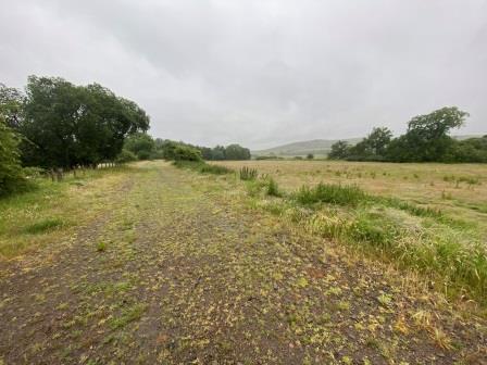
It didn’t seem that many people used the path, it was blocked by branches and foliage in places. It eventually led to a large field (above) where the formation could clearly be following the line of electricity pylons into the distance. I set out to walk alongside it; as I did, I noticed a large herd of cows in the centre of the field out of the corner of my eye.
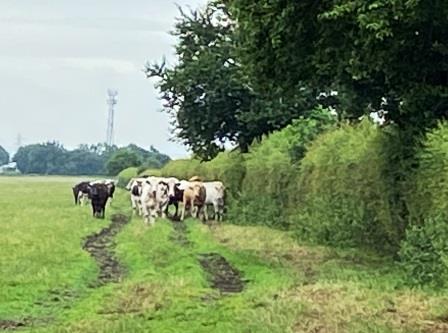
As I walked along the edge of the formation, the cows began to follow me, there were about ten in a long line behind me. I am used to cows doing this on walks, but something felt a bit odd here. One of the animals at the front seemed very agitated and kept running ahead, stopping next to me and then moving sideways almost blocking my path. It felt very threatening, but there was no way out, so I had no option but to keep walking at a brisk pace. Eventually, after 5 minutes, which felt more like 20, they all suddenly stopped (above) and let me go free.

Thistle Viaduct
At the end of the long field, the footpath led over a stile into woods. At this point the A7, old railway, and River Esk come together in close proximity. The footpath skirted the river for a short stretch and then ended up on the old track bed itself.
The walking in the woods was very pleasant, especially as it was cow-free. Eventually I emerged into daylight and continued a short distance until the footpath left the old track.
A short section on the A7 and a right turn had me standing in front of the next station on the line, Scotch Dyke (7), also now a residential property, with one platform clearly still intact.
From here I continued down a lane signposted for the old church at Kirkandrews-on-Esk, before turning left and heading on a footpath across a large field (below) back to the Esk.
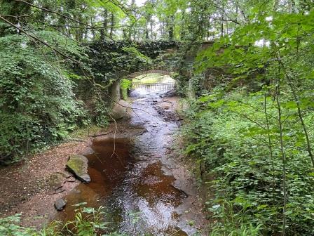
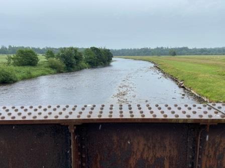
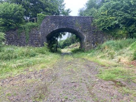
Walking back towards the railway, I passed through a gate and onto the Thistle Viaduct (C) that took the Waverley Line back over the River Esk again. The bridge once consisted of two independent decks, but the one that carried the line towards Carlisle was missing, only the northbound line remained.
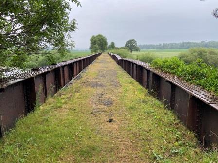
At the other side of the bridge was a gate with a sign that claimed the track bed north of there was private. In fact, the track bed would be pretty much out of bounds for the next eight miles or so.
To move forward from here, there were three options; return to Longtown and cross the Esk there, head to the church at Kirkandrews and cross on a pedestrian suspension bridge, or use the track bed on the other side of the gate until it met a farm track a short distance ahead. All of these routes would lead eventually to the hamlet of Moat which was my next point on the map.
More on walking in the area can be found on this interesting blog.

Goodbye England
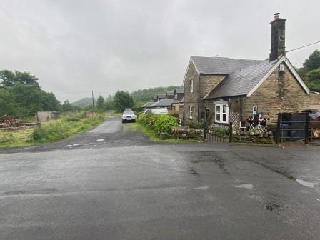
Although the track bed would not be accesible for me to walk on for the next 7.5 miles, I would not be forgetting about it completely. From Moat I took a detour along the lane to Inch and then headed off it towards the farm that now stands on the site of Riddings Junction (8). Peering over the gate here it was possible to discern the old station buildings now adapted to farm use, with the old railway cottages now being used to house farm workers.
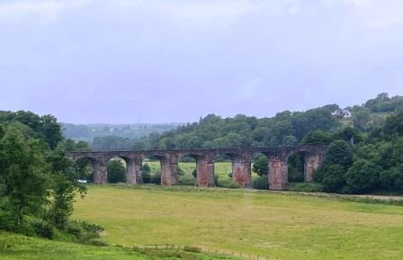
The station was the old junction for the Langholm branch which left the main line to head over Liddel Water on the elegant curving Riddings Viaduct (above). The line itself closed a couple of years before the Waverley, but the viaduct is still in place today. It can be viewed from a gate (D) just after the lane to Inch crosses the main line.
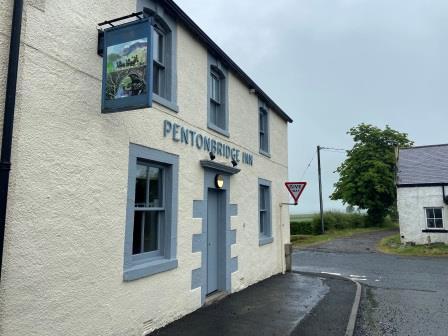
The other side of Liddel Water was Scotland and as I returned to the main road I became aware that I was now walking my last few miles in England. I knew from my map that there was a pub ahead, but I also knew in my heart that it would be closed for lunch. I wasn’t wrong; a shame because the Pentonbridge Inn (E) looked interesting as I turned onto the B6318 and passed its empty car park.

I turned right again on to another lane and soon I was walking parallel with the track bed, a situation that would continue for the next mile or so. All these little lanes were extremely quiet and I hardly ever met any cars. Soon the old station building at Penton (9), another residential conversion, was visible through the trees (above). By rail I would have now been 16.25 miles from Carlisle.

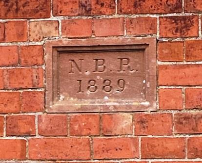
A little further along on the left was a row of railway cottages (F) overlooking the old track bed (above) complete with NBR date stones (below).
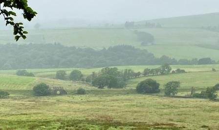
The lane I was following eventually turned away from the railway, but after a while the old track bed became clearly visible again as it crossed the valley below to my left. I stopped for lunch at a gate with a great view of the line (below) in the distance. Somewhere down there was the site of one of the lines’ shortest lived stations, Nook Pasture.
I continued on walking, finally coming to a kink in the road at Longcleughside (G). From here a narrow track led almost back in the direction I had come, descending gently towards the track bed. When I reached the line, it was clear that the way towards Carlisle was totally blocked by thick foliage and for extra effect, someone had placed an oil drum in the middle of the formation. In the other direction, however, the line was clear all the way into Scotland!

Hello Scotland.
It felt good to be walking on the old line again, although this section was almost all in forest with only the occasional view off to either side. In places there were large gaps; evidence that the trees had recently been cultivated. After twenty minutes or so, I reached the site of Kershope Foot (10), 21.25 miles from Carlisle by rail.
There seemed to be nothing left of the old station. I crossed the road at the site of the old level crossing, pausing to photograph the “Welcome to the Scottish Borders” sign close by.
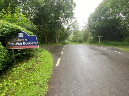
I then continued walking along the track bed on the other side of the road, officially arriving in Scotland a few minutes later having crossed over the stream that marks the border.
Almost immediately the old line emerged from the woods and the scenery opened up on the left hand side with views down towards Liddel Water. I felt pretty good now, safe in the knowledge that I had the right to roam wherever I pleased.
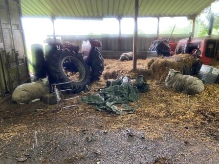
A little further on, I encountered what looked like a miniature sheep farm built on the formation itself. The path narrowed and I found myself walking past a collection of red tractors and several sheep sheds.
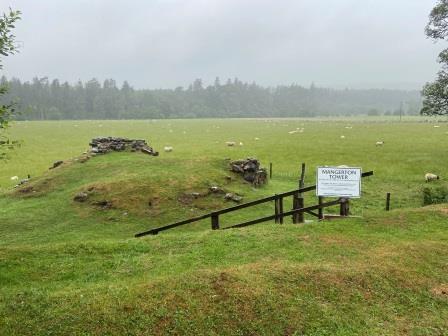
A few minutes later on the left I passed the site of Mangerton Tower (below), a ruined tower castle house formerly belonging to the local Armstrong family. Apparently, it was destroyed by the English in a revenge attack back in 1601. I wondered how many passengers would have noticed it from the train.
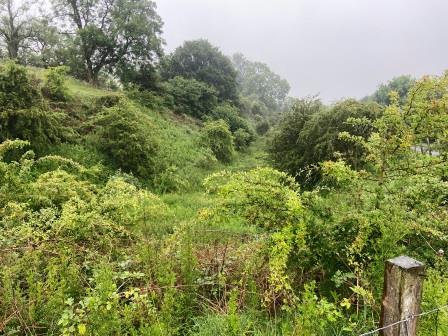
Eventually, around two miles from Kershope Foot, the path diverted off to the left and up on to a bridge over the line. Now, looking back towards Carlisle, I could see that the cutting down below was full of thick impenetrable foliage (below).
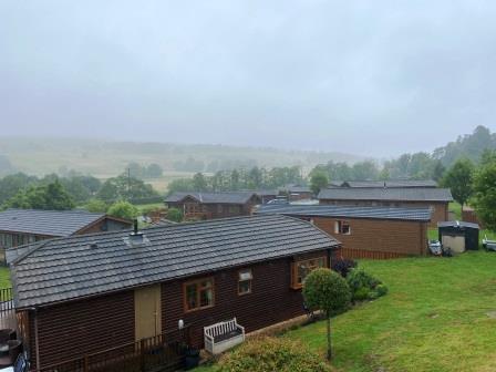
Looking in the other direction towards Newcastleton (below), the formation ahead had been infilled and a little village of mobile homes had been built on the site. Behind the buildings was the missing bridge over Liddel Water (H) that the railway once used to cross into Newcastleton. The Waverley Line had been totally obliterated here.
All this was proof, of course, that whatever the law said, “the right to roam” would have its limitations. Missing river crossings, housing estates and thick foliage could block the line just as much as in England. In order to reach Newcastleton myself I would have to make a little detour.

Newcastleton
As I was walking along the narrow lane that led up from the mobile home village, I was peeped by a couple in a little white Honda. I stood aside to let them pass but when I rounded the bend ahead, I found they had stopped. Ahead an articulated logging truck was completely blocking the little lane. The driver was enclosed in the crane cab at the back picking up logs from a pile and depositing them on the back of the truck.
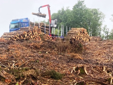
I smiled at the couple in the Honda as I walked past, wondering how long they would be stuck there. Logging is a serious business in this part of the world and at times when I was in Newcastleton it seemed that every truck was either carrying logs or heading up to the forest empty to find more.
A little further on I crossed Liddel Water on a stone bridge (above). Looking south here I couldn’t quite see where the railway bridge used to be, but a thick row of trees in the far distance on the right marked the edge of its course. The main road, the B6357, that I now turned on to went straight through the centre of Newcastleton, whilst the Waverley Line formed a shallow crescent as it bypassed it to the west.
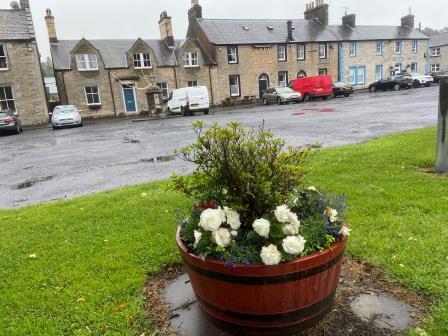
I walked through the centre looking at the collection of shops and the floral displays. Newcastleton marketed itself as cycle-friendly and there was an innovative little kiosk with various bike tools in the central square. It was 5pm by the time I arrived. It had taken me about 9 hours to walk from Longtown. In 1968 the fastest train would have taken 22 minutes.

I found the site of Newcastleton (11) at the end of Langholm Street. There used to be a level crossing here and it was at this spot that around 200 protesters opposing the closure of the line gathered in the early morning of 6 January 1969. They attempted to block the passage of the last train, the sleeper heading for London. The train, hauled by a diesel locomotive named for my home town; Lytham St Annes, was delayed here and arrived at Carlisle around two hours late.
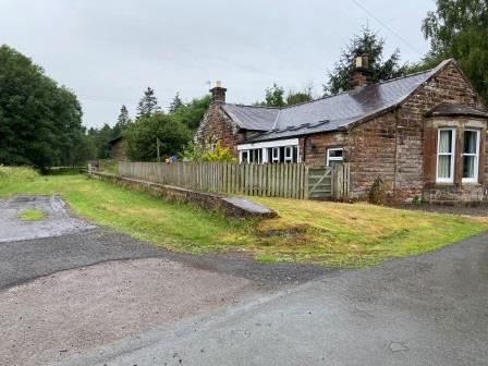
The old station (24.5 miles from Carlisle) which used to be on the “Edinburgh” side of the crossing has completely gone (above), but the station master’s house, now a private residence, still remains on the “Carlisle” side (below). It is suitably decorated with “beware of the trains” notices.
My accommodation in Newcastleton was the excellent Black Burn Lodge, conveniently located on the north side of the town for a quick getaway in the morning. The room was fabulous and the owner, Michael, extra helpful and very friendly. For dinner I ate a wonderful mushroom pasta dish at the Liddesdale Hotel, a place recommended by Michael and booked in advance. I picked up provisions for breakfast and the following day’s lunch from the SPAR on my way back. By 9:30pm I was in bed and soon fast asleep.

Continue – #3 – Newcastleton to Hawick
