Day 4 – Hawick to St Boswells (19.5 mile walk)
Leaving Hawick
Despite the extra distance, Mansfield House proved to be an excellent choice. I received a warm welcome, got a comfortable room, and enjoyed an excellent meal of pasta in their Italian-Scottish fusion restaurant. I slept well and after my best breakfast of the week, a delicious bacon and mushroom omelette, I checked out. I walked back to the “Morrisons” roundabout and was there by 9am.
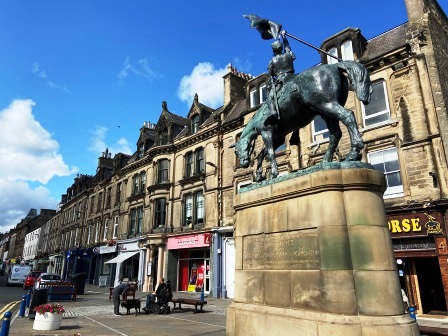
I had a quick look at the High Street (above), bought a Scotch pie and a ham roll from a bakery called Pringles and then set out following the Waverley Line once more.
Standing on the Waverley Bridge that takes the A698 across the River Teviot and looking east (above), I could just about make out where the railway bridge (A) had once been. Hawick’s second station (17) was built on a curve immediately after the river crossing on the north side. The station was constructed when the line was extended southwards towards Carlisle (now 45.5 miles away).
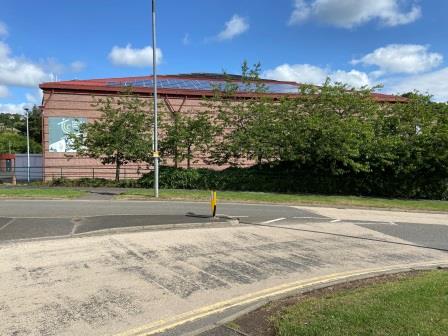
I followed the curve of the line, as it became the Waverley Way path, passing the Teviotdale leisure centre (above) on my left. This was the site of Hawick’s first station when the town served as a terminus of the line from Edinburgh.
I continued walking along the Waverley Way path (above), thinking once again how difficult it might be to restore the line through the town and back over the river. Could it be more likely that a simple terminus of an extension from Tweedbank might be rebuilt somewhere around here?
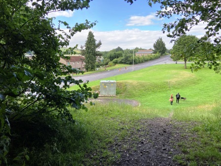
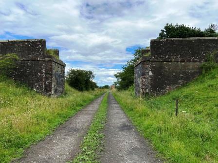
I followed the path until it emerged onto Hamilton Road and then picked it up again to Burnfoot Road. The formation was lost for a while but reemerged opposite the place where the two roads met at a junction. There was a narrow path leading up to the severed embankment (B) , I took it and then turned around at the top (above) to watch a couple with a dog heading down in the opposite direction

The track here was waymarked “Hawick Paths” and continued parallel to the road for a mile or so. The first part led me through woods (above) and at one point there was a well-signposted diversion away from a bridge over a road.
Eventually the path emerged into a shallow cutting and was harder to make out. The ground was also pretty waterlogged here and for the second day running I had wet feet within an hour of starting out.
The path eventually terminated back at the road near Hornshole Hill. I walked a few yards down the road and there was immediately another entry back on to the track bed (C). There was a van parked up there and I exchanged pleasantries with two guys who were engaged in some task with electric cables on the ground.

As I walked back on to the track bed there was a sign warning me that this was an Emtelle Test Track. At the time, I had visions of being mowed down by a sports car or high-speed tractors on trial, but as I later discovered, the company is a local manufacturer of heavy duty electric cables.

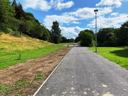
It was finally sunny, and the forecast was for one brief shower for the whole day. I knew my time on the track bed would be short today, so I savoured my walk on this long stretch of raised embankment (above) heading out of Hawick.
The views from either side, but particularly to the south (above) were pretty good. Eventually I came to a cutting, passed under a road bridge and then soon after reached an old footbridge (below). This was Hassendeanburn Farm. I knew the track bed path continued on a bit further from here, but all the information I had suggested that it couldn’t be walked all the way to Hassendean.
I decided to exit, I turned left just after the footbridge and entered the farmyard. I met a farmworker and asked directions on how to exit the farm. I spiralled back over the road bridge I had just walked under, turned left at the end of the lane and continued walking towards Lurden.

Horse Horror
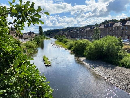
The countryside of the Borders Region was certainly living up to its reputation. As I walked the short distance from Lurden towards Hassendean I had lovely views down towards where the line was (below). At this point it was separated from me by Hassendean Burn and hidden behind a line of trees.
As I got closer to Hassendean I spotted a bridge across the burn in the middle of a large field and a clear way from it back up to the line. I also spotted a herd of cows at the other end of the field, but I figured I could make it over the bridge (below) and on to the line before they even noticed me.
In the event, the cows didn’t even notice me, but as I made it through the stile back onto the track bed, I met two large white horses blocking my path. I moved towards them gingerly and they kind of moved to the side, but as I passed, they followed me, running beside, stopping and trying to block me. They didn’t seem too happy about my right to roam through their field.

My original plan had been to walk under the next bridge, but straight ahead was a third horse blocking my path into this next section of field. Suddenly the first two horses were gathered with the third at the top of the field waiting for me. I gave up on my plan and dived left over the fence into the adjacent meadow. I eventually spiralled round to survey the scene from the safety of the bridge (above).

Eventually I walked around to Hassendean (18) which at 49.75 miles from Carlisle is almost at the mid-point of the line to Edinburgh. The station has been done up spectacularly well with a brightly painted footbridge and signal box. It now serves as holiday accommodation.
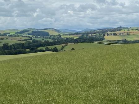
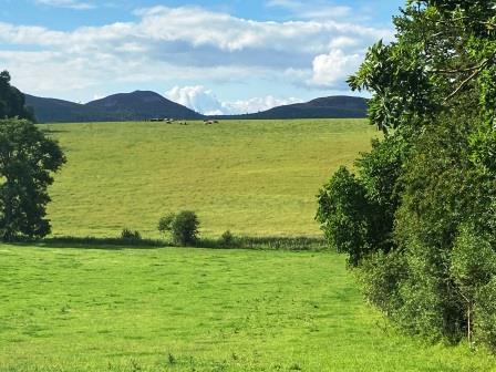
Now, knowing the route was not walkable ahead, I started my biggest diversion away from the line of the trip. The old railway continued straight, but the easiest way for me to follow seemed to be to go east around the other side of the wonderfully named and very picturesque Minto Hills (above).

Straw Struggles
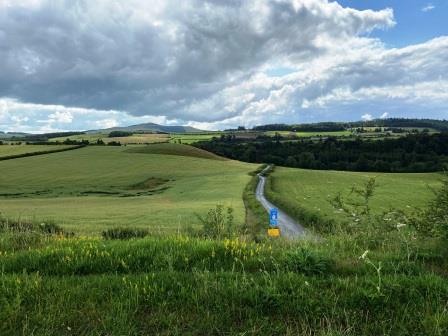
It started to rain just as I was setting out from Hassendean but in the event, the day’s only shower was a short one. It took me just over an hour to circumnavigate Minto Hills on quiet country lanes with little traffic. The views of the hills themselves were fantastic.

I was reunited with the Waverley Line just before Standhill. Here the formation had been removed and looking back towards Hawick (above) there was little evidence that a railway ever came through here.

In the other direction things were different (above), there was a bridge over the track and just to the right of it, marked by two flags, was the entrance to Standhill Farm. I walked down the side road into the farm and, obeying the signs posted, I found the farm office that “visitors had to report to”. I had intended checking on whether I could walk the next section straight through to Belses. There was no one around to ask.
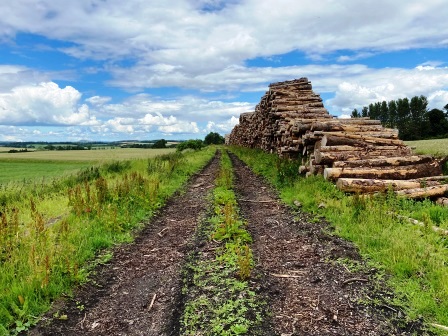
I decided to go for it. I wandered around the back of the yard and found the entrance to the track bed again. It seemed clear as far as I could see. Yet, as I got further along, I saw a large pile of straw and manure once again blocking the whole path in the distance. As I got closer, I saw that, unlike yesterday, it would be impossible to get through it.
Eventually, I managed to manoeuvre over a very difficult fence into the adjacent field and work my way gingerly through some tall grass until I had bypassed all the straw. I was still worried there might be other blockages ahead and I might have to turn back, but luckily there weren’t any.
In fact, the rest of the section, all on grass with sheep running around, was pretty splendid. Unfortunately, it was over far too quickly and I was soon at Belses Cottage where a missing bridge would force me off the formation. I continued along the road until I came to the entrance to Belses (19), 53 miles from Carlisle by train.

I stopped for lunch just outside Belses Mill Farm. I knew that the next section of line, which included the intact-but-sealed Ale Water Viaduct (E), was not suitable for walking. Even after that, a number of other obstacles would prevent any real progress being made.
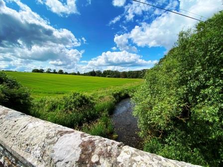
I crossed Ale Water on a stone bridge and looked into the distance to where the line was hidden by a row of trees (above). I then turned onto the road to Longnewton and soon crossed the line, hopelessly overgrown and impassable at this point, again. For the rest of the afternoon, I would have to content myself with views of the line from bridges.

A68 Anxiety
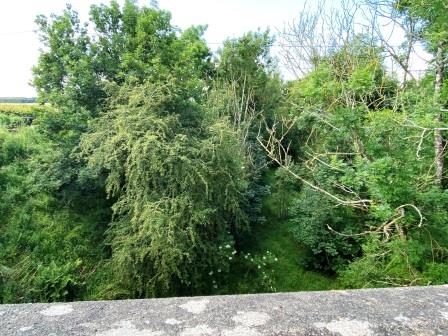
After Longnewton I met the line again at Greenend (F). On the south side of the bridge over the railway the cutting had been infilled, and any progress from that direction would have been impossible. Looking into a deep muddy cutting filled with foliage on the north side (below) it struck me, not for the first time, what a shame it was that more of this old railway couldn’t be turned into cycle paths.
My route to the next station was admittedly quite bonkers. To get one mile further along the line from where I was standing at Greenend, I went over a mile east to reach the A68, a mile up that main road and then another mile back to the line again. Walking up the side of the busy A-road was, save for the cow experience, probably the worst part of the whole trip.
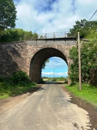
On my way back towards the railway I passed Charlesfield industrial estate (G). This used to be a munitions plant and was the main reason for the opening of Charlesfield Halt (20). The station sat just to the south of the tall bridge over the road (above).
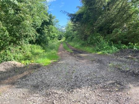
I walked up the old station approach road to the top of the bridge. I wasn’t surprised to see the track bed path intact (above) heading south towards Greenend, but I knew that it only went part of the way. A path led in the other direction as well, but that seemed equally useless. The formation itself disappeared for a bit just before Kelso Junction (H) where the line from Kelso used to join. I resolved to walk around it all.

I took one last look from the bridge in the direction I was about to head (above) and then set off on a pleasant little detour for the last two miles into Newton St Boswells passing through Camieston and Whitelee on the way.
As I finally approached the outskirts of the little town, I realised that in following the railway on its 12 mile journey from Hawick, I had walked almost 20 miles.

Newtown St Boswells
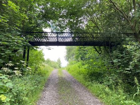
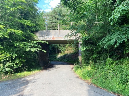
The cumulative effects of walking a distance of sixty miles over three days seemed to be finally getting to me. I was flagging a bit in the afternoon sunshine and knowing I was almost there, was very happy to see the little bridge (below) that once took the Waverley Line into Newtown (I). It was 5:30pm, and my walk from Hawick had taken me eight and a half hours. A train in 1968 would have taken just 15 minutes.
Within ten minutes of passing the bridge I had arrived at my lodgings, The Dryburgh Arms, and was sat in the bar with a pint of Wainwright’s Ale in my hand. I had sunk another pint before I recovered enough strength to ask to be shown up to the room. The Dryburgh was obviously a great pub but there was no evening food on Thursday, and I hadn’t booked any breakfast there either.
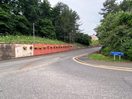
I went across to the local Co-op (located on Old Station Court) to shop for both meals. On my way back I stopped to look at the place where the railway once crossed the main road, roughly at angle where the wall had been painted red (above). St. Boswells (21), 57.75 miles from Carlisle, was positioned above on the bridge, the platforms spanning both sides of the road.
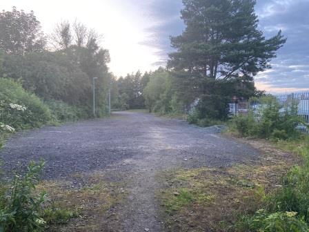
After an improvised dinner in my room, I went for another wander. I climbed up to where the track bed had been on the south side of the station (above) and then went along a little wooded path crossing the bridge (I) that I had walked under earlier. The formation then disappeared just a few yards to the south of the bridge.

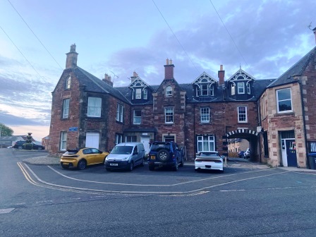
Nothing remains of the station building, but the old water tower and engine shed can be viewed in the yard of a van hire company (above), whilst the old station hotel (below) still exists just across from where the station entrance was.
I returned to the Dryburgh Arms quite pleased with myself. I had just five miles left to walk the next day. I slunk back into the bar and had a final pint of Wainwright’s before another early night.

Continue – #5 – Newtown St Boswells to Tweedbank / Edinburgh
