A walk around Tokyo’s iconic loop line
In March 2019 I spent a day walking between all of the 29 stations on Tokyo’s iconic Yamanote loop line. The 40km journey took me over 11 hours to complete but it was one of the most enjoyable urban walks I have ever done.

I walked clockwise starting from Shinagawa in the southeastern corner of the loop. My route took me past some of Tokyo’s most famous sights, along bustling shopping streets and through quiet residential backwaters.
I lived in Tokyo between 1987 and 1989 and then again between 1991 and 1994, so my walk also provided me with a chance to revisit some of the areas I once knew well and to see how much they had changed.
Start the journey here or read on to find out more about the Yamanote line itself and how I planned my walk.
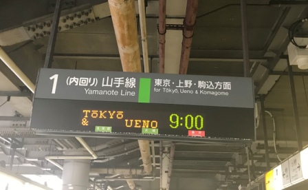
Yamanote Line
The city of Tokyo (until 1868 known as Edo) grew along the Sumida River and the flat area around Nihonbashi (close to the current Tokyo Station) was its commercial centre. The hillier area to the west (not then part of the city) including present-day Shinjuku and Shibuya was named Yamanote which roughly translates as “mountain foothills.”

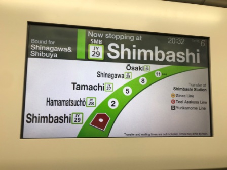
The first railway in Japan linked Shimbashi and Shinagawa with Yokohama (about 30km to the south) and was opened in 1872. It was later extended a few stops north to Tokyo and still exists today as part of the Kehin Tohoku and Tokaido lines.
The first part of track that is now the Yamanote line was opened in 1885. It branched off at Shinagawa and looped clockwise through Shibuya and Shinjuku to Ikebukuro (and on to Akabane). The line was continued clockwise to Ueno in 1903 and the 34km circle was finally completed back through Tokyo to Shimbashi in 1925. The whole line was constructed either on the surface or raised up on viaduct. By the time it had been completed the line was operated by Japan’s state-owned railway corporation.

An early planning law meant that the significant number of private railways heading into Tokyo from the western suburbs were not allowed to penetrate the Yamanote loop and had to terminate where they met the line. In fact, the only surface line ever allowed through the centre was the state railway’s own Chuo line which dissected the loop west to east and opened between Shinjuku and Tokyo in 1919.
The situation persists to this day and, although an intensive network of underground subways has now been constructed in the centre, no other surface lines have ever been built inside the Yamanote loop.
All this had a big impact on the future shape of Tokyo as a multi-centre city. The private railway companies such as Tokyu, Seibu and Keio soon built department stores over their termini and the areas around them quickly became sub-centres that eventually grew to rival the old centre of Tokyo itself. Today, three of these sub-centres; Shinjuku, Shibuya and Ikebukuro boast the top three busiest stations in the world and are now effectively cities in their own right.

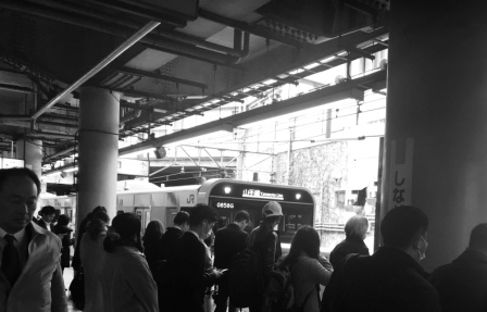
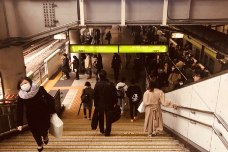
The Yamanote line, now operated by the JR East Company, plays a role in linking up these sub-centres and it helps to define the central area of the greater Tokyo. Until the full development of the subway system in the 1970s it was seriously overcrowded.

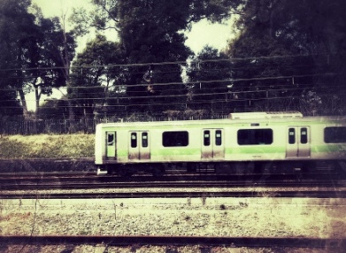
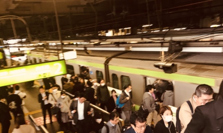
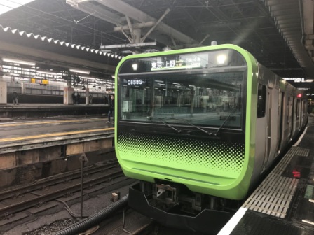
The line, which was given its distinctive green colour in the early 1960s, offers service from around 4:30am until 1:30am every day with trains running every 3-4 minutes in both directions. Although the line is not as crowded as it once was (new subway line openings have alleviated things a bit) it can still get very busy in the rush hour. The line carries an average of 4 million people a day.
Trains in Japan run, as in the UK, on the left and those trains going clockwise on the Yamanote line are said to be on the “outside loop”. Those running anti-clockwise are said to be on the “inside loop”. It takes a train about 65-70 minutes to complete the loop in either direction.
The Trains
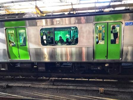
Although effectively the fifth generation of rolling stock for the line, the Class 103 was the first type to carry the distinctive green livery. These trains operated from 1963 until 1988. They were still in service when I first arrived in Tokyo and I used them for my first few trips around the city back then.

The aluminum body of the class 205 meant that the all-green livery was dispensed with and the line colour was reduced to roof and waist banding. These trains were first introduced in 1985 and lasted until 2005. For the majority of the time I lived in the city they were the Yamanote line.

The Class 231s were introduced between 2002 and 2005 and featured enhanced performance and interior digital displays that could convey advertisements and travel information.

Now, after 17 years in service, the Class 231s themselves are giving way to the Class 235s. The whole fleet of 50 trains is expected to be replaced by 2020. At the moment the service is provided by a mixture of both types.
Planning to Walk
In late February 2019 I began to realise that I would have an extra weekday free during a forthcoming business trip to Tokyo. I decided to plan a walk around the city. I first considered walking over one of the subway lines, but soon latched onto the idea of walking around the Yamanote loop.
I did a bit of on-line research and found to my surprise that not only had the thing been done several times and was well documented, but there was also a yearly charity “Yamathon” where groups of 3-4 people would spend a day circling all 29 stations.
Undeterred by the sudden lack of originality, I began to plan the walk. As far as I could see, nobody had ever come up with a definitive route for the challenge, so I decided to use Google maps to create my own. I decided that my objective would be to get a photograph at one of the exits at each station, I didn’t really care which exit. I let Google calculate the shortest distance between each station and with one or two of my own alterations and adjustments I used their suggested routes. I printed out a series of 29 routes.

I decided to start at my hotel in Shinagawa and loop clockwise. I chose clockwise mainly because I knew the later stages of a clockwise walk would be more interesting after nightfall than those in the opposite direction.
The line itself is 34km but as it is impossible to stay by the track the whole way, the walk worked out at around 40km. It was a fair distance but not, I thought, an impossible one. I have certainly walked further in a single day on many occasions.

Putting all of the map timings together gave me an average of 15 minutes between each station and a total time of around 7.5 hours. In reality, stopping to take photographs, waiting to cross the road on numerous pedestrian crossings and the need to pause to take in all the sights, lengthened the time to over 11 hours.
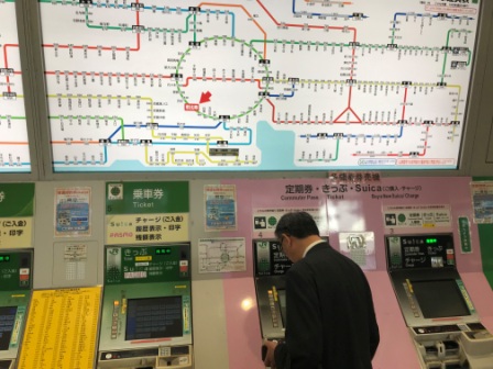
For most of the day I relied on the printed Google maps themselves and they very rarely let me down. Once or twice when I wasn’t quite sure I was able to refer to the excellent street map signage found all over the city.
The Walk
The walk is shown in grey superimposed on the map below.

I have divided my account of the walk into 4 sections based on the points of the compass:
1 – SOUTHWEST (Shinagawa to Yoyogi)
2 – NORTHWEST (Yoyogi to Sugamo)
3 – NORTHEAST (Sugamo to Akihabara)
4 – SOUTHEAST (Akihabara to Shinagawa)

