Walking the South Downs Way
(Nine Sections including bus & rail links)
Section 6)
Amberley to Cocking – 12.5 miles (incl. extra 0.5 mile at start)
There was a very well-located car park where the South Downs Way was intersected by the A286 just outside Cocking. The No. 60 bus, operated by Stagecoach, stopped right across the road from it on its way from Midhurst to Chichester. We parked the car, jumped on the bus and less than half an hour later we were in the “capital of West Sussex”.

The bus was actually heading to the bus station (opposite the railway station) but we got off early at the cathedral; we wandered through the city, grabbed a coffee and made our way slowly to Chichester station. From there we took a train to Barnham (7 minutes) and waited for another for Amberley (14 minutes). The time we were actually moving was less than 50 minutes, but with all the connections the whole journey took us almost two hours!
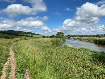
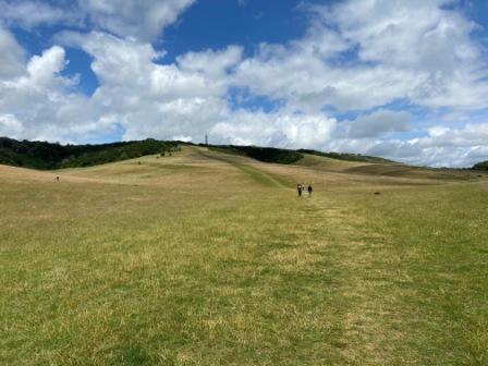
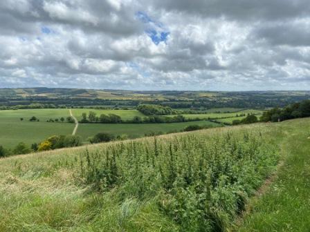
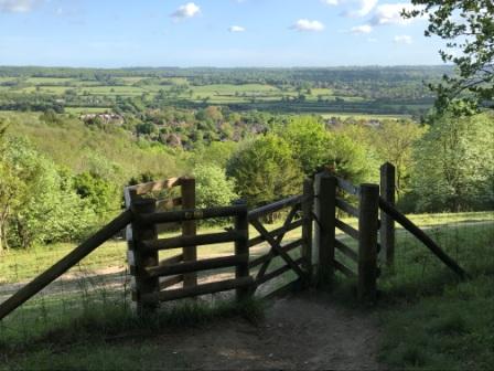
Back on the South Downs Way, we set off again and soon we were crossing the River Arun before climbing once more onto the escarpment. The views, particularly from Bignor Hill, site of an old Roman villa, were once again pretty stunning.
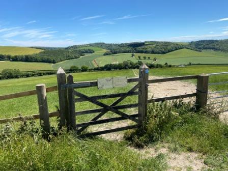
The farmers along the route had placed informative little signs on the gates all about the crops they were growing or the livestock they were keeping. One of them, we learned, was a supplier of milk to Marks & Spencer. About three quarters along the way to Cocking we went through an enormous wheat field; it was actually one of the few places the trail crossed land used for cultivating.

After passing through some quite dense woodland, another change in character for the path, we began to descend once again and eventually we saw our car park in the distance.
Just before we reached the A286 we came to a farm where a friendly lady was selling locally-produced ice cream from one of the barns. We got some and sat enjoying it whilst looking across to the steep-looking climb that would confront us at the start of our next section, whenever that would be.

Section 7)
Cocking to Queen Elizabeth Country Park – 13 miles (100% on trail)
On our seventh outing we headed to the Queen Elizabeth Country Park just outside Petersfield. There were actually a few free parking options in the vicinity but we were running late so we chose to use the pay-to-park option inside the park itself. It wasn’t cheap but it gave us the chance to use the toilets in the centre. There was a café serving breakfast too.

We caught a No. 37 bus from opposite the centre on the main Portsmouth-to-London (A3) road to Petersfield station (20 minutes), and after a wait of around 20 minutes we caught a No.92 heading to Midhurst.
The 92 only ran Monday and Wednesday (at the time of writing) so we had planned the trip carefully to ensure we were travelling on a Wednesday. We got to Midhurst (30 minutes) and after just 10 minutes wait we were off again on the No.60 heading south for the short trip to Cocking Hill (15 minutes).
Our “car-to-trail” time was just over 90 minutes. This was actually a lot shorter than we had first estimated; without the Wednesdays-only 92, we would have been forced to divert all the way south to Havant and then east to Chichester again before heading back to Cocking; a journey that would have taken well over 2 hours.

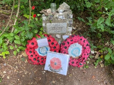
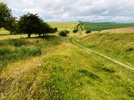
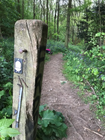
Back on the South Downs Way we climbed towards Cocking Down and then continued to Didling Hill. After a couple of miles we entered the woods for a while, along the side of the path we noticed an old war memorial surrounded by wreaths of poppies. It was dedicated to a pilot lost in the Battle of Britain in 1940; a closer look at the inscription revealed that the airman was actually German.

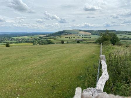
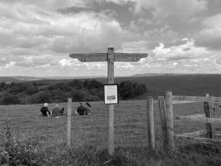
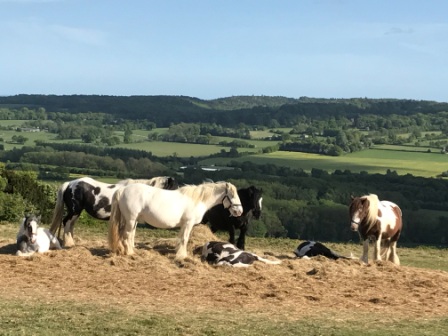
We had lunch near the top of Beacon Hill on the Harting Downs and then spent the early afternoon walking along the ridge once more with beautiful views to the north of the villages of East Harting and South Harting. There was a car park and picnic site along the route and the footpaths were full of hikers and dog walkers enjoying the sunshine.

Just before we arrived at the eastern edge of the Queen Elizabeth Country Park (QECP) we went over the county border and passed from West Sussex into Hampshire: our third and final county. The last bit of the walk was through the heavily-forested but very pleasant QECP. The whole park was criss-crossed by several trails and at times it was a little difficult to make sure we were on the right path.

Section 8)
Queen Elizabeth Country Park to Exton – 13 miles (incl. extra 2 miles at end)
Although there were no realistic public transport options crossing the footpath for the remaining 23 miles to Winchester, we did manage to find one solution. There was a bus from West Meon, a village about two and a half miles north of the South Downs Way at Exton, to Petersfield. By happy coincidence, Exton was almost halfway to Winchester.


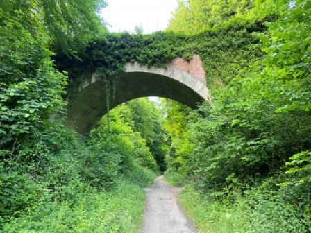
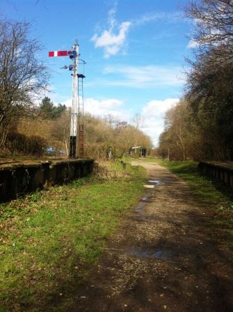
We drove down to West Meon and parked in the car park at the disused station. From there the “Meon Valley Trail” went about ten miles to the south along the track bed of an old railway line that used to link Alton with Fareham. We would be using the trail from the point it intersected with the South Downs Way at the end of our day’s walk.
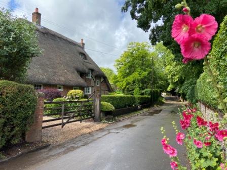
Bus 67 only ran a few times a day, so we had arrived in West Meon with plenty of time to spare. We had a look around the attractive little village. The bus stop was located next to the Thomas Lord pub named in honour of the founder of the famous London cricket ground. He retired to the village and is buried in the local churchyard.
We caught the bus to Petersfield (20 minutes) and spent the layover there looking around the farmers’ market before returning to the Queen Elizabeth Country Park on the No. 37 (20 minutes).
The first part of the day’s walk was an ascent of Butser Hill to the highest part of the whole 100-mile route. I actually ran run up the hill on the South Downs Half Marathon several years ago, so walking up it seemed almost relaxing. From the top of the hill we were walking on tarmac for quite a way; in fact quite a fair proportion of the day would be spent at the side of (normally quiet) roads. The big highlight of the walk was Old Winchester Hill with its great views and Iron Age hill-fort site at the top.
As we descended from the hill the old railway line came in to view and we left the South Downs Way, turned north and walked back up to West Meon. The Meon Valley Trail was pleasant enough but we were was totally enclosed by trees for much of the time. The lack of any real scenery meant the 40 minutes we spent on it seemed to drag a little.
Section 9)
Exton to Winchester – 14.5 miles (incl. extra 2 miles at start)
For the previous eight sections we had used the car to get down to the route. Now we decided to make our final trip to the South Downs Way by rail. We got a train up to Victoria, another to Clapham Junction and a third down to Winchester. It took a bit longer than the car would have done, but it was much more pleasant.
We arrived in Winchester just after 9am and then walked through the city to the bus station. We paused for a coffee and a hot cheese straw (recommended) at Reeve’s bakery near the Buttercross Monument on the way. We boarded the first No.67 (heading towards Petersfield) of the day and 50 minutes later we were standing outside the Thomas Lord in West Meon again.
Soon we were walking along the track bed of the old railway once more and within three quarters of an hour we were back the South Downs Way itself again. Soon after we rejoined the trail, we crossed the River Meon and then passed through the pretty little village of Exton.

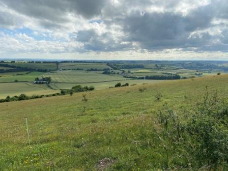
We climbed up towards Beacon Hill after Exton and then, when we were near the top, paused to look back at a wonderful view of the whole Meon Valley complete with Old Winchester Hill in the far distance.
We spent the next few hours on tracks and minor roads before coming to Gander Down; the scenery here was more undulating and a little different from what we had come to expect from the Downs.

Eventually we finished our last climb, up to Cheesefoot Head, and then slowly descended from Telegraph Hill with Winchester at last coming into view in the distance. We passed pretty little Chilcomb and then went through some golden wheat fields before crossing the M3 motorway and entering the city.

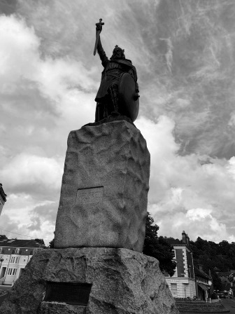
The very last part of the trip took us alongside the River Itchen and then, after a final right turn opposite the city watermill, brought us to the foot of King Alfred’s statue: terminus of the South Downs Way. We congratulated ourselves and then immediately went off in search of a drink.
We got some pints from the Old Vine Hotel and drank them sitting on the grass in front of the cathedral. Our trip on the South Downs Way hadn’t had anywhere near the same amount of drama as the Pennine Way; nor had it been as long or as big a challenge, but we still felt a similar sense of achievement at finishing it and this was again mixed with a bit of sadness that it was all over.
We had certainly enjoyed the whole experience and would recommend it to anyone.

Return to South Downs Way Part 1
INFORMATION ON TRANSPORT LINKS


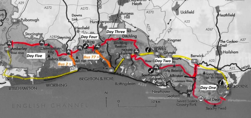
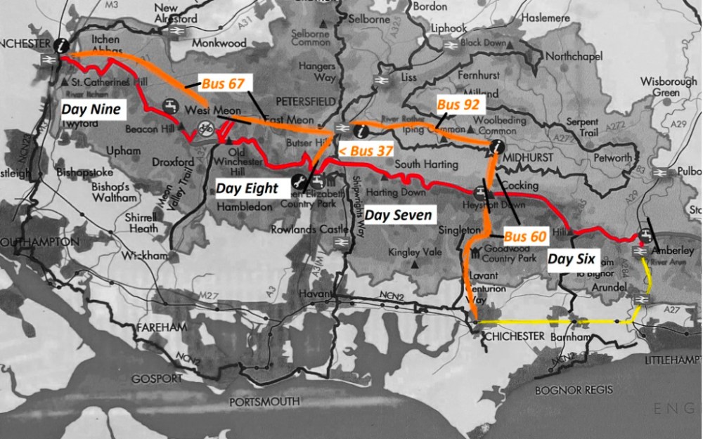
The maps below have been created from black and white photographs I took of parts of a notice board on display at Amberley Station. I have coloured the South Downs Way in red, railways in yellow and added (approximate locations of ) bus routes used in orange.
The transport links shown were, I believe, the best available to us at the time of walking, but other routes could well be available.
As we had the benefit of discounted travel (via Gold Card), we generally favoured rail travel wherever possible. Obviously those eligible to free or discounted bus travel should look at other road-based options. In all cases using bus or train worked out cheaper than a taxi for two of us; with three walkers that balance could shift.
I used https://www.traveline.info/ for general travel enquiries and for rail I used https://www.nationalrail.co.uk/
The buses (77 and 2) that we used in the early sections of the walk were operated by Brighton & Hove. They have an excellent website: https://www.buses.co.uk/
All the buses we used later were operated by Stagecoach. They also have an excellent website: https://www.stagecoachbus.com/about/south and it is well worth using their App to get better deals on tickets and to locate exactly where due (or overdue) buses are on live maps.
There is a limited direct bus service between Alfriston and Eastbourne on weekends. Details at https://cuckmerebuses.org.uk/
There is also normally a bus (100) between Pulborough (just north of Amberley by train) and Upper Beeding but it was suspended at the time of our walk. Details at https://www.compass-travel.co.uk/
Return to South Downs Way part 1
APPENDIX 1 – North Downs Way

The North Downs Way connects Farnham in Surrey to the Kent coast at Dover and includes a loop via Canterbury at the eastern end. It is 153 miles in total and part of the route follows the ancient “Pilgrim’s way” that used to link Winchester with Canterbury.
The path actually runs within a few yards of our front door, so it is perhaps not surprising that it was the first National Trail we ever managed to complete. We walked it in 9 sections over 18 months and finished the final bit in early 2016.
Here are the segments we divided it up into and the transport options we used. The daily distances we walked tended to be greater than our on subsequent journeys on the South Downs Way.
West
1) Otford to Mertsham (20 miles) – Return by train via London (75 mins via Victoria).
2) Mertsham to Gomsall (18 miles) – Park at Redhill Station, train to Mertsham (4 mins) & return by train from Gomsall Station to Redhill (20 mins).
3) Gomsall to Farnham (18 miles) – Park at Gomsall Station & return by train from Farnham to Gomsall changing at Guildford (55 mins).
East
1) Otford to Cuxton (15 miles) – Return by train from Cuxton to Otford via Maidstone Barracks / Maidstone East (approx 70 mins).
2) Cuxton to Harrietsham (21 miles) – Park at Cuxton & return by train from Harrietsham via Maidstone East / Maidstone Barracks (approx 70 mins).
3) Harrietsham to Wye (13 miles) – Park at Harrietsham & return by train from Wye to Harrietsham changing (usually) at Ashford (47 mins).
4) Wye to Dover (23.5 miles) – Park at Wye & return by train from Dover to Wye changing at Ashford (55 mins).

Canterbury Loop
1) Wye to Canterbury (15 miles) – Park at Wye & return by train from Canterbury West (16 mins).
2) Canterbury to Dover (19 miles) – Park at Canterbury East & return by train from Dover (28 mins).
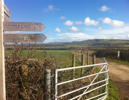
APPENDIX TWO – Downs Link
The Downs Link path links the North Downs Way (near Chilworth) and the South Downs Way (near Shoreham-by-Sea). It doesn’t quite have the status of a National Trail but it is almost all on the old track bed of two old railway lines; so it has a special fascination for me.
It is all pretty flat and whilst it doesn’t have quite as many dramatic views as the other two it is still definitely worth doing. The whole distance is 37 miles and we completed it end to end in 2015 over a single weekend; returning home at the end of the first day.
Day 1) Chilworth to Christ’s Hospital (19 miles)
Out: Park at Redhill, train to Chilworth (30 minutes)
Return: Train from Christ’s Hospital to Redhill / Change at Horsham (up to 60 minutes)
Day 2) Christ’s Hospital to Shoreham-by-Sea (18 miles)
Out: Park at Three Bridges, train to Christ’s Hospital (25 minutes).
Return: Train from Shoreham-by-Sea to Three Bridges (60 minutes)
Return to South Downs Way Part 1
