A road trip around northern Nevada
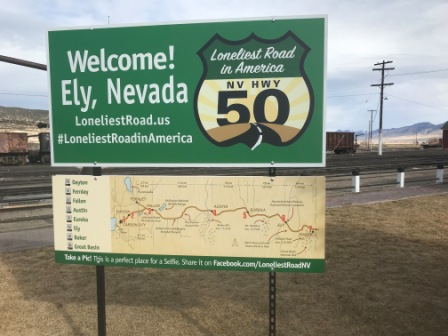
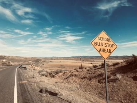
The Loneliest Road in America
In July 1986 LIFE Magazine described the stretch of US 50 that crosses Nevada as the “Loneliest Road in America.” The piece was intended to be critical and suggested that there were absolutely no points of interest along the highway.

Although the article actually encouraged readers to avoid the road, the people in charge of Nevada tourism decided to turn the criticism to their advantage. They began to use the “loneliest” label on roadside signs and include it on tourist maps and leaflets. They even published the “Official Highway 50 Survival Guide” which lists many of the historic sites that can be found along the road.
On a recent visit to Nevada I decided to incorporate some of US 50 into a weekend road trip. The journey (January 2020) was to be made in the company of an old friend who would be visiting from Canada. We had made similar trips a few times before and on this one we planned to revisit some old haunts and discover new ones.

If, like me, you come from a densely populated European country and are looking for a contrast, Nevada is absolutely the perfect place for a road trip. There are miles and miles of virtually empty highways crossing large desert valleys with some truly amazing views. Many of Nevada’s little towns are filled with historical buildings, cheap accommodation and friendly locals. There is even the occasional ghost town to discover too.

Our trip would comprise of a wide clockwise loop from Las Vegas: basically we would drove north on US95, up to US50, head east along it for a hundred miles or more and then back south again along US93.

We were not looking for too much in the way of adventure; no national parks, hiking trails or expensive museums for instance; we were just expecting to enjoy the scenery, experience a few new things and meet some locals. We were hoping to end up with some new stories to tell.
Here are 13 of those stories.
1) The Jim Butler
We left Las Vegas just after lunch on the Friday and, staying on US95 the whole way, we reached the old mining settlement of Tonopah just as it was getting dark. It had been a balmy 19 degrees (Celsius) back in Vegas but now with the change in elevation and latitude it was down to 7.
Tonopah (Population 2,478, Elevation 6,047ft) is located approximately midway between Las Vegas (206 miles) and Reno (237 miles). It is a popular stopping off point for motorists travelling between the two cities and has a fair amount of accommodation as a result. We’d actually visited Tonopah a couple of times before, first in 2009, and we had really enjoyed it.

We headed directly to the “Jim Butler”: a friendly and dependable motel where we had stayed a couple of times before. The lady on reception gave us a decent room rate and explained that it included discount. When we enquired what the discount was for, she told us it was for “walking in the door”. We asked her if we could get an even cheaper price if we walked out and back in again, but she told us it didn’t quite work like that.

The Jim Butler is bang in the centre of town and is named after Tonopah’s founder. Local legend has it that back in the early 1900s Jim, a mining prospector, went looking for a lost burro. When he finally located the animal he picked up a rock to throw at it in anger and frustration. The rock felt usually heavy and Jim quickly realised he had made one of the largest ever finds of silver in Nevada.
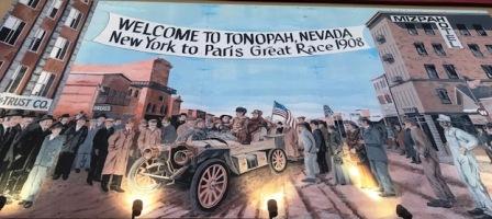
The resulting town was initially named Butler and by 1902 it had over 3000 residents. It was renamed Tonopah in 1905 but the Jim Butler name lives on in many different forms in the town, not least in the annual “Jim Butler Days” festival. The richest mine in the area was known as the Mizpah.
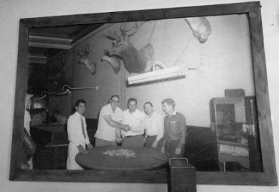
Tonopah’s mining boom years ended before World War Two. Since then it has relied partly on the nearby military test range to survive. There was a book all about the base in the motel reception and it featured the F-117 Nighthawk, partly developed close by, on the cover.
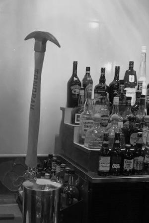
2. The Tonopah Liquor Company
We decided to go on a bit of pub crawl.
We had been quite impressed with Tonopah’s drinking dens back in 2009, but now as we walked around we soon came to the conclusion that things seemed to have got even better in the intervening years.
Probably top of the list of improvements was our first stop: the Tonopah Brewing Company. They make their own beers and they give them names like “Ghost Miner Stout” and “Yankee Girl”. Some of them were served from taps decorated with cute little mining pick axes. We enjoyed sampling a few different brews whilst tucking into some of the excellent southern-style barbeque that the place specialises in.
The Bug Bar was next. It was located on a little ridge overlooking the town and we had to climb a steep path up to it. There was a sign on the door that offered a strange list of things that included molasses and horse baiting. Inside it felt a bit like being in somebody’s sitting room. It was a really nice atmosphere: a bar full of friendly locals chatting convivially and lots of wild-west pictures on the wall. The only downside was that there was no (in our opinion at least) decent beer on tap. We enjoyed a few bottles of Sam Adams and then decided to leave.

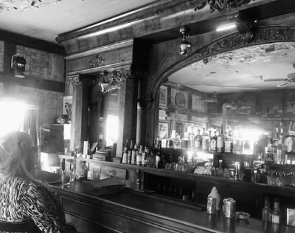
We spent a lot longer at the bar in the Tonopah Liquor Company Building. The bar was housed in a part of the building that was constructed in 1906 and is now one of the best preserved old buildings in the town. The bar claims it is the second oldest in the state in continuous use. The walls were covered with fascinating photographs of people drinking there over the last 100 years.
The bartender entertained us with his stories of life in Tonopah. It was all predictible but interesting stuff; apart from the odd fight there was little crime; the place could feel quite isolated; real estate prices were amazingly low; everyone knew each other’s business.
He also told us of the plans for Interstate 11 which may eventually replace US95 and cause the town to be bypassed. It seems the plan is a good 15 to 20 years in the future though, so there is no need to worry just yet.

We had our last few drinks in the Mizpah Hotel bar talking to a guy who was employed in the gold mining industry. His work was actually based further north but he found living locally cheaper. He had visited Ireland recently and told us all about it.
The Mizpah was right next door to the Jim Butler so we didn’t have far to go to get to our beds.
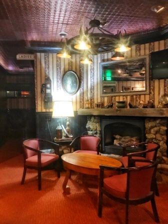
3. The Lady in Red
The next morning we returned to the Mizpah for breakfast.

The building was derelict when we first visited Tonopah in 2009, but in 2011 it was purchased by the owners of a California winery (the same people were responsible for starting up the Tonopah Brewing Company) who renovated it. It had actually been very impressively done up and certainly looked and felt just how it might have done when it first opened over 100 years ago.

One of the breakfast choices was “lady in red” oatmeal and there was a explanation of the origin of the name on the back of the menu: in the 1920s a young woman, dressed in red, was murdered on the fifth floor of the Mizpah.

The room where it happened now bears her name and many believe that her ghost still wanders around the hotel. The owners certainly make it a central part of their “ghost weekend” packages.
The oatmeal looked tempting but in the end I went for the omelette. It was delicious.
4. The Gold in the Silver State
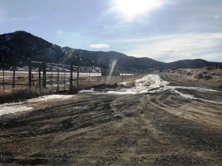
We started out on our second day heading east along US 6 but soon turned north along Nevada 376. The road was almost devoid of traffic and the scenery was fantastic. As we climbed and headed north the temperature continued to drop and we started to see snow. First it was on the hills in the distance and then eventually it was at the side of the road.

As we had learned in the bar of the Mizpah the night before, even though it goes by the name of Silver State, gold is more prominent in Nevada these days. The state has experienced a modern gold mining boom, starting with the discovery of large deposits in the early 1960s.
It is now a major industry, and the area is one of the largest sources of gold in the world. Checking the statistics on line: in 2018 Nevada produced 78% of US gold and 5.0% of the world’s production. The Nevada mining industry supported about 15,000 jobs and the average pay for mining industry employees was almost $100,000 per year.
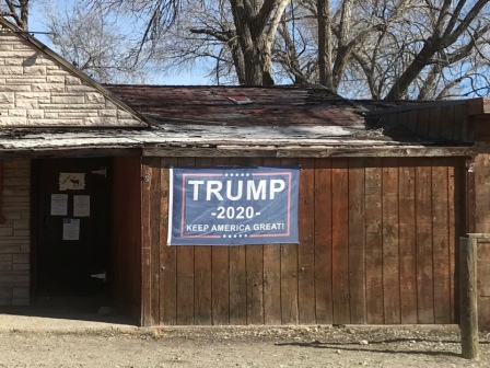
With still 10 months to go before the election there seemed to be quite a lot of political posters around. Nevada is one of the so-called “swing” states but as we drove through little hamlets on our trip we saw only posters supporting President Trump.

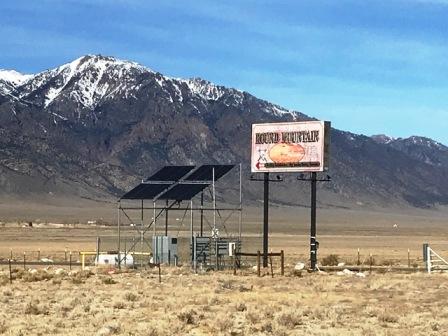
After a drive of around three hours (118 miles) we came to the junction of NV 376 and US 50. Here we noticed some large billboards suggesting a visit to the nearby town of Austin. One board said: “You are going to need a bigger bucket list” and another claimed: “What happens in Austin, you brag about”. It would be a bit of a detour for us, but we decided to head west before going east and see what all the fuss was about.
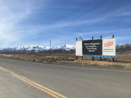
5. The Extended Bucket List
We turned onto US 50 and after negotiating a series of hairpin turns reached the snow-covered Austin summit of the Toyabe range. We then descended slowly into the town itself.

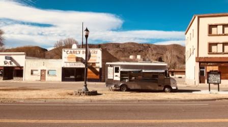
Austin (Population 192, Elevation 6,605ft) was a ramshackle little place. It might not have lived up to the hype but it was certainly a well-preserved example of an early Nevada mining town. We had a bit of a drive around and then parked up and went into the grandly named “International cafe and bar”.
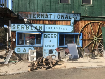
The lady in the cafe told us that Austin was a kind of living Ghost town. She estimated the actual population to be “50 and falling”. As she chomped on a sandwich, she related a familiar story about a small town in decline: young people are leaving and no one is coming in to replace them.
Feeling a little hungry, we enjoyed a couple of her excellent homemade banana and chocolate cookies with some coffee. The cafe part of the International was charming but the bar in the next room was quite wonderful, apparently the whole thing was shipped over from Virginia City in 1864. We regretted that it was only lunch time because it would have been a great place to have a few beers in the evening.
Austin, like Tonopah, grew from silver mining. It even has its own story involving a horse: apparently back in 1862 a Pony Express animal kicked over a rock and triggered the silver rush. By the following summer the place had a population of 10,000.
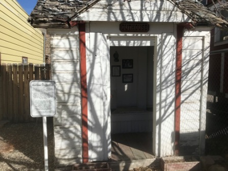
6. The Five Hole Outhouse
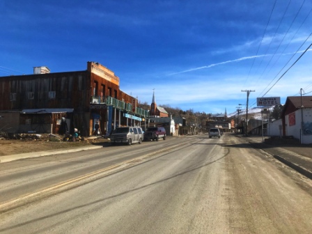
We set off again. We drove east along US 50 until, after 70 miles, we reached Eureka.
Eureka (Population 610, Elevation 6,485ft) markets itself as “the happiest town on the loneliest road”. It is one of the most remote towns in America but it seemed quite an interesting little place. We decided to park up and take a closer look.
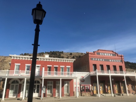
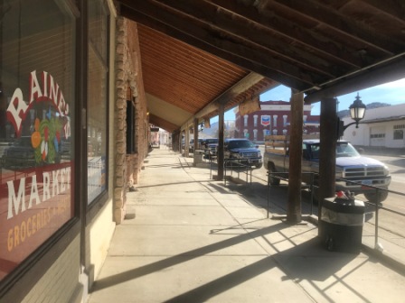
We walked around for a while admiring the many preserved 19th century buildings. They included Eureka Opera House (1880), the Jackson House Hotel (1877) and the Raines Market (1887).
One of the most fascinating old buildings was an historic “five hole” outhouse which was built for a prominent Eureka businessman.
Silver was discovered near Eureka in 1864 and legend has it that the name comes from the words of exclamation by the lucky prospector who found it, apparently he made the discovery without the aid of a horse!
Silver mining declined after a few decades but lead replaced it.
7. The Basque Farmer
As we continued to walk around Eureka, we came across some wonderful murals. Apparently they are part of a campaign to improve the town and brighten things up. One of them (signed by Eirk Burke & Nick d’Auru) showed the town’s history, mining and the connection with the railroads.

Another one depicted the story of the Basques in Nevada. The sign next to it explained that it had been created by Antone D’Amele and showed a guy called James “Toutoun” Ithrralde. He was a native of the Basque country who had immigrated to USA when he was 19. He worked with sheep in the hills around.

The sign also explained that Basques have been living in Northern Nevada for over a century and now form a population of several thousand. Basque immigrants first came in the mid-1800s during the Gold Rush.
9. The Weekly Sentinel
Just as we were about to leave Eureka we passed by the town’s museum. We saw it was still open and decided to pop in to have a look.
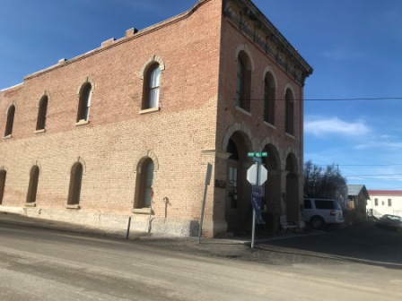
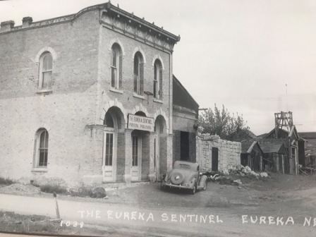
The museum was housed in the building where the Eureka Sentinel newspaper was produced from 1879 until 1960 and, in fact, the first floor featured a complete pressroom from the late 1800s with all of the original press equipment.
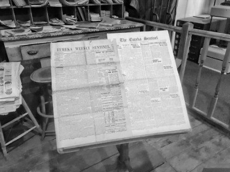
Old copies of the newspaper were displayed throughout and the whole thing offered a marvellous glimpse at what life would have been like in Eureka’s booming heyday when the population was around 10,000.
We chatted with the lady curator about life in town now, the history of the museum and the newspaper itself (it is still going strong online) before heading up to the second floor.
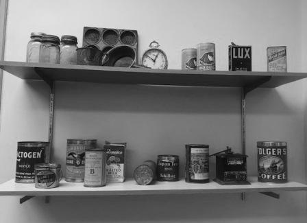
Upstairs we found various exhibits that depicted aspects of everyday life from the history of the town. There were lots of fascinating little items: tins of food, posters and calendars.
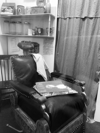
There was also a barber shop complete with an oak barber chair, uniforms from both the first and second world wars, as well as many items that told the story of the local mines.
The collection had all been lovingly put together and we complemented the lady curator again on the way out.
9. The Donkey Mural
It was late afternoon before we completed the final 77 miles along Route 50 into Ely.

The town (Population 4255, Elevation 6,437ft) was originally founded as a station along the Pony Express route but it grew considerably after 1906 when copper was discovered nearby. We had a quick drive around before deciding on a place to stay.
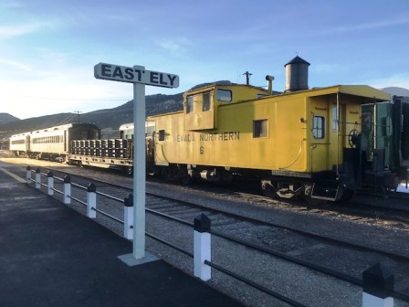
The drive included a visit to the train depot which is home to the North Nevada Railway (a heritage operation). Ely was once connected the transcontinental line and railroads ran out to the mines in Austin and Eureka. Apart from this tourist line they have long since been removed.
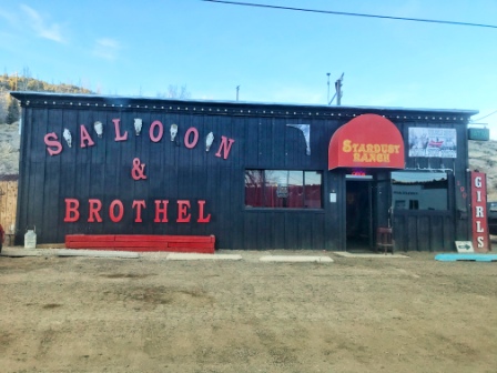
We also drove past Ely’s two remaining brothels. Unlike in Las Vegas or Reno, prostitution is still legal in Ely, and it is thus possibly the largest town in Nevada where working brothels can still be found.
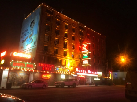
We found a decent-looking motel a couple of blocks away from the main street. It was actually owned by the Hotel Nevada and we were told to head over there to check in.
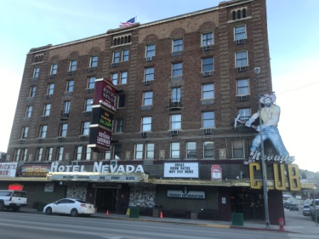
The lady on the hotel reception gave us a reasonable rate for the motel and told us it included a free drink in her bar and breakfast at the Denny’s restaurant inside the hotel. She handed us coupons for both.

The Hotel Nevada was opened in 1929, at six stories it was the tallest building in Nevada until 1931. It features a large mural of a donkey on one of its walls. At the time of opening it was the largest mural in the state.
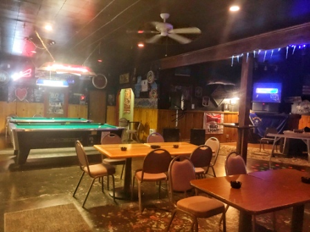
10. The Stripper Bar
When we returned, a little later, to redeem our free drink coupon we found the hotel bar full of bikers. We ended up chatting to a couple of them and we learned that they were having a Hells Angels event in Ely that very night. Four chapters from Nevada, Idaho, Utah and California had gathered and were using the town as a kind of base.
We got some tasty Chinese food at a place across the street and then ended up in a bar where the friendly barmaid explained the story behind each one of her many tattoos to us. The bar was almost empty but she told us to stick around a bit longer because there would be strippers on later. She emphasised that they were visiting especially from Reno. We couldn’t really be bothered with strippers even ones from Reno, and decided to spend the rest of the evening drinking back at the Hotel Nevada.
We ended up sitting at the bar talking to another gold miner, he was around our age and he was out drinking with his girl friend. They told us that she was in the process of leaving someone else but couldn’t quite make the decision to go. They were obviously having issues with their relationship and we did our best to help with advice and support. It started out pleasant enough but it when it threatened to get a bit out of hand we decided to call it a night and beat a hasty retreat.
11. The Roughest Town
The next morning, after breakfast at Denny’s, we started out again. We initially continued along US 50 but soon turned south on US 93 heading towards Pioche 108 miles away.
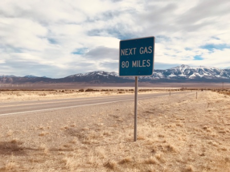
US 93 is marketed by Travel Nevada as the “Great Basin Highway” but as we drove past a sign telling us there would be no gas (and not much of anything else) for 80 miles, I wondered whether this one would be actually lonelier than the loneliest.
As we entered Pioche (Population 1002, Elevation 6,060ft) an old steam locomotive on display got my attention. A sign explained that it was engine 279 from the old Jack Rabbit line. The line was one of several that had once linked Pioche and its mines to the outside world.

Pioche, named for François Pioche (a French land speculator), was using its wild west history as a way of attracting visitors. There were explanation signs everywhere and it was obvious that the place wasn’t shy about telling exactly how violent things use to be back in the day.

There had been raids and massacres by Indian tribes right after silver had been discovered in 1864 and then a few years later, when Pioche was one of the most important silver-mining towns in Nevada, lots of violent brawls between the miners.
The signs claimed that Pioche once had the reputation for being one of the roughest towns in the old west. Legend has it that 72 men had already been killed in gunfights before the town’s first natural death occurred.
12. The Missing “S”
It was already lunch time when we arrived in Caliente another 24 miles to the south along US93. The town (Population 1130, Elevation 4,406ft) is the smallest incorporated settlement in Nevada. We had now descended a fair bit and we noticed the temperature creeping back up towards 18 degrees. It was windy as hell though and the streets were full of tumbleweed.
Legend has it that the town was initially given the name of Calientes, due to the hot springs present in the area, but later in the year when a post office was being built workers removed the “s” from the name of the town.

The Union Pacific train line still goes through the centre of Caliente and although it only carries freight these days, the train depot, built in 1923 in the style of a Spanish mission, still stands. It is a lovely old building with a magnificent oak interior. We peered through the windows for a closer look.
The station was exactly half way between Salt Lake City and Los Angeles and in steam days was an important service stop. The population of the town swelled to 5,000 before the diesels came along in the 1940s.
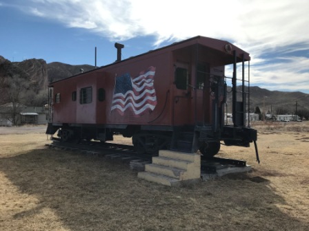
There was a little museum close to the depot based around a box car and a caboose. Sadly it was closed but we still managed a look through into the caboose.

13. The Dry Lake
After a tasty steak sandwich in a cafe next to the tracks, we continued on US93. Now we were heading back to Las Vegas via Crystal Springs (44 miles).
On the way we passed through Dry Lake Valley: a basin and range. The views were some of the most stunning of our whole trip.

Apparently many thousands of years ago, the area was covered in water and marshlands. Looking across the landscape it was not hard to imagine a lake being there.

Anthropologists think that humans (Paleo Indians) also lived in the area. Stone tools thought to be some of those that they used 12,000 years ago have been discovered close by.

From Crystal Springs it was just a matter of a couple of hours to do the 109 miles remaining back to Las Vegas and to complete the circle. We arrived back in Nevada’s largest city later on Sunday afternoon.

The circular route (US95, NV376, US50, US93) we followed is highly recommended as a great introduction to the wonders that Nevada has to offer.
We were constrained by having only a weekend to complete it, and although we never felt we were in a hurry, the route could easily be stretched to four or more days. Adding a few side trips could make it even longer.

We stayed in Tonopah and Ely but we could also easily have been tempted by overnight stops in Beatty, Austin, Eureka, Pioche or Caliente.
