Walking the route of Freetown’s old mountain railway line.
Malaria
During my trip to West Africa in November 2024 I took as many precautions as I could to avoid contracting malaria. I took a Malarone tablet every morning after breakfast, sprayed myself with insect repellent several times a day and slept under a mosquito net each night.
In the first decade of the twentieth century, British settlers in Freetown were also taking malaria extremely seriously: they even went as far as building a mountain railway to help them try to get away from it.

The Railway
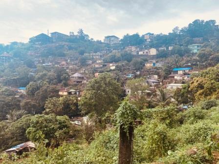
The Freetown Mountain Railway was conceived in the first few years of the twentieth century just after the first railways in Sierra Leone had opened. It was prompted by more than 18 deaths, including those of 7 officials, from tropical diseases in 1902 alone. The plan was to build a whole new settlement for Europeans in the hills high above Freetown and then link it to the downtown area by train. Officials could thus work in the centre of the city during the day but then escape from the swampy mosquito-infested low ground at night.
The railway was opened in 1904 and was built to the same 2ft 6in gauge as the rest of the system. It used the same Water Street terminus as the main line. In its 5 mile 60 chain length it climbed to a height of around 750 feet. Trains were steam hauled and typically comprised of three or four coaches. Despite some fierce gradients (up to 1 in 22 / 4.5%) the line was always worked by adhesion. When it opened, it was one of the steepest railways in the world to do so.
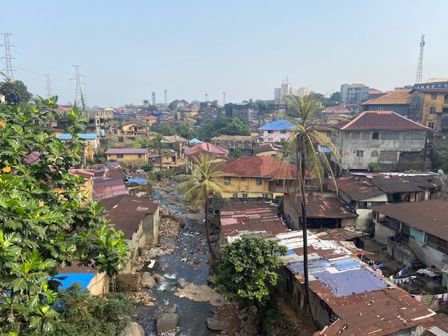
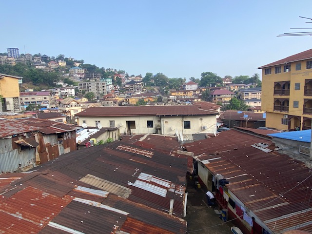
The hill settlement and nearby military barracks that were built at the terminus of the line became permanent and still exist. Yet as roads and motor vehicles developed quickly in the early 1900s, the railway soon became superfluous as a means of reaching them. It closed in 1929 after just 25 years of use. Although almost all traces of it are long gone, the course that it followed can still be walked today.
The Route
During my visit to Freetown, I decided to walk the entire length of the line from Water Street to Hill Station. Mindful of temperatures in the 30s, the extremely high humidity and, of course, the gradient, I split the task over two days. This also enabled me to make a few stops along the way. Nevertheless, there is no reason the walk could not be completed in a single day.
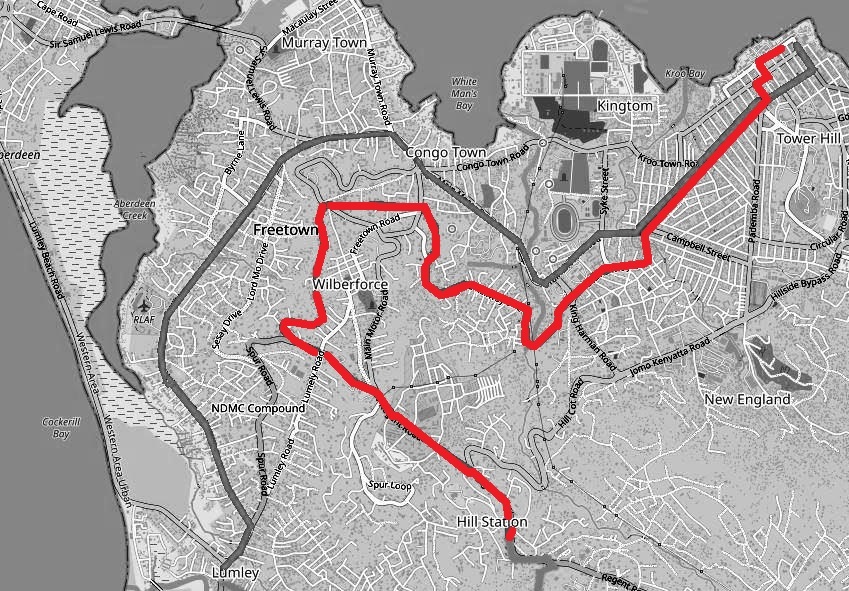
In the description below I have divided the route into three distinct sections. The first part is in the centre of Freetown where the railway ran (tramway-like) along streets that still exist today. The second part is where the railway emerged into what was then open countryside and twisted its way towards the summit. This area is now built up, but the track bed here has been turned into a road which is helpfully called Old Railway Line. The last section is where the exact course has largely disappeared, and it is necessary to follow the adjacent Spur Road to the terminus.
The First Section
My journey begins at Water Street or on what is now known as Wallace Johnson Street, named for politician and activist I.T.A. Wallace Johnson (1894-1965).
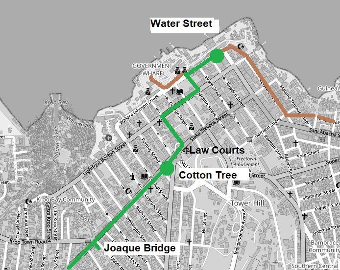
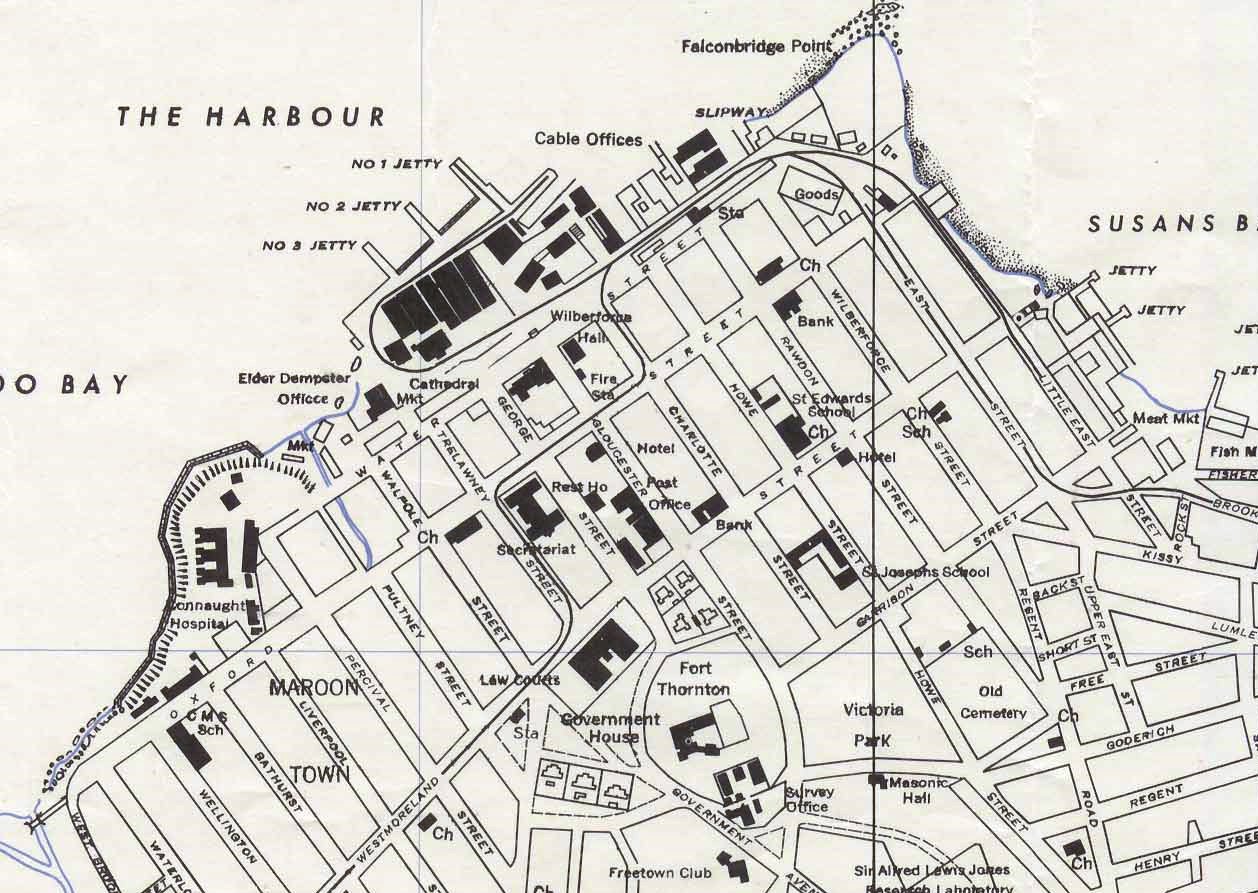
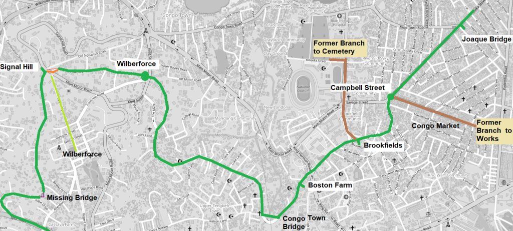
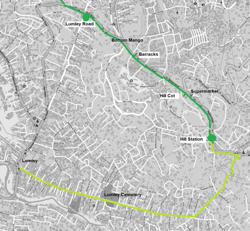
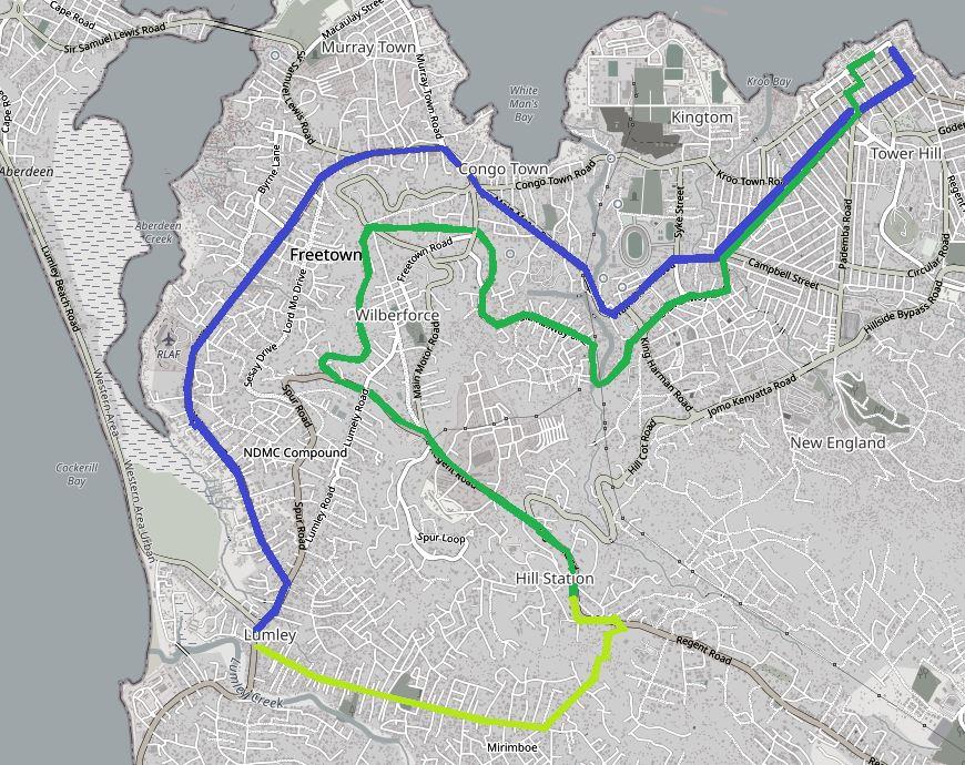
At the eastern end of the street is the former Water Street Station. It was here that the Mountain Railway (shown in green above), a dockside branch and the Sierra Leone Railway (SLR) main line (both shown in brown) all connected.

All SLR operations ceased in 1975, but the station building remained. During the civil war (1991-2002) it became a refuge for displaced people but part of it now serves as the bus station.
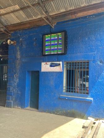
From here recently introduced government-run buses offer services on a couple of main routes. In what I think is a nice touch, their frequent departures are announced by an indicator that uses the blue, white and green colours of the national flag.

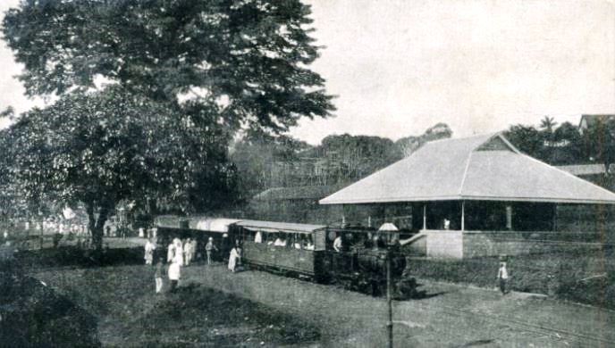
The Mountain Railway left this terminus and continued, tramway style, alongside Water Street. The general view looking back towards the terminus (under the tree) can be seen below.
The Mountain Railway continued alongside Water Street for another block before turning into Charlotte Street. At this point it diverged from the little branch line that circled around to the docks. The course of both lines is shown on a map from 1947 included below.
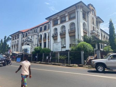
Before following the route along Charlotte Street, I continue along Wallace Johnson Street to take in a few of the sights. On my left is the brand new Freetown City Council building*, one of the few high rise constructions in the city and looking very imposing. It is a sign of things to come, perhaps.
*built on the site of Wilberforce Hall, as shown on the map above.

There is a statue of Edward Blyden (1832-1912) writer and politician and so-called “Father of Pan-Africanism” just outside. Opposite the Council Building is the road that leads down to Government Wharf, destination of the old harbour branch line, and the ferry to Tagrin.

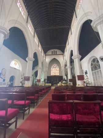
A little further on is St George’s Cathedral (1828). The building was the chief place of worship for the colonial governors, but today it seems quiet. Nevertheless, it is a good place to spend a few minutes away from the heat and bustle of the city.

Returning now to Charlotte Street, I follow the route of the old line as it zigs and zags through the street pattern of downtown Freetown. Turning right along Lightfoot Boston Street (formerly Oxford Street) and continuing for a few blocks before going left into Lamina Sankoh Street (Trelawney Street).
This whole area is full of government departments and banks. On a weekday like today there are plenty of people walking around, but it feels calm and the trees that line the wide streets and the old government buildings make it pleasant to walk along.

There is absolutely no clue here that a railway line once plied down the centre of the street. Yet you can imagine that the colonial administrators who once ran the city from some of these buildings would have been among its passengers.
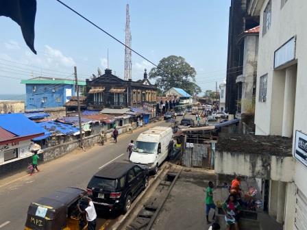
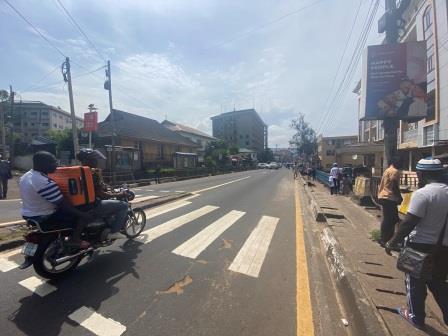
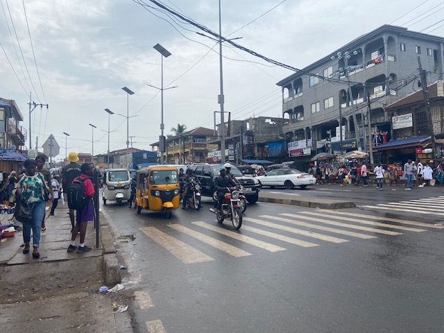
Now I turn into Siaka Stevens Street (formerly Westmoreland Street) and I am met with a lot more bustle. This is one of the city’s main streets and there is a nonstop cavalcade of tuk tuks, cars and motorbikes in both directions.
I am standing across from the Supreme Court, another imposing building dating from the colonial era. It is interesting to stand and watch the well-dressed lawyers hurry in and out of the building, they seem in contrast to almost everyone else here.

Here I am at the acknowledged centre point of Freetown. As I turn around I am greeted by the sight of what is left of the Cotton Tree. The tree was the historic symbol of Freetown, until in May 2023 it was felled in a heavy rain storm. Only the lower part of its trunk is still standing.
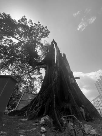
The site is said to be where, in 1792, a group of formerly enslaved African Americans, who had gained their freedom by fighting for the British during the American Revolutionary War, settled the site of modern Freetown.

Cotton Tree station (30 chains) was the first stop on the Mountain Railway. Trains would generally take just 2 minutes to reach it. The station building is still here and is now part of the Sierra Leone Museum. I pause my walk and spend a bit of time in the museum.

The Sierra Leone Museum is a sister museum to the National Railway Museum and has two main galleries, the first covers anthropology including the fascinating story of local secret societies, whilst the second covers more general history over the last two centuries. I am greeted by Olivette, the curator, and then given a personal guided tour of the place by one of the expert guides. 
From Cotton Tree I continue to walk along Siaka Stevens Street. Back in the day, the Mountain Railway would have continued, tramway like, down this avenue, then called Westmoreland Street.
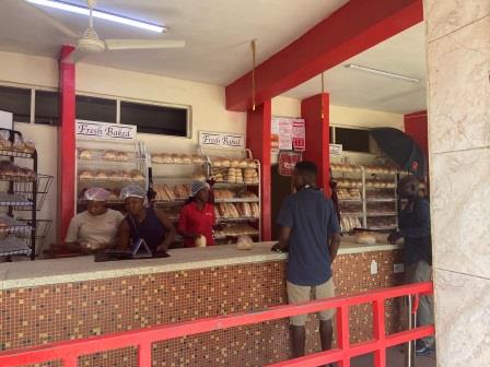
I come to the Red Lion Bakery, apparently it is the oldest bakery in Freetown. “We knead the bread you need” is their slogan. The bread in Sierra Leone is surprisingly good and the rolls I get now from the friendly servers are no exception.
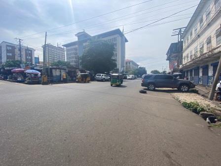
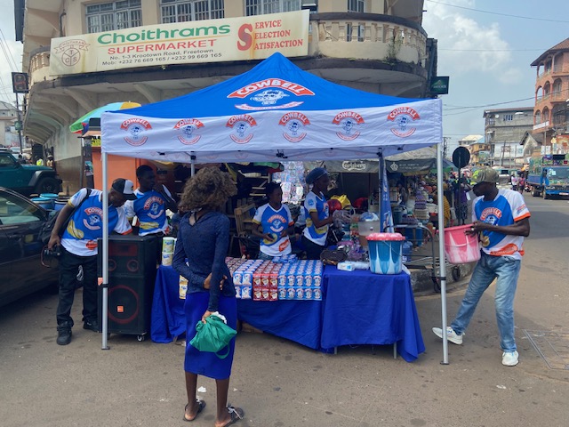
A little further along and the road seems to split. One fork continues straight, now as Sanders Street whereas Kroo Town road goes off to the right. In the centre of the junction is a little stand where they are giving away samples of a new milk drink.
Although the Mountain Railway only had a few actual fully fledged stations, it did have several flag stops, where the train would halt to pick up after a hand signal was given to the driver or to set down after a word was had with the guard. The first of these flag stops was in this area, Joaque Bridge (56 Chains).

I continue on along Saunders Street passing a myriad of shops selling a wide range of goods including electrical appliances and fabrics. Eventually I reach the intersection with Campbell Street.

There was a halt at Campbell Street (1 mile and 9 chains) and trains would normally reach it about 7 minutes after leaving Water Street. Today the whole area around St John the Evangelist Church seems busy with traffic.

There was a little branch line that led off the Mountain Railway and travelled the entire length of Campbell Street to serve a city works depot at its end. A short walk from here is the bustling Congo Market, itself definitely worth visiting.

I am getting a little thirsty, so I divert off down Campbell Street myself for a couple of blocks to enjoy a can of Vimto at Lovetta’s Kitchen. I have already eaten at Lovetta’s earlier in my trip and can highly recommend it.

The Central Section
After Campbell Street the Mountain Railway headed onto its own formation as it began to twist and climb towards its terminus.
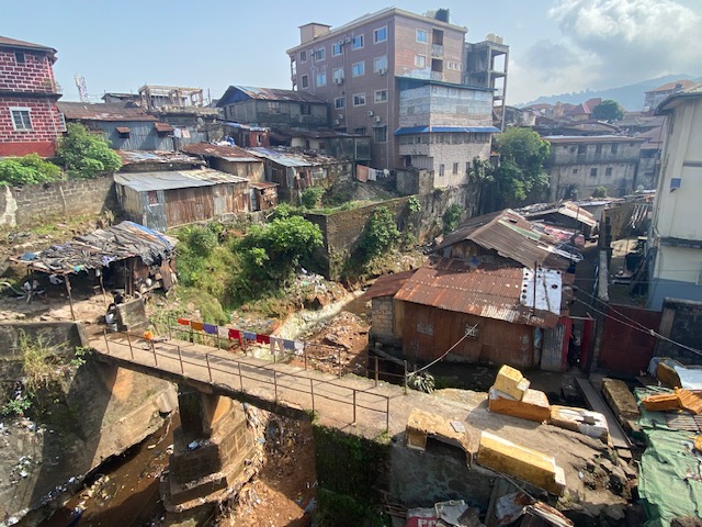
Today the old track bed has been turned into a paved street now called “Old Railway Line.” Soon after leaving Campbell Street, I cross a bridge over a stream.

Although back when the line was operating, this would have been open countryside, today it is totally built up and there are absolutely no clues at all that this was once a railway. In fact, the sharp gradient actually belies the idea I am walking the course of an adhesion-worked line.
As I walk I try to imagine what sort of views the first passengers would have had on this section. Certainly, there would have been nothing like the scene that confronts me today.
A little bit further along and I reach the point where the flag post Brookfield’s (1 mile and 50 chains) used to be. From here a second branch line ran north to a cemetery.

Then, a short distance along was another flag station, Boston Farm (2 miles and 27 chains). The modern “Old Railway Line” lane crosses the wide King Hamman Road at a busy intersection.

A little more walking and then I arrive at the only remaining substantial structure on the line, the Congo Town Bridge. The “Old Railway Line” lane itself diverts around the old bridge, but you can still walk across the narrow structure.


It is impressive that it has survived. There are several old photographs still around which show how it used to look. From these it is easy to discern just how rural this section of the line used to be.

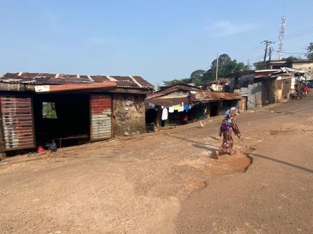
I continue walking along “Old Railway Line.” As I get further away from the centre the traffic gets lighter. It is interesting to see that some of the shacks at the side of the road are somewhat precariously mounted on stilts.

I don’t meet many people walking here, but most of the people I do see give me a friendly greeting or a little wave.

As I walk I know that I am climbing steadily. When I look back and certainly get the feeling that I have already gained a far bit of altitude.

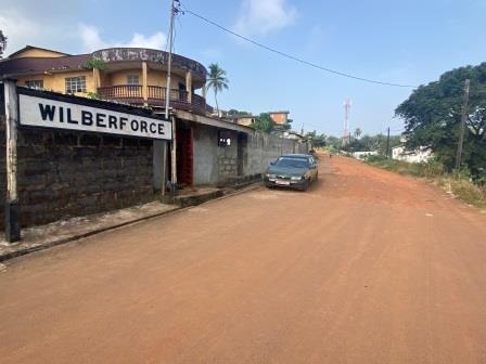
I reach Freetown road, cross it and then notice that on the other side “Old Railway Line” continues as an unmade road. This was the site of Wilberforce Station (3 miles). Trains would have taken about 18 minutes to reach this point.

This was a regular passing place for up and down trains. According to the working timetable of 1926, trains passed here in the morning and evening. The basic Monday to Saturday timetable had departures from Water Street to Hill Station at 5:45am, 6:30am, 11:45am, 12:35pm (SO) 1:55pm (SX) 3:25pm and 7.00pm. In the opposite direction trains left Hill Station at 6:35am, 7:45am, 12:35pm, 1:25pm (SO) 2:42pm (SX) 4:20pm, 6:05pm and 7:50pm. One extra train left Water Street at 8:15am and turned around here at Wilberforce.
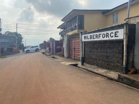
The old station building was preserved until relatively recently but has now disappeared. The concrete station name sign still remains though and stands at the side of the track.
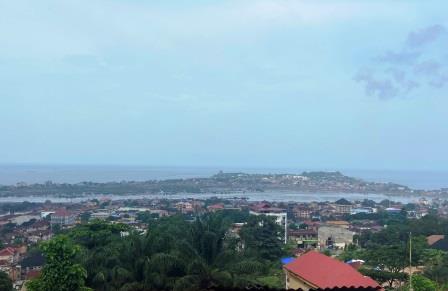
I set off again from Wilberforce now heading along the unmade road. I am now almost on my own, there is no real traffic here, save a couple of parked SUVs. Now there are magnificent views down to the bay on my right and some impressive looking houses on my left.

Now I am no longer walking on tarmac, it is a little easier to imagine that a railway once came through here. Just a little further on I come to the site of what would have been another flag stop, Signal Hill (3 miles 36 chains).
In the working timetable of 1926, the little halt at Signal Hill is denoted by a small letter “m” meaning that trains could be flagged down only by military personnel on duty. This makes sense because the location, as its name suggests, was the perfect place for signalling ships in the bay and beyond.
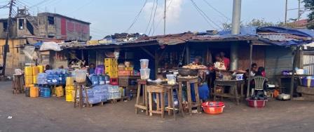
A number of roads converge at what is today known as Signal Hill Junction and a cluster of stalls has grown up to service the local population. From here there are great views down towards Aberdeen.
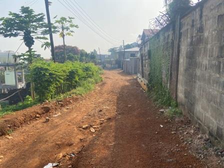
At this point, the course of the old line is slightly hard to discern, the “Old Railway Line” I have been following ends in a very steep bank which then continues on towards the small settlement of Wilberforce. Meanwhile another “Old Railway Line” picks itself up on the other side of Signal Hill. I assume the railway once linked the two strands together, but there is no sign of that now.
A little side trip to Wilberforce (shown in light green on the map above) is certainly worth it and the views southwards from the cemetery are pretty impressive too.


I continue on from Signal Hill, still on dirt track and still climbing at a pace. I am joined on this stage of the trip by a local electrician who is on his way to pick up tools for a house wiring job he has planned.
I tell him what I am doing, and he seems interested. We chat as we walk before eventually parting next to the place where his tools are kept. Just here there is a sign advertising a forthcoming football match between Chad and Sierra Leone and he predicts a win for Sierra Leone. (It ended in a 1-1 draw; in case you are wondering).

I continue following the track bed path until I come to a break. Concrete posts seem to be the only remaining part of a bridge that used to cross a wide stream here. My path forward seems blocked. It is impossible to try to cross the stream at this point and I am wondering what to do when a woman who is hanging out her washing on the other side shouts across to me. 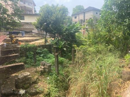
She quickly summons her husband who signals that I should follow a small dirt path that eventually leads to an improvised bridge. Meanwhile, he has run to the other side and is waiting to help me across. I am shown across their yard and guided back onto “Old Railway Line” once again.

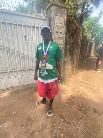
Around the next corner I bump into a man who is wearing a shirt that suggests he is a supporter of the President of Sierra Leone, Julius Bio. We have a little chat about politics in the country before I set off on my way again.
A few yards further on, “Old Railway Line”, the road I have been following since Campbell Street, ends as it merges into the much more substantial Spur Road.

The Last Section
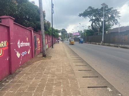
From here the course of the old railway has been somewhat obliterated by modern developments including Spur Road itself, a wide dual carriageway.
It is now possible to use the modern road to follow the rough course of the old line. With the busy traffic it is perhaps not the most pleasant part of the walk but at least this last bit of the line has a slightly shallow gradient as we near Hill Station.

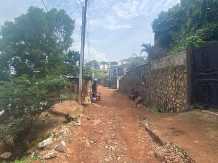
Shortly after joining Spur Road, I come to a crossroads with Lumley Road. This was the site of the last intermediate station, Lumley Road (4 Miles 36 chains). Trains would have taken about 28 minutes to get this far along the line.
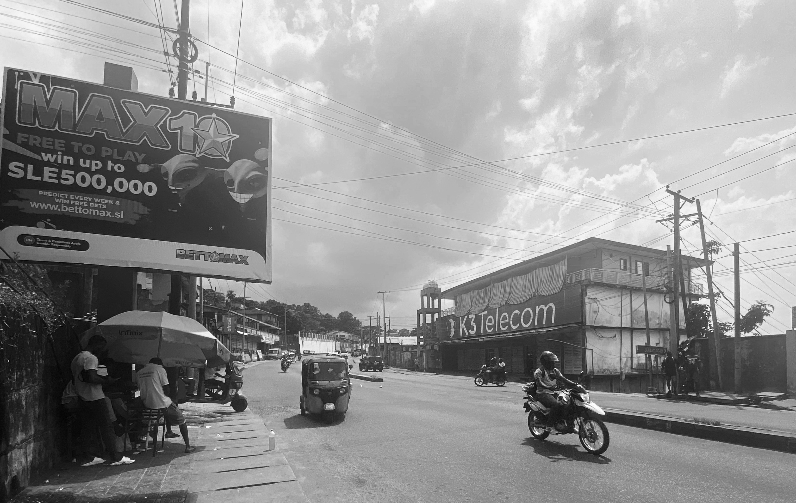
The building would have stood off to the right hand side of the road, near the Lumley Road sign in front of the Telecom building in the photograph above.

I continue on, not exactly enjoying walking along the side of the busy road. I pass the Lebanese embassy on the right hand side (above). For much the same reasons why the Hill Station settlement was first built, this area has become home to many foreign embassies including those of China, Germany, Liberia and Austria. The British High Commission is still located close to the old terminus.

At Bottom Mango (above) there is a major junction and as seems common throughout Freetown, a lot of motorcyclists are gathered presumably waiting for rides.
I press on as the Spur Road takes me past Wilberforce Barracks. The original British base here is still in use by Sierra Leone’s Military. The railway went this way too and there was a halt named Barracks (4 mile 36 chains) which trains would have taken about two or three minutes from Lumley Road to reach.

St Mary’s supermarket is about a mile further on. I am getting thirsty, so it is a very welcome sight. The air conditioning is delightful too and I spend slightly longer than I need inside pretending to look at the rows of western-style soups and sauces. I buy some water and a can of fruit juice. Like many western-style shops in Freetown, the Lebanese run St Mary’s.

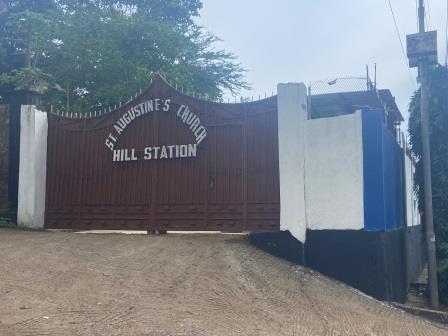
The very last flag stop on the line, Hill Cot (5 miles 33 chains) was located around this point. Feeling refreshed, I manage the last part to Hill Station effortlessly. I pass St Augustine’s church compound, but find it locked up. Apparently there is a railway hut still in there.
I reach the little layby off the main road which is where Hill Station, (5 miles 60 chains) used to be. I have made it. I have climbed 748 feet since leaving Water Street. When the line was operating, trains would have taken around 40 minutes to reach this point. There is nothing here to denote what had once been the end of the line, but I feel getting here is an achievement, nonetheless.

Completing the Circle
Rather than go back the way I have come, I elect to make a circle. I continue along Spur Road until I come to the first right turn which will eventually lead me down into Lumley.
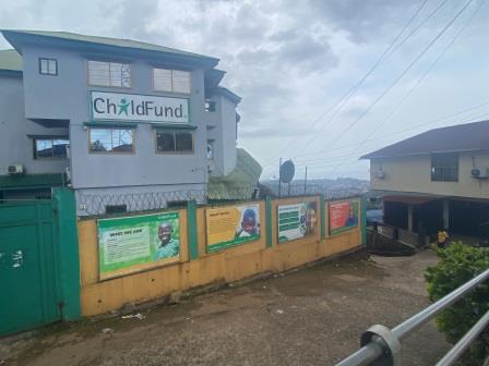
As I turn, I pass the Child Fund agency, one of the many agencies based around here. The road down from here is very steep and it is quite hard going on my knees for a while. As I descend I am rewarded by wonderful views.

The road gets a little less steep and I pass little shops, churches and mosques. It is threatening rain. There are few people around. I pass only one or two hardy souls climbing in the opposite direction. Suddenly the heavens open, and it begins to rain heavily.
I am passing a little shop and the owner beckons me to come in and shelter from the downpour. I sit with his family for more than 40 minutes during which time we discuss the British Royal Family amongst other topics.

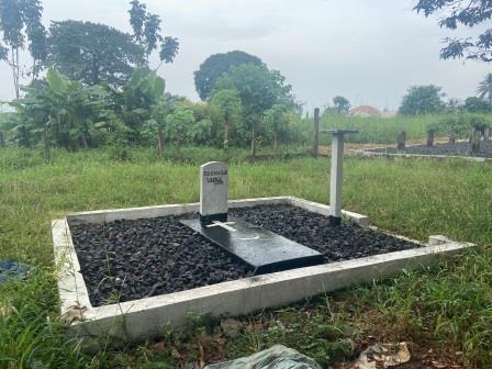
It has almost completely stopped by the time I venture out. I continue on descending to the point where I meet Regent Road and then turn to walk along it towards Lumley. I stop off at Lumley Cemetery and visit the tomb of the unknown soldier.
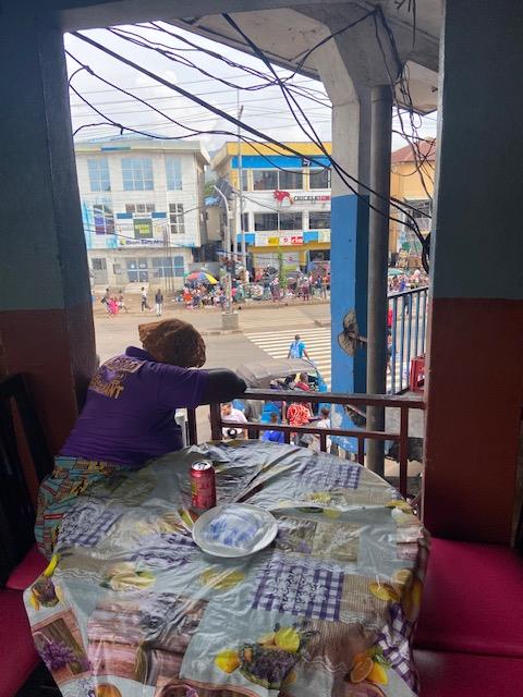
Finally, I reach Lumley and then spend quite a while wandering around its market and shops. Although famous for its beach, Lumley is also quite a vibrant centre. I am getting hungry and I begin to look for somewhere to eat.
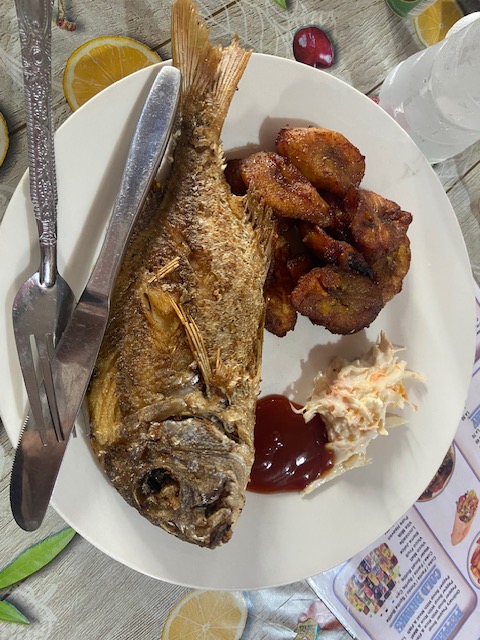
With a table overlooking all the action on the street below, the Home Food Restaurant is an excellent find. I am looking at the menu when one of the customers suggests that I might want to consider ordering what he is having.
I follow his advice and get a tasty piece of grilled fish with plantains on the side. It is just the thing to revive my energy levels after my long walk.
From Lumley Cross it is possible to get on one of the new buses which turn around here. I jump on a number 102 (shown in blue on the map below) and take it all the way back to the old Water Street station, neatly completing the circle.
I am no stranger to track bed walks, but I must admit this one is the strangest I have ever done. I have thoroughly enjoyed it though and if you are ever in Freetown I really recommend it as a way of learning a bit of railway history, experiencing the city and meeting some of its friendly residents.
Links to other track bed walks
2020 – UK – “On the trail of the Pines Express” – Bristol to Bournemouth
2021 – UK – “Pennine Rose” – Manchester to Sheffield
2022 – UK – “In the footsteps of the ACE” – Okehampton to Bude/Padstow
2023 – UK – “Walking Waverley”- Carlisle to Tweedbank
