“Or Chester-le-Street….”
Chester-le-Street (1868) was opened by the Great Eastern Railway and is situated on the premier East Coast Main Line linking London Kings Cross with Newcastle and Edinburgh. It is the only station in County Durham mentioned in the lyrics.
It was listed for closure as part of a plan to remove unnecessary stopping services from the busy main line. The station was later reprieved and is the first one mentioned in the song that never actually closed.
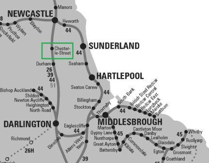
Location
Services: Past, Present & Future?
Astonishingly, back in 1962 there were only 2 or 3 trains a day serving the station. The journey time from Durham was around 10 minutes and to Newcastle around 13 minutes.
There is now a basic two-hourly service operated by Trans-Pennine Express, with the trains heading in either direction towards Liverpool or Newcastle. A few daily Northern local services and a single Cross-Country train also make a stop. Journey times have been reduced to 6 minutes from Durham and 8 minutes into Newcastle.
In 2019 around 200,000 people used the station, and it would appear to have a strong future.
The Station Today
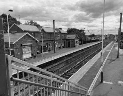
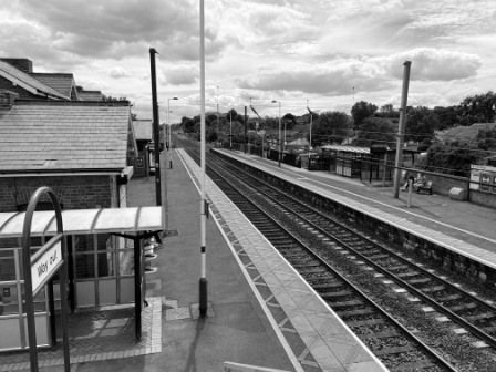
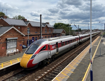
I have passed through Chester-le-Street on countless occasions but have never had the occasion to stop before. The station has two platforms; there is just a simple shelter on the northbound one, but on the London-bound side the main building remains largely intact. During our visit it was all closed and the station itself was unmanned.
A private company, “Chester-le-Track”, used to occupy part of the building and they used to have a business selling railway tickets from it. With the growth in the number of people who bought tickets online they ceased trading; their former offices were now advertised as “to let”.
Despite being unmanned, the station was well kept. It was clean and functional; there were two ticket machines on the southbound platform, lots of information boards and plenty of seats to sit on. The footbridge that linked the two platforms was also the pedestrian access route to a housing estate on the west side of the tracks; it was constantly busy with passers-by, so the place felt safe.

Although comparatively few services stop at Chester-le-Street, there was no shortage of trains passing through; they included lots of LNER “Azuma” services on their way to and from London.
Surrounding Area
On one of the station walls was an information board that explained some of the history connected with the arrival of the railway. As well as a photograph of the station in earlier times there was also a picture of “Dainty Dinah”: the logo of a confectionery company that had once had their factory nearby; apparently, they used to account for much of the freight traffic from the station.

The board had been put there by the Chester-le-Street Heritage Group and was one of eight on a little walking tour around the town that they had created. We decided to follow the trail and use it to explore the town. I am very glad we did.
Although Chester-le-Street (population: 24,227) had some really very attractive parkland around the River Wear, the main centre of the town could not really be described as picturesque. The explanations on the heritage signs gave us a much deeper perspective and helped to locate and appreciate many of the historical buildings dotted around.
We walked around the main central part of the town situated to the north east of the railway station. The settlement dates from Roman times and the excavated remains of the first fort built in the 2nd century AD was one of the stops on the trail.
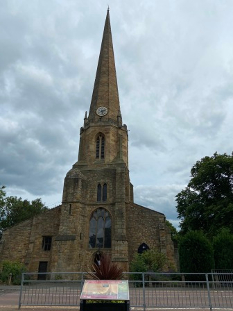
Just across from the remains of the fort was the Parish Church of St Mary and St Cuthbert. The current building dates from the 13th Century but the site on which it stands has been in the hands of the church since 883. The information board in front of it explained that it was the first stop on the famous Jarrow Hunger March of 1936.

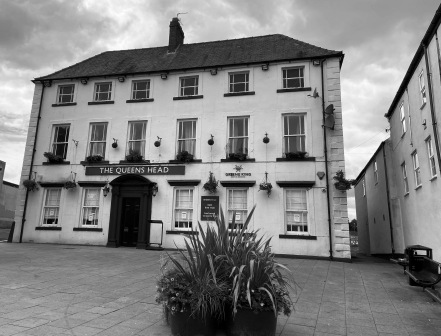
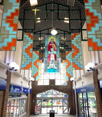
We walked along Front Street and we were quite impressed by the diverse collection of buildings; they ranged from the old 18th century Queen’s Head pub (grade 2 listed) to the art-deco-styled Cooperative Society building. Cooperative Street had some fine examples of Victorian houses built by the society in 1885. The more modern St Cuthbert’s Walk was a typical small town shopping arcade, but it had some impressive murals hanging from the roof and a lovely little café that had a great value roast dinner.
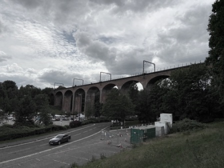
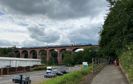
Our final stop on the heritage trail was the (Grade 2 listed) Chester Burn Railway viaduct; it consists of 11 arches and it was completed in 1868. It has been in constant use ever since. I have crossed it many times, but I have never had the chance to see it up close. We walked right up to it and stood there gazing at the impressive brick work.
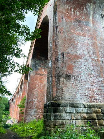
Then we watched as a train crossed the viaduct as it hurried north; I thought how frustrating it would have been for the residents to have had to watch trains all day long without the chance of ever getting on them. It is very fortunate that the station was eventually saved, other places on the same main line were not as lucky.