THURSDAY
Launceston to Delabole (Walk: 24 miles)
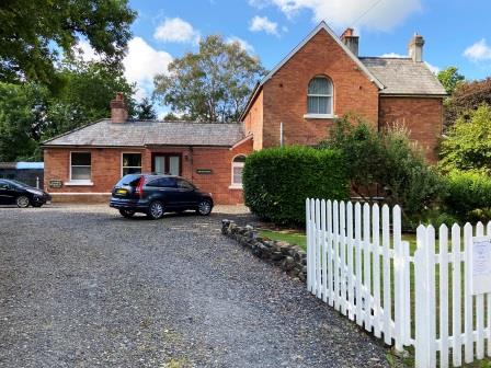
Egloskerry (228 miles from Waterloo)
It is approaching 10am when, 4 miles out from Launceston, I reach the first station of the day. The old station building looks to be in excellent condition; it still has some of its green signboards and its platform edges are intact. It is being used as a Bed & Breakfast; I had thought about staying here, it has some great reviews online, but I couldn’t easily fit it into my plan. In July 1962 the A.C.E. would have passed here without stopping, but in winter it would have halted at 4:12pm.
I walk on through the little village centre of Egloskerry with its attractive church (Eglos means church in the Cornish language) and then strike out towards Tresmeer. I am now walking along a road but the only vehicles I meet are farm tractors. As I walk, I spy an old 45″ record lying on the ground; I am intrigued to how it came to be here. It is a copy of Michael Jackson’s “Off the wall” from 1979. There must be a story here. I decide that it was the result of a heated argument about musical taste in a passing car.

I am keeping an eye on the old line as I walk. It is running parallel with me to my left, separated from me by fields full of sheep. It is following the River Kensey at this point, and it is easy to spot by the line of shorter trees that have grown along its length and the taller ones around the river.

Just before Tresmeer, the line leaves the river and comes up to the road that I am walking on. The cutting that was once here has disappeared and the over bridge has been filled almost to its crown.

The line makes a large arc passing to the west of Tremaine and curves around to Splatt. I follow it on a series of footpaths. It is now that I first discover just how badly kept some of the footpaths in Cornwall are.

I curse and swear as I try to push through a jungle of nettles, brambles and bushes blocking my way. I wonder if the reason is that nobody uses the paths, so nobody complains, and nothing gets done. Eventually I emerge from the undergrowth, now 10 miles from Launceston and at my next station.

Tresmeer (231 miles)
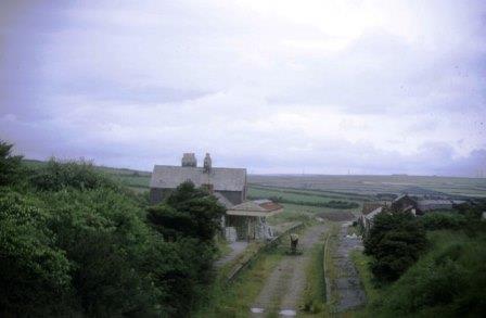
Tresmeer Station is in the village of Splatt, a couple of miles away from the settlement it is named for. The station was at the end of the first extension of the NCR line from Launceston and opened in 1892. The old building is a residence, the platforms are still intact and there is even a gradient marker standing on the up side. In a hurry to get to Padstow, the July 1962 A.C.E. would have passed through here just after 4pm, but in winter there would have been a stop at 4:22pm.
My route on from Splatt takes me along roads and more footpaths towards Goad’s Green. My experience of Cornish footpaths now actually gets worse; there are almost no markings on the gates and at Scarsick where the railway rose on a high embankment, there is even a missing footbridge. It all makes progress frustrating and difficult.

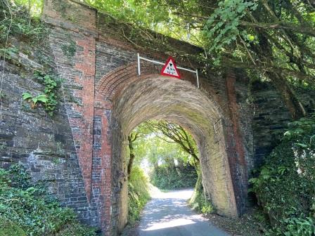
As I continue the walk, I am amazed at just how many of the old under bridges have been kept in situ. This railway has been out of use for more than 55 years, cuttings have been infilled, most of the track bed is an impenetrable mess, yet most of these bridges are retained. Each one is surrounded by a collection of “low bridge ahead” warning signs on the local roads.
It is now getting on for 1pm; I find a nice place to stop for lunch in a field overlooking the course of the railway. Knowing that there would be nowhere to purchase anything along the route today, I bought a pasty back in Launceston from local chain Malcolm Barnecott. It might be the walking, it might be the country air, but it tastes divine! After lunch, I continue for another 20 minutes and then, 15 miles from Launceston, arrive at my third station of the day.

Otterham (236 miles)
Having skipped the previous two stations, the July 1962 A.C.E. would have finally paused here at 4:16pm. The old building is also being used as a residence, but it is mostly hidden by trees; there is little discernible evidence of the line. The station was well used in the war by the American military as there was an airbase at nearby Davidstow. As I walk along I spot signs to the “Cornwall at War” museum that now occupies the site.
Apparently, goods traffic was also important here and included milk for the Cow & Gate company and rabbits for the national retail chain Mac Fisheries. The latter doesn’t surprise me as I have been seeing quite a lot of the little creatures bouncing around in the fields as I have been walking.
I pass Halwill Barton close to where the line, which has been climbing steadily since Launceston, has its 800ft summit. At least for the railway, although not necessarily for me, it will be mostly downhill all the way from here to Padstow.
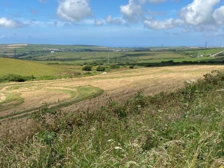
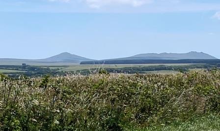
This is also one of the closest points that the line gets to the Atlantic. As I make my way onwards towards Waterpit Down I get fantastic views down towards the coast. The railway, barely discernible here, soon crosses my path, descending towards Trekeek. As soon as I get the chance, I turn down a side road and follow it.

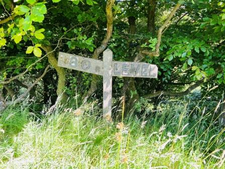
The embankment is still in place near Trekreek and I wander up to take a closer look. I walk about a bit and find an old concrete gradient sign in the bushes. I wonder how many of these things there are left hidden along the way.
I head over the nascent River Camel and then try to follow the railway using a series of footpaths. Yet again, there are few way markers to guide me and in places the foliage makes the paths almost impassable. I emerge near Slaughterbridge, bitten, stung, scratched and totally frustrated with Cornwall County Council.
Just ahead of the main road I see a farm shop. I hadn’t expected any way of replenishing my supply of water, so I still have enough, but a soft drink would be fantastic. The sign says the shop is open until 4pm, I glance at my watch, it is exactly one minute past. The owner is just locking up, but he kindly puts the lights back on to sell me a single can of Diet Coke. I drink it whilst continuing to the fourth station of the day, having walked 21 miles from Launceston.
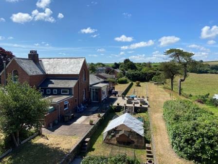
Camelford (241 miles)
I arrive at Camelford Station almost the same time as the 1962 A.C.E. would have done; 4:24pm. The station, opened in August 1893 when the line was extended on from Tresmeer, was used as a cycle museum for a long time but is now a private dwelling set off the main road.
Like most of the others on the line, the station here was over a mile from the place it served. The station name boards advertised the nearby tourist centres of Boscastle and Tintagel and there were road services connecting them.

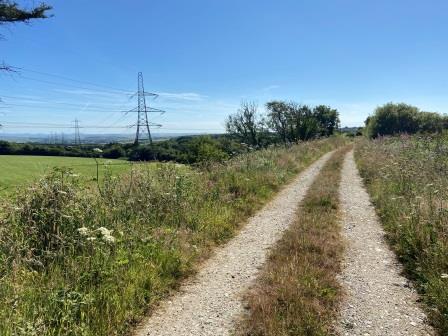
I don’t linger here and soon I am off again. I find what I think is a shortcut footpath across a wind farm. It takes me back onto the track bed itself for a while, riding up on a small embankment at this point. It is the easiest walking I have had all day, but it is only when I reach the road again that I realise that I probably wasn’t supposed to be on the path.
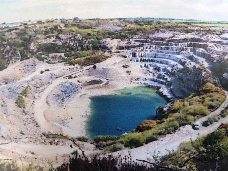
I am now on the edge of Delabole, and as I am reunited with the track bed once again, the famous Delabole Slate Quarry comes into view. The railway skirted its edge as it entered the town, and the footpath now follows the old line all the way through the village.

It is difficult to get an idea of the scale of the quarry from the path, but a photograph I find later does a better job (below). This is one of the largest slate quarries in Europe and it is also England’s oldest. It is clear why the line was routed past here; the railway benefited from the traffic it created. As I reach my final station of the day, the total distance I have walked from Launceston is 24 miles.
Delabole (243 miles)
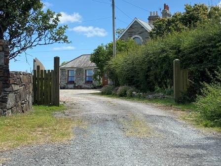
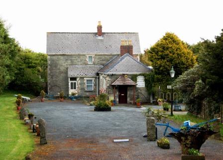
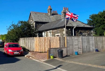
Delabole’s old station, now a private residence, is surrounded by a group of more modern buildings. It has blended in well and it is quite difficult to imagine it performing its original function. The station was first opened in late 1893 at the end of another extension only a few months after the line had reached Camelford. In July 1962 the Atlantic Coast Express would have called here at 4:30pm.
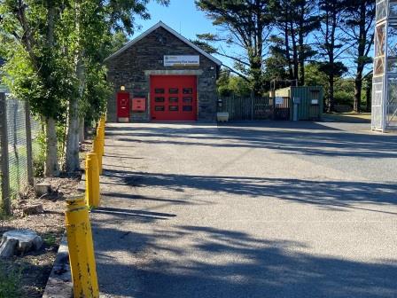
Just around the corner is a fire station housed in the old railway goods shed. It is great that they have found new uses for all these old buildings, and I like the way they have blended in to their new environments. Looking at this place now you would never guess that it used to be part of a busy station yard.
I am finished with the line for the day, and I wander uphill towards my accommodation. I like the look of Delabole. It is just a village, but it is the biggest place I have seen since I left Launceston and so strangely it feels quite busy. It feels friendly too and I am greeted with plenty of nice smiles as I walk up the hill.
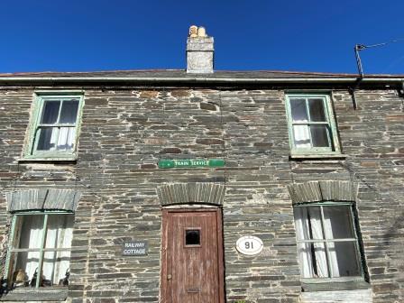
There are lots of interesting buildings, including a railway cottage decorated with old signs, the imposing Bridge House that used to stand next to the railway bridge and a Methodist chapel with an unusual frontage. Naturally, all of them are displaying the village’s most famous product on their rooves.

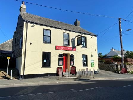
Undoubtedly my favourite building in Delabole is the Bettle and Chisel pub: my accommodation for the night. It is named for the tools that are used to split slate and it is a real gem. As well as a warm welcome and comfortable bed, I enjoy a fabulous homemade Beef and Turkey pie with a suet-crust pastry washed down with pints of local Hicks Ale. Not surprisingly, I sleep well.
FRIDAY – “Delabole to Padstow”
RETURN TO – “In the Footsteps of the Atlantic Coast Express”
