Return to Turkey St
If our first day visiting the New River had been in idyllic conditions, our second day certainly wasn’t: the forecast was promising light rain and there were even “yellow” warnings of high winds too. We were hoping for an improvement later on.
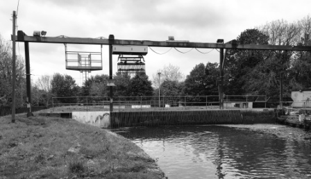
We made our way back from Turkey St. Station and started back along the path. We hadn’t gone far when the New River came to a bit of a stop. We could see that just ahead of us the water was disappearing into a comb-like structure that had been built across the channel. Over the top was a gantry supporting an automatic dredger which was busy removing leaves, branches and other debris from the water.

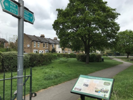
We followed the path as it descended away to the left side of the gantry. In 1613 the New River had to divert west (to our right here) to avoid the sudden dip in terrain caused by Maidens Brook just ahead. This diversion, one of the longest on the route, was known as Whitewebb’s Loop. It is mostly dry now but there are some remains of the original course. In fact, there is an alternative footpath, “New River Link”, which follows the old loop around to Enfield.
We followed the main path as it dipped down to cross Maidens Brook on a little footbridge. To the right we could see the New River itself crossing the brook using the Docwra Aqueduct built in 1859.

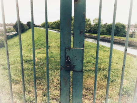
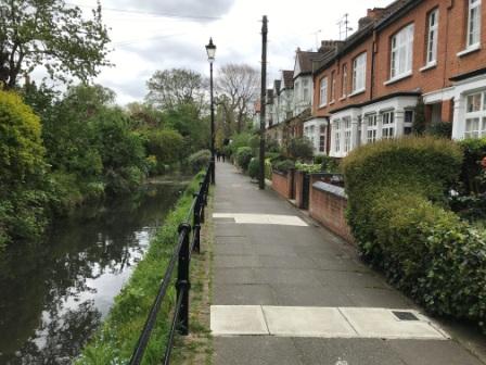
We were soon reunited with the New River south of the aqueduct and we continued on towards Enfield. After 15 minutes we reached Carterhach Lane and found the way ahead blocked by padlocked gates. The path diverted here and we were forced to walk down Ladysmith Road: a long avenue of 1920s houses. There was to be no sight of the New River for the next half a mile or so.
Enfield
Things get quite complicated for the New River and the New River Path around Enfield. The 1613 waterway made a large loop to the west that passed through the town centre. In 1900 this loop was bypassed by underground pipes south to Bush Hill. The redundant loop has now been restored in places and, rather than following over the top of the current route, the path follows parts of this old section.

Although the path links to the best restored sections, it manages to miss the centre of Enfield. We thought that this was a shame, not least because we were hungry, so we decided to head off directly to Enfield Market on our own.
In the centre of the town we passed the branch of Barclays Bank that was the location of the world’s first automatic cash machine in 1967. We stopped to look at the large photographs of the first ever withdrawal displayed in the front windows.

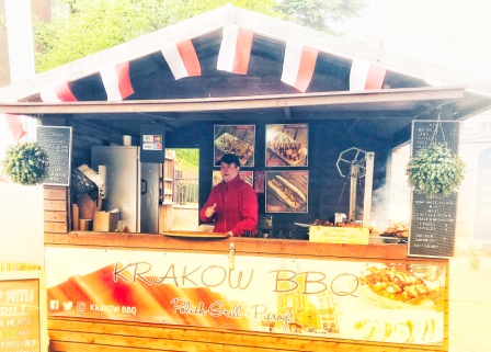
In the market we found a Polish BBQ stand and had a fabulous meal of hot dogs and Polish mixed grill. The friendly owner was from Krakow and we talked to him about our trip and our visit to his city 15 years ago.
Just north of the market we encountered the first small section of restored New River. It was just in front of the Civic Centre and could have easily been mistaken for the sort of water feature that you find in front of many modern buildings. Yet here it was in exactly the right orientation to be part of the original 1613 route.

Crown and Horseshoes
We saw the next bit of restored New River just across from the Civic Centre, but it was impossible for us to follow it as it lay inside the grounds of Enfield Grammar School. So, we carried on, rejoined the official path at Parsonage Lane and then walked west to meet up with it as it left the school fields.
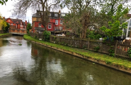
In contrast to the flowing “real” New River we could see that the water here was stagnant. It was all very attractive though and it was obvious that great effort had been made with the restoration. As we turned the next corner we came across the first pub that we had seen located directly on the New River. We decided to stop for a quick pint.

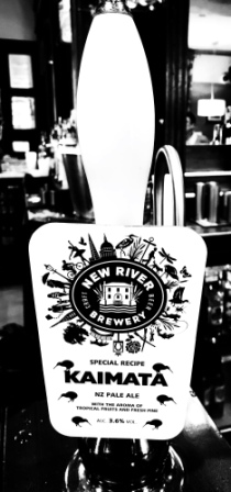
The Crown and Horseshoes was a great place for a stop. Although it is predominantly a Greene King pub, I was pleased to see they had beer from the New River Brewery on too. The brewery itself is based back near Rye House and their logo features the New Gauge House. They produce a range of several beers, but on offer here was “New Zealand-style” pale ale. It was quite delicious.
We left the pub and walked on past a row of lovely terraced cottages fronting the waterway. There were old-style lampposts on this section too and they added to the quaint charming atmosphere. We passed a more open park area: Chase Side, crossed over Church Street and headed along the edge of Enfield’s Town Park.
At the bottom of the park we crossed a bridge and then headed away from the water into a bit of woodland. We noticed that the signpost here had been tampered with and it pointed, wrongly, towards the last bit of restored New River: a dead end. This was not the last time during the day we were to come across signage issues.
Lost on Bush Hill
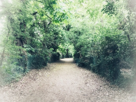
Now we climbed gently along a pleasant woodland track before turning left and descending on another. We were passing through Bush Hill Golf Course here and there were several signs warning us not to trespass left or right. Eventually we emerged onto Bush Hill, a road with some very expensive-looking houses, and followed it to a junction with Bush Hill Road. Here a signpost suggested continuing down Bush Hill and so we did just that.
After another 10 minutes the New River appeared again on the left. This was the New River “proper” finally having emerged from its piped journey underneath Enfield. All seemed well until we realised that we had just missed a section of the path. We were curious to see where we had gone wrong, so we followed the waterway back northwards until we reached Bush Hill Road. We then realised that the previous sign should have directed us here but it must also have been tampered with. I began to wonder if someone in Enfield had something against the New River Path.

We retraced our steps again and found ourselves back on Bush Hill reading a signboard that introduced one of the New River’s most historic structures: the Clarendon Arch. The board explained that the stone arch had replaced the original wooden bridge in 1682 and it took Salmons Brook under the New River. It had been restored a few years ago and steps down to a little viewing gallery had been added. For some unexplained reason though it had all since been closed. The gate to the steps was locked and there was a large red sign that said – “Keep Out – Private Property”.
Beer Cans and Pizza Boxes
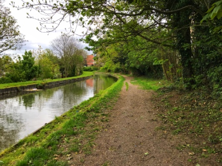
Slightly disappointed at missing the arch, we continued down Bush Hill now walking alongside the waterway once again. For the next two or three miles we continued to follow it, occasionally having to resort to walking along avenues and streets for short distances.
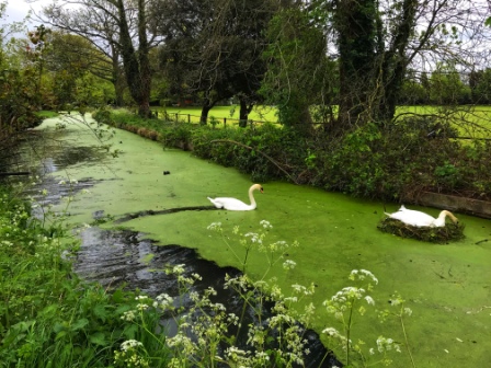
We were now deep into suburbia and, as we went through Winchmore Hill and then Palmers Green, we passed pretty semi-detached houses, cricket pitches, warehouses and small factories. Although it was all still tranquil and pleasant, we had begun to notice there was now more litter and debris in and around the water. We saw beer cans and pizza boxes floating in the water and there was even a shopping trolley thrown behind a wall.

We were directed away from the waterway briefly to circle Southgate Town Hall (now a library) and then a few minutes afterwards we curved around on an aqueduct high over Pymmes Brook. After another few minutes more we came to another large metal comb-like device across the waterway. Just beyond it was a bridge carrying the North Circular Road.
Tunnel
By now we were used to the little interruptions to the peace of the New River that each road crossing brought. Nevertheless, we always wished we could have fitted, like the waterway itself, under the ultra-low bridges and thus have avoided negotiating the traffic each time. At the North Circular we felt this even more keenly than usual as we were forced to make a longish diversion to a pedestrian crossing.

Finally back at the water’s edge, we were rewarded with a short but pretty section through an attractive area known as Bowes Park. This bit ended at the entrance to Wood Green Tunnel and the New River disappeared from view. This tunnel was completed in 1859 and is almost a mile long. It corrected another long meander that had taken the original route west through Arnos Park.
Thames Water had signposted a route for the path over the top of the tunnel and we followed it through a series of avenues and parks; Finsbury Gardens, Hidden River Path, Nightingale Gardens, and finally Avenue Gardens where we saw the waterway emerge into daylight again. Alexandra Palace station was just to the right of the southern portal of the tunnel and it marked the halfway point of our day’s walk.
Hornsey
We crossed the road just to the left of Alexandra Palace station and saw the New River disappear out of view again as it headed under the East Coast main line railway. The path now led us in a different direction as we went around Wood Green Common, which was quite pleasant, and then through an industrial estate, which was less so.

After walking past a large chocolate factory, we finally headed underneath the railway ourselves to catch up with the New River on the other side. We walked along the grassy left bank for a long straight section. It was nice and quiet on the left, as all the action seemed to be on the opposite bank.
On the right bank in quick succession were; Hornsey Water Treatment Works, where the New River’s water gets processed and cleaned; New River Village, a large modern housing development with flats overlooking the waterway, and finally old Hornsey pumping station, now a restaurant and gallery.
Passage through Harringay
At Hornsey High Street the New River went back under the East Coast line again. We were forced to go around it for a while as we followed signs that took us on a route down Wightman Road, right at a gold-roofed mosque and then finally back to the waterway for a lovely quiet stretch just beyond Hornsey station and train depot.

Sadly, we were eventually forced back onto Wightman Road as the New River disappeared underneath. The official path followed Wightman Road all the way to the edge of Finsbury Park, but the waterway itself threaded through a series of lanes known (for obvious reasons if you look at a map!) as the “Haringay Ladder”.
The “towpath” was completely closed off here but it was possible to see the New River from the bridges along each of the lanes. It was also possible to walk between the lanes by using the Haringay Passage: an interesting narrow little alleyway that threads through the whole of the “ladder”. It was a much better route than the official path.
We met the New River again as it emerged from the Haringay Ladder, passed under Endymion Road and flowed into Finsbury Park. We followed it as it went around the top end of the park, across Green Lanes and then curved around the contour to finally reach Seven Sisters Road.
The view from here was pretty impressive; looking east we could see down into the Lea Valley and beyond; looking back in the direction we had come we could see Alexandra Palace on its hill with its radio mast sticking out.
End of the Line
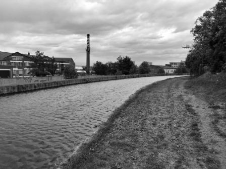
As we crossed Seven Sisters Road, the East Reservoir came into view. Together with its neighbour, the West Reservoir, it was built by the New River Company back in the 1830s to store water. On a map of London the two large lakes always look to me like the lenses of a pair of spectacles with the New River connecting them like the frame.

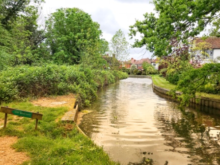
We followed the New River as, separated by a little embankment, it wove along the northern edge of the East Reservoir. As we reached the north eastern corner we saw another metal comb-like structure across its path. We watched as another device, just like the one we had seen earlier at Maidens Brook, grabbed debris from the channel and deposited it on the bank. We stood there as the water flowed away from us, passed through the comb grate and disappeared.

We then walked around to the other side and saw the same scene from a different angle. We stood again watching as the water came gushing through the grate and cascaded into the reservoir below. We had reached the end of the New River.
East Reservoir
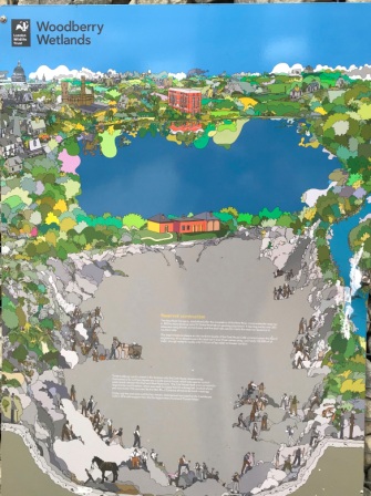
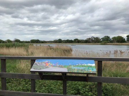
With the New River out of the way, at least for now, we decided to take a little break. We walked over a boardwalk, part of the Woodberry Wetlands Nature Reserve, that led us across part of the edge of the reservoir to a cafe on the other side.

The café was located in an old coal house that once belonged to the New River Company and it was absolutely delightful. We sat there enjoying the waterside view with a coffee and a delicious slice of cake.


There was a lovely poster outside the café that depicted the two reservoirs. The West one was shown as it appears today whereas the East one was shown as being still under construction. The same poster also revealed the rather startling fact that the large lake we were looking at contained the equivalent of just 11 hours worth of London’s water.
There was plenty of new development here; all along the edge of the East Reservoir Berkley Homes were building a series of blocks of flats with views out on to the water. A quick search on-line revealed that prices started at around £500,000 for the smallest units.
Looking at all this, we were amazed to learn that the reservoir had actually remained closed off to the public until 2016 and had only been opened out for everyone to see in the last few years.

Having seen enough, at least for now, we crossed over to the West Reservoir to continue on the New River Path for the last 3 miles of the Heritage Section.
We had now left the “working” New River behind. From here, for the most part, we would be walking on pavements and through parks following the course that the water once took and trying to imagine where it used to be.
