PW Day 11 (Trip 5 – Day 1)
Friday 22nd June 2018 – Middleton to High Force – 5.1 Miles
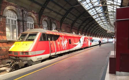
On the morning of Friday 22nd June 2018 we caught the 0830 train from Kings Cross to Darlington. It was Virgin East Coast’s last weekday in charge of the East Coast Line (Hurrah!) and there were already plenty of signs of the impending switch over to the new “nationalised” operator: LNER.
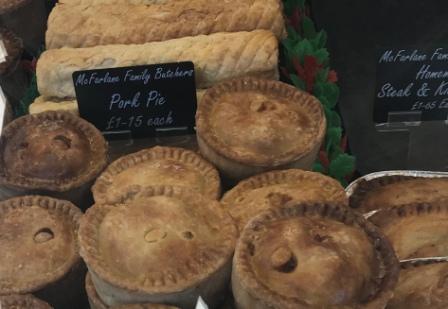
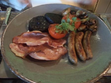
We arrived at Darlington, walked into the centre and then bought sandwiches and a pork pie from exactly the same market stall as we had used a year before. We ate our lunch on the steps of the nearby Dolphin Centre whilst waiting for the bus to Barnard Castle.
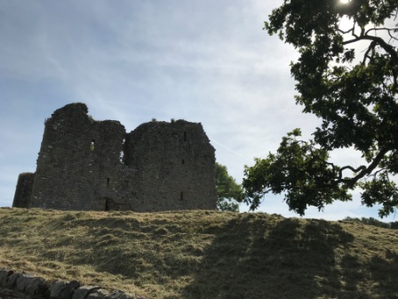
The bus turned up and, retracing our steps from the year before once more, we made the the 50 minute ride to Barnard. There we sat at an outside table of a cafe in the warm sunshine relaxing with a coffee whilst we waited for another bus to Middleton. We were impressed by Barnard, it seemed a lively and attractive place and had what looked like a very interesting castle. We agreed that we probably need to think of an excuse to return there on day and explore more.
By 2:30pm the second bus had deposited us in Middleton. We were almost at point on the Pennine where we had finished last year. In contrast to the rain of 12 months ago it was now a beautiful day with a cloudless blue sky and bright sunshine. It was quite hot too.
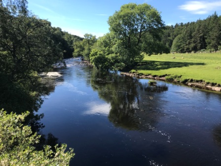
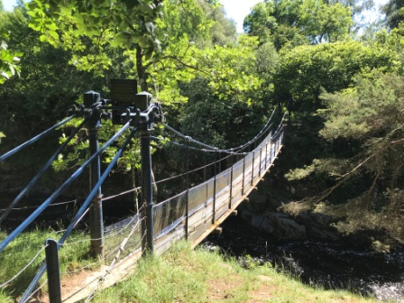
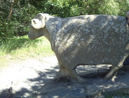
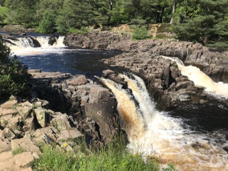
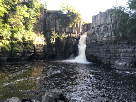
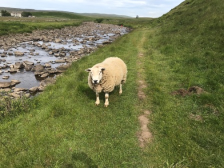
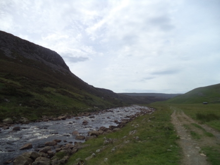
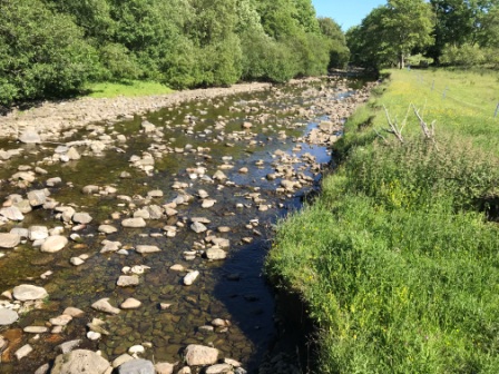
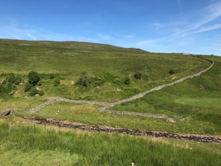
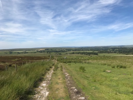
We set off walking immediately and made good progress. The going was excellent and the route, largely along the south bank of the River Tees, was flat. The 5 miles were broken up with stops at some of the “sites”; the 19th Century Wynch Suspension Bridge (the earliest such bridge in the UK), a cute sheep sculpture and the impressive waterfall at Low Force where the river plunges a full five and a half metres.

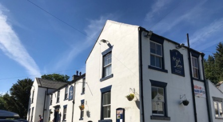
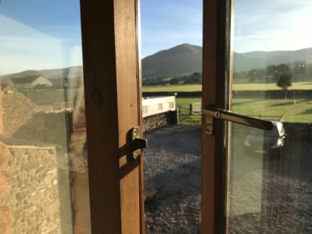
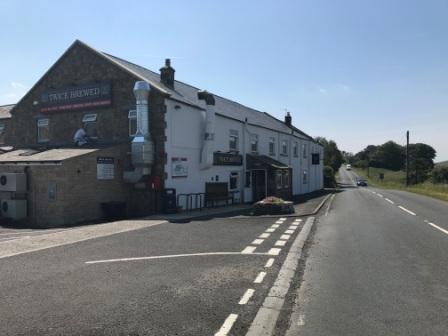
After a little more than two hours we reached our goal for the day. We left the PW, crossed the river and climbed a steep path to arrive at our lodgings for the night: The High Force Hotel. We checked in and then had a lovely evening meal sat outside in the warm sunshine in the company of a group of people from Chiswick who were also attempting the same sections of the PW as us. It seemed they were planning on doing a very similar plan as us. We were even due to stay in the same hotel again on Monday night.
After dinner we took a short path opposite the hotel to see the High Force waterfall. With water plunging down 21 metres it was even more impressive than Low Force. Although we knew that the waterfall would also be visible by making a short detour from the PW the next day, seeing it now would mean saving time later.
We got an early night in preparation for the next day. We had a full day’s walking ahead.
PW Day 12 (Trip 5 – Day 2)
Saturday 23rd June 2018 – High Force to Dufton – 16.5 Miles
We woke up nice and early, had breakfast in the “tea shop” part of the hotel and then prepared to set out. It was still only 8am and as we were leaving we bade farewell to the people from Chiswick. They would be following us on the same path, but due to the different lodging arrangements we had worked out that we probably wouldn’t see them again until Monday evening.
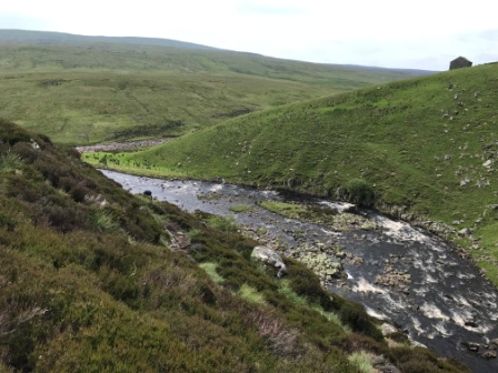
We rejoined the Pennine Way and then continued on the southern bank of the River Tees. Beyond High Force the track heads past a quarry on the opposite bank and then climbs through bushes onto Bracken Rigg. The weather wasn’t quite as nice as the previous day; it was warm enough, but there were also plenty of clouds in the sky.

Soon we turned right and headed down to Cronkley Farm and finally via a Bridge onto the North bank of the Tees. A while later a smaller stream, Langdon Beck, branched off to the left and the PW followed it for a while before finally bridging it, heading off through a few fields and meadows and back towards the Tees.


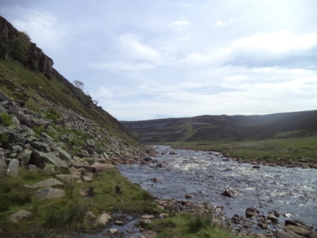
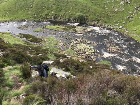
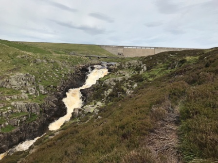
Once we had rejoined the river the going got tougher with a lot of rocky boulders blocking our path. This meant that walking was almost impossible and it made a bit of scrambling necessary. The guide books all warn of the possibility of broken ankles on this stretch and it is easy to see why. Eventually we reached the bottom of our third waterfall in two days: Cauldron Snout.
Here the path went, more or less, straight up the side of the waterfall and it seemed to get unnervingly close to the gushing water. We opted to take a little more tranquil route through the adjacent heather. This required a bit of steep scrambling but we felt a little safer not being quite as close to all that water.
Eventually we reached the top and there we were confronted by the sight of the dam at the head of Cow Green Reservoir. The dam is ugly to look at but it is certainly impressive in scale. Apparently it holds back a total of 40,000 million litres of water.

We crossed the Tees, for the last time, on a bridge just in front of the dam, and then, after climbing the opposite bank, we paused for lunch overlooking the Snout and viewed the path we had just walked on.

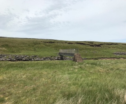
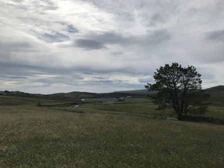
After lunch the path levelled off for a while and the scenery began to change. We headed west onto more open moorland. We went first along a track and then on a grass path towards Birkdale. We crossed the footbridge, added later to divert the PW over less boggy ground, over Maize Beck and eventually came to High Cup Nick.
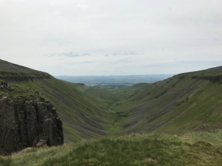
There are many stunning sights along the Pennine Way, but perhaps the most stunning of all is High Cup Nick. You come upon it suddenly and it reveals itself very quickly. It is a massive U-shaped valley and even though we had seen photographs of it before, it was still amazing.
We paused for a while, sitting down to enjoy a drink and a bite to eat and just take in the stunning view.
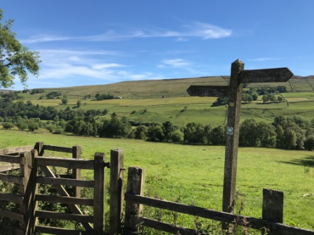
The Pennine Way heads along the north side of High Cup, and as we pushed on to Dufton, the whole of the Eden Valley began to open up below. It was all downhill from then on and eventually we made it to the outskirts of the village and to our little farmhouse B&B. It was earlier than we had expected. It wasn’t even 5pm.
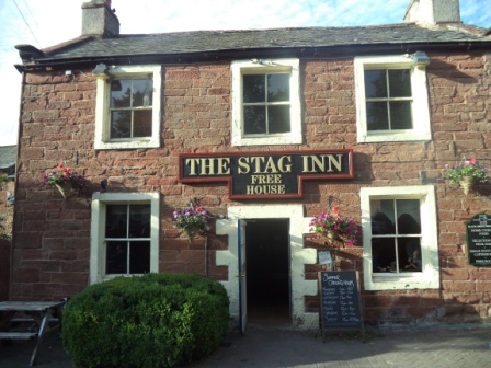
We relaxed for a while and then went for a walk around the village. It was a charming little place full of character and history. We popped into the Stag Inn for a pint and then had a lovely dinner there in the company of a charming couple who were visiting from Norway. They talked about their visit Hagi in Japan.
Incredibly it was still very light outside at 10pm as we prepared to get another early night. The next day was billed by all the guide books as the hardest one of all.
PW Day 13 (Trip 5 – Day 3)
Sunday 24th June 2018 – Dufton to Alston – 21.2 Miles
We had breakfast at 7am and, once again, by 8am we were ready to leave. We were keen to get away early as we knew the day’s walk would include climbing 4 peaks, the last of them the highest point of the whole Pennine Way walk: Cross Fell, as well as walking the full 21.2 miles to Alston.
When planning the trip I knew that even in “relatively good” weather there was a good chance of cloud covering the top of Cross Fell and the other peaks we would need to cross. In fact one of the reasons I had purchased a GPS was to make sure we would have no poor-visibility navigational issues on Cross Fell.
Now, looking out of the window of the B&B, it was clear that we didn’t have “relatively good” weather, we had “exceptionally amazing” weather. Even at 8am it was warming up nicely and as we looked across the horizon and towards the hills we noticed there was not a single cloud in the beautiful blue sky. The GPS wouldn’t be needed after all.

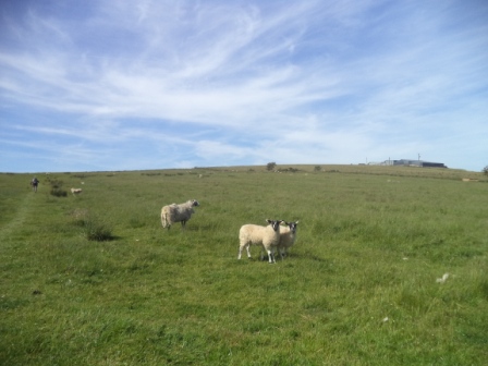
We set out walking and after 30 minutes we had already negotiated a series of stiles that led us out of Dufton and back into the open country. With Dufton Pike (481m) to the side of us we slowly made our way up Green Fell. The going was steady at first but it soon got quite steep. Eventually we were caught up by a lad from South Yorkshire who had been wild camping close by and was now embarking on the same journey as us over to Alston.

For the next couple of hours we walked with him at roughly the same pace. Sometimes we were just behind him or sometimes just in front. We didn’t chat an awful lot but we conversed enough to find out that his dad had been a miner, he was living near Sheffield and that this was his second PW trip in 3 years. We asked him what his favourite part had been last time but, disappointingly, he couldn’t really tell us. It must have all been good then !
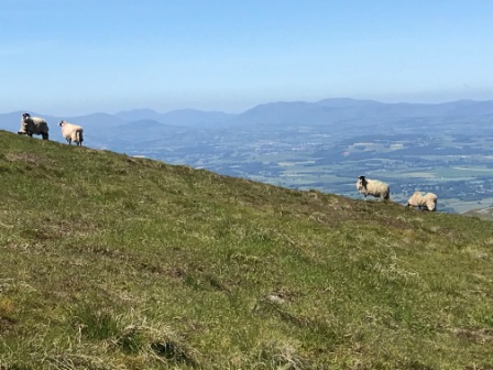
As we approached the summit of our first target of the day, Knock Old Man, we were joined by a local lass from Penrith out for a walk by herself and heading over back towards Dufton. As the four of us sat in the morning sunshine surveying the views back down into the Eden Valley she amazed us by telling us she had never ever seen High Cup Nick.
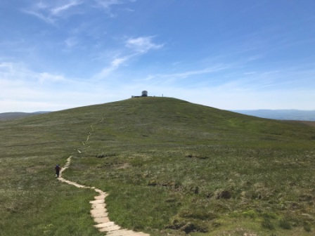
From Knock Old Man we were alone for a while and we descended a bit as we made a roller-coaster like traverse of the three remaining peaks. The path, down and then back up, to the next summit: Great Dun Fell wasn’t too clear. It didn’t really matter though as Great Dun Fell is home to an air traffic control radar station and has a huge golf ball like dome on the top. It was pretty clear where we should head next.
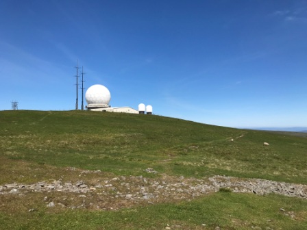
In really bad weather (and there is a lot of that up here) it is impossible to see the station from Knock Old Man. It was a sign of the remarkable weather we had, that we had actually seen the radar station from our B&B bedroom window back in Dufton!
Half way across to Great Dun Fell the Pennine Way joins a tarmac road (the service road for the station) and the fact that the road is lined by a series of very tall snow poles is another sign of how bad the weather gets in winter.
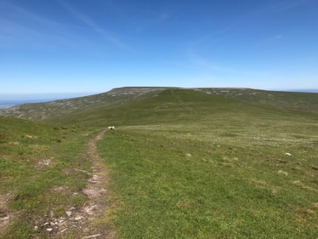
It was quite windy on the top of Great Dun Fell, even next to the station, so we didn’t linger for long. We kept moving and descended for a second time before ascending once more towards our third “target”: Little Dun Fell. Despite the name, Little Dun is only a few metres short of its bigger neighbour.
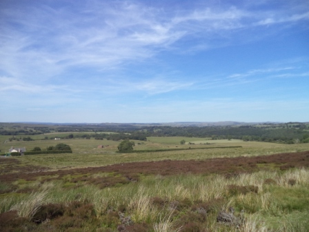
The views in all directions were now just amazing, and we knew, experiencing them was quite rare. To the west we could see the Lake District and its row of hills, to the north the Cheviots across the Scottish Border and to the south the lake and the dam at Cauldron Snout that we had passed the day before.
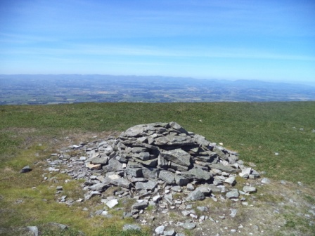

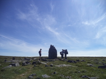
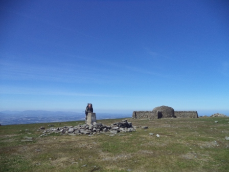
The summit of Little Dun had a cairn to mark the spot and close by a small, but useful, shelter. We had a little bit of a scramble across the rocks just north of the summit but were soon heading down once more in preparation for our final ascent of the day: Cross Fell.
After another 30 minutes of hard walking we finally made it to the trig point on the top of the fell. This is officially the highest summit in the Pennines, (893m) the highest point reached on the Pennine Way and the highest mountain in England outside the Lake District. We celebrated in the company of the lad from South Yorkshire who had caught us up again and another lad from Manchester who was already there.
There was another very impressive shelter just next to the trig point. It was nice to get out of the wind, but we didn’t linger too long. Almost immediately we started to head down towards Alston. Although it was to be all downhill from now on, we still had 12 miles to go and a full 8 miles before we saw any real civilisation.
There is little evidence of a path heading off Cross Fell and in bad weather it is necessary to exercise extreme caution to make sure you set off in the right direction. In the conditions we were enjoying though there was no need to worry at all. Simply making sure the radar station was behind us we headed down until we intersected the more substantial track known as the “Corpse Road”.
The area was a big lead mining centre and the Corpse Road was used by the miners to take the bodies of their deceased colleagues back to the villages to be buried in consecrated ground. As we joined the Corpse Road we met about 15 people on their way up to Cross Fell. The group included, we later found out that evening, our landlady at our B&B and our waitress at dinner, both of whom recognised us later.

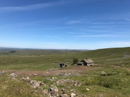
We hadn’t descended along the Corpse Road too far before we came to Greg’s Hut. The hut, originally a cottage built for lead miners, was adopted by a group of people to commemorate the sad death of John Gregory in a climbing accident in the Alps in 1968. The hut is now in the care of the Greg’s Hut Association and is well maintained as the highest “bothy” in England.
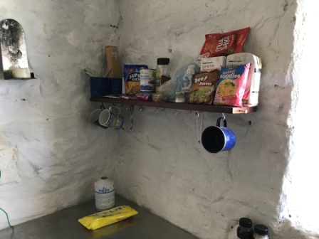
The hut would have been a great place to shelter had the weather been inclement. We didn’t need it at all but we popped in for a look anyway. We left some food and signed the visitor’s book before opting to eat our lunch in the sunshine outside.
After lunch we continued for a few hours gently descending on the Corpse Road passing old mines and spoil heaps. We got some great views of Great Dun Fell and the radar station in the distance on the way down. As we descended the temperature got higher. Apparently it had been about 13 on the summit but it was well over 25 degrees as we reached the bottom.
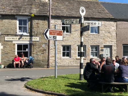
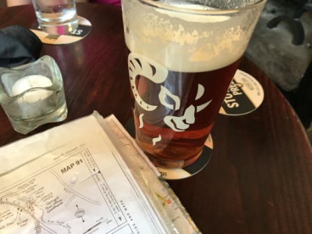
It took us more than three hours from the summit to finally get to civilisation in the form of the village of Garagill. The guide books had been a bit uncertain as to whether the George and Dragon pub would be open, so we were glad to find it was. The England game (2018 World Cup group game against Panama) had been on earlier and the area outside the pub was crowded with fans celebrating the 6-1 victory. As it was a bit hot outside we opted to sat inside and cooled off a bit.
After a brief pint and a sparkling mineral water we were off again. The last 4 miles were totally different to what had come before. After passing a scrap yard full of rusting machinery, we settled into a pretty pleasant walk first along the banks of the nascent River South Tyne and then through fields and over stiles until we finally reached the outskirts of Alston.
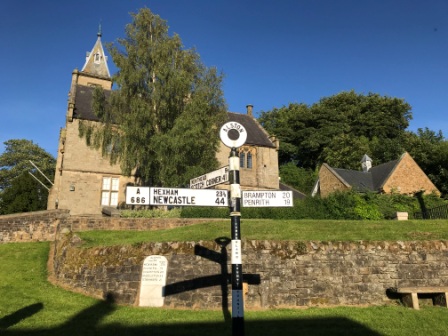
Alston is a pretty little market town and it claims to be the highest market town in England. The PW doesn’t enter the town itself, so we left it at the river and headed into the centre. It was 6pm. We hadn’t done too badly.
We had another pint at another pub, again full with the still celebrating football fans, before making our way to our B&B for the night. The landlady opened the door to us and immediately told us that she recognised us from Cross Fell. She explained she had been up there with a party of children. They had only walked up from Garagill, she had only just got back herself.
The B&B was, like Alston itself, a charming little place and it was run by a couple who had moved up from the south to escape the “rat race”. We chatted with them both whilst we settled into our room.

After a quick shower and a change we went set off out to a pub they had recommended for food: The Cumbrian Hotel. When we arrived there was a fight going on in the car park (we later learnt that was very rare for Alston) and the whole pub was looking out of the window to watch.
Fighting apart, the atmosphere at the Cumbrian was extremely friendly and the home cooked food was absolutely delicious. We were served by a young waitress, another member of the team who had been escorting the children up Cross Fell and who also recognised us. We compared how sun burnt we all were.
PW Day 14 (Trip 5 – Day 4)
Monday 25th June 2018 – Alston to Greenhead – 18.8 Miles
For the third day running we were up and having breakfast before 7:30am. The breakfast at the B&B, consisted of cereal and beans on toast. It wasn’t quite as substantial as the previous two had been, but we both agreed that it was actually a welcome change.
The landlady had had to go out early on an errand so we chatted to the husband whilst we ate. We got a pretty good picture of what life living in the town of Alston was like. They had moved up from Essex and a life working in London a few years previously for a change of pace and clearly they had no regrets.
Alston, we were told, was an old lead mining settlement. It had had a population of 7,000 back in 1900 but was down to less than 1000 these days. It was best described in one simple word: “Isolated”. This isolation meant good things like a strong and independent community but it also meant a lack of tourists compared with the rest of Cumbria. It was obvious that the location on the Pennine Way and also on the Coast to Coast Cycle route was a life saver for the tourist businesses in the town.
We walked back down through the town admiring the attractive buildings and cobbled streets and eventually came back to the river to rejoin the PW. We crossed the South Tyne and turned North again. It was already hot at 8:30am and the forecast was for it to hit the high twenties later.
After a march through some fields we crossed the A689 and passed by more fields as we headed from Cumbria into Northumberland. We went across a little bridge at the border and there was a sign attached to it welcoming us to Northumberland and announcing that we were on Isaac’s tea trail. (It is a trail named after a local philanthropist).
Soon after that we made a rudimentary navigational error (not paying attention to the maps) and followed a footpath that lead us back towards the A689 too soon. This caused us to miss the old Roman Fort that lay on the proper path. We then had to trudge a quarter of a mile down the A-road. Later, on examination, the map clearly said “Don’t take this path” – so there was absolutely no excuse.
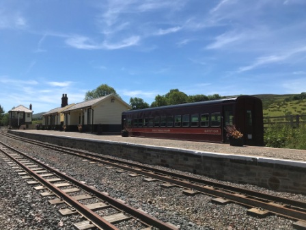
We met up with the PW soon enough though and then followed it down towards the South Tyne Trail. The Trail follows the old Alston to Haltwhistle Railway line. The line was one of the last to close in 1976 and the South Tyne path follows the old trackbed from Alston to Haltwhistle. Between Alston and Slaggyford the path is joined by a volunteer-run narrow gauge line: the South Tyneside Railway. It wasn’t running on the day we walked past, but the track was visible for part of our walk.
One wonders if the Pennine Way, dating as it does from 1965, had been created after the closure of the railway it might have used more of the old track bed itself. In fact a fair few “Wayfarers” choose to do the “Trail” instead of the “Way” between Alston and Greenhead (near to Haltwhistle). Given that this section of the PW is hardly spectacular, who could blame them.
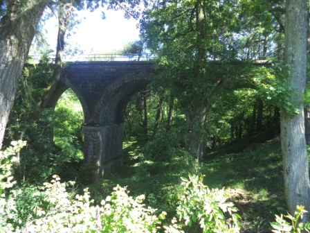
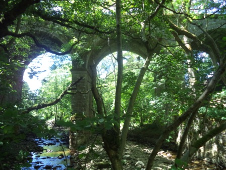
We spent a while walking alongside the River South Tyne again and darted under a couple of railway viaducts before reaching the village of Slaggyford. We ended up taking a wrong turning (honest) and ended up at the narrow gauge railway station by mistake.
Eventually we found our way out of Slaggyford and back into open fields again towards Knarsdale. We searched for a place in the shade to halt for lunch but couldn’t find anywhere better than the shadow of a stone wall. It was getting hotter and the walking wasn’t at all pleasant. We knew we had just enough water to last, but we would have to ration it a bit and we couldn’t drink quite as much as we really wanted.
Whilst we were having lunch we were caught up by two lads from Manchester who were doing the whole PW in 15 days using Sherpa. They were the only people we met all day but for the rest of the journey we encountered them several times. We would pass them whilst they were having a break and then they would pass us whilst we were resting.
In the shadow of yet another viaduct, we said goodbye to the South Tyne Trail and, ignoring a sign for the local pub (it was tempting though) ,we climbed out onto a hill. Here the Way becomes part of the Maiden Way for a few miles. Although now it is a barely discern-able as a path it was actually once a roman road heading in the direction of Hadrian’s Wall.
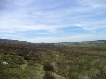
After crossing the A-road again we arrived on Hartleyburn Common. Together with its neighbour Blenkinsopp Common, Hartleyburn forms a large area of moss and thick green grass. It has a reputation for being boggy and being hard to navigate on. The one good aspect of the blistering hot weather was the lack of any real bogs on this section. They had clearly dried out. The occasional squelchy patches that we encountered were signs that we had probably got off a lot lighter than most on this section.
Navigation across the flat commons was a little challenging. With no clear paths to follow nor landmarks to reference, I resorted to the GPS in places. The lads from Manchester, now behind us, seemed to trust my guidance and followed close behind.

We finally reached the edge of Blenkinsopp Common and ascended Black Hill. This gave us a view of the farmland beyond and our goal, the town of Greenhead, below.
The final bit of the route into Greenhead presented us with two last challenges.
The first was getting across the very busy A69. The traffic was constant and travelling at speeds up to 60 and 70mph. It took quite a while to get a gap in the traffic. We paused on the other side and totally parched drank the last of our water.
The last challenge was the local golf course. On the map the path traverses it and the route looks clear, but as soon as we were onto the course we could see no obvious way across the bunkers, greens and paths of the course. Luckily the place was deserted so we just darted across. We found an opening in a fence, jumped across a ditch and exited using the club house road.

Back on the main road we found the PW sign again. It still wasn’t totally clear how we should have arrived at it directly via the golf course, but at least it marked the point we needed to resume the next day.
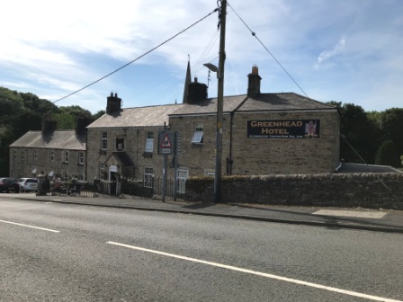
We then walked the short distance into the village itself. It had been a long day and we it was already 6pm when we walked into the Greenhead Hotel for a pint and a rest. The beer tasted magnificent. We chatted with a lovely couple from Dorset who were touring the whole of the UK over 4 months in a motor home as we relaxed with our drinks.
Eventually, with our strength partially restored, we walked the last ¾ mile to our hotel: The Blenkinsopp Castle. We had done another 18 miles for the day. We hadn’t climbed nearly as much as the day before but the heat had taken it out of us. We both agreed that this had been the hardest day.
The people from Chiswick were drinking on the patio for us and clapped us in and congratulated us before revealing how little walking they had achieved on their own trip. They joked that they had only completed 9 miles that day, having had lifts for more than half of the way.
We got our room and went straight back out onto the patio for drinks and a lovely dinner of Steak and Chips. It was warm enough and it was light enough to sit outside until 10pm. Eventually the sheer fatigue was replaced by a feeling of pride in what we had achieved.
PW Day 15 (Trip 5 – Day 5)
Tuesday 26th June 2018 – Greenhead to Once Brewed – 7.2 Miles
We ate breakfast, which was the best one of the whole trip, later than on the previous three days, but we were still ready to go at 9am.
We toyed with the idea of accepting a lift from the hotel manager back to the Pennine Way. He told us that he wouldn’t be leaving for an hour but he would save us the 30 minutes walk. In the end we declined and decided to walk.
By 9:30am we were back across the road from the golf course and standing at a sign that explained that for the next 9 miles the “Pennine Way” and the “Hadrian’s Wall Trail” would be merged and that all signs would simply refer to “National Trails”. It was already hot, the sun was out and the sky was cloudless again. The forecast was for the temperatures to reach 30 degrees later on. Today would be a short walk but we were still not much looking forward to it.
We crossed the Newcastle to Carlisle Railway Line on a level crossing and then began to climb immediately. We passed the remains of Thirwell Castle; a building constructed in the 12th century from stones obtained from Hadrian’s Wall.
From there we headed upwards on a track that went across a large field and became very steep at the top. This was our first major encounter with the Whinstone Sill, which is effectively the undulating ridge on which Hadrian’s Wall was built.
For the next 6 miles, the rest of our walk, we would be going up and down in roller coaster fashion. In fact, the total ascent for the morning was not far off the total climb up to Cross Fell a couple of days before.
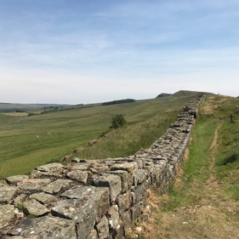
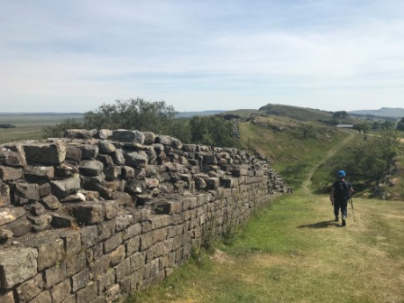
We climbed over a style at the end of the field and were rewarded by our first view of Hadrian’s Wall. I was impressed. Whilst it was hardly the Great Wall of China, it was nevertheless quite a substantial construction and given that it dated back to AD122 it was impressive that any of it remained at all. We weren’t the only ones around though and even though it was baking hot, there were plenty of tourists. We met more than 50 other walkers during our brief 6 mile trip.
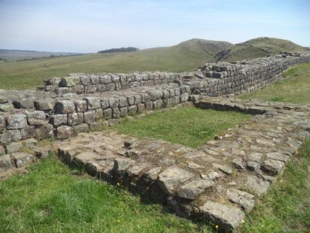
After a brief walk alongside the wall, we returned to the defensive ditch (Roman word – Vallum) alongside it. Soon we reached Walltown Quarry. In the 19th century several quarries grew up along the wall to mine the Whinstone from the ridge. They are all gone now but the remains have been converted into tourist features. Walltown was one of the biggest quarries and is now completely renovated as a country park with car park, lake and toilets.
We climbed past the lake and met a young man dressed as a Roman soldier. He asked us if we had seen another soldier carrying a shield. It was a bit surreal to be honest. Then he explained that he and his lost friend were students and were doing a sponsored walk of the wall in the full Roman kit. Sadly he had disappeared before I had the chance to take a picture.
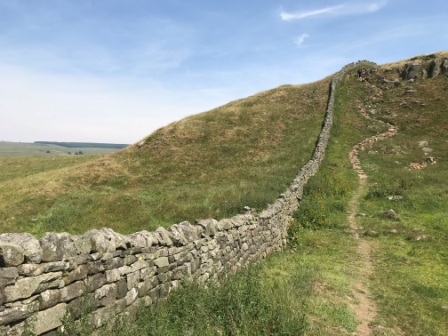
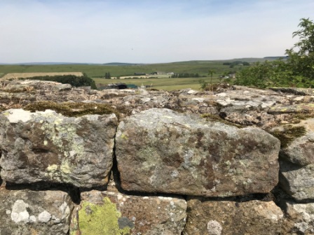
We climbed back towards the wall and kept with it for another mile or so. It rose in most places to about chest height. Every so often we came across the remains of the “mile castles” There are 80 of these in total and they are roughly a Roman mile (slightly further than a regular mile) apart. They were all manned by 20 guards and formed an extra defensive position. They were also used as trading posts and it is often forgotten that the wall acted as a customs line as well. The Romans traded with their northern neighbours too.
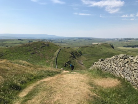
After several ups and downs we flattened out for a while, passed through a forest and then had a break nearby. It was tough walking and the heat really was helping at all.
We headed back onto the path for another mile and a half of three more ups and downs until we finally reached our goal: the car park at Steel Rigg.. We ended this fifth trip to the Pennine Way where the track met the road, noting where exactly we would need to start from again a month later.
It was just after 1pm and as we had a while to wait until the bus turned up at 2:40pm we wandered down towards the little settlement of Once Brewed. As you would expect, given the name of the place, there is a pub at Once Brewed and it is known as “Twice Brewed” !
After a thirst-quenching pint of IPA, we moved across to the Sill Centre close by. This was a brand new building with a few different uses. Its museum concentrated on the natural history of the Sill and the surrounding landscape.
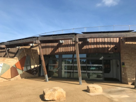
The building also housed a Youth Hostel and it had an excellent Café too. It was a very pleasant place to grab lunch and relax for an hour.
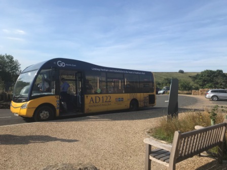
The bus that links the Sill Centre and the other tourist sites of Hadrian’s Wall to the Railway stations at Hexham and Haltwhistle is given the rather cute number “AD 122”.
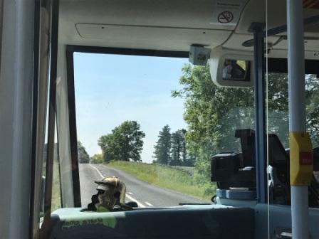
It comes complete with a Roman helmet perched on the dashboard and has announcements that point out the historical significance of all the stops. Although it runs only in the summer months, it runs every day of the week and this was a lifesaver for us. There was no other obvious way of getting from the place we had stopped walking to the railway at Haltwhistle.
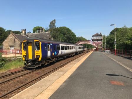
By 3:30pm we were at Haltwhistle Station. The temperature was now around 30 degrees. It was too hot to wait outside so we decamped to the deserted waiting room and also used it as a changing room. We had just under an hour to wait before we caught the train west along the picturesque Newcastle to Carlisle line.
We were met with total chaos at Carlisle. The electricity had been turned off and nothing was moving. A series of lineside fires and other hot-weather-related problems meant that our London-bound Virgin train was over 30 minutes late arriving and then over 70 minutes behind schedule getting into Euston. We later claimed a full refund !

With just 70 miles left, the end of the Pennine Way was now finally in sight.

