Day 5 – Newtown St Boswells to Tweedbank (5.5 mile walk)
Leaving Newtown
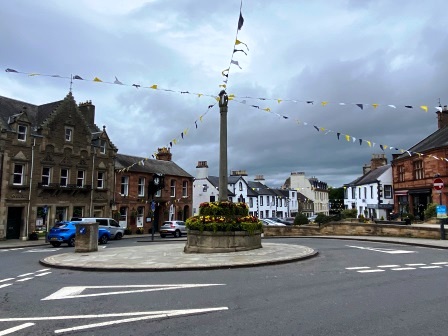
I woke a little later on Friday morning, and spent a leisurely hour in the room having several cups of coffee and the bread rolls I had bought from the Co-op. By 9am I was ready to go.

I walked a short distance down the main street, turned right into Waverley Way and then left on to a little path (above) to follow the track bed out of the town. I soon reached the A68 bypass. The formation disappeared on the other side of the road. It emerged again inside the Monksford Glen Golf Course through which, judging by the size of the fence, I certainly did not have the right to roam.
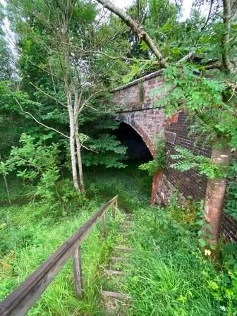
Instead, I walked up the A68 for about a half a mile until I reached a gate with a green “Do not block” sign attached. I went through the gate and cut across a field on a footpath to rendezvous with the Waverley Line at the point it exited the golf course. Here a set of steps (above) led down from a bridge (J) to a path along the track bed. I then followed the path which was waymarked “Melrose walks” back towards the A68.

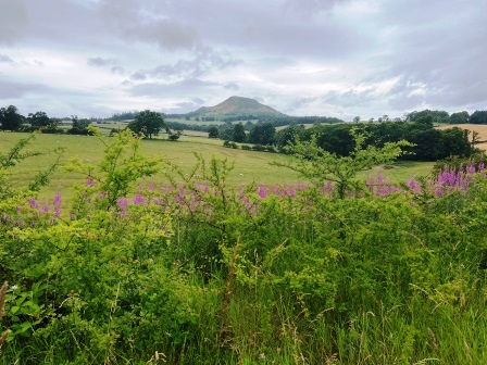
Having crossed the busy road, the track bed then cut an arc towards the A6091 Melrose bypass. This partially paved section (above) was short but very pleasant with excellent views off to the south (below).
The path met the A6091 at the site of Ravenswood Junction, where a branch once peeled off to the north, heading eventually for Reston on the East Coast Main Line. For the next half a mile the old Waverley Line itself lay under the A road. It wasn’t much fun following it, but one small consolation was the slightly wider shoulder for walking on the north side.
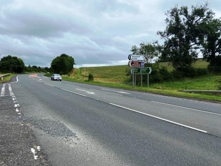
As I reached the turning for Newstead (K) I looked back (above) at the way I had just walked. It seemed clear that if the railway does ever return here, something will have to be done about the bypass.

Newstead Nettle Nightmare
Just after the turning there was a gate on the north side of the A6091. I was surprised to find the gate locked but climbed over it anyway. From here westwards the old track bed now continued parallel but just to the north of the road. Somewhere in this area was once Newstead, one of the lines shorter lived halts.

For some reason I had expected that the nearer to Tweedbank I got, the easier the walk would be. I was now shocked to find that the way ahead was almost impassable. Nettles and other foliage pretty much blocked my path (above). If I hadn’t been sure there was supposed to be a way through here, I would have given up.

I donned my gloves and pulled my sleeves down, but I still managed to get a few nettle stings on the way through. It was difficult for a few minutes but then it got better. Eventually it widened out onto a nice embankment, and I passed over a lane on an old bridge with a view south to the bypass (above).
Suddenly the path was paved and much easier to follow. It gave out into Dean Road, and I continued walking along High Road on the way into Melrose with the formation on an embankment, inaccessible just to my left. I cut through Scott’s Place and looked left to see the old bridge abutments still in place (below) at Dingleton Road. Melrose Station lay just to the right of this. What would have been a seven minute train ride from Newtown back in 1968 had taken me about two hours.

I had some time to kill, so I went for a little wander around the town. Famous for its Abbey, it was a lovely little place with an attractive centre and plenty of independent shops. I got a Scotch pie at a local baker’s and then found a little cafe for a coffee.
As I made my way towards the station, I actually felt a little sad that I was about to complete the last bit of what had been a very satisfying walk.

The Last Little Bit
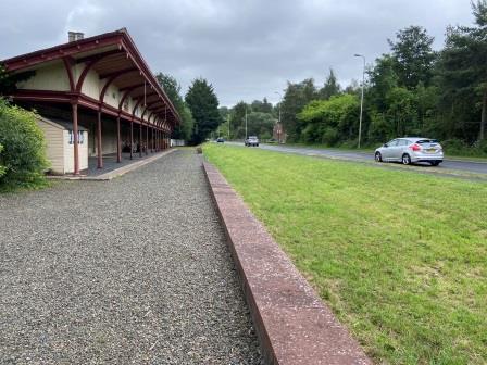
In terms of impressive station buildings, Melrose (22) certainly was a case of saving the best until last. Although the interior now serves a few different purposes, including as an Italian restaurant, the magnificent exterior (below) has been beautifully preserved.

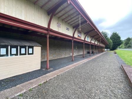
I walked up the steps and out on to the renovated platform. Only the Carlisle-bound side (below) still exists, the rest of the former railway land being taken up by the bypass. Signs on a shed towards the end of the platform reveal that much of the restoration work has been done by a small group of local volunteers.
Sadly, as the sign also explains, the group are getting on a bit now and are looking for assistance to finish off the work. Their intention is to lay a bit of track next to the platform and install authentic light fittings. Donations and offers of help are requested via kevtherev7@aol.com.
Before I left the station, I paused to admire the name board the group have put up further along the platform. I was now 61 miles from Carlisle by rail, which meant just about 37 miles to go to Edinburgh. However, less than two of those would be on foot.

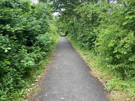
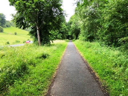
As I set off again on the paved path heading towards Tweedbank, still following the old track bed (below), it started to rain. I crossed Chiefswood Road, and continued on until I reached a little T-junction. Ignoring the left fork, which led to a subway under the bypass, I turned right following the course of the old railway down Lye Road.
At Broomilees Road I cut away from the track bed to head through a little nature reserve on a pleasant path which eventually emerged at Waverley Road. Having crossed that, I soon turned left on to a cycle track that brought me to a sign (below) on Tweedside Park across from the entrance to the “Black Path”.

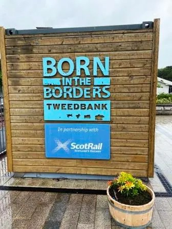
I followed the sign on to the “Black Path.” Here I was, for one last time, following the course of the old railway (below). As I got closer to Tweedbank, I could see the red station starter signal at the end of the platform perfectly aligned with the path I was walking along.

A few minutes later I walked across the road leading to the station car park and on to the platform itself. I had followed the roughly 63 miles of missing track all the way from Carlisle, and now the railway was finally back.

I calculated that on my own walk of 80 miles over five days I had covered about 32 miles walking directly over the track bed and several miles more walking alongside it.
This was actually my second visit to Tweedbank; I had made the trip from here to Edinburgh at the end of my Pennine Way adventure a few years ago. It still didn’t take anything out of my excitement though.

I wandered over to inspect the stone unveiled by the Queen in 2015 when she opened the new line, on the same day as she broke the record for being the longest reigning British monarch. Just as I was finishing reading it, I noticed that my train was already entering the platform.

Tweedbank to Edinburgh Waverley (35 mile train ride)
Anytime Day Single
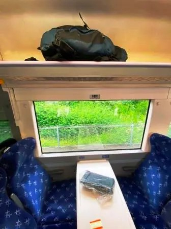
My train, the 12:49 to Edinburgh was formed of a 3-car Class 170 in Scotrail’s attractive blue livery. I got a ticket from the machine on the platform and then jumped on board.

The train was nicely refurbished on the inside too. I placed my trusty rucksack, its job now completed, on the luggage rack above me and sat down in one of the comfortable blue seats. It was a quick turnaround and within a few minutes we were heading north.
The journey to Edinburgh was timed to take an hour, with stops at all of the eight stations. The service is half-hourly. There had been quite a few passengers getting on at Tweedbank, and as we went north more and more joined and by the time we reached Shawfair, the train was pretty full. This is not at all bad for a line that was once deemed totally unnecessary and was actually closed for 46 long years.

As we went along, I stared out of the window, for most of the journey the scenery was beautiful, similar to what I had been walking through.

This part of the line too might have once made an interesting track bed walk, although it is obviously much better as it is now. We don’t quite have to imagine what walking it would have been like; Scotrail have made several videos of the view from the front – Cab View – Borders Railway

Finally, bang on time, the train pulled into Platform 4 at Edinburgh’s Waverley station, a distance via rail of 98.25 miles (via Hawick) from Carlisle. As I alighted, I wondered if trains will ever again depart from here and travel over the route I had just walked.

As of July 2023, it still seems unlikely. A feasibility study is being planned but there are plenty of obstacles to overcome. I really hope they do decide to re-open it, but whether they do or not, wonderful as it all was, I am not sure I could walk it all again.

Impressions, Conclusions and Advice

Walking all the way from Carlisle to Tweedbank was immensely satisfying, but as I had expected, the most rewarding part was the middle section.
For me, the “unmissable bits” were from (just north of) Newcastleton to Riccarton Junction and from Whitrope to Stobs Wood.
Although the path to bypass Whitrope Tunnel is well made, I saw no signs indicating the existence of the “Waverley Way” trail that is supposed to exist between Flex and Steele Road.
Signs indicating routes around Whitrope Tunnel, Shankend Viaduct and Stobs Station / Viaduct were also non-existent.
Given the obstacles I encountered, I would suggest there is not much point in accessing the track bed at Flex. Newcastleton to Stobs (ca 17.5 miles) would make a very worthwhile one-way day walk if transport could be arranged at each end.
Tracking the old railway in the Carlisle and Longtown areas was interesting, and the walk north from Longtown (although probably without the cows) to Thistle Viaduct was excellent.
I had planned to use more footpaths on the section between Moat and Kershopefoot but found them overgrown. I opted to use small lanes instead, which was not ideal.
The section between Thistle and Kershopefoot on the second day could easily have been skipped. On the fourth day, the section between Belses and Newtown St Boswells could also be missed without losing too much.
Encountering two days of rain, some of it very heavy, did not detract too much from the experience. I was prepared with waterproofs and managed to stay, mostly, dry.
The cuttings just north of Newcastleton and just north of Hawick were extremely waterlogged. Water was above my ankles in both places. Better waterproof footwear might have helped. In both areas a parallel road was available.
Navigation off the track bed was sometimes difficult. MAPS.ME proved to be a massive help. It helped me to locate the entrance to the path at Whitrope and gave me confidence to persevere through nettles in the knowledge I was on some kind of path in other places.
Mobile phone reception was expectedly pretty poor for most of the time, even in some urban areas such as the centre of Newcastleton.
All the accommodation I booked was excellent. I reserved in advance to guarantee an evening meal in Newcastleton but was unable to find anything in Longtown or Newtown St Boswells. Nevertheless, the local SPARs and Co-ops, open until late, provided reasonable substitutes in both places.
If you need any other advice on walking the route, please get in contact.
Back to “Walking Waverley”
Links to other track bed walks –
2020 – Somerset & Dorset (Bristol to Bournemouth)
2021 – Woodhead (Manchester to Sheffield)
2022 – North Cornwall (Okehampton to Bude / Padstow)
