Walking in Yorkshire
The Plan
After my return from Kirkby Stephen I mulled over several options for completing the rest of the walk to Robin Hood’s Bay. My wife seemed keen to accompany me but we both had concerns about whether she would really enjoy 7 continuous days of walking.
Finally in August 2015, after a very pleasant weekend of walking in North Wales, we decided to give it a go. In December 2015 we finalised a plan and I made a formal booking with Sherpa.
To make booking easy I decided to use exactly the same itinerary that my 3 walking companions had used to finish the trip the year before. After the first night in Kirkby Stephen on Saturday, May 21st we would set off on the Sunday and make stops at Keld, Reeth, Richmond (extending to Bolton), Ingleby, Chop Gate (Clay Bank Top) and Grosmont before reaching Robin Hood’s Bay the following Saturday. That would be 7 days walking in all and, as a small reward, we booked an extra night in Scarborough on the Sunday before heading back south on Monday.
Apart from one hotel change in Robin Hood’s Bay, I managed to secure exactly the same accommodation options as my predecessors. By coincidence our proposed itinerary was just one day adrift of being exactly 1 year later.
Preparation
As winter turned to spring my wife put in a lot of hard work first on Otford Mount and then on sections of local footpaths. Her efforts culminated in us completing the 55-mile western section of the North Downs Way from Otford to Farnham in just 3 days with a record 26.5 miles from Caterham to Gomshall in a single day.

By mid-May we were both confident that she was more than ready for the big challenge.
By now the pebbles I had picked up from St Bees were getting very impatient sitting on the sideboard. One of them obviously desired to make a new home on the beach at Robin Hoods Bay, whilst the other clearly wanted a new companion to bring home from the east coast.
Return to Kirkby Stephen
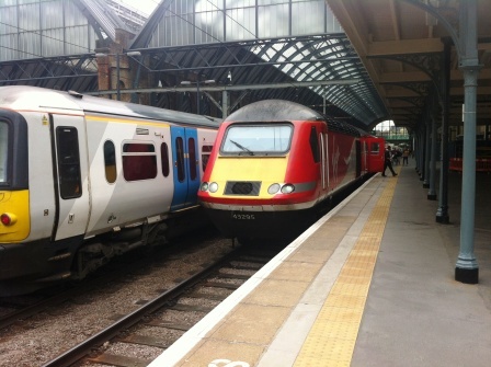
Saturday, 21st May finally arrived and we found ourselves at Kings Cross boarding the 12.03pm to Leeds. Virgin trains (yuk!) got us to Leeds and we had a 20 minute connection for the train up to Kirkby. We arrived on time at 4:30pm.
Knowing that the station was almost 2 miles from the town I had pre-ordered a taxi. We found the taxi waiting in the car park and immediately took pity on an Australian lady who had alighted from the train with us.
She hadn’t realised how far the town was and so we offered her a lift. In the taxi we learnt that she had just flown in from Sydney and was about to commence the 2nd part of the Coast to Coast after 2 days recuperating in Kirkby. We dropped her off at her bed and breakfast and continued to Fletcher House.
I` recognised Gillian, the owner of Fletcher House, from a year ago and she quickly showed us to our room. Fletcher House was a great start to Part 2. Gillian was a great host and the facilities included a pamper bath (with 30 different bubble baths) a foot spa, a relaxing lounge and, best of all for me, lots of train photographs on all the walls.
We ventured out to the Black Bull pub where I had enjoyed my post-walk pint 1 year and 1 day before. At 6pm the bar was already full of C2C walkers. Americans and British were entertaining themselves with tales of the day’s walks from Shap and Orton. I bought a pint and sat down listening to them whilst trying to explain to my wife what they were talking about. It felt great to be back.
The Black Bull was fully booked for dinner so after a walk around the delightful little town we tried our luck at the “Century” Chinese. It was a good find. We secured one of the last tables and again found almost all of the clientele were Coast to Coasters. With almost 10,000 walkers a year, England’s busiest footpath certainly brings a lot of trade to little towns like Kirkby.
We expected nothing from a little Chinese in a remote part of Cumbria, but the Century was excellent. It delivered friendly service and really fresh tasty food.
We slept well and woke early. We arranged the bags and attached the Sherpa labels ready for collection and went down for breakfast at 8am.
Day 7 (Day 1)
Kirkby Stephen to Keld – 14.2 Miles
Gillian did us proud with a delicious breakfast. Over breakfast we made our first contact with some of our fellow walkers. Paul and Susan were a couple from Buckinghamshire and they were on day 8. They would be talking one more day than us to reach the end of the trail. Linda and Diana were two ladies from Cornwall. Linda was from the Lizard and Diana was from Saltash. Diana was on her third C2C trip. She explained that she was something of an addict.
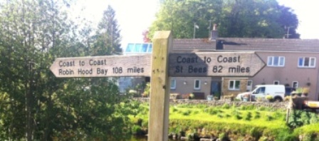
At 8:45am we gathered our stuff together and started out. There was nobody about as we made our way out of town. Perhaps this was not surprising as it was a Sunday morning. We headed east and quickly crossed the River Eden on Frank’s bridge (not sure who Frank was).
As we crossed we saw a signpost pointing both to St Bees (82 miles) and to Robin Hood’s Bay (108 miles) and this brought it home to me that despite thinking that I had just started “the second half, ” in fact I was still quite a few miles short of the 50% point.
We made our way along the river bank and eventually began following a small track that wound its way gently up the mountainside. We paused briefly to examine the beautifully restored Podgill viaduct on the old Stainmore Railway, and then continued on up past Hartley Quarries.

We had set off early to give ourselves extra time to walk slowly, so we were surprised to see that we were slowly gaining on two figures carrying large rucksacks in front of us. After another twenty minutes as we wound gently higher we finally overtook this couple in front. Phillip and Christine were from Tournai in Belgium and were on their very last day.
They had started in St Bees in September and had walked as far as Kirkby Stephen. They had then returned a week ago to Keld and started to walk to Robin Hood’s Bay where they had finished just two days previously. The day before they had caught the Packhorse bus back to Kirkby and they were now filling in the final missing leg. We chatted with them for a while before drawing ahead.

We spent another thirty minutes heading up Faraday Gill (named for the famous inventor who lived close by) admiring the stunning views that stretched far in the distance and over to the Lake District.

Looking back to Kirkby Stephen we spotted Paul and Susan coming up fast behind and eventually they overtook first the Belgians and then us. It was nearing 10:45am as we arrived at our first goal; Nine Standards Rigg. No one is quite sure why the nine giant piles of stones ended up on this mountain, but they are fascinating nonetheless. The sun was still shining and the views from all angles were quite amazing.
As well as being the boundary between Cumbria and North Yorkshire, The top of Nine Standards marks the change in watercourse. All the streams on the west side flow towards the Irish Sea and all those on the east side flow into the North Sea.

The wind was getting up a little bit and whilst we were sheltering and putting on extra layers we met Fiona and Janet, a mother and daughter from Ashford in Kent. Like the Belgians they were on their last day.
They had set out from Keld and headed east to Robin Hood’s Bay, jumped on the Packhorse bus to go all the way to St Bees, before continuing east again back to Keld. It occurred to me that there must actually be a lot of people who do this. The attraction being a single simple drive to the midpoint and then a walk to and then from each end.
By now the Belgians had caught up and after a few more minutes savouring the views together we continued across to the trig point (662 metres) before heading down.
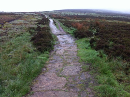
The route off Nine Standards is notorious with Coast to Coasters as it is the only part that is not on a clearly marked footpath (it is all open access land) and it is supposed to be very boggy. The Yorkshire Dales National Park try to protect the damage being done to the peat by designating three routes to follow depending on season.
The green route is the lower winter route, the blue route is the late summer route to the east, whilst the main route is confined for use between May and July. This is designated red and this was the one we were about to follow.

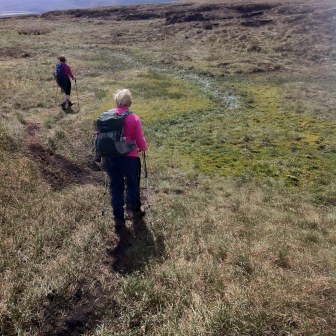
The route heads first due south and then south east off the summit. It is not so clearly defined and every so often a large amount of watery bog blocks the way. The only solution is to try and find a way around or to jump as far as possible over the bog and hope you don’t land in the wettest part.
We were a group of six as we came down the mountain side; Fiona, Janet, Phillip and Christine. The ground was drier than expected and, helping each other by spreading out to find the best routes, we made it down without too much trouble. We stayed largely dry.
I can only imagine how the journey down must be in poor visibility and when the ground is much wetter. Only this March a campaign has been launched to raise money to place stones on the worst parts of bog to reduce erosion and aide walking and direction finding.

By 12:00 we had come off Nine Standards and were on a track heading east. This is shooting country and there were several grouse butts and shooting boxes along the side of the track. Eventually we came into Whitsundale and we happened upon a sign that I often had seen in the guide books and on the blogs “Slow Down, Free Range Children”

This sign marks the entrance to Amanda’s farm. Amanda has written a book on the Coast to Coast and does a roaring trade selling cream teas to walkers. She has a little bell outside the farmhouse door to attract attention and the customers place orders whilst standing at the farm door.
She has spread out six or seven picnic benches around the farmyard and as we arrived they were almost all full. We got the last empty bench and enjoyed a cup of Amanda’s tea and coffee whilst eating our sandwiches. The setting overlooking Whitsundale Beck with the sun shinning was totally idyllic.
After our break we set off again ahead of the others along a footpath on the north side of the beck. The views here, as the beck feeds into the River Swale, were totally different to anything encountered so far but wonderful nonetheless. We kept high on the valley side and passed over a series of waterfalls before we eventually reached the last road bridge before Keld.
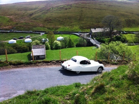
As we were descending towards the bridge we were passed by a series of old vehicles. First came a parade of about 20 chugging tractors from the 1950s and then around 20 or 30 classic cars: MGs, Jaguars and Minis. We watched as this curious cavalcade descended into the valley below.
After a final stretch along the road to Keld we reached some Mongolian yurt tents ( a way of bringing more much needed C2C accommodation to the village ) and we waved goodbye to Fiona and Janet who were actually spending their last night in a yurt.
A few steps further down the road we reached our goal for the day; Keld Lodge. We had made it by 3:30pm in roughly 6 hours walking time (excluding the break). Keld Lodge is a converted former youth hostel and is now a hotel. The landlord greeted us outside and informed us that the bags had already arrived and were in our rooms.
We then spent a nice hour or so in the bar chatting with Christine and Phillip. We were amazed to learn that the Belgians had completed many of the trails in the UK: the North Downs Way, Pennine Way, Offa’s Dyke and now, of course, the Coast to Coast.

After a short rest in the room we dined on beef pie washed down with a glass or two of Merlot.
My wife had done really well on her first day. We fell asleep early recharging for another day.
Day 8 (Day 2) – Keld to Reeth – 15.2 miles
After a rather splendid (Scottish-themed) breakfast of salted porridge and smoked kippers we were ready for our second day. We left Keld Lodge just after 9:00am and the sun was already shining (with a high of 14c forecast) as we wandered down through the little village towards the river.
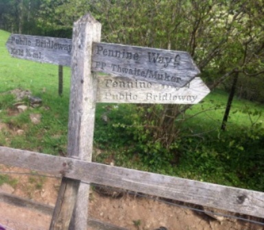
After a few minutes we saw sign posts for the Pennine Way. Keld is the not only the midway point of the Coast to Coast, but it is also located at the intersection with the great North-South trail – “The Pennine Way”. The Pennine Way was first opened in 1965 and so it predates the C2C by about 8 years. The two routes effectively form a cross shape on a hiking map of the north of England.
We now stood at the dead centre of this cross. Standing at this intersection St Bees lay approximately 95 miles behind us to the west and Robin Hood’s Bay was about the same distance in front of us to the east. Turning right here would have led us south to Edale in about 100 miles, whilst turning left would have meant eventually reaching Kirk Yetholm on the Scottish Border after 167 miles.
We resisted the temptation to turn left or right and we continued straight on.
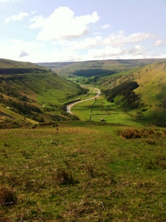
We crossed the infant River Swale and started on climbing the side of the valley. We quickly gained height and were rewarded immediately with fantastic views looking south along Swaledale.
The official C2C route goes over the hills to Reeth but there is a recognised alternative that continues along the River Swale itself. The river route is picturesque but longer. It is a fair option for those who have walked continuously from St Bees or when the weather on the hills is bad.
Having neither of those excuses we had opted to take the hill route. In the end, as this proved to be one of my favourite days on the whole trip, I am glad we did.
At the division of the two routes we chatted with Ron from Manchester who we recognised from the Chinese in Kirkby. Ron had chosen the lower route.
We then headed up the track to Crackpot Hall. The hall is totally derelict but in a stunning location. We entered the grounds to have a closer look and we started to imagine what it would cost to renovate it. We continued discussing this as we exited through the garden and onto the track We were caught up by Paul and Susan who had been thinking the same thing.
The four of us continued for another 5 minutes discussing our plans for renovating the property and trying to decide where we would add the conservatory as we walked along the footpath that led out of the garden. We soon realised we were all going in the wrong direction. Putting our real estate discussions on hold, we retraced our steps to the hall and resumed the correct course. Paul and Susan made swift progress and were soon way out in front.
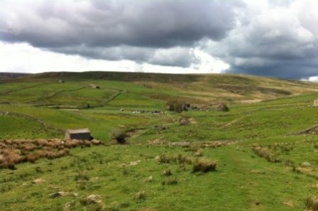
We continued climbing on the steep side of Swinner Gill whilst looking back on the ever more beautiful views of Swaledale below. As we stopped to take photos were caught up by Peter and Michael, a father and son from Germany, who were doing the C2C in 15 days.
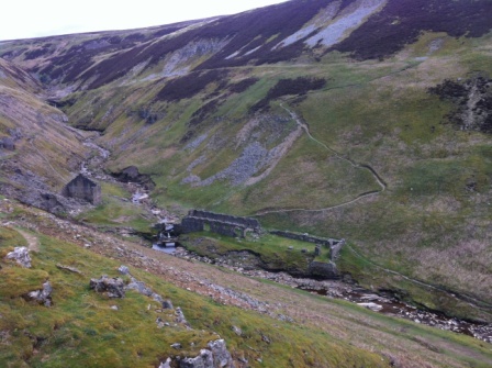
We continued on until we reached the disused lead mine halfway up. This was the first of several lead-connected industrial ruins we saw. Lead Mining was prevalent here in Victorian times when England produced 50% of the world’s lead and this area of Yorkshire produced a fifth of that.
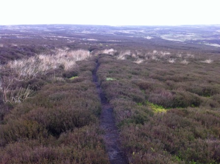
After a final haul we came to the top of Swinner Gill and out onto the top of the heather-covered moor. We were in shooting country again with plenty of signs about baby grouse all around.
After another little while we descended Gunnerside Gill to another disused lead mine at the bottom of the valley. We crossed a beck and immediately zig-zagged up the other side of the hill and out onto Melbecks Moor.
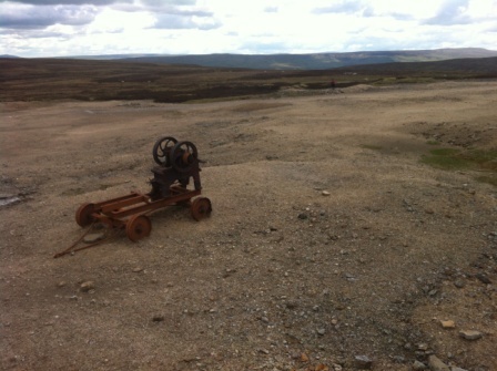
For the next few miles the landscape was almost lunar. There was a lot of evidence of the extensive stone working that had gone on here in years gone by. We passed an old stone cutting machine that had been left there in tribute to the workers who had toiled here long ago.
We continued down the path and about 1pm we stopped for lunch at the Old Gang Smelting works. This was perhaps the most extensive of the old lead sites we passed. Paul and Susan and the Germans were just finishing their own lunch as we arrived. We paused for about 30 minutes or so and continued down on the track now following a new beck (Old Gang Beck) towards Reeth.
As we came closer to Reeth the valley opened up again and, as we moved along the north side, we enjoyed more spectacular views. The trail threw us a nasty surprise at Cringley Bottom where we had to descend and ascend the steep sides of a gill, but otherwise it was a pleasant and easy downward walk. We saw no one else and we assumed that most of the walkers from Keld had elected to take the river route.
Rabbits featured largely on this section. They were bouncing around in the fields alongside the sheep as we walked past and their dead bodies were lining the path we were walking on.
After sighting 10 or so dead and about 20 living bunnies we finally entered the village of Reeth. We headed straight into the Buck Inn for a pint of Black Sheep Bitter. It was 4:20pm.
After a relaxing pint we headed down the street to the Hackney House B&B where the landlady, Becca, seemed happy to see us. We were provided with coffee and cakes in the lovely sitting room before being shown to our own room. The bags were there already of course.
As we looked outside we noticed that it had just started raining. The first rain of the trip.

Later in the evening we went back to the pub and enjoyed a lovely meal of lamb’s liver and Swaledale pork chop. By now the small daily walking conversations were bearing “friendship fruit” – and we sat on a table of eight. Paul, Susan, the Germans and the two ladies from Cornwall. All in all we had a great evening’s drinking and chat.
My wife was still doing really well with the walking but had started to apply peppermint gel to her legs.
Day 9 (Day 3)
Reeth to Bolton 21.1 miles
We woke to the sound of donkeys braying (there were four in the back yard) and at 8am we went downstairs. Becca fussed around both us and the two ladies from Cornwall and produced the best breakfast so far; lovely back bacon, local sausage, tomatoes on the vine and delicious mushrooms.

Sherpa – Luggage label
The weather had held for a third day running and we were greeted by 15 degrees and not a cloud in the sky. We said goodbye to the Cornish ladies (they were stopping next short of Richmond so we wouldn’t see them again) and headed out into the sun. It was already quite strong even at 9am.

The first few miles were along the north bank of the Swale and we quickly met and overhauled “Manchester Ron” again as we walked along the riverside.
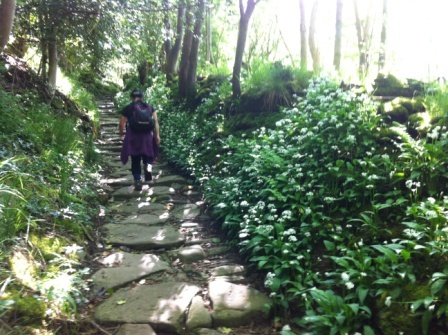
After a while the path went further up the slope, headed over the brow of the hill and up through a forest thick on both sides of the path with wild garlic. The flowers were beautiful and the garlic smell was quite obvious.
We climbed through this forest (Steps Wood) and eventually made it out to the small village of Marrick. We continued on through fields that alternated between dairy cattle and their calves and sheep with their lambs. We made good progress but, apart from one coast to coaster going westbound, we saw no one. At about 11:30 we stopped for a rest in the village of Marske.
After Marske we crossed a field and watched a sheepdog in action rounding up the sheep. It was absolutely fascinating to watch. As we were watching Paul and Susan caught us up and we all reminisced about watching “One Man and his Dog” on the TV. We bid farewell to Paul and Susan as they set off ahead. They were also stopping short of us.
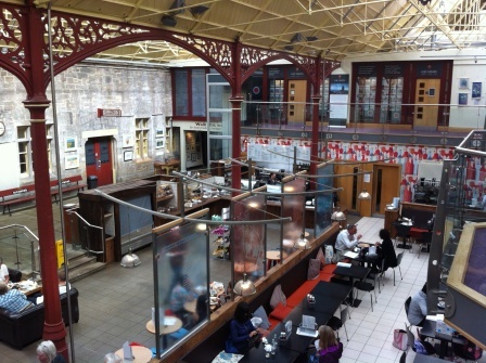
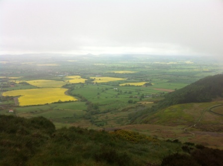
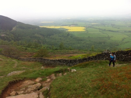
The next stage was at the foot of Applegarth Scar and we dipped in and out of forest as we descended gently towards Richmond. Before long Richmond came into view and we walked down through the town, the largest on the whole C2C. We paused at our guest house and then headed past the foot of Richmond castle towards the old station.

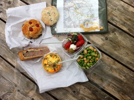
It was almost 2:00pm when we arrived at the station. The old station has been tastefully renovated and now contains several shops including the northern champion in the ITV artisan bakery competition – “Angels Share”. We purchased a slice of Cumberland sausage, apple and ham pie, a new potato chorizo quiche, some salads and a couple of cakes and ate them all sitting outside in the sunshine. A wonderful lunch and a great reward for the 12 miles we had walked from Reeth.
Whilst many of our fellow walkers would stay in or just short of Richmond and would spend the afternoon relaxing, we had decided to continue on for another few miles.
There was a bus back from Bolton-on-Swale (7 miles east) after 6pm and another bus due to return there the next morning. The plan was to cover the distance in the afternoon and then resume from Bolton in the morning.
After our half-hour lunch break we set off along the old formation of the Richmond branch line, now a cycle track, and we were eventually reunited with the Coast to Coast a half mile on. Having crossed the bridge at Richmond we were now on the south bank of the Swale and the path followed the river for a while before climbing again through dense woodland thick with yet more wild garlic.
Signs warning that military training takes place near here was evidence that Europe’s largest Army base, Catterick garrison, is just a few miles to the south.
Out of the woods the scenery became less interesting especially when compared with the drama of the last couple of days. About 3 miles out of Richmond we were suddenly greeted by a sign “Footpath Closed”. They are widening the A1M in this area and they have set up an elaborate diversion for the Coast to Coast that takes it on an ugly route along an A road, through a construction site and over a new pedestrian crossing of the widened motorway before it goes past Catterick race course.
Eventually we were free of the diversion and crossed the river on the old railway bridge that used to carry the Army camp branch line. A walk of a few more miles along the river, past a quarry and across fields brought us to the hamlet of Bolton-on-Swale. It was 5:35pm.
We sat in the little churchyard and eventually made our way to the bus stop for the 6:13pm bus back to Richmond. It was a mere 20 minutes back to the town. A disappointingly short ride to cover ground we had taken almost 3 hours to walk.

Once back in Richmond we checked into the Old Brewery Guest House and climbed back up the hill to the town centre for a tasty Thai meal. Unlike the other villages along the way Richmond was large enough to absorb the Coast to Coasters and we saw no-one we knew all evening.
A bath, more peppermint leg gel and an early night.
Day 10 (Day 4)
Bolton to Ingleby 18.2 miles
We had originally planned to return to Bolton on the 10am bus and have a leisurely walk to Ingleby, Then we saw the weather forecast and changed our minds. The forecast was for heavy rain from midday onwards with temperatures dropping to 10c. We elected instead to breakfast early (on porridge and kippers again) and catch the 8am bus.

We met a couple from Toronto and a lady from Texas in the breakfast room and we were soon joined by the Germans, Peter and Michael. We let them all know about the diversion needed for the closed section and we left Peter and Michael with our map from the day before.

We walked up to the little town square and we bought provisions for our picnic lunch before hopping on the 8am bus. Fifteen minutes later we were in Bolton (at the well) again and ready to start walking.
It was already overcast when we started out across the fields and down by Bolton brook. We made reasonable progress along the flat as the path zig zagged across fields. We saw plenty of rabbits and a lot of swallows but today we were crossing fields with more crops and less livestock. At one point we crossed the centre of a beautiful field of rape seed but in the main it was dull walking.

The lowest point of the C2C is reached at Danby Wiske (just 40 metres above sea level) and as it was 11:00am we were expecting morning coffee at the Swan Pub. So it was a bit of a low point physiologically too when we found the pub was closed until noon. We didn’t wait. We crossed the main London-to-Edinburgh railway line and carried on traipsing across field after field.

Just before we reached the York-Middlesbrough rail line at Wray we encountered a rather gothic display of skulls and plastic rats stuck to the stile. It might have been a joke by the local farmer but it proved a bad omen; almost immediately it started to rain. It rained hard. Very hard.
We sheltered in a nearby woods and had our picnic there. (this included an outstanding pork pie from Taylor’s butchers in Richmond) The heavy rain was not giving up and we donned full waterproof gear and headed out into the fields to continue towards Ingleby. Shortly afterwards we were overhauled by another walker. He wasn’t doing the C2C and he was the only other person we encountered on the whole day’s walk.
The rain continued to be heavy but the scenery never really changed until we grew closer to Ingleby. Gradually the hills of the North Yorkshire Moors ahead in the distance became closer and closer.

We reached the single most dangerous obstacle on the whole C2C route; the busy A19 four-lane dual carriageway. Cars and trucks were roaring down at over 80 mph and looking even more fearsome as they created spray in the heavy rain. We waited for gaps in the traffic and eventually ran across. We cursed the local politicians who have ignored pleas for a footbridge as we did so.
A few more minutes down a picturesque lane and we reached our goal for the day; the Blue Bell pub. It was 3:20pm.
We went in to find the Canadians who had obviously set out later than us already sitting at the bar. As we had never been passed and we had had an 8 mile head start we quickly surmised that they had cheated and used a motor vehicle to overtake us. There was no other logical explanation.
A pint of Theakston’s bitter hit the spot and we were just about to walk the half mile (off route) to our guest house when a lad at the bar introduced himself as Ashley and told us that he was our landlord at Somerset House guest house. He kindly gave us a lift back to our lodgings in his van and checked us in.
Later in the evening we went back to the Blue Bell and had a great cottage pie in the company of Stephen and Claire, a couple from Derbyshire who were camping and crossing in 15 days, and our new German friends Peter and Michael. Peter (73) was a retired doctor whilst son Michael (45) was a lawyer based at the EU headquarters in Brussels. A real live Eurocrat.
The conversation moved from Stephen’s experiences of Corsica and Peter’s hiking trips in Ireland to the history of Germany and the future of the EU. The liveliest topic was, however, the cheating Canadians and the fact that they used taxis when it rained or to cross the bits they didn’t like. Michael told us they had done it before earlier on in the trip.
Actually as Richmond to Ingleby was the worst section of the whole trip I can’t totally blame them for missing it.
Day 11 (Day 5)
Ingleby to Clay Bank Top 14.4 miles
The next morning we awoke at 8am and had breakfast with a Dutch mother and daughter who were crossing in 15 days.
We left at 9am and started by retracing our steps to the Blue Bell and then out towards Arncliffe Wood. Today’s walk, whilst quite short in distance, represented the second largest amount of ascent of the whole C2C. Only the day that included the climb to Kidsty had more uphill.
The route was a switchback that took us several times up onto the tops of the moor and then down again onto the level. The route wound its way out of Ingleby. After about 2 miles it joined the Cleveland Way which it would follow for the next 30 miles. As the Cleveland way was a National Trail navigation was much easier. The whole route was now signposted with the national trail acorn signs.
On top of that the section that we were following was stone slabbed for its entire length. As it ascended and descended across the moorland it was so clearly visible that it often felt like the yellow brick road in the Wizard of Oz.

We didn’t encounter Dorothy or the scarecrow but we did meet a few dog walkers. We climbed twice up to about 400 metres and then descended back down to 100 again. At about 11:30am we paused for a drink and were immediately caught up by a couple from Victoria, Australia. We stopped and chatted for a while and then continued on the switch back. We descended back down to about 100 metres and back up to 400 again.
We caught the Australians up as they had lunch and then they overtook us again as we had lunch at Cringle Moor. The moorland was different from anything we had seen so far but not as spectacular as it must be when the heather is purple in August / September.
As we went back up for the third time the mist was starting to gather. The path was very clear and apparent at all times but nevertheless limited visibility and the knowledge that we were quite high up added to a sense of unease.
The fourth and final haul up to about 400 metres took us to the Wainstones; an ancient pile of rocks sitting high on the hillside. We momentarily got lost and asked the way from a group of teachers and children climbing on the rocks. With a side path and a bit of scrambling we made it back onto the path. As soon as we knew we were back on track we called the Buck Inn at Chopgate.

The Buck inn, in common with other B&B’s around the area, offers free transport from Clay Bank Top. This is to compensate for the fact that there are no places to stay on the track itself. The recommended method is to call your chosen hostelry from the Wainstones and then spend the next 30 minutes descending down to the roadside whilst a vehicle is sent out to pick you up.
We descended down to the road and after a wait of 10 minutes or so Wolfgang turned up in an Audi SUV. Wolfgang was originally from Heidelberg but had spent 30 years in Perth, Australia and now, as an alternative to retirement, had bought the Buck Inn from the receivers and was running it with his British wife Helen.
I had a pint of the local Red Label ale before retiring to our room. We went back for dinner and met the Australians and the Dutch girls again before chatting to some cyclists from Essex who were also doing the cycling version of the coast to coast.
We dined on excellent German food at the Buck. Delicious schnitzel with jaeger sauce and Kasseler pork chops with red cabbage and sauerkraut.

It had been a long and tiring day but my wife showed no obvious signs of fatigue. The training was certainly paying off.
Day 12 (Day 6)
Clay Bank Top to Grosmont – 23.1 Miles
The next morning we breakfasted at 7am on bacon, sausages, tomato and mushrooms and by 7.30am we were in Wolfgang’s car heading back to the trail. We complemented him on his German food and he told us a few of his secrets. He marinated the pork for 5 days and only used free-range local meat. He made his own red cabbage and sauerkraut, and those ingredients he couldn’t find locally, he imported from the same supplier that the German embassy used. He was dedicated to providing a very authentic German experience in Yorkshire.

We bade farewell to Wolfgang and by 7.40am we were already on the trail. We knew it was going to be a long day so we were trying to give ourselves as much time as possible. The weather had improved overnight. It was warmer now at about 12 degrees and the mist had gone. We climbed immediately up 400m on to Urra moor and, once on top, walked along again in typical moorland scenery.

After a few miles the Cleveland Way finally gave up and went off in another direction. It was replaced by the track bed of the disused Rosedale railway. My wife changed her boots to training shoes (she did this back and forth about 4 times throughout the day) and the walking got a bit quicker.
For the next five miles the old railway took us via a series of S bends through cuttings and over embankments to the Lion pub at Blakey Ridge. It wasn’t the most interesting walk of the trip but it was flat and quick. Apart from a couple of joggers going in the opposite direction we saw no one.
We were at the door of the pub at 10:30am. Built of moorland stone and having a real cozy atmosphere, the Lion provided us with a great coffee break. We chatted with a family from Redcar who were just back from a continental holiday and recovering from a night on the Zebrugge-to-Hull ferry.
The route on from the pub was on a B road across Danby Moor. Save for a muddy short cut across the Heather it was all Tarmac and sometimes a little soul destroying.

After a few more miles we turned off the road onto a bridleway and we passed a derelict house called Trough House. We were now up on Glaisdale Moor and the views down into the strangely named (apparently it is Norse) Fryup dale were magnificent.

We paused for lunch at about 1:30pm with about 4 miles to Glaisdale still to go. We sat on a fence and enjoyed Wolfgang’s turkey and salad sandwiches. Then the sun came out and lit the whole valley up. It felt warm too. We carried on but apart from a few westbound cyclists we saw no one.

We finally left the moor behind and descended into Glaisdale village. It was quite a burden on our ankles as we negotiated the steep lanes down to the River Esk.
The scenery was now dramatically different. For the first mile or so out of Glaisdale we followed a wooded Riverside track, the Esk Valley walk, eventually exiting the forest onto a small road leading down to Egton.
After crossing the Esk on some stepping stones we continued on the north bank for the rest of the short walk to Grosmont crossing back to the south side just before we got to the centre of Grosmont itself.
It was 4:40pm when we reached our B&B for the night, the “Gallery”. Excluding stops we had taken about eight and a half hours from Clay Bank. It was our longest walk to date.
We were met by the friendly landlady and shown to our room. The place was situated over an art gallery and tea shop and the room was rather tastefully decorated by paintings and furnished with art works. We didn’t hang around appreciating any of this though. After changing clothes we headed back outside as quickly as we could. We had an important appointment to keep.
The last northbound steam train of the day on the North Yorkshire Moors Railway (NYMR) left at 5:15pm and we were just in time. The station was across the road from the Gallery and we were on the platform just after 5pm.
The train was on time and in 20 minutes it took us a few more miles further along the Esk Valley to the terminus; the coastal town and fishing port of Whitby.
We walked from the impressively restored station alongside the harbour to our goal; the “Quayside” fish and chip restaurant, one of the winners of the best in Britain competition. After 23 miles of walking, haddock and chips went down very well indeed.
We had a quick look around the town before wandering back to the station in time for the 7:20pm train back to Grosmont. By 7:40 we were back in Grosmont. After enjoying a pint in the Railwayman’s Tavern we headed back to the Gallery for an early night.
Everyone we knew; Australians, Dutch and Germans were back in Glaisdale that night.
This had been the hardest day for my wife and she was clearly very tired. Even the fact we had travelled on a steam train hadn’t revived her much. I think she was really glad the next day would be the last.

Day 13 (Day 7)
Grosmont to Robin Hoods Bay – 18.8 Miles
The bed at the Gallery provided us with the best night’s sleep of all. In fact, I would rate the Gallery B&B as the best of the whole 14 night experience. We woke at about 7.30am and we were in the breakfast room by 8am. We were just in time to meet Bernard and Helen, a couple from Keswick, who were also just setting out on their last day. This was to be their 16th from St Bees. Helen was suffering with a bad foot and was even doubtful whether she would make it to the finish.
After they had gone our landlady prepared us a lovely breakfast and chatted to us about the business. It seemed that Grosmont was missing out to Glaisdale on a lot of the hotel traffic for the C2C and they were more reliant on guests connected with the steam railway. She told us that after the end-of-season 1940’s war weekend in October the village was totally dead until March.
We left the Gallery at 8.45am and bought some sandwiches at the Co-op next door. Grosmont had the longest continually operating Co-operative society in the UK.

We then had a bit of a diversion through what was claimed to be one of the oldest railway tunnels in the world (now a footpath) to the NYMR workshops. We made a little tour of the workshops before coming back to the station in time to watch a locomotive back on to the first departure of the day.

It was 9:00am when we finally headed up the hill from Grosmont. It was a steep hill and it took a while for us to get up it and out onto the top of the moor again.
We walked for a while on the top of the moor before crossing the busy A road heading into Whitby and then headed down into Littlebeck village. There was a ford at the centre of the village.

The path changed course after Littlebeck and headed through a forest. We wound our way past a waterfall and a cave and we gained height until the beck itself was only visible through the trees a long way below.
Not far into the forest we met a guy doing the C2C westbound. He was only the third I met in the entire crossing. Like him the other two westbound walkers were single men who were carrying their own camping gear.
We climbed a long steep staircase and came to a tree that people had pushed coins into. We pushed a penny in too. Further along from there we found “The hermitage” – a stone structure created by a local teacher in 1790 with stone seats inside it.

After another half mile we came to a bigger clearing, a larger waterfall and a nice surprise; a tea garden. We had been walking for about two hours so this was welcome indeed. It was a true oasis. The couple from Keswick were just finishing their teas and we chatted with them as we ordered our own tea, coffee and a scone. Helen’s foot was still hurting and she was taking pain killers but she was determined to finish. They left us to sit in the garden relaxing for a while.
We set out again back into the wood and continued for a few more miles before we finally climbed clear of it. We headed up a B road back up to the moor and towards the top we caught up with Helen and Bernard.
For the next few miles we accompanied them across the boggiest section of the whole trip. They were originally from Durham and had met at Nottingham University and moved to Keswick a few years ago. Helen was a pharmacist and chatted to my wife as we all struggled across.

They stopped for lunch and we carried on longer through the mud. The path was relieved a little bit in the later stages by duck boards. At about 1:30pm we finally emerged from the marsh and stopped on a hill overlooking Hawkser and enjoyed our coronation chicken and beef and red onion sandwiches.
After our lunch we descended through Hawkser and eventually made it to the caravan site on the top of the cliffs. We couldn’t resist another coffee in the site cafe and this time we lingered a while. By now it was well after 3pm. Helen and Bernard arrived whilst we were still there. Helen was limping slightly but luckily she had a walking pole to use as a stick.
We headed out through the caravan site and down to coast to be reunited with the Cleveland Way. As we reached the cliff tops we overtook two Canadian guys from Calgary who had crossed in 21 days. The last 2 or 3 miles or so along the cliffs were spectacular and the weather was clear if a little drizzly.
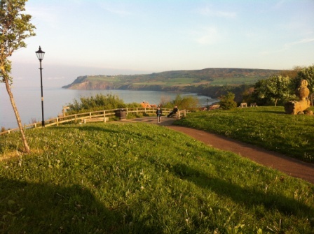
Eventually after another hour or so we finally rounded a bend and spotted Robin Hood’s Bay in the distance.

The cliff path gave way to a road leading past some cliff top houses and soon we were heading down to the harbour. The streets got quainter as we descended. It was bank holiday weekend and the town was absolutely crammed full of tourists.

Finally we were there at the bottom facing the Bay Hotel. We were at the end of the walk. It was 4:30pm.

We headed straight down to the beach and, as the tide was out, we had to walk a long way to start the first of the four finishing rituals; dipping our boots in the North Sea.
After doing that it was time to complete the second ritual and select a pebble to bring home. After a bit of searching I found a small pebble on his own in a rock pool. I was sure he was a genuine North Sea pebble and I exchanged him for one of the pebbles I had brought from Cumbria.

As we were walking back up to the Bay Hotel Helen and Bernard were just arriving and we clapped them onto the sands. We did our next ritual together taking pictures in front of the Bay Hotel.
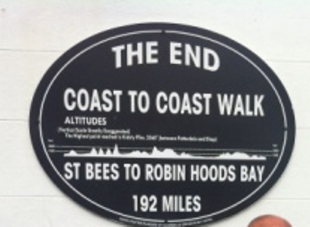
Helen’s parents arrived to pick them both up and we said goodbye. Then we sat there amongst all the tourists drinking their beer and eating their Fish and Chips. Of course no one knew what we had done and even if they had known they wouldn’t have been interested. But we knew and that was enough. Up until a year ago the most that my wife had walked in a day was 6 miles and now she had done 7 continuous days amounting to more than 100 in total.
We had arranged by text that we would wait for Peter and Michael to arrive. They had been in different accommodation villages for the past two nights but we had agreed to celebrate together. They had started back in Glaisdale and so were about an hour behind us.
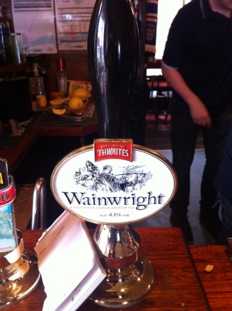
Eventually they came around the corner and we gave them a big round of applause and exchanged handshakes and hugs. We waited whilst they walked out to the beach and then headed inside the Bay Hotel together to complete the last ritual;, enjoying a pint of Wainwrights Ale in Wainwrights bar and signing the C2C book.
Done !.
And then…..
We chatted together with Michael and Peter for a while and then checked into our B&B. (The shittiest one of the whole trek) We headed up to the top of the town to meet up again at the Victoria Hotel for a really enjoyable celebratory dinner of Whitby scampi together.
The next morning we woke up later than usual. By coincidence it was the end of the annual overnight C2C relay race from St Bees and we watched the final runners take their batons across the Bay Hotel finishing line.
After breakfast we dragged our cases back up the hill for the bus to Scarborough. The bus broke down but its replacement finally got us to Scarborough in time for lunch. We enjoyed a pleasant sunny afternoon without too much walking and then caught the train home the next day.
Naturally there was a lot of talk throughout the week about what everyone’s next challenge would be. We got ideas from a lot of the people we met. The Australians had loved the West Highland way in Scotland. The Germans told us about the Ring of Kerry in Ireland. The Belgians recommended Offa’s Dyke as a good option whilst the Dutch told us Hadrian’s Wall would be worth a try.
Of course we still have to finish the eastern part of the North Down’s Way and possibly make an attempt on the South Down’s Way too. For my wife there is also the small matter of the first 82 miles of the C2C.
My own preference is for the Pennine Way.
However, I may have some persuading to do first.
Equipment & Mapping
Equipment
I walked the whole trip in my trusty Vasque hiking boots. I purchased them in the United States a few years ago and I find them extremely comfortable. They have Gore-Tex uppers and are pretty water-proof too.
My basic clothing was light hiking trousers and simple Polyester T shirts (mostly received as free gifts after half marathons). Further layers included my beloved Canadian fleece from Arc’teryx and, for the second section, an excellent lightweight waterproof jacket in Gore-Tex Pro from US manufacturer Black Diamond.
On the First Section I carried a cheap and simple day pack. This was perfectly adequate and I had no problems fitting in food, a litre of water, waterproofs and extra clothing.
On the Second Section I was effectively carrying for two people (My wife carried lunch only) and so I needed a bigger bag. I shopped around and eventually purchased a Mountain Warehouse – Saker 35 L rucksack.
I found it excellent for the job. Contents varied from day to day, but roughly amounted to:
- Water for two
- Emergency Rations
- Waterproofs for two
- Change of clothing (Warm Gloves etc.) for two
- First aid kit
- Whistle
- Light
Weight was generally about – 5kg to 7kg depending on the section.
On the first 5 days of the hilly first section I walked with poles and found them very useful (but certainly not essential) particularly on the downhill stretches.
On the second section I dispensed with the poles completely.
Mapping
With the exception of the lengthy descent from Nine Standards Rigg (which crosses open access land) the route is entirely on footpaths.
Outside of the Lake District many of the footpaths are signposted as “Coast to Coast”, but it is important to remember that the C2C is not an official trail and, unlike the National Trails, the signposting can be quite hit and miss.
Good maps and map reading skills are therefore essential.
On the first section we were expertly guided by one of our walking companions who mainly used the original Alf Wainwright guide book. Harvey’s maps were also carried.
For the trip on from Kirkby Stephen I navigated myself. I decided to use Martin Wainwright’s “The Coast to Coast Walk” guidebook. The book is published by Aurum Press and in 2016 was priced at £14.99. The book is part of a series that include the official guides to the 15 National Trails (Including the North Downs Way and the Pennine Way) as well as several others for “unofficial” trails (like the West Highland Way and the Coast to Coast itself).
The author’s name is a coincidence as Martin Wainwright is absolutely no relation to Alfred. For me the great attraction of the Arum guides is that they use the familiar and excellent Ordnance Survey mapping. The mapping in the guides is taken from the “Orange” Explorer series of maps at 1 to 25,000 scale.
I also purchased some of the actual OS Explorer maps as well just to gain a better understanding of the surrounding areas and for future use.
I also carried a compass. Map and compass skills are a very sensible precaution against sudden poor visibility on the higher sections.
Coast to Coast – Mileage Chart
| Day No. | Date Completed | Route | Miles | Cumulative
Miles |
|
| 1 | May 15th 2015 (Fri) | St. Bees to Ennerdale Bridge | 14 | 14 | |
| 2 | May 16th 2015 (Sat) | Ennerdale Bridge to Rosthwaite | 14 | 28 | |
| 3 | May 17th 2015(Sun) | Rosthwaite to Grasmere | 8 | 36 | |
| 4 | May 18th 2015 (Mon) | Grasmere to Patterdale | 8 | 44 | |
| 5 | May 19th 2015 (Tue) | Patterdale to Shap | 15.5 | 59.5 | |
| 6 | May 20 2015 (Wed) | Shap to Kirkby Stephen | 21 | 80.5 | |
| 7 (1) | May 22nd 2016 (Sun) | Kirkby Stephen to Keld | 14.21 | 94.71 | |
| 8 (2) | May 23rd 2016 (Mon) | Keld to Reeth | 15.20 | 29.41 | 109.91 |
| 9 (3) | May 24th 2016 (Tue) | Reeth to Bolton | 21.10 | 50.51 | 131.01 |
| 10 (4) | May 25th 2016 (Wed) | Bolton to Ingleby Cross | 18.28 | 68.79 | 149.29 |
| 11 (5) | May 26th 2016 (Thu) | Ingleby Cross to Clay Bank Top | 14.46 | 83.25 | 163.75 |
| 12 (6) | May 27th 2016 (Fri) | Clay Bank Top to Grosmont | 23.18 | 106.43 | 186.93 |
| 13 (7) | May 28th 2016 (Sat) | Grosmont to Robin Hoods Bay | 18.81 | 125.24 | 205.74 |
Note – Days 3 and 4 could be comfortably combined to reduce the total number of days to 12. This is Martin Wainwright’s suggestion. Doing this would probably sacrifice the interesting diversion via Helm Crag and it would certainly mean missing a very enjoyable evening in Grasmere.
Wainwright’s other suggestion is to stop at Glaisdale not Grosmont – and this makes the last day 3 miles longer but shortens the day before. In the end, I thought Grosmont was just fine.
