A walk from Northampton to Market Harborough
The Plan
It is a Wednesday morning in early September 2026 and there is just enough time for a coffee at the station. I am about to make a trip from London to the small Leicestershire town of Market Harborough. Trains normally leave from St Pancras every thirty minutes and make the 83 mile journey in just under an hour.

Whenever I look up at the beautiful roof at St Pancras, take in the posh brasserie bar and watch the Eurostar trains humming in and out, I always find it difficult to believe that back in the mid-sixties the station was threatened with demolition.

Today though, I am not actually at St Pancras, I am at Euston. I am here because I am going to use the route that the railway planners of sixty years ago would have had me follow if they had had their way. There is a catch though, although I will have a train to take me the first 65 miles, I am going to have to walk the rest and I am going to need a good torch.

This is the story of the Northampton to Market Harborough, ‘Brampton Valley’, Line and how it almost became part of an electrified trunk route but then ended up as a walking path. I will take the train from Euston to Northampton, walk along that path, negotiating its two long dark tunnels in the process, have a look around Market Harborough itself and then return directly to St Pancras.

Click here – For more on the story of how the railway network grew north from Euston and then south to St Pancras, and how the history of the two great termini became intertwined.
London Euston
I am looking down from the mezzanine outside my favourite breakfast place, the Signal Box pub. As I survey the great concourse, I check to make sure no one is about and then whisper to myself, “I actually like this station”. I wouldn’t want to shout that too loud though because Euston (1968) is consistently at the bottom of all the passenger satisfaction surveys and was as recently as 2024 described in the Independent newspaper as “hell on earth”.

The ‘new great hall’ that I am looking at was mainly the work of British Railways’ architect, Ray Moorcroft. It is the biggest of several station reconstructions he was involved in during the 1960s electrification of the West Coast Main Line. Brutalist and modernist it may be, but back in the day Euston seemed to represent the very future of railways.

It seems dated now, the white concrete has faded to beige, but some light still streams in at the top of the building making it seem quite airy. The deep green faux marble tiles on the floor and the black granite on the central columns still lend a touch of elegance. We shouldn’t forget the ‘very 1960s’ egg box ceiling in the ticket office either.

Euston’s real problem is actually a sign of its success. It was designed for a maximum throughput of 20 million passengers a year. Last year the number of people using the station was almost 40 million. Once spacious, the concourse now feels congested and the addition of the mezzanine to create more space has reduced the amount of natural light and made It feel more cramped.

The overcrowding is often confounded by the late calling of the platforms of train departures, giving rise to the infamous ‘Euston rush’ as people frantically try to find their trains with just minutes to spare. The train operators have been trying hard recently to assuage the problem after strong criticism from the Secretary of State for Transport.

So, it is impossible to imagine how this station would be coping now if a plan, considered for a brief time in the 1960s, to close St Pancras and transfer all its long distance services to Euston and route them via Northampton and Market Harborough had been enacted. It seems that the shelving of the project led to a lucky escape not just for St Pancras but for Euston also.
Euston to Northampton by Train (65 Miles)
My train today, already available to board with more than 15 minutes still to go, is the 09:56 to Birmingham New Street via Northampton. It is formed of a pair of 4-car Class 350 EMU sets in London Northwestern Railway (LNR) dark green livery. LNR is part of a train operating company that has been state owned since February.

The Class 350s are now more than 20 years old and they are now being replaced on this route by brand new Class 730/2 trains. The old trains are quite comfortable though. My service is lightly loaded and I find a bay of seats with a table all to myself.

As we edge out of Euston, we pass the big blue fence behind which the construction work for HS2 is still continuing. Nobody knows when it will be completed, but ironically the, now cancelled, original plans for the high speed line featured trains from Euston to Nottingham and Sheffield, effectively replacing the long distance services from St. Pancras. 
We leave the London suburbs behind, passing through Watford Tunnel and into rural Hertfordshire. We are on the fast line here and we speed up to 110 mph. I have done this journey many times and I always enjoy it. This is the original London to Birmingham Railway. It was opened back in 1838 but has been renewed several times since. The original double track railway avoided Northampton bypassing it on a line that included a long tunnel at Kilsby.

The railway as far as Rugby was quadrupled in the 1880s with the extra pair of slow lines diverting off to serve Northampton. 100mph electric services began operating along this line to Liverpool and Manchester almost exactly sixty years ago on 18 April 1966. That modernisation project was one of British Railways’ finest achievements; it launched the InterCity brand and greatly increased passenger numbers.

The West Coast Route Modernisation of 2002, controversially costing almost £15 billion, further upgraded the line and enabled the introduction of tilting 125mph Pendolino trains operated first by Virgin and now by Avanti.
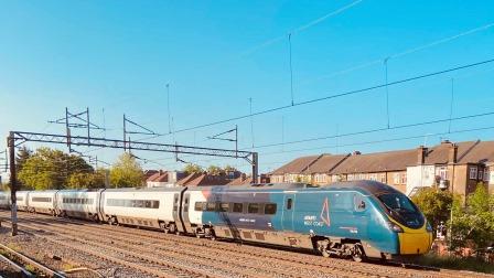
After more than twenty minutes speeding along the fast line we cross over on to the slow. We make our first stop at Leighton Buzzard at 10:25 and that is quickly followed by Bletchley, Milton Keynes Central and Wolverton. Pendolino trains flash past in both directions on the fast lines. Avanti has around nine or ten paths each hour off peak, all of these run via Kilsby along with a single hourly LNR service to Crewe that also avoids Northampton.

We leave Wolverton at the scheduled time of 10:42 and then a few minutes later pass through Roade. Here all four tracks head into a cutting and the pair of slow lines gradually drop down below the level of the fast lines. The Northampton-bound slow lines then peel off to the right, cross over the M1, pass through a short tunnel and arrive in the town itself. We are at the platform at 10:56, bang on time.

The History of Railways around Northampton
Northampton (Population: 238,654) is one of England’s largest towns. It is situated on the River Nene and famous for its shoe and leather industries. The first railway into Northampton (A on the map below) left the London & Birmingham Railway’s main line at Blisworth. It passed through a station at Bridge Street (1) in Northampton on the way to Peterborough. The 47 mile line opened in 1845 and was eventually absorbed into the London & Birmingham’s successor company, the London and North Western Railway (LNWR).
The next line was the Brampton Valley (B) itself. Constructed by the 1850s by the LNWR to tap into the ironstone deposits locally. It headed north from Bridge Street and involved the construction of Northampton’s second station, Castle (2).

The third line was a branch line from Bedford (C) added by the rival Midland Railway in 1870. It crossed the original Blisworth to Peterborough line to terminate at another station at St Johns (3). The final line (D) is the only one remaining today. The Northampton loop, completed in 1882, left the main line at Roade and was part of the quadrupling of the London to Birmingham Railway from Euston to Rugby.
All the lines eventually came into the ownership of the London Midland and Scottish Railway (LMS) in 1923 and subsequently British Railways in 1948. The line from Blisworth closed in 1960 and the section on towards Peterborough in 1964. The branch to Bedford also closed in 1964 although services to St Johns had already ceased in 1939. The line to Market Harborough first closed to passengers in 1960 but lingered on until 1981.
Northampton Castle Station was originally opened as the first stop on the line from Bridge Street to Market Harborough in 1859. Its original modest buildings gave way to an enlarged station complex when the Northampton Loop opened in the 1880s. The enlarged station used land released by the demolition of the medieval castle.

The station was rebuilt again in the 1960s and, as at Euston, Ray Moorcroft was the architect. The 1965–66 station building had plenty of critics, it was sometimes referred to as three barns joined together. It may have been more functional than its Victorian predecessor but it certainly didn’t last as long. It was replaced after just 50 years.

Northampton
My train arrives at platform 3. There are three through platforms, number 3 is primarily used for northbound services whilst services arriving from the north and heading to London use platform 1. Almost all freight heading up and down the West Coast Main Line is routed via Northampton and often uses the down fast (platform 2) and the extra middle road. There are also two south-facing bay platforms.

I go over the footbridge and into the station building. Just before the barrier is a display on the wall which features tickets from all over the country to Northampton. They have also marked out the names of the stations they need to complete the collection. It is quite a clever idea.

I come through the ticket barrier and then realise I should have checked if Market Harborough was listed. The route by train today would take me back to Bletchley, across to Bedford and then finally north again with a change at Kettering. It would take two hours and thirty minutes and cost around £30. A walk of 16 miles almost seems easier.

The station building here is very new. The impressive modern glass‑and‑steel structure dates from 2015. The whole layout feels spacious and functional. It seems like a nice place to wait. There is a WH Smith and a coffee shop. Northampton recorded 2.84 million passengers in 2024/2025.

Yet the town is poorly provided for as far as rail connections go. The half hourly LNR trains make at least four stops to Euston and take an hour for the 65 miles. There are a few extra services which run each way in the rush hour making fewer stops but they only save around five minutes. It would be possible for a Pendolino to reach here in just over 40 minutes. If Northampton had become a stop on the way to Leicester and Sheffield, it might have got a far better rail service.

Northampton to Market Harborough (Walk 16 miles)
I head out of the station and go over to the bus stand. In order to walk along the old line to Market Harborough, I first need to make my way north to the point where it diverged from the current Northampton Loop Line. To save some time I am taking the number 8 bus out to Mill Lane where the walking and cycle path, known as the Brampton Valley Way, that follows the old track bed begins.

The bus, a Stagecoach double decker, turns up after a few minutes and the ride through the suburbs of Northampton takes about a quarter of an hour. I walk from the bus stop along Mill Lane following numerous signs for Brampton Valley Way / Cycle Route 6. I pass a huge new housing estate under construction and then, after a short walk, I am facing the Northampton Loop Line. I go under the bridge and emerge on the other side.

Here, peeking through a fence, I look back towards Northampton and can clearly see the space where the junction used to be. Turning around, with the modern railway behind the fence on my left, the route of the old line, closed in 1981, stretches out in front of me. From here to Market Harborough is approximately 16 miles. It is now 11:45am and I want to try and get to my destination by 5:45pm at the latest.

The Brampton Valley Way stays parallel with the modern railway as it crosses the River Nene on a bridge. The old line I am walking on towards Market Harborough was actually the first railway here and it is going straight here. As I walk, the loop line heading to Rugby, added later in the 1880s, begins to slowly peel off to the left and eventually disappears.

In 1966 British Railways announced it was considering a plan to close St Pancras and transfer express trains heading to Leicester, Nottingham, Derby and Sheffield to Euston. They would have followed the route that I am now taking from Northampton to Market Harborough. The idea was paused in November 1967 when St Pancras was listed, and dropped officially in 1968.

As I walk along I meet a few cyclists and dog walkers. I am conscious that I am skirting the edge of a housing estate here, For much of the rest of the day my route will take me through the Northamptonshire countryside well away from any significant settlements.

After I have been walking for a mile or so, I pass an old railway three mile marker. This is the distance measured from Northampton Station. The old concrete railway post has a modern Cycle Route 6 sign attached to it. Route 6 stretches from London to the Lake District and it uses this old line for all of its length.

A little further on, the old line is temporarily intersected by a large new roundabout at Brampton Lane (1.4 miles) and then on the other side the path emerges next to the entrance to a railway station.

This is the heritage Northampton and Lamport railway (NLR) which runs from here for a distance of one and a half miles along the old formation. Sadly, it is not in operation today, generally it only operates on Sundays.

I am impressed. The NLR started as a movement in 1984 just three years after the line closed but it wasn’t until 1996 until they opened the first stretch of line. This station, Broughton, is part of a more recent southern extension.

Broughton itself is a new creation and was not a stop on the original Line. When it closed in 1981 the line was double track and as I walk north, I see that the Brampton Valley Way is now occupying the down (away from London) line whilst the heritage operation is, on the other side of a security fence, using the old up line.

A few minutes later I come to Pitsford Sidings. Here there is an excellent display board erected by the NLR about the ironstone quarry that was once located close by. The discovery of ironstone in Northamptonshire was the main reason behind the proposal to build the Brampton Valley Line in the 1850s.

The sign also explains that the signal box that now stands at Pitsford sidings was originally at Wolverton. The NLR have an impressive total of six signal boxes, with one at Boughton, two at Pitsford & Brampton station and two in store awaiting future use on a proposed northern extension.

A little further on, the Brampton Valley Way crosses the railway track and then continues to follow it on the up side. The line was engineered by a nephew of George Stephenson, who also shared his name. It was officially opened on 16 February 1859. For the first twenty years or so it remained single tracked.

I come to the first overbridge I have encountered since I started walking. It is said that some of the bridges on this line were modified in the 1960s in order to provide extra clearance. Whether this was done specifically in anticipation of the electrification of the line for its proposed new role as a main trunk route is less clear.

To the railway planners of the 1960s, electrifying the 30 or so miles from Northampton to Leicester would have made a lot of sense. Not only would the cost of maintaining St Pancras have been saved, but the East Midlands could also have been connected to London by electric train at a fraction of the cost of wiring the Midland Main Line via Bedford. 
I walk on to reach Pitsford & Brampton (1859-1950), the first original station out of Northampton. It opened at the same time as the line. It was never very busy, save for sugar beet traffic. In common with all the other intermediate stations, it closed a long time before the line itself. Apart from the sugar beet terminal, the buildings were raised.

Today, the NLR is using portable buildings for its reconstructed station. There is a single platform on the main running line and two north-facing bay platforms. The two signal boxes here have been transplanted from elsewhere, one from Lamport and one from Little Bowden Crossing near Market Harborough.

On the Brampton Valley Way there are a couple of benches opposite the station. It is now 12:30 and having covered 2.4 miles so far, I decide to have a brief rest. As I sit for a few moments I can’t see anyone about at the heritage railway, it all seems quite deserted today.

The NLR has an interesting fleet of steam and diesel locomotives as well as a number of passenger coaches including a driver trailer vehicle and several wagons. Some of this wonderful stuff is visible to the curious walker.


As I continue, I reach the point where a metal structure placed across the track marks the end of the NLR’s current operations (3.04 miles). The track continues on for a while, part of an initial effort to extend northwards. At the point where the rails finally stop is a sign explaining the challenges of building the proposed 1.5 mile extension to Stratton. 2,112 sleepers will be needed for each mile to be laid.

The Brampton Valley Way criss crosses several rivers on several small viaducts throughout its journey north. Around here most of them are tributaries of the Nene, the watercourse flows through Northampton to Peterborough before draining into the North Sea near the Wash.

I now come to the first objective that the heritage line wants to reach, the site of the second original station (4.9 miles) which opened a few years after the line. Nothing remains now at the site of Spratton (1863-1949) but the NLR have the old signal box which stood at the level crossing here in store.

Another twenty minutes brings me to Brixworth (1859-1960). Like all the intermediate stations, it saw about four or five trains a day throughout its history. Close to here were some more ironstone quarries. There is nothing left here either.

It is now 1:20pm and I have covered 5.7 miles. I decide this is as good a place as any to pause for lunch. It has stayed dry so far, but the forecast is indicating rain, so I want to press on as soon as I can. I take a ten minute break to eat my sandwiches.

Continue to Market Harborough and return to St Pancras


