Walk Two

Finsbury Park to Alexandra Palace (4.4 miles)
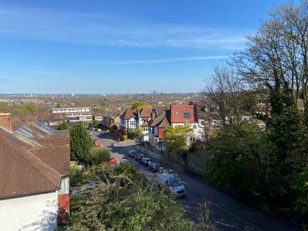
This walk mostly involves following the very popular “Parkland Walk” along the disused railway line that used to link Finsbury Park with Alexandra Palace. It is easy to navigate, and although it involves a bit of a gentle uphill climb, the views across London from Alexandra Palace at the end are worth the effort.
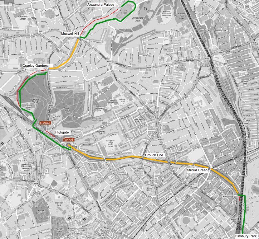
Note – On the map above the route is usually marked in green. Where it follows the old track bed it is marked in orange. Where the old track bed is either indistinct or inaccessible, it is marked in red.
To start, get an Oyster/ Travel Card that includes at least Zones 2-3 and get yourself to Finsbury Park Station.
Finsbury Park (1861) would have had 14 trains an hour heading up from Moorgate and feeding into the new high-level platforms in front of the east side of the main line station. A short distance after leaving Finsbury Park these trains would have crossed over the main line using a pre-existing flyover to access the LNER (former GNR) Edgware line on west side.
The LNER Edgware line was steam operated back in 1935 and the plan was for it to be transferred to London Transport and electrified. Half of the 14 trains on the line would have been heading towards Alexandra Palace and half for Finchley Central.

The GNR had opened its line west from Finsbury Park via Highgate to Edgware in 1867 with additional branches opening in 1872 to High Barnet and (initially, by a separate company) to Alexandra Palace in 1873.
By 1935 trains heading to these three destinations could originate at Kings Cross and by using the Metropolitan “widened lines” via Farringdon also back at Moorgate. They could also use the link with the North London line and start from Broad Street. In the northbound direction these trains often used, now abandoned, platforms on the far left hand side of the station.
The old flyover (long since removed) just north of the station enabled the soutbound LNER trains from the Edgware line to access the slow lines (Platform 1 etc.) on the east side of Finsbury Park.

In the event, the Edgware line was never electrified and the existing LNER steam services continued. They served Alexandra Palace until the line was closed to passengers in 1954. The Edgware line remained open to freight until 1964. It was then used for Northern line stock movements between Highgate depot and (via a complicated route) Drayton Park until 1970. The line was lifted a few years later.
We will now follow the line from the east side of Finsbury Park all the way to Alexandra Palace.
From Station Place, cross Stroud Green Road and enter Finsbury Park itself.
Part of the bridge abutment that would have carried the new tube line is visible to the left as you enter the park.
Keep to the western edge of the park and walk north until you reach a footbridge on the left across the railway.
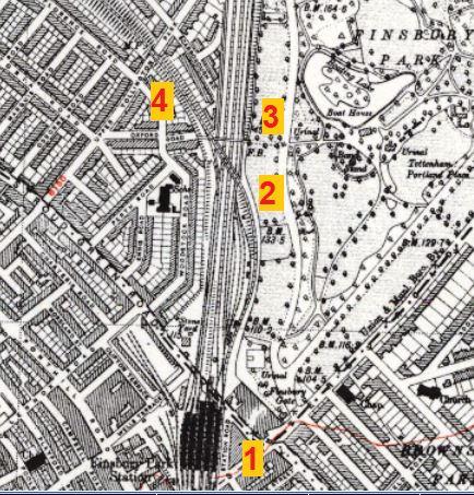
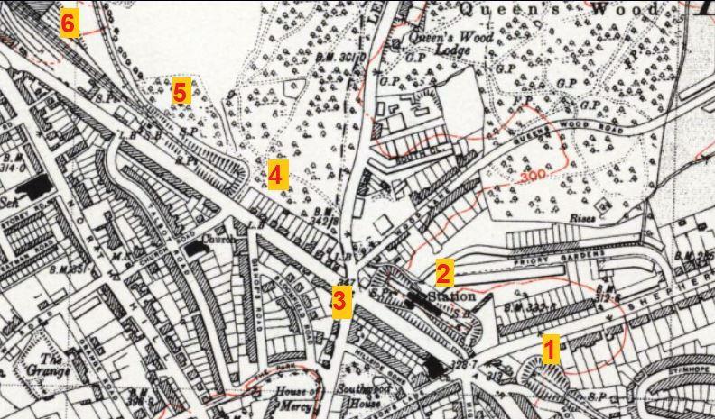
The flyover (2) can be seen on the old 1946 OS map above. The track rises from Finsbury Park station (1) and crosses the main line to where the Edgware line branches off to the left (4). Today’s footbridge can also be seen (3) on the map.

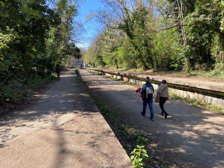
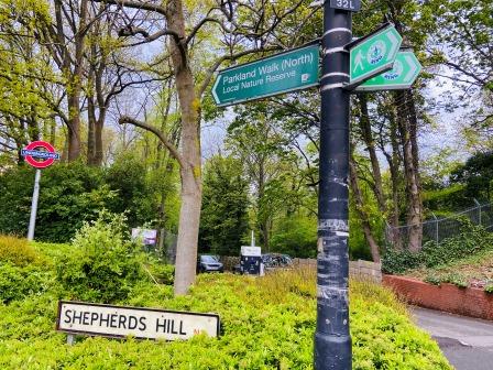
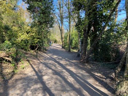
Cross the footbridge and enter Parkland Walk.
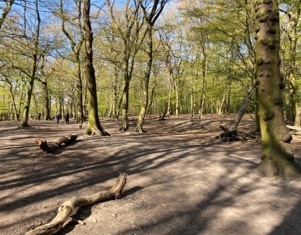
The walk, built on the old railway line, is a 3.1-mile linear pedestrian and cycle route. It was declared a local nature reserve in 1990 and is London’s longest. It is home to more than 300 species of wildflowers, 60 species of bird, 22 species of butterfly. There are and also hedgehogs, foxes, and a bat roost.
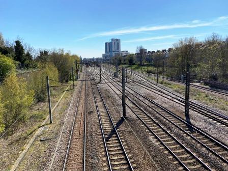
As you walk along, it soon rises on an embankment overlooking the back gardens of the Victorian houses.
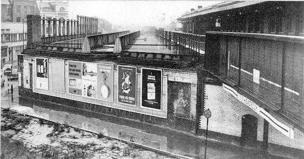
After a short while the path crosses Stapleton Hall Road, Stroud Green station was just after this bridge (0.8 miles).
Had the electrification work not been cancelled in 1940, Stroud Green (1881-1954) would have enjoyed a service of 14 trains an hour coming down from Moorgate. Half of them would have been heading to Alexandra Palace; the other half on towards Finchley Central, extending to High Barnet.
There is a wealth of information about the station’s history on the excellent website “Disused Stations” and I have included a link here. I have also added similar links to all the disused stations on the walks.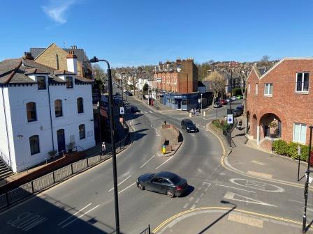
After almost 70 years, there is nothing left of the station itself but the stationmaster’s house (the white building in the photograph above) is now a community centre. Crouch Hill station on the London Overground is relatively close, although it does not provide the same level as service as the Northern line here would have done.
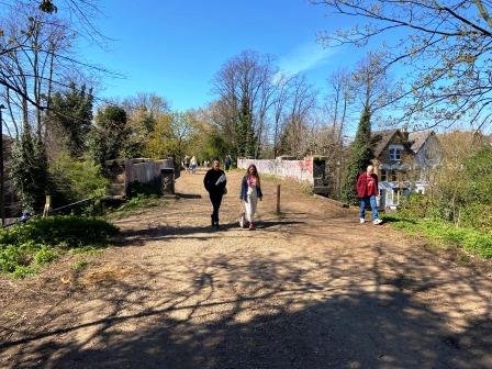
Keep walking along Parkland Walk as the embankment gives way to a cutting and the route continues beneath overbridges.
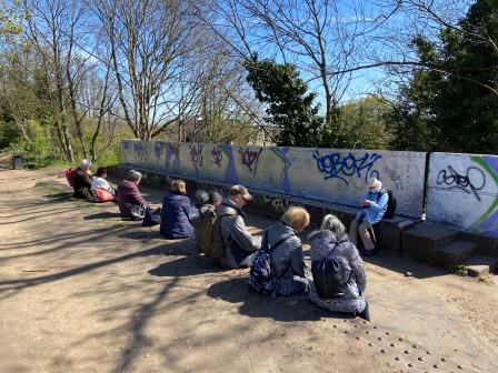
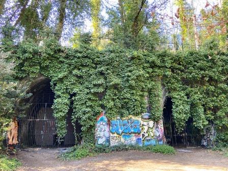
On the approach to Crouch End, there are massive retaining walls that have been covered with colourful graffiti. The platforms at Crouch End station soon come into view (1.4 miles).

Crouch End (1867-1954 / link to Disused Stations), like Stroud Green, would have have enjoyed a service of 14 trains an hour.
Back in 1940 work had been started here and the platforms had been modified in concrete to a “compromise height” between the door level of the new tubes and the existing LNER trains. Those platforms are almost fully preserved but only small parts of the station building remain today.
Crouch End was certainly one of the biggest losers from the abandonment of the Northern Heights plan. When the steam services were withdrawn in 1954, residents were then left to rely on road transportation. There is still disquiet today and there even some voices calling for the Parkland Walk to be abandoned and turned back into a railway link.
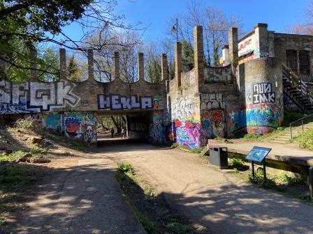
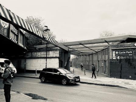
Continue along Parkland Walk until it ends just before the tunnels that lead into Highgate Station. It is possible to go right up to the mouths of the tunnels, but they are blocked off. The route is forced to bypass the station site for safety reasons.
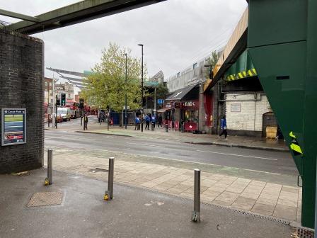
Exit the Parkland Walk onto Holmesdale Road and turn right into Archway Road. The entrance to Highgate Station is on the right (2.5 miles). Back in 1867 the GNR station was constructed in a deep cutting between two tunnels. It is barely visible today from Archway Road through the trees.
If the whole plan to electrify the link through here from Finsbury Park to East Finchley and Alexandra Palace had been completed, Highgate GNR (1867-1954 / Link to Disused Stations) would have enjoyed a service of 14 tube trains an hour from Moorgate. There would also have been interchange connection with new deep level tube platforms that were constructed underneath the existing station and completed in 1941.
In preparation for the Northern Heights project some new buildings were added to the surface platforms and a new concourse was added underneath with an escalator linking down to the new deep-level platforms below.
When the new deep-level platforms opened in 1941 the LNER cut its steam service to East Finchley. BR, its successor, maintained the Alexandra Palace trains only until 1954, but freight services continued through the station until 1964. Tube stock movements (hauled by battery locomotives) from Highgate depot to Drayton Park depot lasted until 1970.
Although the track was lifted in 1972, the abandoned platforms and station buildings remain. They are not accessible (although TfL do conduct tours occasionally) but they can be glimpsed from the Albany Road exit lobby (exit only) of the current station.
Continue along Archway Road passing the Woodman public house on the corner of Muswell Hill Road on the right.
The area can be seen on the old OS map below. The line entered the eastern tunnel (1) and passed through the station (2) before entering the western tunnel (3). The Woodman is the “square” above and to the left of the tunnel portal.
Just after the line exited the west tunnel (4) was Park Junction (5) where the line to Alexandra Palace curved off in an arc. Under the Northern Heights plan, 7 trains would have turned off here; 7 would have continued towards the next station: East Finchley.
Just after Park Junction on the main line was a shed (6) on the site of which the current Highgate tube depot was built.
Opposite the junction with Church Road, turn off Archway Road (the entrance can be seen near 4 on the map above) and enter Highgate Wood. At this point the line is visible (just) on the left as it emerges from the western tunnel and heads towards East Finchley. Track in connection with the Northern line depot at Highgate has been laid up to the tunnel portals here.
Walk through Highgate Wood, passing the Pavilion Café, and follow the path on the far western edge of the park. The formation of the old railway defines the curve of the park here, but the track bed is overgrown and inaccessible outside the fence.

Follow the path around to the exit of the park and emerge left onto Muswell Hill Road. Cranley Gardens Station was just to the left of this point (3.2 miles).
Cranley Gardens (1902-1954 / Link to Disused Stations) would have had a service of 7 trains an hour from Moorgate heading towards Alexandra Palace.
Nothing remains of the station: the site is now occupied by a school and housing.
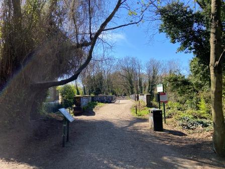
A further shorter section of the Parkland Walk begins just beyond Cranley Gardens. Turn right from Muswell Hill Road onto the Parkland Walk (North).
The walk now follows the old formation of the Alexandra Palace branch.
After a while, the path crosses the seventeen-arch Muswell Hill viaduct which offers magnificent views of central London.
The track bed route ends with a reconstructed overbridge under Muswell Hill. It is worth a short diversion here to the centre of Muswell Hill with its elegant Edwardian retail parade.

Muswell Hill (1873-1954 / Link to Disused Stations), like Cranley Gardens, would have had a service of 7 trains an hour from Moorgate heading towards Alexandra Palace.

The station was closed to passengers in 1954 although goods services remained until 1956. The track was removed shortly afterwards and now nothing remains. Muswell Hill Primary School has been built on the site.
Muswell Hill is a significant centre today with a growing population but has no easy connection to the tube network. Along with Crouch End, it is probably the biggest loser from the cancellation of the Northern Heights plan.
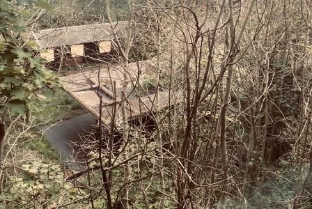
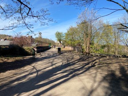
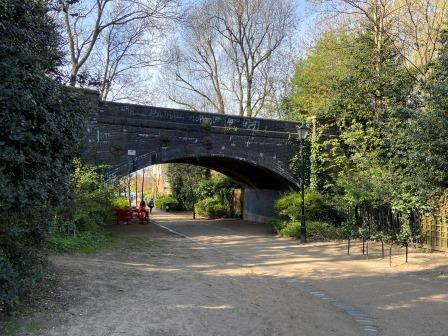
The pedestrian route by-passes the school and leads into Alexandra Palace Park. Further remains of the track bed can be seen in Alexandra Park, including the elegant underbridge in the photograph below.
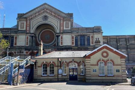
As you approach the main Alexandra Palace building, the direct way to the station is blocked by buildings and a security barrier. It is necessary to walk around the front of the main Alexandra Palace building and then loop around it to reach the old station (4.5 miles).
Alexandra Palace (1873-1954 / Link to Disused Stations ) would have had a service of 7 tube trains an hour terminating from Moorgate.
The station was located adjacent to the Palace buildings on the north side. It had a bit of a chequered history, having to close due to the fire at the Palace just two weeks after it opened. There were also several periods of closure subsequently.

There is nothing left of the tracks or the platform and where they once stood is now a car park. The station building has been retained though and it is now used as a community centre.
Alexandra Palace itself was also opened in 1873 and was intended as a counterpart to Crystal Palace in South London. It was destroyed by fire within two weeks of opening but quickly rebuilt and reopened in 1875. It contained a concert hall, art galleries, a museum, lecture hall, library, banqueting room, and large theatre.

In 1900, when the owners were threatening to redevelop, it was passed to a charitable trust which was eventually transferred to Haringey council. It is now Grade II listed
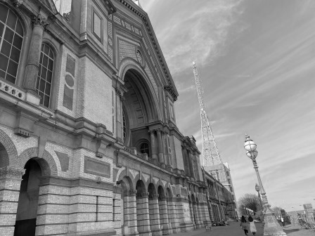
The Great Hall and West Hall are still used for exhibitions, music concerts, and conferences. There is also a pub, ice rink, palm court, and a panoramic view of central London. In November, every year a large fireworks display is scheduled as part of London’s Bonfire Night.

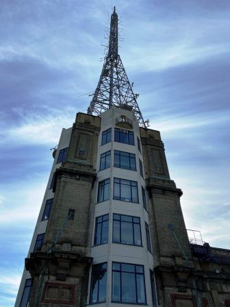
The BBC at Alexandra Palace in 1936
The BBC leased the eastern wing of the palace in 1935 for use as a transmission and production centre for their forthcoming BBC Television service.
At the time it was considered necessary to have the transmitting antenna and the studios in one place. A tall transmitting mast was erected on top of the eastern tower; two studios, stores, make-up areas, dressing rooms and offices were created in the building below.
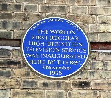
Test transmissions and special broadcasts (including one live from Alexandra Palace to a Radio exhibition at Olympia) began in August 1936. The full service was officially launched on 2 November 1936. It broadcast for two or three hours each day thereafter and thus became the world’s first regular high-definition television service.
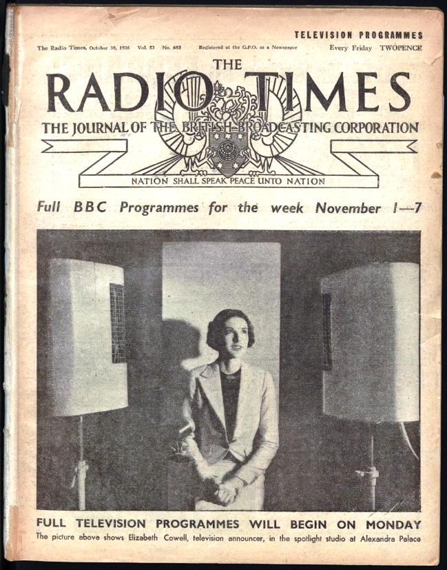
After a short period of using two rival systems, the 405-line Marconi-EMI system was chosen and became the standard. The station’s viewing audience was initially limited to the London area by the range of the transmitter but by 1939 it was being received in over 25,000 households.
The whole story is fascinating. A brief film about the first TV programme and a slightly dated BBC drama about the start of the service are currently available (2021) on YouTube.
BBC TV was suspended just before the start of World War 2 but the channel resumed in June 1946 and continues to this day as BBC One.
Alexandra Palace continued in use by the BBC for many years after 1946; the antenna mast is still used for commercial radio and DAB broadcasts.
There are some interesting explanation boards on the outside of the palace building; hopefully plans to create a museum on the site will eventually be realised.
To return to Finsbury Park catch a W3 bus from opposite the main Palace building.
Alternatively, walk all the way down through the park to Alexandra Palace (former Wood Green) station on the main line and catch a Great Northern train heading for either Finsbury Park or Moorgate.
Links
More information on the Northern Heights
Walk 1 – Moorgate to Finsbury Park (3.6 miles)
Walk 3 – Archway to High Barnet (8.3 miles)
Walk 4 – Finchley Central to Edgware (4.5 miles)
Walk 5 – Edgware to Elstree & Borehamwood (6.6 miles)
