Walk 5
Edgware to Elstree & Borehamwood via Bushey Heath (6.6 miles)
The final walk follows the path of the extension that was never built. Although all three of the proposed station sites can be viewed, there is nothing much to see. It is also impossible to walk along the route that the railway would have followed. Nevertheless, as you head out through the open countryside beyond Brockley Hill, you start to get a sense of what could have been lost had the project gone ahead. A visit to Borehamwood also provides an interesting finale.

Note – On the map above the route is usually marked in green. Where the old track bed is either indistinct or inaccessible, it is marked in red.
To start, get an Oyster / Travel Card that includes at least Zones 5-6 and get yourself to Edgware.
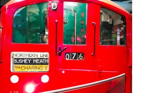
Edgware (1924) would have been transformed if the Northern Heights plan had been implemented. In addition to existing trains on the line via Golders Green, there would have been an additional 7 services an hour arriving from Finchley Central via the new chord with the LNER line. These 7 trains would have then continued north along the new extension to Bushey Heath. The station would have been enlarged to cope and, under one proposal, rebuilt with a new frontage.

The tube had reached Edgware back in 1924 when the Underground Electric Railways Company (UERL) had extended their Hampstead line from Golders Green. Although the original 1867 GNR (by then LNER) station had already been open for over 60 years, Edgware was still essentially a village surrounded by open fields. Within a decade of the new electric railway opening, the area was covered with new housing.
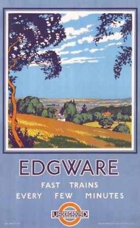
The UERL promoted housing development around Edgware and produced posters encouraging people to move to the area, enjoy the lovely countryside and, of course, use the tube to get into London. This approach was slightly dishonest perhaps because they were already planning to extend their line into that same lovely countryside, and they were hoping that it would stimulate yet more housing development.
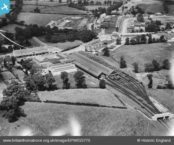
Provision had already been made in the design of Edgware station for an extension north (it can be clearly seen in the 1926 aerial photograph). The UERL had inherited a plan from the now defunct Watford and Edgware railway for an extension towards Bushey and Watford and were planning to act on it.
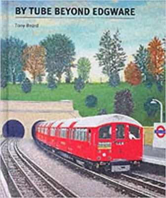
In the event, nothing came of the extension plans before the UERL was absorbed into the London Passenger Transport Board (LPTB) in 1933. The history is a bit complicated, but it is all very well explained in Tony Beard’s excellent book By Tube beyond Edgware (Capital Transport). The book is an essential read if you are interested in the extension project.
The 1935-40 LPTB Northern Heights project revived the idea of the Bushey extension, and added another reason for completing it: the need to find space for a new train depot. The addition of the various LNER lines to the tube system would increase the number of trains needed to service the network. The requirement to find somewhere to store them became a big factor in the renewed project to push into the green fields beyond Edgware.
The plan to build an extension of just over two miles was finally agreed and went before Parliament in 1937. There would be three stations at Brockley Hill, Elstree South, and Bushey Heath (as they all eventually became known as). The new depot would be built at Aldenham between the final two stations. Work on the line commenced in 1939 but, with a few exceptions, little more than the clearance of shrubs and trees had been completed by the time war was declared.
Meanwhile at Edgware, work began to modify the station for the new services. With trains from Edgware via Golders Green almost at capacity, it was decided from the outset that (in normal service) no trains from the Golders Green line would run through to the new extension.
Instead, the new stations would be served only by trains coming from Finchley Central via the new chord being built from the LNER line. This would have meant a time penalty of over 5 minutes for passengers going from the new Bushey Heath terminus to the West End, but it was thought necessary to pacify commuters on the overcrowded Golders Green line.
The layout of Edgware station was to be altered to cope with the new plan. The exisiting terminating platforms (having been linked to the new LNER chord) would become through platforms and continue north to the new line. New terminating platforms with cross-platform interchange for the Golders Green services would be constructed to the west.
By the time work was postponed in late 1939, a fair amount of progress had been made at Edgware. Evidence of this can still be seen today. The photograph above shows the north end of platforms 2/3 as the tracks seem to burrow under Station Road on their way north. Although, as the photograph below shows, they didn’t quite make it under the road and they soon terminate in a stub tunnel.

After the war, the whole project including the extension, the LNER chord, and the Edgware remodelling was abandoned in stages with the final cancellation announced in 1954.
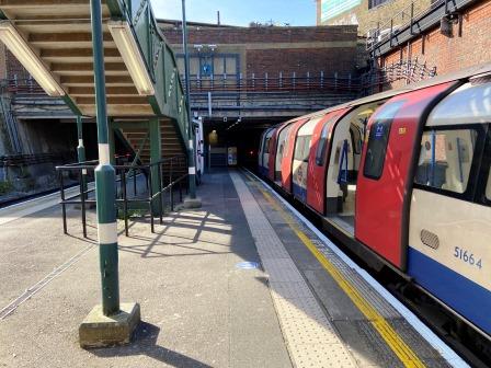
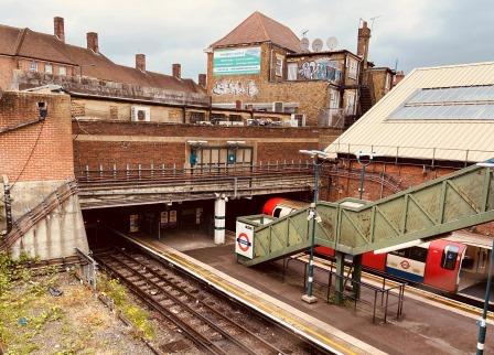
The tube still terminates at Edgware today, as it has done now for almost 100 years.
We will now follow the abandoned extension all the way to its planned terminus at Bushey Heath.
Exit the station and turn left onto Station Road, cross the road, and turn right into Rectory Lane and soon right again (also Rectory Lane) walk parallel to Station Road until you reach a little opening in the road.
This is the spot where trains heading north would have emerged after leaving Edgware. When the buildings on Station Road were being constructed here in the late 1920s, a concrete raft was used underneath them to make the job of subsequent burrowing easier. The tracks would have been in a cutting here.
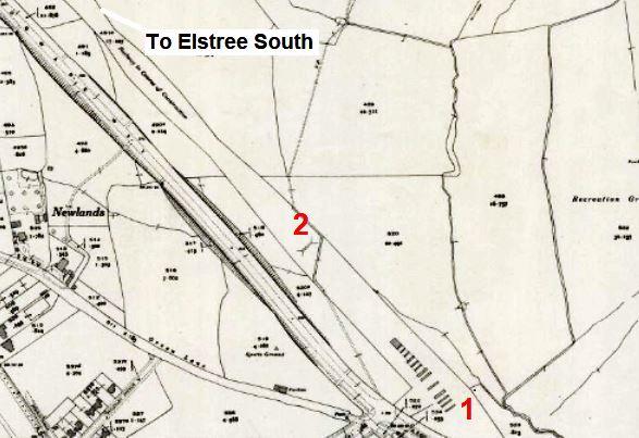
It is easy to see the intended route between Edgware Station (1) and the next planned station at Brockley Hill (5) on the 1947 OS map below.
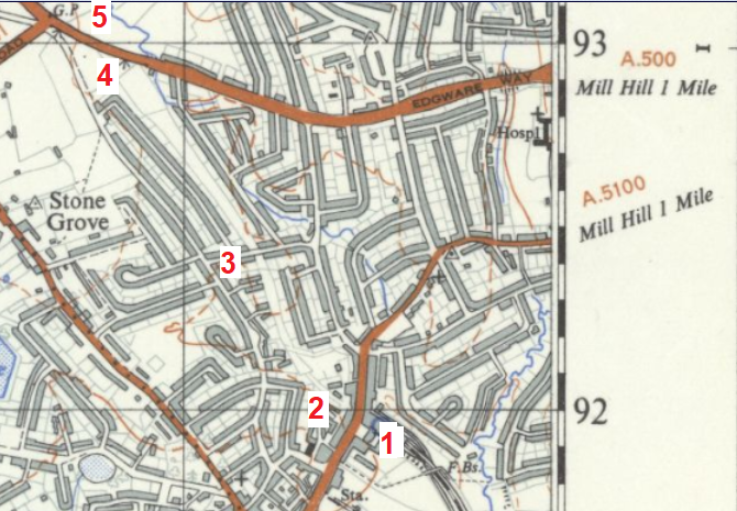
The formation has now been built over all the way to Brockley Hill by a series of roads and buildings. The first such edifice can be seen in the photograph below looking north from Rectory Road (2).
Continue heading east on Rectory Lane until it curves back to Station Road. Take the next left turning off Station Road and head up Edgwarebury Lane.
Take the 3rd left into Purcells Avenue. The eventual route onwards will be the first right turn up Glendale Avenue, but for a moment continue along Purcells Avenue (3) until you see Campbell Croft on the left and Shelley Close on the right.
These two roads and a third, Sterling Avenue (4), further north were added after the extension was cancelled in 1954 and are occupying the formation itself.

If you look closely at the houses on either side of Purcells Avenue at this point you can see that two are of a more modern design than the others either side.
Had the line been completed, these houses would never have existed, the road itself would have been severed here and the tube trains would have passed at grade under a footbridge.
Similarly, a short walk along Shelley Close reveals that it is a road with post-war houses on just one side; an arrangement that just fitted into the space where the trains were supposed to run.
Return to Glendale Avenue and follow it all the way to the end. Behind this street (to the left) the line would have risen from grade level towards arches that would lift it towards the bridge that would take it across Edgware Way. Construction of these arches was started in 1939 but all evidence of them was removed in the late 1950s.
Turn left into Edgware Way (A41). Walk under the footbridge and continue towards the roundabout. The new line would have crossed this road diagonally. (4 to 5 on the map above). In the view below (taken from the footbridge) the railway bridge would have been around the point where the second pair of streetlights are. Some evidence of the abutments remains here.
Continue along Edgware Way to the roundabout. Walk clockwise around it on the southern side and emerge onto the footpath on the left side of the Watford Bypass (A41).
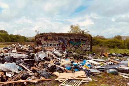
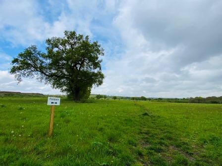
Almost immediately after leaving the roundabout cross the road to the right-hand side. Enter the Edgware Way Grassland. The sight ahead is very depressing: the remains of two structures built from brick surrounded by a pile of dumped rubbish.
This is, in fact, the only thing that remains of the planned Brockley Hill station (1 mile).
Brockley Hill (planned to open 1941 / cancelled 1954) would have been the first station on the extension. An image of how it could have looked appears in Tony Beard’s excellent book. In common with the other two stations planned further north it was to have been another Art Deco / Streamline Moderne design in the style of East Finchley, South Harrow, Turnpike Lane and all the others.

The line, having just crossed Edgware Way, would have been elevated at this point; some work on the arches needed to carry it was done during the short period of construction in 1939. The two crumbling structures, covered in graffiti and surrounded by rubbish, are all that is left today.
More arches were actually completed and already appeared (1) on the 1941/42 revision of an OS map published in 1947 below. The map still describes the formation as “a railway in the course of construction”.
The green belt legislation introduced in 1947 meant that London “finished” here and beyond is, even today, mostly open countryside. The new law prohibited further housing development and effectively removed the main reason for building the last two stations on the extension.
Nevertheless, as the area between Edgware and Brockley Hill was already built up by 1945, a station here might still have made sense; it is interesting to note that the decision to cancel this one took a little longer than the others.

The line was planned to be parallel with the A41 as it went north. It would then have disappeared into a tunnel (just off the map above) under Brockley Hill. The tunnel workings were begun in 1939 but abandoned and then completely buried after the war. The formation is not really discernible north of the arches, it is seriously overgrown and on private land.
Although it would be quicker to walk almost directly along the A41 to the next station, to avoid walking alongside a busy road and to enjoy some of the green belt, the route now makes a long scenic diversion.
Return to the gate to pick up a footpath that heads diagonally away from the arches. The footpath would have gone under the new railway in a subway (2 on the map above) and it still has a bit of a kink in it because of the diversion today.

Follow the footpath (there are some helpful white signs here) across fields towards Edgwarebury Lane. The passage from London to the green belt is very apparent here and it soon feels very different to walking around Edgware’s housing estates.

After the footpath meets Edgwarebury Lane, continue until the bridge over the M1. Looking north from here the traffic on the A41 is just visible in the distance. The new railway would have been just in front of that road, and it is roughly represented by the yellow line in the photograph below. It would have disappeared into the tunnel just to the right of the X.

After crossing the motorway, continue along Edgwarebury Lane until it ends at Barnet Lane (A411). Turn left and follow Barnet Lane into Elstree village.
Turn left onto the High Street (A5183) at the crossroads in the middle of the village. This road is the ancient Watling Street.

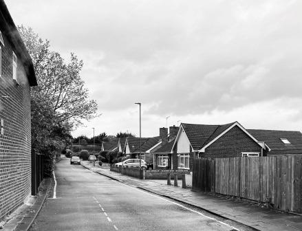
The High Street heads downhill as it leaves the village and soon changes its name to Elstree Hill South. On the right-hand side are small housing estates, built after the war, using previous permissions and some on land previously owned by LPTB.

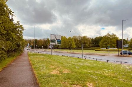
Keep on the left-hand side of the road. Follow the footpath as it makes a little short cut to the left of the large roundabout at the entrance to the Centennial Park. The second station on the extension, Elstree South, would have been visible at this point (3.6 miles).
Elstree South (planned to open 1941 / cancelled 1950) would have been located at the point where northbound trains exited the tunnel under Brockley Hill. The cover of Tony Beard’s book has an attractive image of a northbound 1938 tube train leaving the tunnel and pulling into the station.
Construction of the station never started, and although some work on the tunnels was done, nothing remains visible: it was all buried during the construction of the M1 in the 1960s. It is easy to find the location on a map though and place it just to the left of the current Centennial roundabout and in the field in the photograph below.

The platforms would have started just north of the tunnels and they would have passed under the road. The station entrance building would have been on the road itself, although on which side it would have been on is not quite clear. Indications for the early designs point strongly to the north side, several published maps (including the original version of the one below) have the “station dot” to the left of Watling Street.

The plans were revised a couple of times though and Tony Beard’s book has an image of a later design that clearly shows the station building on the south side. Just for the hell of it, I have amended the 1934 OS map adaptation included above to move the dot. I have also included the tunnel and the walking route (in yellow). For orientation purposes I have marked the A41/A5183 junction with a red circle.
Whichever side of the road the building would have been on, it is certain that it would have been another Art Deco / Modernist design. In a reference to the site of a Roman fort nearby, one of the designs included a statue of a centurion.
Walk across the road to the entrance of Centennial Park. This modern business estate is built on the site where Aldenham tube depot would have been.

Aldenham Depot
In a similar arrangement to Oakwood and Cockfosters on the Piccadilly Line extension of 1933, a large depot was planned between Elstree South and the Bushey Heath terminus. The depot would take the same name as a reservoir just to the north: Aldenham.
Construction of the depot was started in 1939 but soon postponed after the start of war. The buildings were then completed as an aircraft factory and used during the conflict to make Halifax bombers. When the extension was cancelled in the early 50s, London Transport converted it to the vast Aldenham bus works.
The old bus works can also be seen in the aerial photograph (part of the excellent “Britain from above” series) below. The photograph was taken in the mid-1950s and is looking north. The A41/A5183 junction is again marked with a red circle here. Although the project had already been abandoned by the time of the photograph, the path (highlighted in green) the railway would have taken towards the terminus is still clear.

The 1963 Cliff Richard film “Summer Holiday” tells the story of a group of Aldenham mechanics who convert a London RT bus and take it on a trip to the Mediterranean. The first scene was filmed inside the plant. It is currently (2021) on YouTube and is worth a watch.
The plant serviced London Transport’s fleet of buses for several decades before being demolished in the 90s.
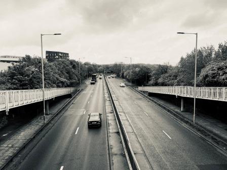
Walk to the junction of the A41/A5183. There is an ESSO filling station at the spot. Turn right onto the A41 and follow the footpath on the left-hand side of the road for about a mile. Walking alongside the traffic here can be a bit soul destroying but at least the footpath is reasonably separated from the road and there is plenty of greenery.
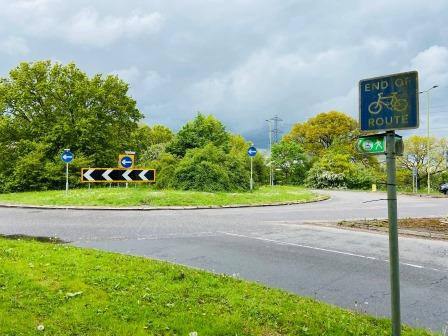
Eventually, after passing the welcome sign for Hertfordshire, the roundabout at the junction with the A411 is reached. This was to have been the site of Bushey Heath station (4.5 miles).
Bushey Heath (planned to open 1941 / cancelled 1950) would have been built at the large roundabout where the A41 meets Elstree Road (A411). The aerial photograph below (another from Britain from Above”) shows the spot looking north east in 1937 with Aldenham Reservoir in the background.

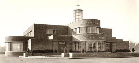
If the line had been built to the original plan, the station would have filled the triangle (1) to the right of the roundabout. A parade of shops would have been constructed around the road junction itself and there would also have been a modern roadhouse pub/hotel (like the Comet at Hatfield) and a cinema. No doubt there would also have been further housing developments all around the station too.
A second design, conceived during the war, had the station repositioned north of Elstree Road (2). With a possible nod to the coming green belt legislation, the revised plan did not include any surrounding developments.
Today, apart from the not insignificant detail that the M1 has been built just south of and parallel to the A41, the scene is not too different from the one that the 1937 aeriel photograph shows.
Walk around the roundabout to explore a bit.
The second proposed site for the station is shown here….

Whereas the original proposed location is here….

From the roundabout, head east along the footpath on the south side of Elstree Road (A411). After a while there is a little lane on the right. Have one last peep back into the field here. If the Northern Heights plan had gone ahead, you could be looking at a busy tube terminus here now.

To finish the walk, continue on the A411 as it curves around the south side of Aldenham Reservoir. After passing a large Indian restaurant on the right, cross the road and follow a footpath into the woods and along the eastern edge of Aldenham Reservoir.
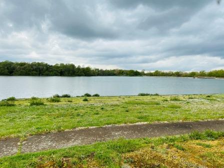
Before you reach the dam at the end, head off to the right. Cross Aldenham Road, and then cut across fields on a footpath to emerge at Elstree Hill North (A5183) almost opposite the T-junction with Allum Lane. Follow Allum Lane for the rest of the distance to Elstree and Borehamwood Station (6.6 miles).
London bus No. 107 stops outside the station and offers an easy return to Edgware. There are also frequent Thameslink trains to St. Pancras and beyond from the station.
To explore a little bit more, go past the station as Allum Lane becomes Shenley Road: the main street of Borehamwood town centre. It is lined with lots of places to eat and drink.
According to Tony Beard’s book, in the early 1930s a Borehamwood chartered surveyor corresponded with the LPTB and made an unsuccessful attempt to have the Morden-Edgware line extension terminate in Borehamwood.
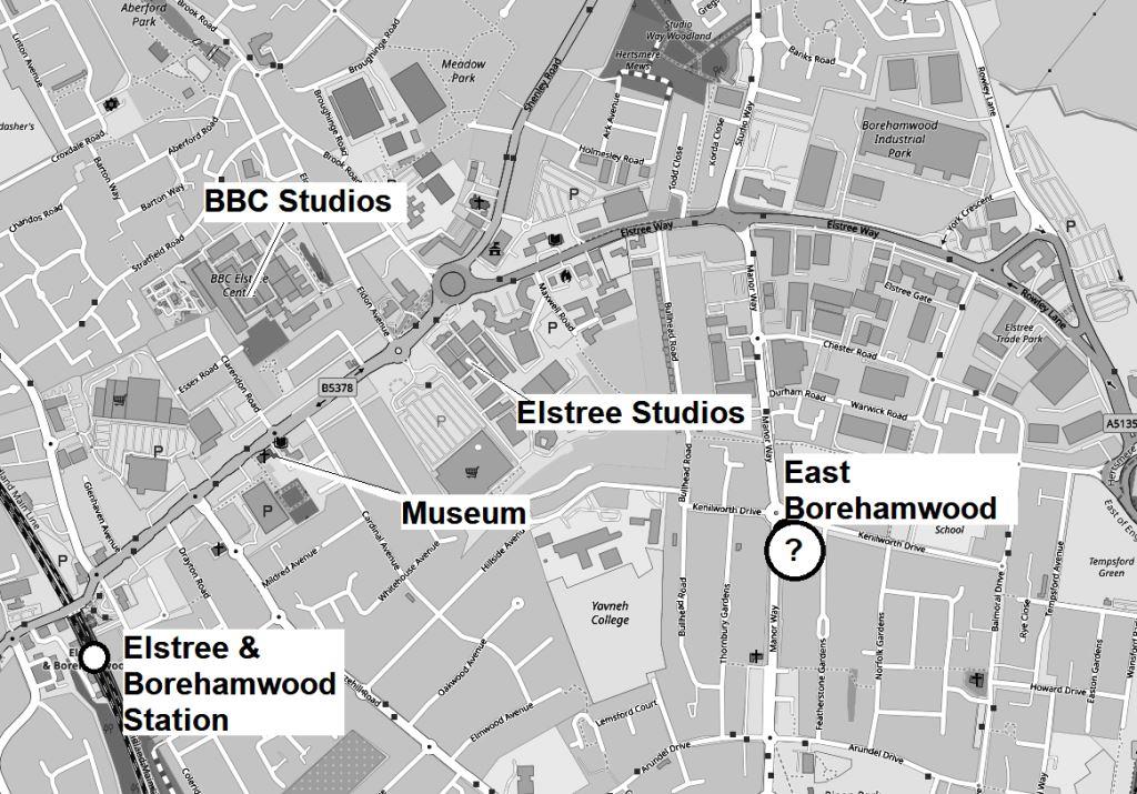
He used the growing national importance of the local film studios in his arguments. The initial name of the station was to have been East Borehamwood. The rough proposed location, which was then in open countryside, is shown on the map above.

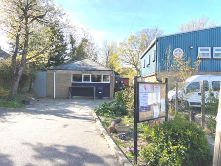
Elstree and Borehamwood Museum (entrance free but limited opening hours) is a short distance along Shenley Road on the right-hand side inside the library. It is well worth a visit.
Edited in 2022 to add
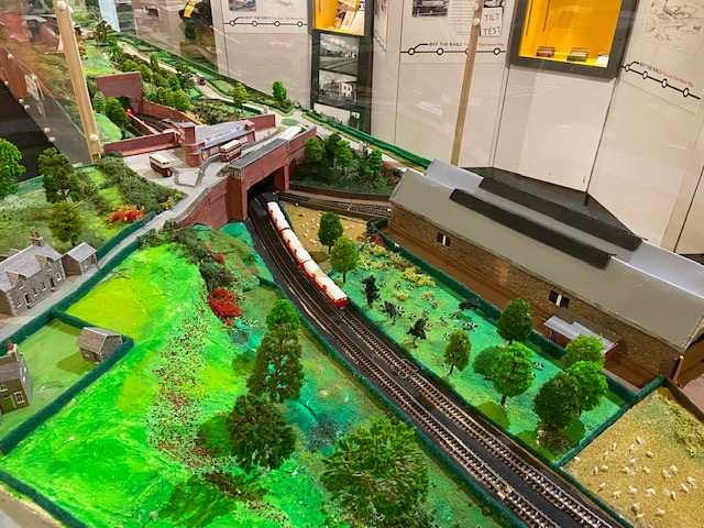
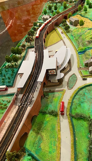
Between January 2022 and August 20th, 2022, the Museum is hosting its own exhibition on the Bushey Heath extension – “Off the Rails – the line that never was”. It features a lot of fascinating information on the project including rare track plans and photographs. Pride of place is given to a wonderful N-gauge model of the line with all three proposed stations lovingly created. The whole thing is very well presented and not to be missed.


A little beyond the museum, the BBC studios are off to the left, and the film studios are off to the right. Neither are open to the public; neither encourage visitors.
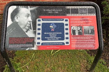
Borehamwood seems to have a bit of a strange relationship with its movie making history. The lamp posts are decorated with banners showing pictures of film stars and there are a few modest “Made in Elstree” signs that depict historical figures like Hitchcock, but generally you get the impression that they have decided to keep the “British Hollywood” thing a bit quiet.
The Film Industry at Elstree
There has been film making in this area for more than 100 years; there are still large two studios remaining near Elstree & Borehamwood station today.
What is now the BBC Elstree Centre on Eldon Avenue first opened in 1914 and was eventually sold to ATV in the 1950s and used to film such TV classics as The Muppet Show (1976–81). The BBC bought it 1984 to produce the soap opera EastEnders and have used it for other shows including Top of the Pops and ‘Holby City.

Meanwhile, Elstree Studios on Shenley Road started as British National Pictures in 1925. Renamed as British International Pictures, the studio produced Alfred Hitchcock’s Blackmail (the first British talkie) in 1929. After the war it passed through different ownership but by 1976 it was facing problems; then George Lucas chose to make Star Wars there and revived its fortunes.
Subsequent Star Wars sequels and the Indiana Jones series were also made there; today it is a combined film and TV studio, “Strictly come dancing” and “The Crown” are both produced here as well as many other classic TV shows and films.

In the past there have been several other studios in the area; J Arthur Rank had one, British & Dominion had another (before moving to Pinewood) and MGM made films at a third between 1944 and 1968. The last Elstree MGM film was 2001: A Space Odyssey.
Although the old MGM site was eventually redeveloped for factories and housing, the future of film making at Elstree looks bright; Sky is developing a brand new 14 stage facility and it is due to open next year.
Links
More information on the Northern Heights
Walk 1 – Moorgate to Finsbury Park (3.6 miles)
Walk 2 – Finsbury Park to Alexandra Palace (4.4 miles)
Walk 3 – Archway to High Barnet (8.3 miles)
Walk 4 – Finchley Central to Edgware (4.5 miles)
